Elevation map of Adams County, WA, USA
Location: United States > Washington >
Longitude: -118.51098
Latitude: 46.9272238
Elevation: 508m / 1667feet
Barometric Pressure: 0KPa
Related Photos:

Sad Sunflower
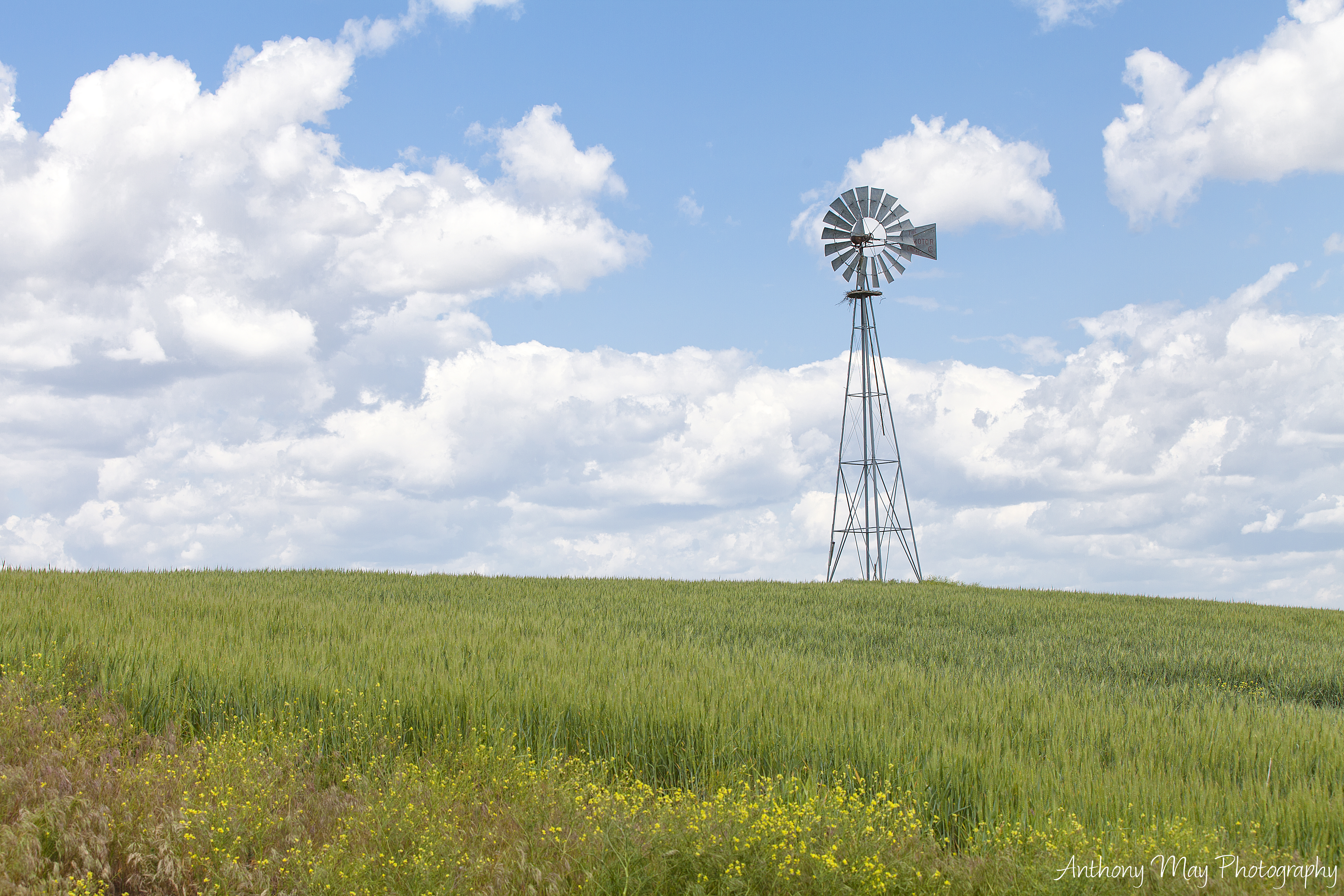
Turning Wind Into Watts

Sun Flower

IMG_4701.jpg

Eastern Washington Wheat fields, Washington
6-27-11 Lind,WA

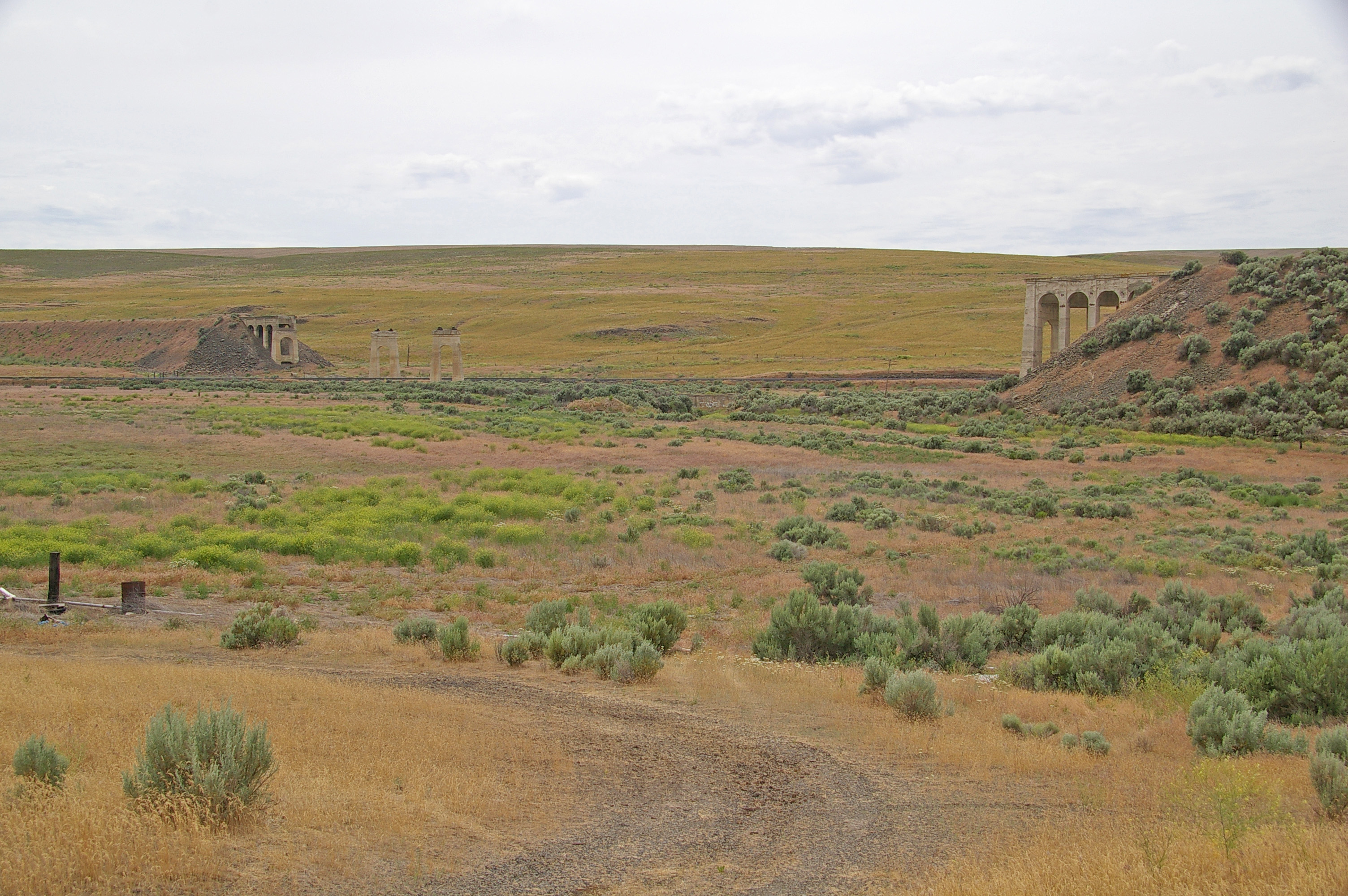
Freight train climbing Lind Coulee

Palouse wheat field

Sunflower Field

WooHoo! Finally got out there with the snowshoes. Carol breaking trail. #snowshoe #tubbs #winterwonderland
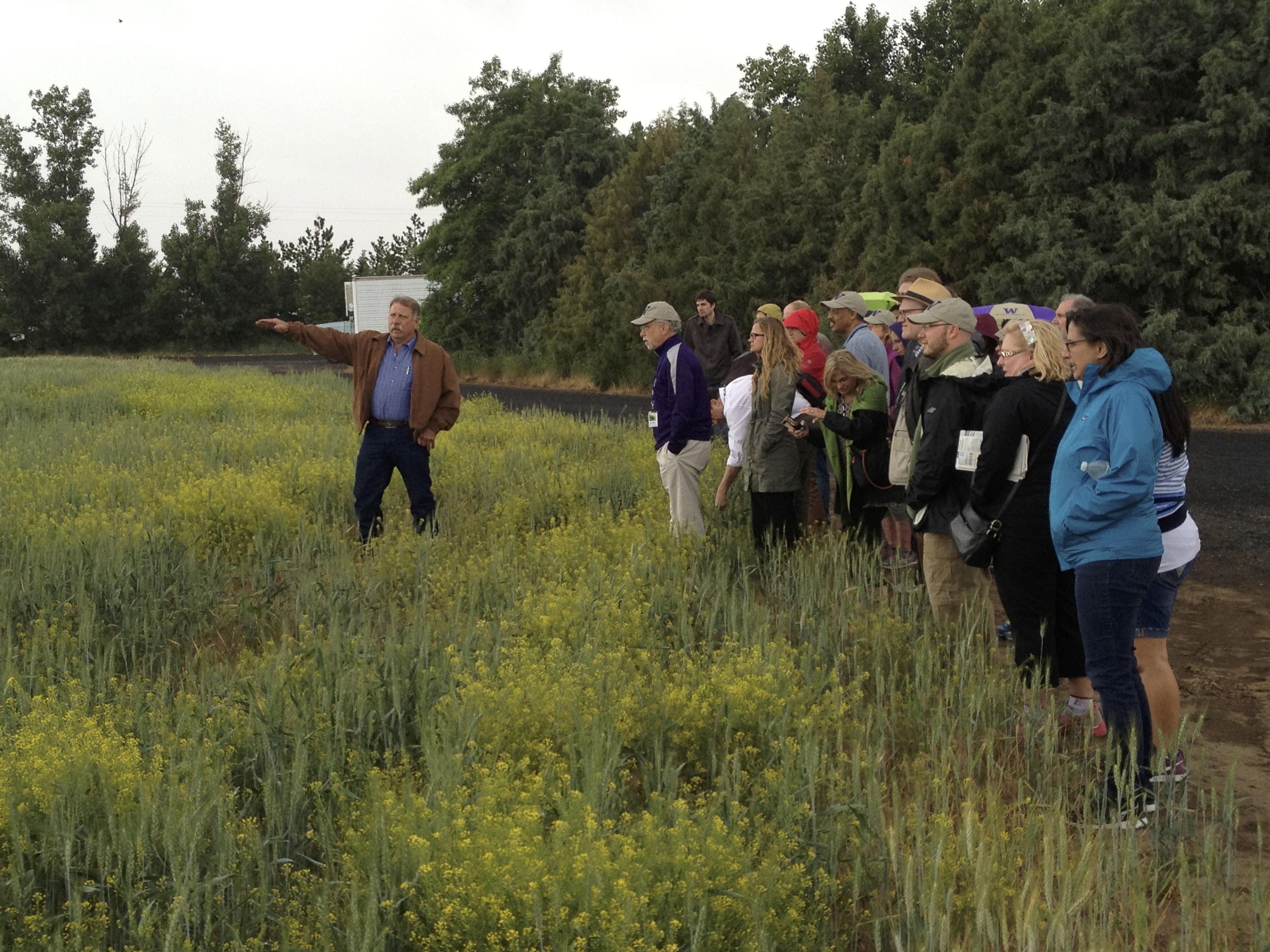
Farm Visit
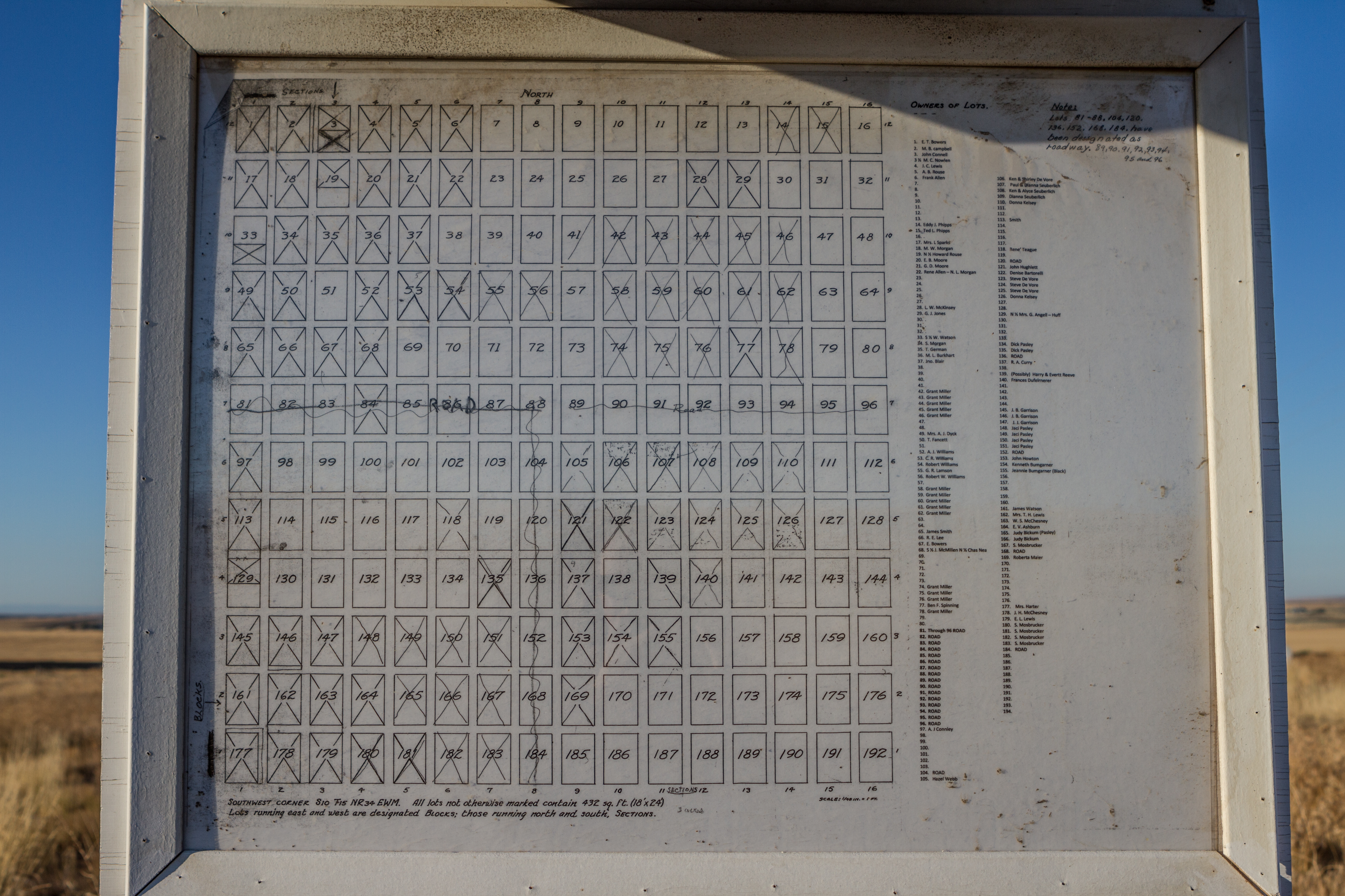
Delight Cemetery Map

Combine Demolition Derby

Combine Demolition Derby 2

C-BUMRBE0-03A

C-BUMRBE0-03A

All That Remains

Central Washington A7 (59)

Homeward Bound
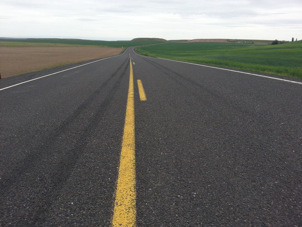
Road to Palouse Falls
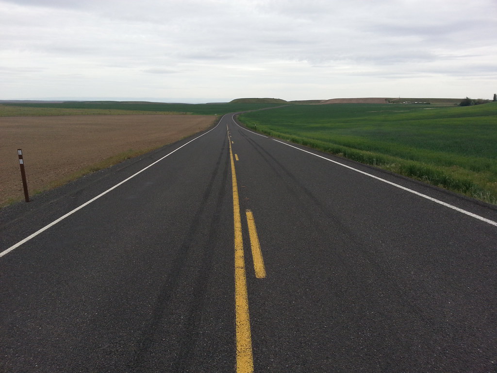
Road to Palouse Falls
Topographic Map of Adams County, WA, USA
Find elevation by address:

Places in Adams County, WA, USA:
Places near Adams County, WA, USA:
Lind
Ritzville
East Templin Road
Washtucna
Kahlotus
Hatton
Bronson St, Hatton, WA, USA
South Roxboro Road
Palouse Falls
31 Wallace Walker Rd, Pasco, WA, USA
Columbia Rd, Mesa, WA, USA
Odessa
20 W 1st Ave, Odessa, WA, USA
100 Burr Canyon Rd
Lyons Ferry Rd, Prescott, WA, USA
Simmons Rd, Prescott, WA, USA
Braeburn Pl NW, Soap Lake, WA, USA
Franklin County
Coffeepot Lake
20450 Coffee Pot Rd E
Recent Searches:
- Elevation map of Litang County, Sichuan, China
- Elevation map of Madoi County, Qinghai, China
- Elevation of 3314, Ohio State Route 114, Payne, Paulding County, Ohio, 45880, USA
- Elevation of Sarahills Drive, Saratoga, Santa Clara County, California, 95070, USA
- Elevation of Town of Bombay, Franklin County, New York, USA
- Elevation of 9, Convent Lane, Center Moriches, Suffolk County, New York, 11934, USA
- Elevation of Saint Angelas Convent, 9, Convent Lane, Center Moriches, Suffolk County, New York, 11934, USA
- Elevation of 131st Street Southwest, Mukilteo, Snohomish County, Washington, 98275, USA
- Elevation of 304, Harrison Road, Naples, Cumberland County, Maine, 04055, USA
- Elevation of 2362, Timber Ridge Road, Harrisburg, Cabarrus County, North Carolina, 28075, USA
- Elevation of Ridge Road, Marshalltown, Marshall County, Iowa, 50158, USA
- Elevation of 2459, Misty Shadows Drive, Pigeon Forge, Sevier County, Tennessee, 37862, USA
- Elevation of 8043, Brightwater Way, Spring Hill, Williamson County, Tennessee, 37179, USA
- Elevation of Starkweather Road, San Luis, Costilla County, Colorado, 81152, USA
- Elevation of 5277, Woodside Drive, Baton Rouge, East Baton Rouge Parish, Louisiana, 70808, USA
- Elevation of 1139, Curtin Street, Shepherd Park Plaza, Houston, Harris County, Texas, 77018, USA
- Elevation of 136, Sellers Lane, Repton, Monroe County, Alabama, 36475, USA
- Elevation of 12914, Elmington Drive, Lakewood Forest, Houston, Harris County, Texas, 77429, USA
- Elevation of 417, Camelot Drive, Statesville, Iredell County, North Carolina, 28625, USA
- Elevation of 5792, Wildridge Road, Avon, Eagle County, Colorado, 81620, USA