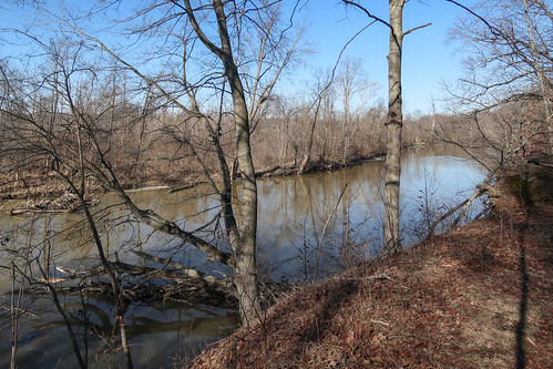
Elevation of 3314, Ohio State Route 114, Payne, Paulding County, Ohio, 45880, USA

Longitude: -84.75801047567712

Latitude: 41.01864400140646

Elevation: 233m / 764feet

Barometric Pressure: 0KPa

Related Photos:

cellphonetower overheadpowerlines parking downtownparkinglot 20190727 adamscountyindiana redandwhitetowers northernindiana powerlines parkedcars backsofbuildings adamscounty decatur townscape downtownbuildings celltower northeastindiana buildings radiotower downtown decaturtownscape commercialbuildings fortwaynemetropolitanarea centralbusinessdistrict downtowndecatur indiana north3rdstreet stripedradiotower backsidesofbuildings norththirdstreet electriclines rearsofbuildings urbanlandscape northindiana mostlysunny northeasternindiana july2019 indianalandscape img0372 landscape overheadelectriclines cars thirdstreet parkinglot 3rdstreet decaturlandscape july cession99 downtownlandscape 2019 treatyofstmarys decaturindiana
A small town's townscape of modest commercial buildings gets aggressively dominated by a cell tower and automobile parking.
saintmarysriver img0216 powerline viewfromabridge suspendedsediments northernindiana 1965 summer decatur cloudlesssky eastmonroestreet urbanstream fortwaynemetropolitanarea turbidriver downtowndecatur monroestreet overheadpowerline urbanlandscape northindiana northeasternindiana usroute224 sunnylandscape stmarysriverlandscape eastjacksonstreet decaturlandscape july cession99 ushighway224 riverinelandscape sunny muddywater turbidwater urbanriver adamscountyindiana muddyriver turbidstream us224 adamscounty powerlineshadow roadbridge northeastindiana summerlandscape lakeeriewatershed indiana maumeeriverdrainagebasin stmarysriver riverlandscape stream lakeeriedrainagebasin saintmarysriverlandscape maumeeriverwatershed july2019 northeastindianalandscape 20190727 indianalandscape streamlandscape creek mud overheadelectricline shadow river electricline downtown muddystream landscape decaturindiana creeklandscape 2019 treatyofstmarys 1965bridge
The St. Marys River is one of the most popularly beloved water amenities of both the state of Indiana and the entire Lake Erie drainage basin of the U.S. and Canada.
aerial aerialview tomato farm rows fortwayne indiana organized goldenhour crops agriculture rural sustainability warm farming fruit rurallife healthy growth arid organic sunset climate sunrise landscape light vegetables unitedstates greenery sunlight maintenance soil planning paths topdown clearsky harvest environment productivity lush unitedstatesofamerica
Aerial View of Tomato Farm Rows in Fort Wayne Indiana
winter snow tree beautiful landscape pretty solitude alone indiana decatur breathtaking lonetree winterscape oohlala worldbest platinumphoto decaturin ourmasterpieces qualitypixels fujifilmfinepixs1000fd blipfree decaturindidana
Solitude
15october2022 2022 20221015 auglaizeriverdrainagebasin auglaizeriverwatershed cession87 dscf1018 eastperrystreet flatrockcreek flatrockcreeklandscape huronerielakeplains lakeeriedrainagebasin lakeeriewatershed maumeelakeplain maumeeriverdrainagebasin maumeeriverwatershed northandeastofthefirstprincipalmeridian october october2022 octoberlandscape ohio ohiolandscape paulding pauldingcounty pauldingcountyohio pauldingohio pauldinglandscape southerngreatlakesforests treatyoffortmeigs treatyofthefootoftherapids treatyofthemaumeerapids us127 usroute127 autumn autumnlandscape autumnallandscape coarsewoodydebris creek creeklandscape culturallandscape deadtrees deadtreesinacreek deadtreesinariver electriclines fall falllandscape landscape northwestohio northwestohiolandscape northwesternohio overheadelectriclines overheadpowerlines partlysunny powerlines riparianforest riparianwoodland riparianwoods river riverengineering riverlandscape riverbankengineering riverbankstabilization riverinelandscape stream streamengineering streamlandscape streambankengineering streambankstabilization temperatedeciduousforest viewfromabridge woodedriverbanks woodedstreambanks woods
Here was Flatrock Creek, one of the weirdest fluvial weirdos of the Maumee River drainage basin.
2018 20180128 acreslandtrust allencounty allencountyindiana allencountylandscape fortwaynemetropolitanarea img5407 indiana january january2018 lakeeriedrainagebasin lakeeriewatershed maumeeriverdrainagebasin maumeeriverwatershed mcnabbwalternaturepreserve saintjosephriver spencertownship spencertownshipallencountyindiana spencertownshipindiana spencertownshiplandscape stjosephriver bluff fallentrees lowbluff naturepreserve naturereserve northindiana northeastindiana northeasternindiana northernindiana river riverbluff riverlandscape smallbluff smallriverbluff stream streamlandscape sunny sunnylandscape viewfromabluff winter winterlandscape wintersun
Saw a mild river from a modest blufftop.
2014 20140907 allencounty allencountyindiana brandon eastwashingtonboulevard fortwayne fortwayneindiana fortwaynecityscape fortwaynelandscape fortwayneskyline img4424 indiana indianalandscape koehlinger koehlingersecuritytechnology koehlingersecuritytechnologyinc mexican mexicanburgerswings september september2014 sperryvanness washingtonboulevard buildings burgers callbrandon chainlink chainlinkfence cityskyline cityscape cloudlesssky commercialrealestate downtown downtownfortwayne downtownfortwayneskyline downtownskyline fence graybuilding graysiding greybuilding greysiding landscape lightpoles missingletter noareacode northindiana northeastindiana northeasternindiana northernindiana parking parkinglot paved pavement phonenumber priceredcuced shrubbery shrubs skyline skyscrapers streetlights sunny telephonenumber urbanlandscape view wings unitedstates
Another spectacular view of the downtown Fort Wayne skyline.
2018 20180128 acreslandtrust allencounty allencountyindiana allencountylandscape fortwaynemetropolitanarea img5470 indiana indianalandscape january january2018 januarylandscape januarysun mcnabbwalternaturepreserve spencertownship spencertownshipallencountyindiana spencertownshipindiana spencertownshiplandscape dormantforest dormanttrees dormantwoodland dormantwoods floodplain floodplainforest forest forestlandscape naturepreserve naturepreservelandscape naturereserve northindiana northeastindiana northeasternindiana northernindiana sunnyforest sunnylandscape sunnywoodland sunnywoods temperatedeciduousforest viewfromabluff winterwoodland winterwoods woodedlandscape woodlandlandscape woods woodslandscape
View from a small bluff down into a riverbottom woods.

Topographic Map of 3314, Ohio State Route 114, Payne, Paulding County, Ohio, 45880, USA

Find elevation by address:


Places near 3314, Ohio State Route 114, Payne, Paulding County, Ohio, 45880, USA:

Recent Searches: