Elevation of US-, Cody, WY, USA

Location: United States > Wyoming > Cody >

Longitude: -109.55964

Latitude: 44.9429654

Elevation: 2850m / 9350feet

Barometric Pressure: 71KPa

Elevation Map:

elevation map of US-, Cody, WY, USA

Satellite Map:

Satellite map of US-, Cody, WY, USA
Related Photos:

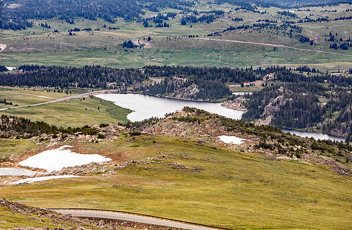
beartoothhighway allamericanroad mostbeautifuldriveinamerica beartoothpass wyoming montana glaciers plateaus cirques twinlakes
Twin Lakes, Beartooth Pass
beartoothpass beartoothhighway alpine ecosystem glaciers wyoming montana
High Plateau
wyoming absarokamountains indexpeak pilotpeak clarksforkoftheyellowstone clarksfork crandall clarksforkvalley lodgepolepines chiefjosephhighway crandallroad valley winter snow clouds sky evening eventide sunset road highway mists fog lowclouds glacial glaciallandforms geology horn glacialhorn cirque arête geomorphology absarokavolcanics wyojones np
Peaks At Sunset
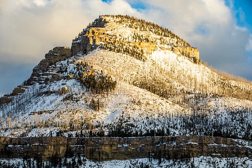
wyoming cody chiefjosephhighway geology sugarloafmountain bighorndolomite pilgrimlimestone parkshale ordovician cambrian heartmountaindetachment fault absarokamountains snow clouds sky evening shoshonenationalforest
Sugarloaf Mountain
wyoming crandall clarksforkoftheyellowstone shoshonenationalforest parkcounty cabins homes summerhomes snow winter melt flags trees puddles wyojones np
Summer Homes In Winter
wyoming cody chiefjosephhighway geology shoshonenatiuonalforest sugarloafmountain bighorndolomite pilgrimlimestone parkshale ordovician cambrian heartmountaindetachment fault absarokamountains snow clouds sky evening
Sugarloaf Mountain
wyoming beartoothmountains thebeartooth mirrorlake canyon glacialvalley horn glaciallake pasternosterlake trees hangingvalley shoshonenationalforest
Mirror Lake
wyoming beartoothplateau clarksforkoftheyellowstone clarksfork crandall clarksforkvalley lodgepolepines chiefjosephhighway galcialvalley cathedralcliffs windymountain russellpeak valley winter snow clouds sky evening eventide light panorama meadow swamplakefen wyojones np
Last Light On Cathedral Cliffs
wyoming beartoothplateau clarksforkoftheyellowstone clarksfork crandall clarksforkvalley lodgepolepines chiefjosephhighway galcialvalley hunterpeak cathedralcliffs windymountain russellpeak valley winter snow clouds sky evening eventide panorama wyojones np
Looking Down The Clarks Fork Valley in Winter
wyoming beartoothhighway beartoothplateau vista shoshonenationalforest frozenlake longlake alpinetundra snowfields trees wyojones np
Beartooth Plateau Vista
new sky countryside bright
The bear's tooth
wyoming lakecreek flows lookingdownstream newlakecreekbridge beartoothhighway shoshonenationalforest northwestwyoming stream creek trees logs rocks rapids bridge view beartoothmountains wyojones np
Mountain Stream
wyoming shoshonenationalforest beartoothhighway beartoothmountains beartoothravine beartoothfalls canyon waterfall cascade stream creek beartoothcreek trees wyojones np
Beartooth Falls
wyoming beartoothhighway beartoothplateau shoshonenationalforest parkcounty lakecreekfalls rapids cascade fan chute lakecreek lakecreekbridge ccc lakecreeknewbridge trres rocks waterfalls falls creek stream mountain granite wyojones np
Lake Creek Falls
wyoming beartoothmountains chiefjosephhighway shoshonenationalforest cambrianshale hunterpeak hunterpeaksubdivision crandall summerhomes vacationhomes cabins parkcounty mudflow landslide earthflow damage wetspring repair squawcreekroad geology wyojones np
Damaged Cabin On Edge Of Mudslide
beartooth rock wyoming rockcreek beartoothplateau beartoothhighway glacialvalley glacialcanyon glaciallake canyon lake cliff road creek pleistocene geology geomorphology
View Into Rock Creek Canyon
wyoming beartoothhighway beartoothplateau shoshonenationalforest parkcounty lakecreekfalls rapids cascade fan chute lakecreek lakecreekbridge ccc lakecreeknewbridge trres rocks waterfalls falls creek stream mountain granite wyojones np
Lake Creek Falls
wyoming beartoothplateau clarksforkoftheyellowstone clarksfork campcreek deadmancreek meadow rim lodgepolepines cheifjosephhighway wyojones np
A Summer Day
wyoming beartoothmountains chiefjosephhighway shoshonenationalforest cambrianshale hunterpeak hunterpeaksubdivision crandall summerhomes vacationhomes cabins parkcounty mudflow landslide earthflow damage wetspring repair squawcreekroad geology countyroadxux wyojones np
The Hunter Peak Mud Flow
wyoming beartoothmountains chiefjosephhighway shoshonenationalforest cambrianshale hunterpeak hunterpeaksubdivision crandall summerhomes vacationhomes cabins parkcounty mudflow landslide earthflow damage wetspring repair squawcreekroad geology mudslide countyroadxux wyojones np
Caught In A Mudslide
wyoming beartoothmountains chiefjosephhighway shoshonenationalforest cambrianshale hunterpeak hunterpeaksubdivision crandall summerhomes vacationhomes cabins parkcounty mudflow landslide earthflow damage wetspring repair squawcreekroad geology countyroadxux hunterpeakwildfire wyojones np
Hunter Peak Mud Flow
wyoming absarokamountains clarksforkoftheyellowstone clarksfork crandall clarksforkvalley lodgepolepines chiefjosephhighway pilotpeak indexpeak valley winter snow clouds wildfire burnedarea cloudscape horn glacialhorn sky afternoon wyojones np
Afternoon Near Crandall
montana wyoming beartooth beartoothrange usa soshonenationalforest
Beartooth Range
wyoming lakecreek clarksforkvalley shoshonenationalforest trees creek stream rapids whitewater haze mist wyojones np
Lake Creek
landscape wyoming pilotpeak mountain
Pilot Peak Wyoming
wyoming beartoothplateau beartoothhighway shoshonenationalforest chainlakes longlake snowbank snow reddust melt highway absarokamountains storm clouds cloudscape wyojones np
View Along The Beartooth Highway
wyoming chiefjosephhighway shoshonenationalforest crandall swamplakefen marsh fen bog pond lake trees landscape wetland groundwater reflection peat speciesofconcern alkaline wyojones np
Cathedral Cliffs
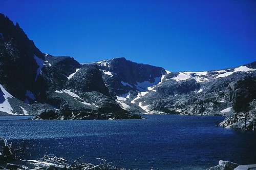
usa montana wyoming glacierlake beartooth beartoothrange
Glacier Lake
wyoming chiefjosephhighway shoshonenationalforest crandall swamplakefen marsh fen bog pond lake trees landscape wetland groundwater reflection peat speciesofconcern alkaline wyojones np
Swamp Lake Fen 2
wyoming chiefjosephhighway shoshonenationalforest crandall swamplakefen marsh fen bog pond lake trees landscape wetland groundwater reflection peat speciesofconcern alkaline wyojones np
Trees, Water and Cliffs
cody wyoming unitedstates us beartoothpass mountaingoats landscape
Day 239/365 2017-08-27 Mountain Goats
wyoming beartoothplateau beartoothmountains beartoothhighway glacialcarvedlandscape glacialdeposits glaciallake lake highway rocks granite graniticgneiss metamorphicrocks historicdistrict nationalregisterofhistoricplaces igneousrocks road trees pleistocene geology alpinemeadows geomorphology streamlet
Hairpin Curve
wyoming beartoothplateau beartoothmountains beartoothhighway glacialcarvedlandscape glacialdeposists glaciallake lake highway rocks granite graniticgneiss metamorphicrocks igneousrocks road trees pleistocene geology alpinemeadows geomorphology archean precambrian longlake
Long Lake
wyoming beartoothplateau beartoothmountains beartoothhighway glacialcarvedlandscape glaciallake lake highway rocks granite graniticgneiss metamorphicrocks igneousrocks road trees pleistocene geology alpinemeadows geomorphology snow glacialdeposits historicdistrict nationalregisterofhistoricplaces
Long Lake
wyoming beartoothhighway beartoothplateau road highway car snowbanks curve switchback summer elevation wyojones np
Snowbanks in Mid Summer (Mid-July)
allamericanroad beartoothhighway explored nationalscenicbyway shoshonenationalforest usa unitedstates wy wyoming ynp yellowstonenationalpark canyon cloud gorge lake landscapephotography mountain nationalpark park rock rugged sky valley water
Twin Lakes (Explored Apr 17, 2016)
usa montana wyoming glacierlake beartoothrange
Glacier Lake
wyoming chiefjosephhighway shoshonenationalforest crandall swamplakefen marsh fen bog moraine pond lake trees landscape wetland groundwater reflection wyojones np
Remnant of a Lake