Elevation of Digrani, Uttarakhand, India
| Latitude | 29.5637793 |
|---|---|
| Longitude | 80.2809129 |
| Elevation | 1482m / 4862feet |
| Barometric Pressure | 847KPa |
Related Photos:

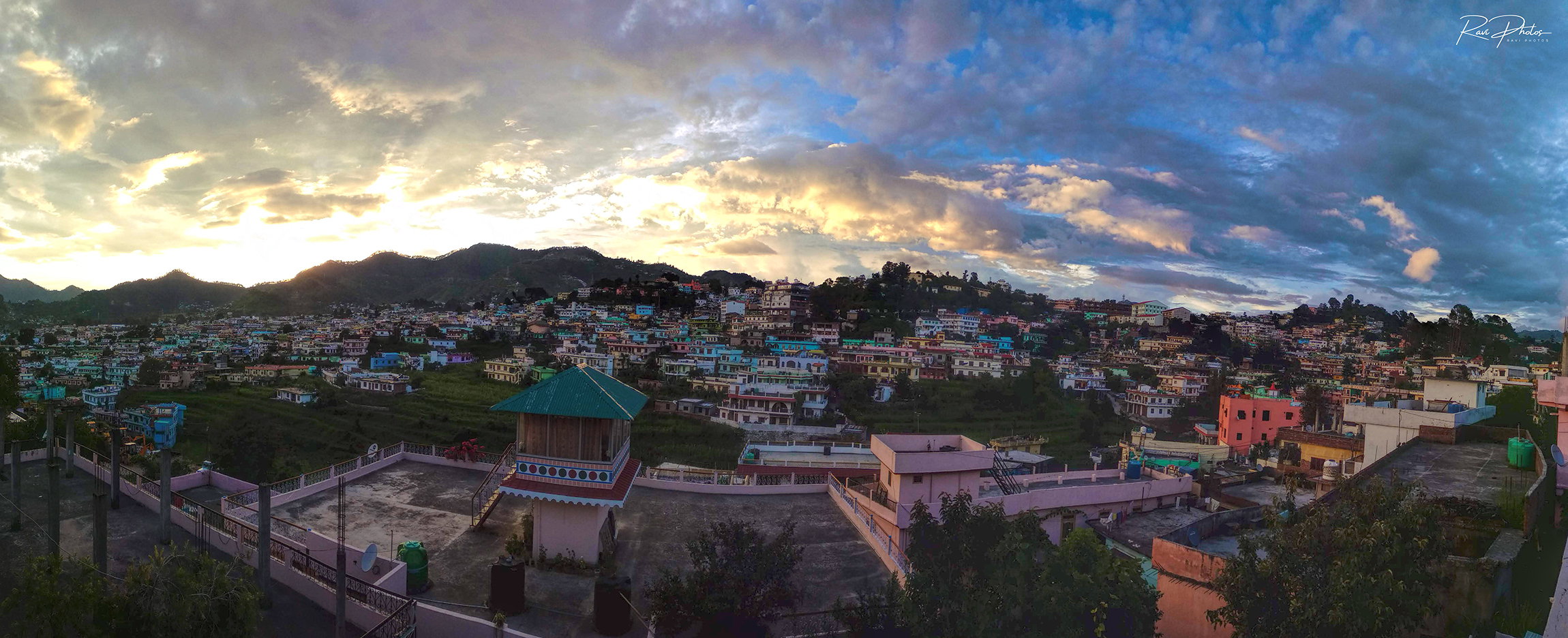
A village of Nepal, seen from India

PANO_20180818_163838 b

PANO_20180818_162705 b

IMG_20180818_163820_HDR b

IMG_9562.jpg

IMG_20180815_180944_HDR b

IMG_20180818_141636_HDR b

IMG_20180818_154607_HDR b

IMG_20180818_154620_HDR b

IMG_20180818_171249 b

IMG_20180822_162101_HDR b

IMG_20180822_162106_HDR b

IMG_20180822_162157_HDR b

IMG_20180822_162202_HDR b

IMG_20180822_162208_HDR b

IMG_20180826_182430_HDR-01 b
PANO_20180808_183711 b

beautiful #Uttarakhand #travel #photography #mountain #himalaya

Mike and the Chopper

anil kapri

choliya dance

Python molurus
Topographic Map of Digrani, Uttarakhand, India
Find elevation by address:
Places in Digrani, Uttarakhand, India:
Places near Digrani, Uttarakhand, India:
Wadda
Govt.polytechnic Munakot(pithoragarh)
Muna Kote
Govt.polytechnic Munakot
Gaina
Pithoragarh
Munsyari Dharchula Shop
Mostamanu Temple
Kanda Jhusiya
Government Primary School, Panagarh
Askote
Api
Khalanga
Darma
Munsyari
Sarmoli
Pithoragarh
Darchula
Api
Byash
Recent Searches:
- Elevation of Burnt Store Village, Charlotte County, Florida, 33955, USA
- Elevation of 26552, Angelica Road, Punta Gorda, Charlotte County, Florida, 33955, USA
- Elevation of 104, Chancery Road, Middletown Township, Bucks County, Pennsylvania, 19047, USA
- Elevation of 1212, Cypress Lane, Dayton, Liberty County, Texas, 77535, USA
- Elevation map of Central Hungary, Hungary
- Elevation map of Pest, Central Hungary, Hungary
- Elevation of Pilisszentkereszt, Pest, Central Hungary, Hungary
- Elevation of Dharamkot Tahsil, Punjab, India
- Elevation of Bhinder Khurd, Dharamkot Tahsil, Punjab, India
- Elevation of 2881, Chabot Drive, San Bruno, San Mateo County, California, 94066, USA
- Elevation of 10370, West 107th Circle, Westminster, Jefferson County, Colorado, 80021, USA
- Elevation of 611, Roman Road, Old Ford, Bow, London, England, E3 2RW, United Kingdom
- Elevation of 116, Beartown Road, Underhill, Chittenden County, Vermont, 05489, USA
- Elevation of Window Rock, Colfax County, New Mexico, 87714, USA
- Elevation of 4807, Rosecroft Street, Kempsville Gardens, Virginia Beach, Virginia, 23464, USA
- Elevation map of Matawinie, Quebec, Canada
- Elevation of Sainte-Émélie-de-l'Énergie, Matawinie, Quebec, Canada
- Elevation of Rue du Pont, Sainte-Émélie-de-l'Énergie, Matawinie, Quebec, J0K2K0, Canada
- Elevation of 8, Rue de Bécancour, Blainville, Thérèse-De Blainville, Quebec, J7B1N2, Canada
- Elevation of Wilmot Court North, 163, University Avenue West, Northdale, Waterloo, Region of Waterloo, Ontario, N2L6B6, Canada