Elevation of North 3rd Street, N 3rd St, Zanesville, OH, USA
Location: United States > Ohio > Muskingum County > Zanesville >
Longitude: -82.0089483
Latitude: 39.9419332
Elevation: -10000m / -32808feet
Barometric Pressure: 0KPa
Related Photos:

Zanesville, OH

Old mill viewed from a train

Y Bridge - Zanesville, Ohio

Jacks Hollow Covered Bridge, view from bridge, Perry County, Ohio

Muskingum County Courthouse, Front View

View of railyard area Just west of N. 3rd St Zanesville, OH 004

View of downtown Zanesville

Signage method; kind of sign.
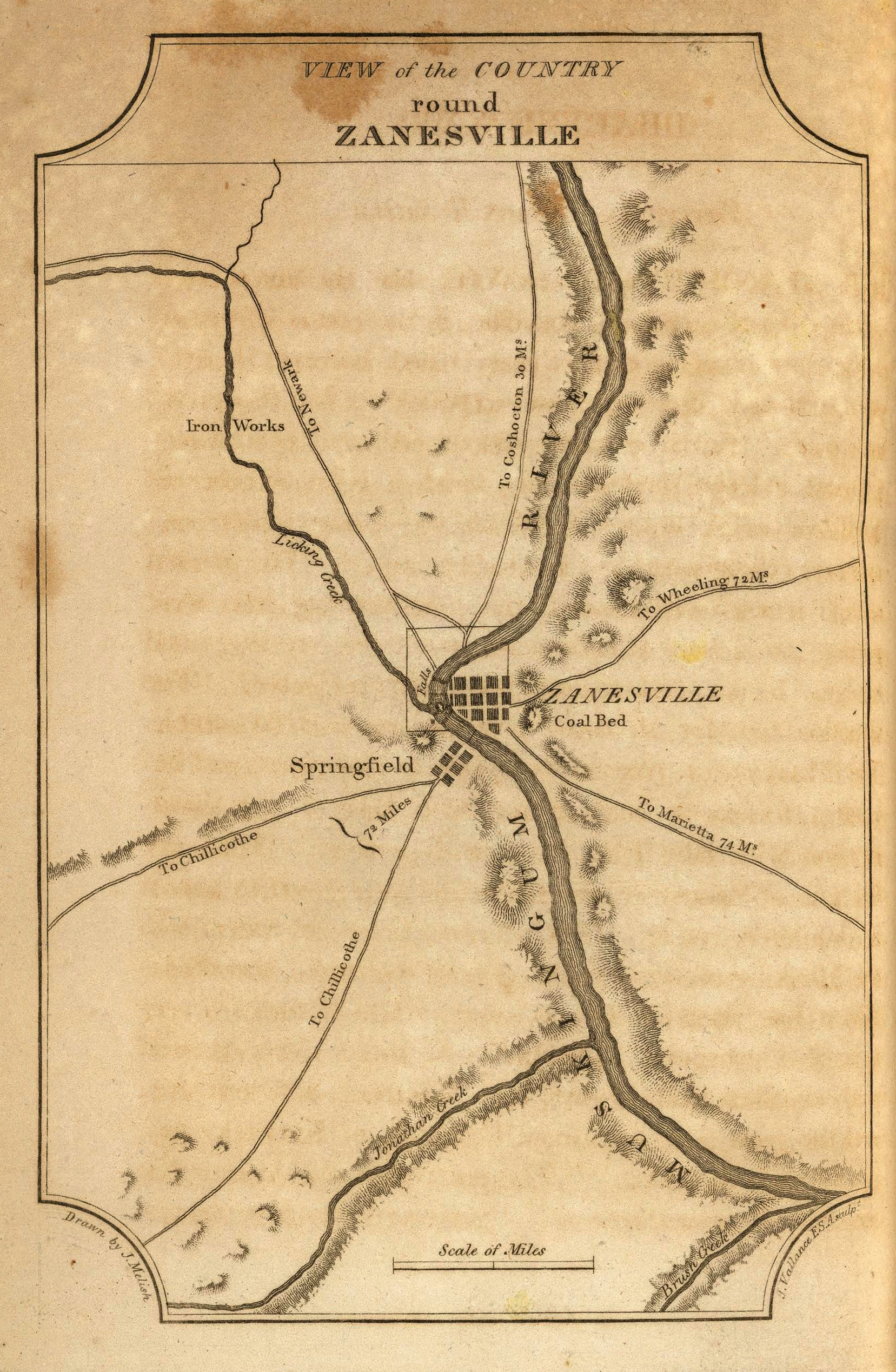
View of the Country round Zanesville

Jacks Hollow Covered Bridge, truss view, Perry County, Ohio

View of Muskingum County Courthouse from the Landing Park on the Muskingum River in Zanesville, OH 005

Jacks Hollow Covered Bridge, cross creek view, Perry County, Ohio
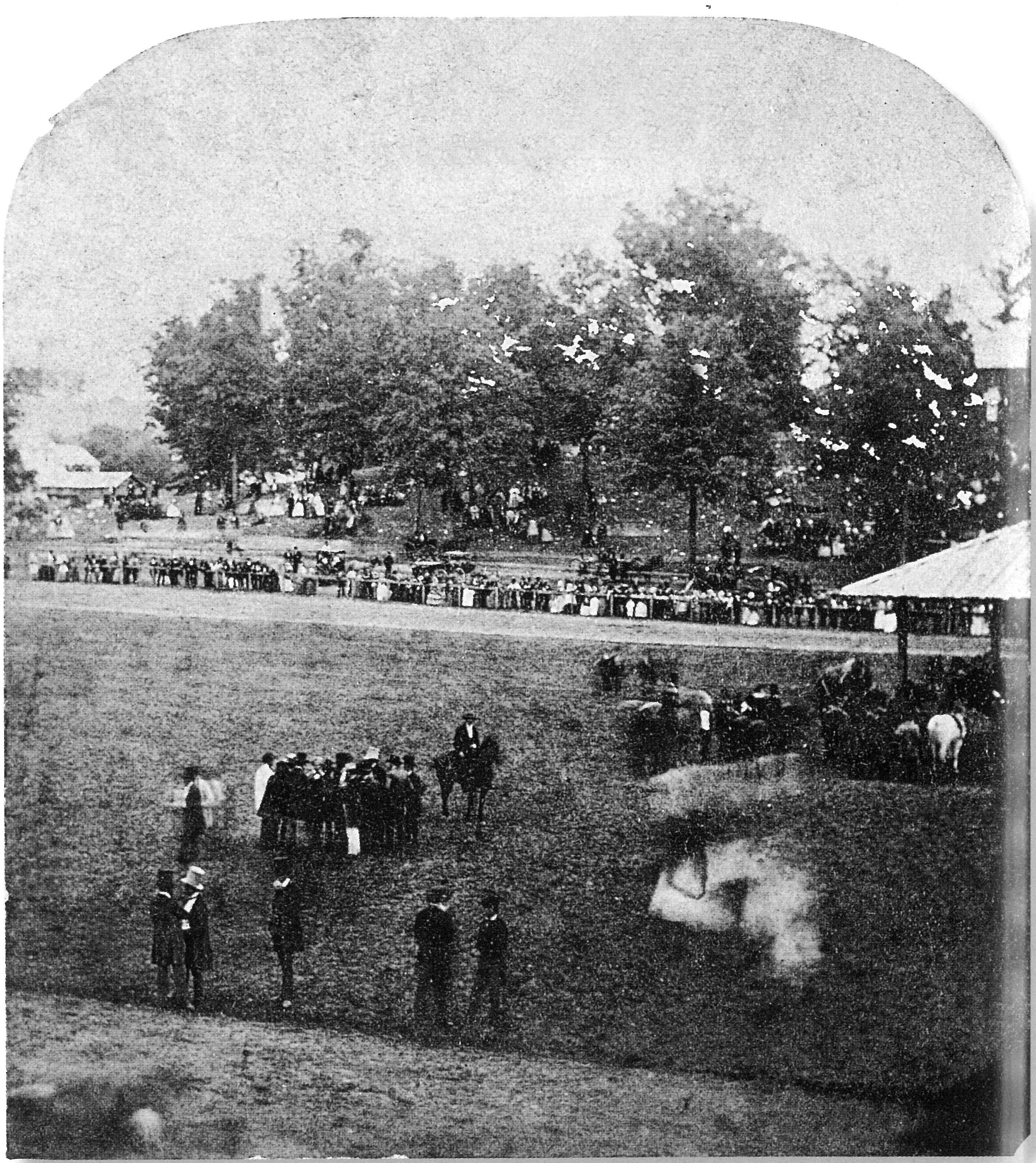
View from the Grandstand, Ohio State Fair

Jacks Hollow Covered Bridge, cross creek view, Perry County, Ohio (2)

Building View 1

200 Yards

From 100 yards

Reflections: After the storm, Rainbow in the Rear View #rainbowloom #roadtrips #amazingshotz_ #lgg4 #mobilephotography

360 Panorama Shot Alan Cottrill Studio and Gallery - Zanesville

View near Zanesville

Zanesville OH 165

Where Rivers Meet

Ellis Lock & Dam #11

Ohio Central Railroad

Y Bridge

Hay Fever

Projects 34.jpg
06 Nov. 2011. Near Zanesville, OH. Brown Fields, Exit 160 off I-70.

Railroad Bridge, Zanesville, OH

some bold and vivid fall color

Bridge at Zanesville, Ohio

Zanesville OH 152

18 tee box
Zanesville OH 106

Y Bridge, Zanesville, OH

some bold and vivid fall color

Zanesville OH 150
Topographic Map of North 3rd Street, N 3rd St, Zanesville, OH, USA
Find elevation by address:

Places near North 3rd Street, N 3rd St, Zanesville, OH, USA:
12 US-40, Zanesville, OH, USA
Zanesville
Marjorie And Butch's School Of Dance Llc (studio 51)
730 Fountain Square
800 Harvey St
1072 Harvey St
Zane St, Zanesville, OH, USA
1700 State St
Licking Rd, Zanesville, OH, USA
1308 Coopermill Rd
Dresden Rd, Zanesville, OH, USA
North Zanesville
Greenlawn Estates
1356 Athena Ln
940 Schlaegel Dr
Pleasant Grove
Muskingum County
3540 E Pike
Washington Township
6125 Southview Dr
Recent Searches:
- Elevation map of Greenland, Greenland
- Elevation of Sullivan Hill, New York, New York, 10002, USA
- Elevation of Morehead Road, Withrow Downs, Charlotte, Mecklenburg County, North Carolina, 28262, USA
- Elevation of 2800, Morehead Road, Withrow Downs, Charlotte, Mecklenburg County, North Carolina, 28262, USA
- Elevation of Yangbi Yi Autonomous County, Yunnan, China
- Elevation of Pingpo, Yangbi Yi Autonomous County, Yunnan, China
- Elevation of Mount Malong, Pingpo, Yangbi Yi Autonomous County, Yunnan, China
- Elevation map of Yongping County, Yunnan, China
- Elevation of North 8th Street, Palatka, Putnam County, Florida, 32177, USA
- Elevation of 107, Big Apple Road, East Palatka, Putnam County, Florida, 32131, USA
- Elevation of Jiezi, Chongzhou City, Sichuan, China
- Elevation of Chongzhou City, Sichuan, China
- Elevation of Huaiyuan, Chongzhou City, Sichuan, China
- Elevation of Qingxia, Chengdu, Sichuan, China
- Elevation of Corso Fratelli Cairoli, 35, Macerata MC, Italy
- Elevation of Tallevast Rd, Sarasota, FL, USA
- Elevation of 4th St E, Sonoma, CA, USA
- Elevation of Black Hollow Rd, Pennsdale, PA, USA
- Elevation of Oakland Ave, Williamsport, PA, USA
- Elevation of Pedrógão Grande, Portugal