Elevation of Marjorie and Butch's School of Dance LLC (Studio 51), 51 S 7th St, Zanesville, OH, USA
Location: United States > Ohio > Muskingum County > Zanesville >
Longitude: -82.004289
Latitude: 39.9387972
Elevation: 223m / 732feet
Barometric Pressure: 99KPa
Elevation Map:
Satellite Map:
Related Photos:

Old mill viewed from a train

Y Bridge - Zanesville, Ohio

Lorena Sternwheeler upriver

Building View 2

Bridge Openings

Zanesville, OH

IMG_4143.JPG

IMG_4158.JPG

Signage method; kind of sign.

View of downtown Zanesville

Muskingum County Courthouse, Front View

-Side view of the Y-Bridge, Zanesville, Ohio
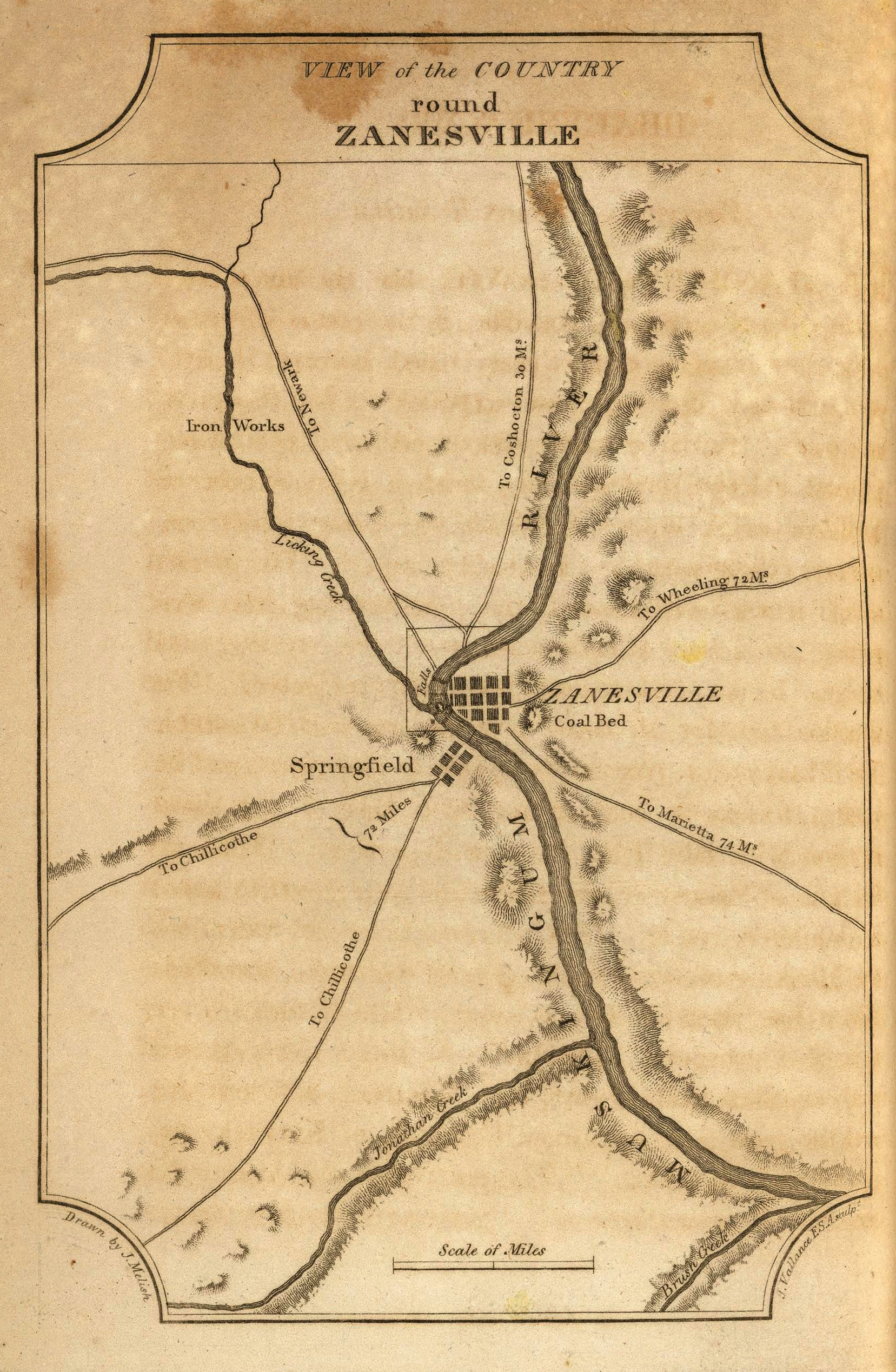
View of the Country round Zanesville

View of the Country round Zanesville
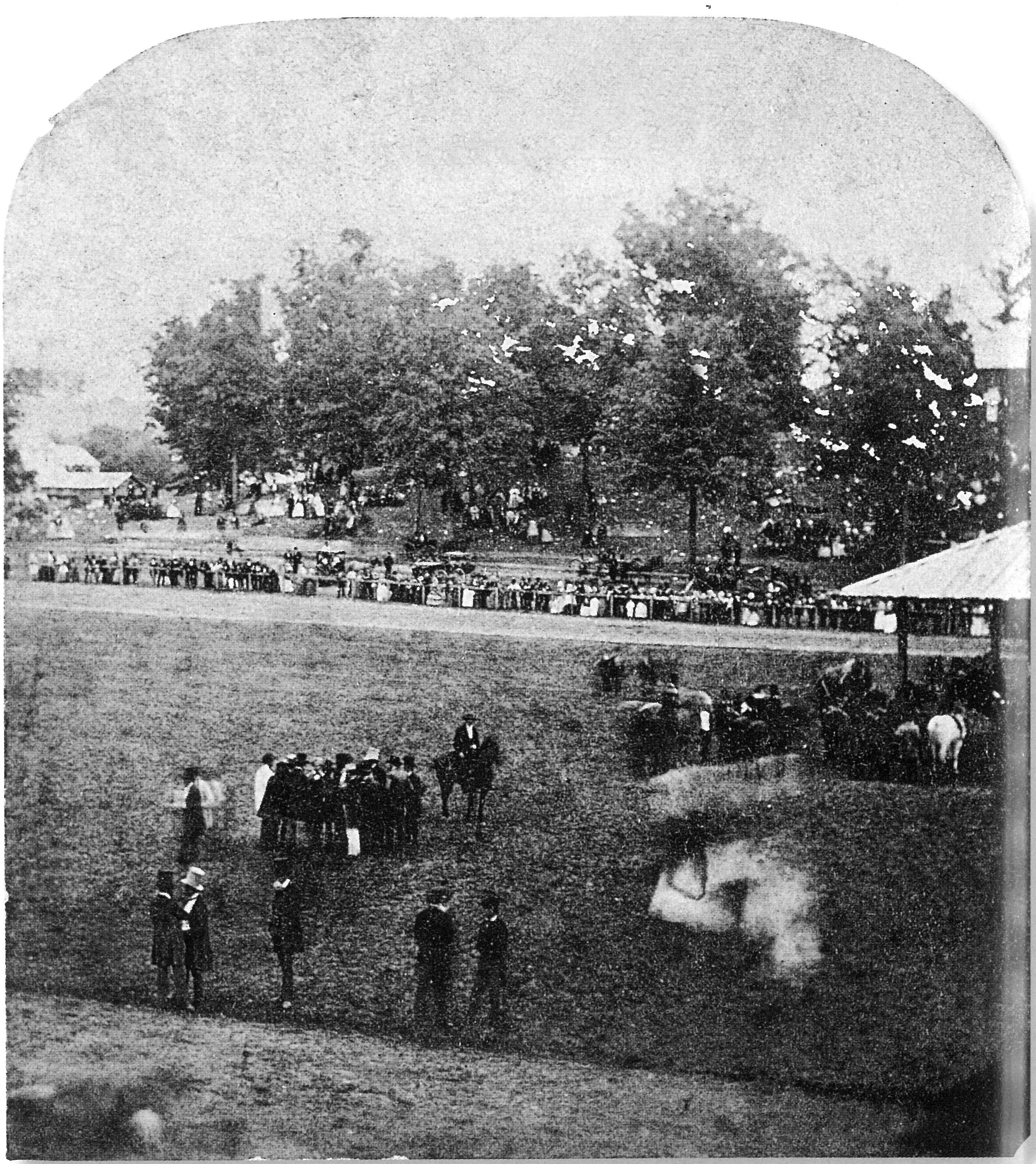
View from the Grandstand, Ohio State Fair

Jacks Hollow Covered Bridge, cross creek view, Perry County, Ohio

360 Panorama Shot Alan Cottrill Studio and Gallery - Zanesville

200 Yards

Jacks Hollow Covered Bridge, view from bridge, Perry County, Ohio

Jacks Hollow Covered Bridge, barrel view, Perry County, Ohio

Jacks Hollow Covered Bridge, cross creek view, Perry County, Ohio (2)

Ohio Central Railroad

The "Y" Bridge

Zanesville OH 165

From 100 yards

Railroad Bridge, Zanesville, OH

Where Rivers Meet

Y Bridge, Zanesville, OH

Bridge at Zanesville, Ohio

There are thirteen stripes at the left side of the flag, but only nine at the right.

Ohio ~ Zanesville

Karen atop Seip Mound

Y-bridge

Muskingum River

The beat of her heart moves an ocean in me.

American Woodcock, Scolopax minor DSC_6458

here while there

"Y" Bridge, Zanesville (Ohio), 23 August 1999
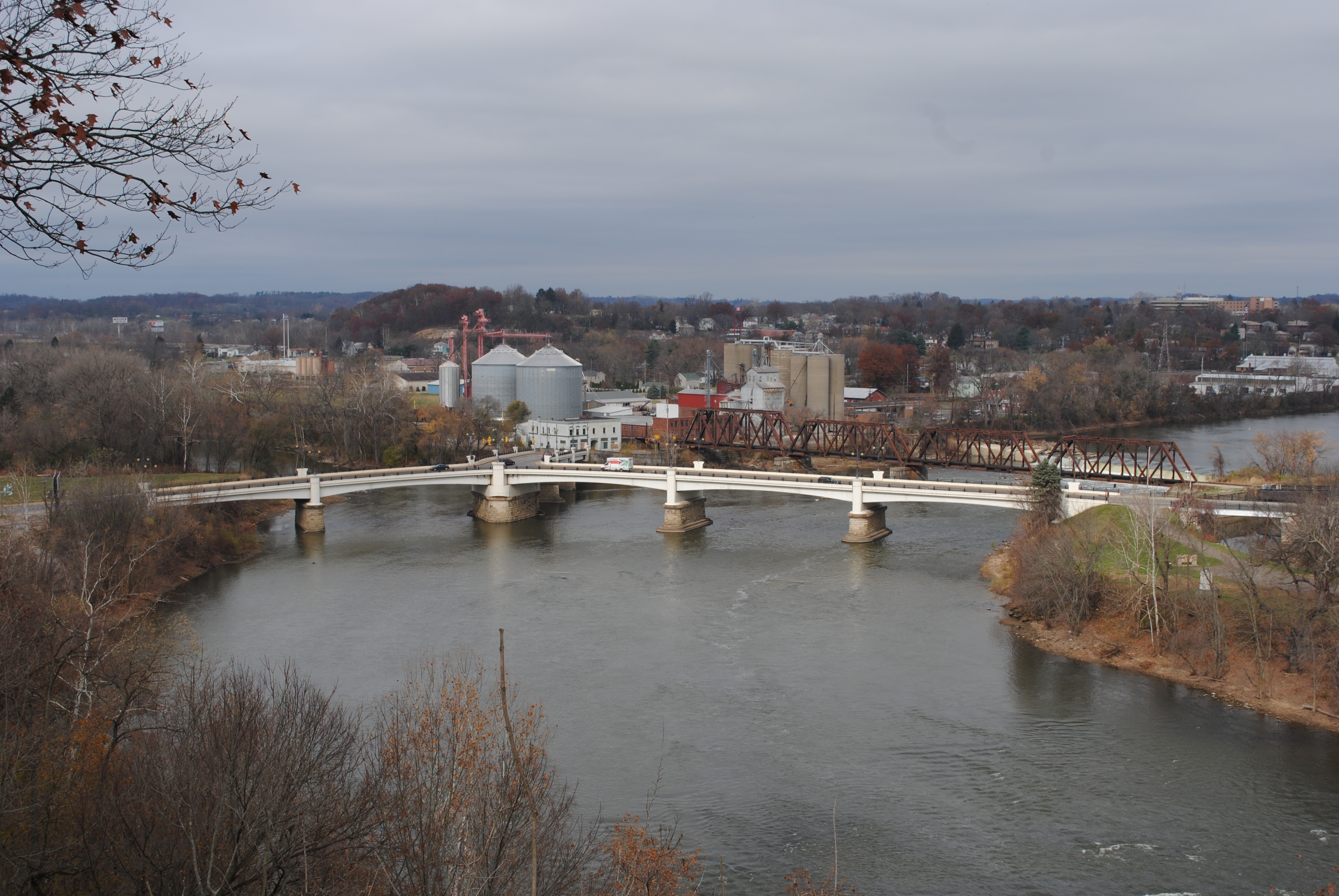
Zanesville Y Bridge
Topographic Map of Marjorie and Butch's School of Dance LLC (Studio 51), 51 S 7th St, Zanesville, OH, USA
Find elevation by address:

Places near Marjorie and Butch's School of Dance LLC (Studio 51), 51 S 7th St, Zanesville, OH, USA:
800 Harvey St
730 Fountain Square
North 3rd Street
1072 Harvey St
12 US-40, Zanesville, OH, USA
Zanesville
Zane St, Zanesville, OH, USA
1308 Coopermill Rd
Licking Rd, Zanesville, OH, USA
Greenlawn Estates
Dresden Rd, Zanesville, OH, USA
North Zanesville
Pleasant Grove
1356 Athena Ln
Muskingum County
940 Schlaegel Dr
3540 E Pike
Washington Township
6125 Southview Dr
Coopermill Rd, Zanesville, OH, USA
Recent Searches:
- Elevation of Elwyn Dr, Roanoke Rapids, NC, USA
- Elevation of Congressional Dr, Stevensville, MD, USA
- Elevation of Bellview Rd, McLean, VA, USA
- Elevation of Stage Island Rd, Chatham, MA, USA
- Elevation of Shibuya Scramble Crossing, 21 Udagawacho, Shibuya City, Tokyo -, Japan
- Elevation of Jadagoniai, Kaunas District Municipality, Lithuania
- Elevation of Pagonija rock, Kranto 7-oji g. 8"N, Kaunas, Lithuania
- Elevation of Co Rd 87, Jamestown, CO, USA
- Elevation of Tenjo, Cundinamarca, Colombia
- Elevation of Côte-des-Neiges, Montreal, QC H4A 3J6, Canada