Elevation map of Upper Dir, Pakistan
Location: Pakistan > Khyber Pakhtunkhwa >
Longitude: 72.0468164
Latitude: 35.1655239
Elevation: 1841m / 6040feet
Barometric Pressure: 81KPa
Elevation Map:
Satellite Map:
Related Photos:

Swat River Valley
At Hotel Mid-Hills, Kalam, Swat.
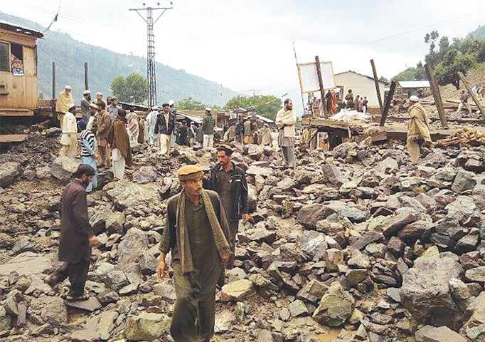
Day 32 Flash Flood Upper Dir District Pakistan
Topographic Map of Upper Dir, Pakistan
Find elevation by address:

Places in Upper Dir, Pakistan:
Shandur Lake
Lowari Pass
Lowari Tunnel
Lowari Tunnel
Lowari Tunnel
Lowari Tunnel
Sheringal
Dir
Bibyawar
Darora
Barawal Bandi
Dir
Barawal
Places near Upper Dir, Pakistan:
Shaheed Benazir Bhutto University, Sheringal
Sheringal
Dir
Dir
Shandur Lake
Lowari Tunnel
Lowari Tunnel
Lowari Tunnel
Lowari Tunnel
Lowari Top
Lowari Pass
Lowari Tunnel Road
Katora Lake
Kumrat Valley
Pari Lake
Kundol Lake
Drosh
Bahrain
Utrar
Bahrain
Recent Searches:
- Elevation of Corso Fratelli Cairoli, 35, Macerata MC, Italy
- Elevation of Tallevast Rd, Sarasota, FL, USA
- Elevation of 4th St E, Sonoma, CA, USA
- Elevation of Black Hollow Rd, Pennsdale, PA, USA
- Elevation of Oakland Ave, Williamsport, PA, USA
- Elevation of Pedrógão Grande, Portugal
- Elevation of Klee Dr, Martinsburg, WV, USA
- Elevation of Via Roma, Pieranica CR, Italy
- Elevation of Tavkvetili Mountain, Georgia
- Elevation of Hartfords Bluff Cir, Mt Pleasant, SC, USA