Elevation of Lower Pine Grove Road, Lower Pine Grove Rd, Baker, WV, USA

Location: United States > West Virginia > Baker >

Longitude: -78.799433

Latitude: 39.0553032

Elevation: 476m / 1562feet

Barometric Pressure: 96KPa

Elevation Map:

elevation map of Lower Pine Grove Road, Lower Pine Grove Rd, Baker, WV, USA

Satellite Map:

Satellite map of Lower Pine Grove Road, Lower Pine Grove Rd, Baker, WV, USA

Related Photos:

canon river scenic westvirginia 5dmarkii
Lost River
DSC01431 027 View
DSC01434 027 View
DSC01433 027 View
DSC01432 027 View
DSC01435 027 View
South Branch Potomac
The view around the pond at Winchester Medical Center
baker unitedstates westvirginia
catching the view while we stop to fix a flat
mountains westvirginia fallfoliage autumn nature moorefield unitedstates us
Appalachian Autumn
The view around the pond at Winchester Medical Center
DSC00996 006 Max Spitzer Overlook view
rock geotagged fossil westvirginia geolat39064607 geolon7865505
IMG_2034.JPG
The view around the pond at Winchester Medical Center
autumn fall hike foliage georgewashingtonnationalforest greatnorthmountain laurelrun brycemountainresort
Distant view of Bryce Mountain Resort
2016 Big Schloss (10)
2016 Big Schloss (9)
autumn fall tourism nature water canon river landscape eos fallcolors fallfoliage westvirginia lostriver 6d mccauley
Lost River, McCauley, West Virginia
rural canon 50mm countryside westvirginia 5dmarkii
Beauty On The River
chesapeakebay chesapeakebayprogram habitats nature science westvirginia conservation environment forests mountains partnership restoration woods unitedstates camera:model=canoneos5dmarkii camera:make=canon exif:isospeed=100 geostate exif:model=canoneos5dmarkii exif:aperture=ƒ56 geo:country=unitedstates geocity exif:focallength=400mm exif:lens=ef100400mmf4556lisusm exif:make=canon
Forested mountains in Hardy County, W.Va.
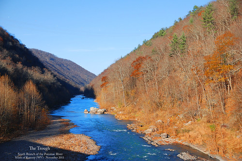
thetrough romneywv roncogswell potomaceaglescenicrailroad potomaceaglescenicrailroadromneywv thetroughsouthbranchofthepotomacriverwv thetroughwv
The Trough -- South Branch of the Potomac River South of Romney (WV) November 12, 2011
EXITING "THE TROUGH"
hiking bigschloss georgewashingtonnationalforest gwnf greatnorthmountain halfmoontrail tibbetknob halfmoonlookoutspurtrail troutrunvalleywv
trout run valley, wv
baker westvirginia unitedstates us
Sunset At 10 Feet
morning autumn mountains fall clouds nikon wv d700
Scenic Overlook
morning westvirginia hay haybales wv summer lgg3 county hardy
Hay Bales Sperrys Run
eaglesnestoutfitters south branch potomac
IMG_9805.poker.float.eagles.nest.jim
Clouds rolling through the gap
chesapeakebay chesapeakebayprogram habitats nature science westvirginia conservation environment forests issuesforests mountains partnership restoration woods unitedstates exif:focallength=340mm camera:model=canoneos5dmarkii camera:make=canon exif:isospeed=100 geostate exif:model=canoneos5dmarkii exif:aperture=ƒ56 geo:country=unitedstates geocity exif:make=canon
Forested mountains in Hardy County, W.Va.
chesapeakebay chesapeakebayprogram habitats nature science westvirginia conservation environment forests mountains partnership restoration woods unitedstates camera:model=canoneos5dmarkii camera:make=canon exif:isospeed=100 geostate exif:model=canoneos5dmarkii exif:aperture=ƒ56 exif:focallength=330mm geo:country=unitedstates geocity exif:lens=ef100400mmf4556lisusm exif:make=canon
Forested mountains in Hardy County, W.Va.
chesapeakebay chesapeakebayprogram galleries habitats landscapesgallery nature science westvirginia conservation environment forests mountains partnership restoration woods unitedstates exif:focallength=260mm camera:model=canoneos5dmarkii camera:make=canon exif:isospeed=100 geostate exif:model=canoneos5dmarkii exif:aperture=ƒ56 geo:country=unitedstates geocity exif:lens=ef100400mmf4556lisusm exif:make=canon
Forested mountains in Hardy County, W.Va.
chesapeakebay chesapeakebayprogram habitats nature science westvirginia conservation environment forests mountains partnership restoration woods unitedstates camera:model=canoneos5dmarkii camera:make=canon exif:isospeed=100 geostate exif:model=canoneos5dmarkii exif:aperture=ƒ56 geo:country=unitedstates geocity exif:focallength=400mm exif:lens=ef100400mmf4556lisusm exif:make=canon
Forested mountains in Hardy County, W.Va.
us 48 route highway road mountains rural wv west virginia appalachians nature exit ramp signs expressway pavement clouds sky landscape roadtrip light post moorefield rt 220
On the Highway In West Virginia
agriculture business chesapeakebay harpersferrynationalhistoricpark jeffersoncounty westvirginia environment farm farming food unitedstates camera:model=canoneos5dmarkii camera:make=canon exif:isospeed=100 geostate exif:model=canoneos5dmarkii exif:aperture=ƒ56 geo:country=unitedstates geocity exif:focallength=400mm exif:lens=ef100400mmf4556lisusm exif:make=canon
Grain silo in Hardy County, W.Va.