Elevation of Henry County Airport, Co Rd O, Napoleon, OH, USA
Location: United States > Ohio > Henry County > Napoleon >
Longitude: -84.068935
Latitude: 41.3743095
Elevation: 208m / 682feet
Barometric Pressure: 99KPa
Elevation Map:
Satellite Map:
Related Photos:

My hometown of Grand Rapids, Ohio may not have the dramatic night skies of the West, but look in the right places and you'll find some amazing views. #visitohio #GrandRapids #nightphotography #railroad #stars #nwohio #maumeeriver #nightsky #Sonyalpha #aw

Waiting for Warmth

Leasers at the Holgate Barn
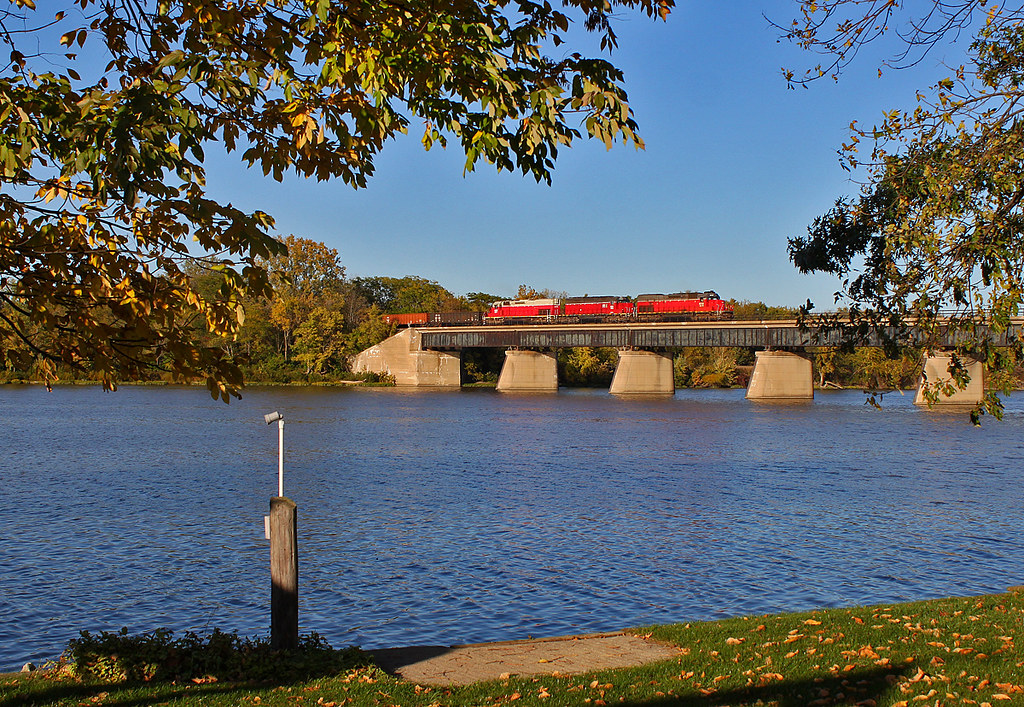
Over the Maumee

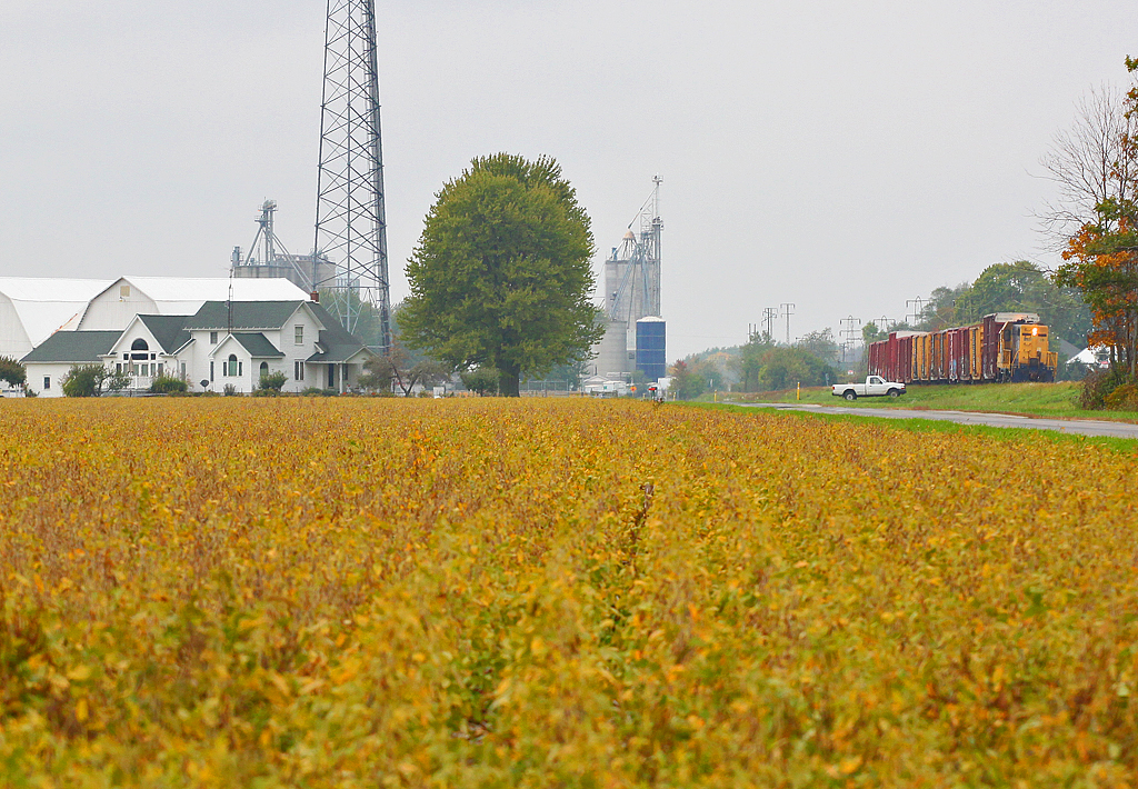
How Things Have Changed
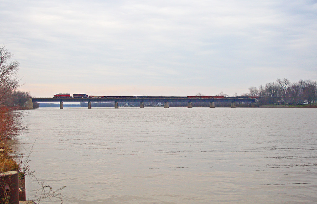
A Little Further Down the Road...
Christmas Eve Extra

41° 24' 36.8" N 84° 1' 58.7" W0.0IMG_4607Apr 24, 201413:58:37

TV Time Popcorn

41° 21' 23.6" N 84° 8' 42.7" W0.0IMG_4400Apr 23, 201413:46:29
Napoleon-Napoleon Commerce Park Hogrefe (CORF)

41° 25' 5.8" N 83° 58' 2.6" W0.0IMG_4682Apr 24, 201417:15:17

41° 25' 4.2" N 83° 58' 5.8" W0.0IMG_4677Apr 24, 201417:14:20

41° 25' 6.1" N 83° 58' 2.1" W0.0IMG_4684Apr 24, 201417:15:28
Napoleon-Napoleon Commerce Park Hogrefe (CORF)
41° 24' 39.1" N 84° 2' 17.7" W0.0IMG_4601Apr 24, 201413:51:39

41° 20' 42.7" N 84° 8' 39.6" W0.0IMG_4385Apr 23, 201412:29:39

41° 21' 23.6" N 84° 8' 42.9" W0.0IMG_4401Apr 23, 201413:46:34

41° 22' 15.2" N 84° 10' 3.2" W0.0IMG_4396Apr 23, 201413:39:12

41° 24' 23.7" N 83° 59' 54.7" W0.0IMG_4646Apr 24, 201415:42:05

41° 24' 22.7" N 84° 0' 22.7" W0.0IMG_4639Apr 24, 201415:24:08

41° 24' 23.8" N 84° 0' 27.0" W0.0IMG_4632Apr 24, 201415:21:50
Topographic Map of Henry County Airport, Co Rd O, Napoleon, OH, USA
Find elevation by address:

Places near Henry County Airport, Co Rd O, Napoleon, OH, USA:
Henry County Hospital
Henry County
600 Independence Dr
Napoleon
N Turkey Foot Ave, Malinta, OH, USA
Monroe Township
Elery
13414 County Rd S
175 Wayne Park Dr
S Damascus St, Liberty Center, OH, USA
Liberty Center
Co Rd 10, Hamler, OH, USA
Flatrock Township
544 Township Rd 5b
W North St, McClure, OH, USA
Mcclure
Texas
US-6, Napoleon, OH, USA
Co Rd U, Napoleon, OH, USA
County Rd W, Wauseon, OH, USA
Recent Searches:
- Elevation of Corso Fratelli Cairoli, 35, Macerata MC, Italy
- Elevation of Tallevast Rd, Sarasota, FL, USA
- Elevation of 4th St E, Sonoma, CA, USA
- Elevation of Black Hollow Rd, Pennsdale, PA, USA
- Elevation of Oakland Ave, Williamsport, PA, USA
- Elevation of Pedrógão Grande, Portugal
- Elevation of Klee Dr, Martinsburg, WV, USA
- Elevation of Via Roma, Pieranica CR, Italy
- Elevation of Tavkvetili Mountain, Georgia
- Elevation of Hartfords Bluff Cir, Mt Pleasant, SC, USA