Latitude: 39.5991924
Longitude: -77.8081363
Elevation: 140 meters / 459 feet
Barometric Pressure 997KPa

Related Photos

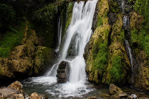
Falling Waters Falls by PeaceLoveJava™, Falling Waters was the site of two battles during the American Civil War:

The Battle of Hoke's Run
Falling Waters Falls by PeaceLoveJava™
Echoes of History by GSB Photography, Antietam National Battlefield Park, Maryland.

This lovely Maryland countryside is quiet today, simp
Echoes of History by GSB Photography
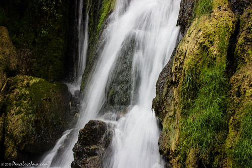
Falling Waters Falls Closeup by PeaceLoveJava™, Falling Waters was the site of two battles during the American Civil War:

The Battle of Hoke's Run
Falling Waters Falls Closeup by PeaceLoveJava™
Falling (Explored) by Scott of SWPA, It seems like an eternity since I snapped a photo for Flickr as work has been very busy so far this
Falling (Explored) by Scott of SWPA
Trickle (Explored) by Scott of SWPA, Falling Waters, WV with low flow. 

This past Monday, while in Chambersburg, PA, I managed to get ou
Trickle (Explored) by Scott of SWPA
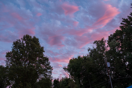
Hagerstown, Maryland, USA by takasphoto.com, Living in California for a while, we sometimes miss the east coast - from these impressive clouds, g
Hagerstown, Maryland, USA by takasphoto.com
Dunker Church, Antietam Battlefield, a low light photo by PhotosToArtByMike, A three minute exposure with a spotlight "painting" the historic church.  It was a Low-Lig
Dunker Church, Antietam Battlefield, a low light photo by PhotosToArtByMike
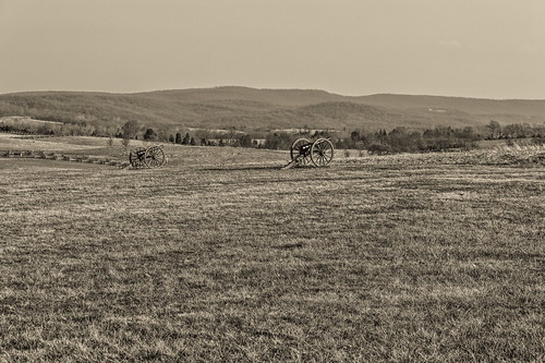
Antietam Battlefield by 95wombat, What I was taking a picture of in the <a href="http://www.flickr.com/photos/95wombat/9660695757/">pr
Antietam Battlefield by 95wombat
The New Day Brings its Shining Sun by SunnyDazzled, The Maryland Monument at Antietam National Battlefield in Sharpsburg is the only monument there dedi
The New Day Brings its Shining Sun by SunnyDazzled
Fence Sitting Snow by T-3 Photography, HFF!

A view down the fence line of the Piper Farm at the Antietam National Battlefield.battlefield
Fence Sitting Snow by T-3 Photography
Inside The Roundhouse by DJ Witty, The view inside the Western Maryland Railway's Hagerstown Roundhouse looking somewhat northwest towa
Inside The Roundhouse by DJ Witty
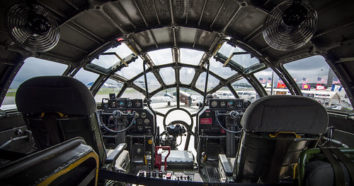
Ready To Jump To Hyperspace by trainmann1, You're looking through the cockpit windows of the B-29 Superfortress "Fifi" which came to
Ready To Jump To Hyperspace by trainmann1
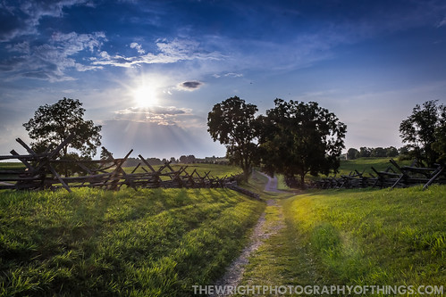
ANTIETAM BLOODY LANE SUNDOWN by The Wright Photography of Things, The sun begins to set on another day  recently at the Antietam battlefield near Sharpsburg, MD. Here
ANTIETAM BLOODY LANE SUNDOWN by The Wright Photography of Things
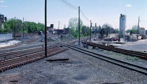
CP Town/NC Tower by DJ Witty, This is a view of the at-grade crossing between CSXT's Lurgan Subdivision and Conrail's Lurgan Line
CP Town/NC Tower by DJ Witty
The Sky of Hagerstown in Dusk, Maryland, USA by takasphoto.com, Living in California for a while, we sometimes miss the east coast - from these impressive clouds, g
The Sky of Hagerstown in Dusk, Maryland, USA by takasphoto.com
Devils Backbone Park, Boonesboro MD silky water by PhotosToArtByMike, This was a 3 or 4 second exposure late evening.  Print size 13x19 inches.

Critique by Jon Heller  <
Devils Backbone Park, Boonesboro MD silky water by PhotosToArtByMike
US 11-1-2 by Mr_Samson, View of the Potomac River from Potomac Park in Williamsport, MD.

Once again many thanks for visits,
US 11-1-2 by Mr_Samson
The Slaughter Pen by T-3 Photography, HFF

A view of the fencing lining Bloody Lane at Antietam National Battlefield.battlefield civilwar
The Slaughter Pen by T-3 Photography
Afternoon At Antietam by T-3 Photography, I stopped in at the battlefield on my way back from shooting trains around Shepherdstown, WV. The ni
Afternoon At Antietam by T-3 Photography
Sunset On The Six Eight by T-3 Photography, A view of yesterday's sunset from Maryland 68, near Clear Spring.

This HDR image was created from t
Sunset On The Six Eight by T-3 Photography
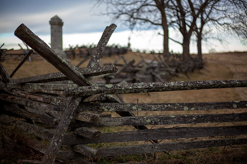
Piper Fence Post by T-3 Photography, HFF!

This is a view of the fence that lines the driveway to the Piper Farm at the Antietam National
Piper Fence Post by T-3 Photography
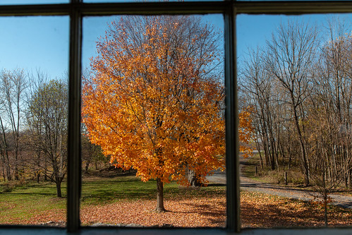
Looking Out The Church Window. by gleavesm, The view outside the window of the Dunker Church at Antietam National Battlefield in Sharpsburg, Mar
Looking Out The Church Window. by gleavesm

Good Morning Tree by jeffsmallwood, While I was at Antietam Battlefield for sunrise the sky was changing dramatically from minute to min
Good Morning Tree by jeffsmallwood
Rectangular Square by T-3 Photography, An overhead view of Hagerstown's City Square.drone dji mavic2pro aerial dronephotography hagerstown
Rectangular Square by T-3 Photography
Twelve-Pound Napoleon Complex by T-3 Photography, A 12-poun Napoleon marks the position of Batter B, 4th United States Artillery at Antietam.history b
Twelve-Pound Napoleon Complex by T-3 Photography
Devils Backbone Park, Boonsboro MD waterfall by PhotosToArtByMike, I can't believe I got my wife to hold still for a 3 second exposure.  Print size 8x10 inches.landsca
Devils Backbone Park, Boonsboro MD waterfall by PhotosToArtByMike
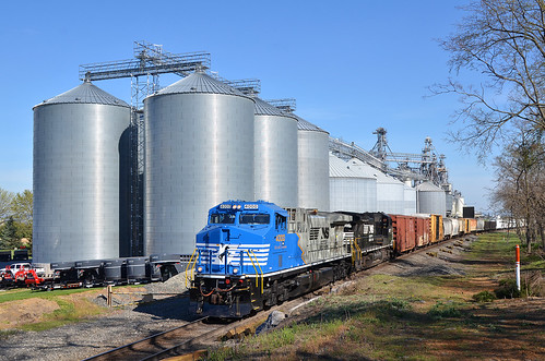
2016 04-18 9:33AM NS AC44C6M-4000 S/B 37-Q, Maugansville, MD by guitartrain203, Wide angle view at the Martin's Elevators.
2016 04-18 9:33AM NS AC44C6M-4000 S/B 37-Q, Maugansville, MD by guitartrain203
Fine Old Barn with Fresh Repairs by paininthelens, Route 70 through Maryland is rich with beautiful rural images. Unfortunately - the weather was not c
Fine Old Barn with Fresh Repairs by paininthelens

Under surveillance by baalands, Max has got his eye on something or someone.pet max grass 510fav cat spring orangecat creamsicles cc
Under surveillance by baalands
Doubleday Hill by T-3 Photography, A pair of 3-inch Ordnance Rifles (a third is behind me) represent the former earthworks on what used
Doubleday Hill by T-3 Photography
Crystal Grottoes Caverns, Boonsboro, Maryland by Jeff Bey, The caverns were discovered in 1920 and opened to the public in 1922.beautiful rock bacon md ribbons
Crystal Grottoes Caverns, Boonsboro, Maryland by Jeff Bey
Burnside's Bridge by Jaime Dillen-Seibel, Crossing over Antietam Creek, the bridge played a key role in the September 1862 Battle of Antietam
Burnside's Bridge by Jaime Dillen-Seibel
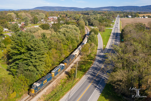
CSX B702 - Chewsville, MD by T-3 Photography, A pair of geeps lead B702 back to Hagerstown after interchanging with the Maryland Midland at Highfi
CSX B702 - Chewsville, MD by T-3 Photography

South Side Of The Sky by T-3 Photography, An aerial view of the south end of downtown Hagerstown.

Title inspired by the Yes <a href="https://
South Side Of The Sky by T-3 Photography
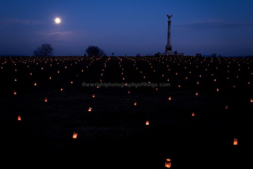
NEW YORK MONUMENT by The Wright Photography of Things, A near Full Moon lights the night sky as some of the 23,000 luminaries dot the "landscape turne
NEW YORK MONUMENT by The Wright Photography of Things
NS 203 - Hagerstown, MD by T-3 Photography, A pair of SD70s lead the Pennsy Heritage unit south out of Vardo Yard on the H-Line.
NS 203 - Hagerstown, MD by T-3 Photography
Conococheague Aqueduct by Itinerant Wanderer, A view of the historic Conococheague Aqueduct in the Williamsport, Maryland section of Chesapeake &a
Conococheague Aqueduct by Itinerant Wanderer
South On North by T-3 Photography, A view south on North Potomac Street.street city longexposure urban night canon nocturnal citylife m
South On North by T-3 Photography
2016 04-18 9:32AM NS AC44C6M-4000 S/B 37-Q, Maugansville, MD by guitartrain203, In this tele view, our chase of 37-Q begins as "Jake" comes into view at the Martin's Elev
2016 04-18 9:32AM NS AC44C6M-4000 S/B 37-Q, Maugansville, MD by guitartrain203
2015 Chesapeake Watershed Forum in Jefferson County, W.Va. by chesbayprogram, The Potomac River is seen in Shepherdstown, W. Va. on Sept. 26, 2015. (Photo by Will Parson/Chesapea
2015 Chesapeake Watershed Forum in Jefferson County, W.Va. by chesbayprogram
View of the West Virginia Power Plant across Dam No. 4 of the Potomac at Downsville MD by PhotosToArtByMike, Dam No.4 is one of seven dams on the Potomac River which were originally built to divert water into
View of the West Virginia Power Plant across Dam No. 4 of the Potomac at Downsville MD by PhotosToArtByMike
Across by T-3 Photography, A view into the cemetery behind the Zion United Church of Christ in Hagerstown. The former M. P. Möl
Across by T-3 Photography
2015-11-23 0956 W&W 459 on #86 Falling Waters, WV by jimkleeman, At Learic Road in Falling Waters the tracks turn to the east on the approach to the Potomac River br
2015-11-23 0956 W&W 459 on #86 Falling Waters, WV by jimkleeman
Morning on the Conococheague Creek in Williamsport MD by PhotosToArtByMike, Print size 13x19 inches. morning sunrise landscape md scenic maryland potomacriver cocanal cushwa ca
Morning on the Conococheague Creek in Williamsport MD by PhotosToArtByMike
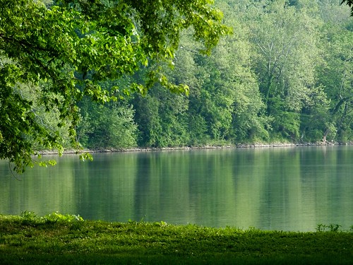
Four Locks by JRWhitaker1, Photographed at the Four Locks area, Chesapeake and Ohio Canal National Historic Park near Clear Spr
Four Locks by JRWhitaker1
MASON DIXON FIELDS by The Wright Photography of Things, Norfolk Southern manifest 13R passes through the Mason Dixon Line after waiting for and following K8
MASON DIXON FIELDS by The Wright Photography of Things

City Square by T-3 Photography, A look down view of Hagerstown's city square from about 200' up.
City Square by T-3 Photography
Hagerstown, Maryland, USA by takasphoto.com, Living in California for a while, we sometimes miss the east coast - from these impressive clouds, g
Hagerstown, Maryland, USA by takasphoto.com
2021-03-10 0822 NS 8014 Jordon Rd, Fairplay, MD by jimkleeman, I spent Wednesday 3/10/2021 railfanning the NS Lurgan and H-Line with Bob Kaplan. Bob knew of this n
2021-03-10 0822 NS 8014 Jordon Rd, Fairplay, MD by jimkleeman
The Bloody Cornfield, Antietam Battlefield by Msanders55,                                maryland civilwar antietam battlefield magichour americancivilwar cor
The Bloody Cornfield, Antietam Battlefield by Msanders55
When you don't get the memo by lionel682, Have long wanted to see the only Western Maryland K2 Pacific steam locomotive #202 still unscrapped.
When you don't get the memo by lionel682
Piper Farm by Piedmont Fossil, The battle of Antietam, fought on September 17, 1862, near the little village of Sharpsburg, Marylan
Piper Farm by Piedmont Fossil
2021 07-21 1945-6 W&W GP38-2-2256, 2689 N/B 301 Turn, Falling Waters, WV by guitartrain203, In this view from Encampment Road, W&W's N/B 301 Turn rolls by at a blistering 15, maybe 20, MPH
2021 07-21 1945-6 W&W GP38-2-2256, 2689 N/B 301 Turn, Falling Waters, WV by guitartrain203
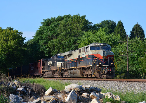
2020 08-11 0813-4 NS-CofG ES44AC-8101 N/B 12R St. James, MD by guitartrain203, TELE View: Norfolk Southern's Central of Georgia ES44AC-8101 & NS C44-9W-9853 are on the point o
2020 08-11 0813-4 NS-CofG ES44AC-8101 N/B 12R St. James, MD by guitartrain203
2020 07-30 1859-91 NKP ES44AC-8100, LV ES44AC-8104 S/B Q76 Hagerstown, MD by guitartrain203, WIDE View: Double Heritage! The Nickel Plate Road & Lehigh Valley heritage engines are leading S
2020 07-30 1859-91 NKP ES44AC-8100, LV ES44AC-8104 S/B Q76 Hagerstown, MD by guitartrain203
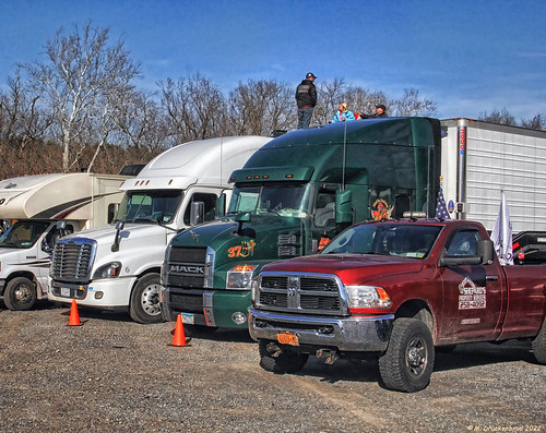
Climb on up for a Great View by PhotosToArtByMike, Truck parking at the Hagerstown Speedway in Hagerstown Maryland, a city near the Appalachian Mountai
Climb on up for a Great View by PhotosToArtByMike
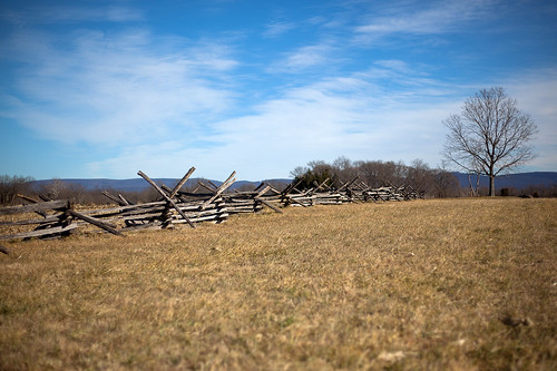
Antietam, Stubblefield by Msanders55, Along the Smoketown Road, Antietam Battlefield.
fence maryland antietam battlefield farmfield
Antietam, Stubblefield by Msanders55
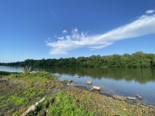
Potomac River by Itinerant Wanderer, A view of the Potomac River in River Bottom Park, Williamsport, Maryland.

<a href="https://www.cana
Potomac River by Itinerant Wanderer
Potomac River by Itinerant Wanderer, A view of the Potomac River in River Bottom Park, Williamsport, Maryland.

<a href="https://www.cana
Potomac River by Itinerant Wanderer
CastleGrudnick2020 by Grudnick, Noted landscraper, Handlungsunfähiger VonBraun, has updated the gardens of Schloss Grudnick.ourhouse
CastleGrudnick2020 by Grudnick