Elevation of Mount Adams, West Coast, New Zealand
Location: New Zealand > West Coast > Harihari >
Longitude: 170.5275
Latitude: -43.268333
Elevation: 1730m / 5676feet
Barometric Pressure: 82KPa
Elevation Map:
Satellite Map:
Related Photos:

IMG_1812 - Version 2
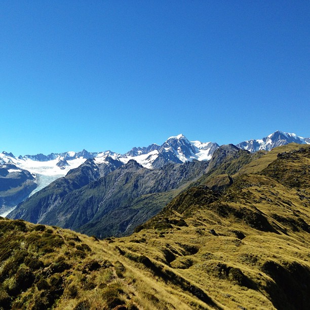
Fox Glacier to the left, mount Tasman in the middle and the mighty mount Cook on the right. 2 and a half hour hike, vertical elevation gain of 5000 ft to summit mount fox for this view. #climbingtrees #mountcook #glaciers #foxglacier #tramping #viewsworth
Topographic Map of Mount Adams, West Coast, New Zealand
Find elevation by address:

Places near Mount Adams, West Coast, New Zealand:
Mount Kensington
Harihari
102 Main Rd
49 Main Rd
Whataroa
8 La Fontaine Road
Newton Peak
Mount D'archiac
Lake Ianthe
Mount Sibbald
Ramsay
The Warrior
Sibbald
Kakapotahi
17 Albert St
Franz Josef Glacier
41 The Strand
Okarito
The Thumbs
Mount Whitcombe
Recent Searches:
- Elevation of Corso Fratelli Cairoli, 35, Macerata MC, Italy
- Elevation of Tallevast Rd, Sarasota, FL, USA
- Elevation of 4th St E, Sonoma, CA, USA
- Elevation of Black Hollow Rd, Pennsdale, PA, USA
- Elevation of Oakland Ave, Williamsport, PA, USA
- Elevation of Pedrógão Grande, Portugal
- Elevation of Klee Dr, Martinsburg, WV, USA
- Elevation of Via Roma, Pieranica CR, Italy
- Elevation of Tavkvetili Mountain, Georgia
- Elevation of Hartfords Bluff Cir, Mt Pleasant, SC, USA