Elevation of Canyon Rd, Julian, CA, USA

Location: United States > California > San Diego County > Julian >

Longitude: -116.25598

Latitude: 32.8988943

Elevation: 374m / 1227feet

Barometric Pressure: 97KPa

Elevation Map:

elevation map of Canyon Rd, Julian, CA, USA

Satellite Map:

Satellite map of Canyon Rd, Julian, CA, USA

Related Photos:

california panorama landscape 360 geology anzaborrego hdr vr equirectangular sdosremedios size2x3 size1x2 ©stevendosremedios
Dry Waterfall
sky snow ice weather landscape webcam timelapse lookout vista backcountry remote ucsd anzaborregodesert monumentpeak 360degreeview lagunamountains sunrisehighway motiondetection desertpanorama sandiegocountycalifornia hpwren mountlagunanorthview 1352568971 113012updatedgps328917321167541164225268364 mtlagunanorthview flickrmaplocation3289232611642066 extremesoutherncalifornia elevation6300ft1920m backbonesite
Mount Laguna after the snow and ice storm 10-Nov-2012 9:36 am PST
sky snow ice weather landscape webcam timelapse lookout vista backcountry remote ucsd anzaborregodesert monumentpeak 360degreeview lagunamountains sunrisehighway motiondetection desertpanorama sandiegocountycalifornia hpwren mountlagunanorthview 1352576771 113012updatedgps328917321167541164225268364 mtlagunanorthview flickrmaplocation3289232611642066 extremesoutherncalifornia elevation6300ft1920m backbonesite
Falling Ice ~ Mount Laguna
way stars timelapse desert time anzaborrego milky lapse
Milky Way and Other Stars - Time Lapse - Anza-Borrego Desert State Park - May 2, 2011
california urban cold abandoned station warning underground geotagged san war mt force control decay aircraft military air nuclear diego mount bunker urbanexploration dew rads falloutshelter laguna airforce shelter bomb exploration usaf base radar coldwar fallout urbex acw gatr 751st 751strads geo:lat=328763685205425 geo:lon=116414565187874
Mother do you think they'll drop the bomb?
sun silhouette sunrise mountlaguna hpwren mountlagunaeastview
Mt Laguna east view at sunrise
sky weather landscape webcam timelapse lookout vista backcountry remote ucsd anzaborregodesert monumentpeak 360degreeview lagunamountains sunrisehighway motiondetection desertpanorama sandiegocountycalifornia hpwren mtlagunanorthview flickrmaplocation3289232611642066 extremesoutherncalifornia elevation6300ft1920m backbonesite
Mt Laguna North view
california urban cold abandoned station clouds warning geotagged san war mt force control decay aircraft military air diego mount urbanexploration dew rads laguna airforce exploration usaf base radar coldwar urbex acw gatr geo:lon=116414547 751st 751strads geo:lat=328750705
Abandoned Distant Early Warning radar tower on top of Mount Laguna.
california urban cold abandoned station warning geotagged san war mt force control decay aircraft military air nuclear diego mount urbanexploration dew rads falloutshelter laguna airforce exploration usaf base radar coldwar nukes urbex acw gatr 751st 751strads geo:lat=328763620706023 geo:lon=116414573480654
When you walk through that door; Don't say you're easy on me; You're about as easy as a nuclear war.
february southerncalifornia smugglercanyon anzaborregodesertpark
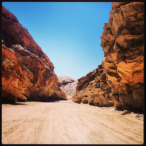
View from Smuggler Canyon dryfall
california urban cold abandoned station warning geotagged san war mt force control decay aircraft military air diego mount urbanexploration dew rads laguna airforce exploration usaf base radar coldwar urbex acw gatr 751st 751strads geo:lat=328764239593139 geo:lon=116414493909454
Light socket inside the bomb shelter
california urban cold abandoned station warning underground geotagged san war mt force control decay aircraft military air nuclear diego mount bunker urbanexploration dew rads falloutshelter laguna airforce shelter bomb exploration usaf base radar coldwar fallout urbex acw gatr 751st 751strads geo:lat=328763836932589 geo:lon=116414545680096
Cause I'm radioactive oh yeah; Oh yeah radioactive; Don't you stand, stand too close; You might catch it
sky snow ice weather landscape webcam timelapse lookout vista backcountry remote ucsd anzaborregodesert monumentpeak 360degreeview lagunamountains sunrisehighway motiondetection desertpanorama sandiegocountycalifornia hpwren mountlagunanorthview 1352562971 113012updatedgps328917321167541164225268364 mtlagunanorthview flickrmaplocation3289232611642066 extremesoutherncalifornia elevation6300ft1920m backbonesite
10-Nov-2012 7:56 am PST
california urban cold abandoned station warning underground geotagged san war mt force control decay aircraft military air nuclear diego mount bunker urbanexploration dew rads falloutshelter laguna airforce shelter bomb exploration usaf base radar coldwar fallout urbex acw gatr 751st 751strads geo:lat=328763936445951 geo:lon=116414532885521
We couldn't save them
california urban cold abandoned station warning geotagged san war mt force control decay aircraft military air diego mount urbanexploration dew rads laguna airforce exploration usaf base radar coldwar urbex acw gatr 751st 751strads geo:lat=328770735384615 geo:lon=116414754846154
Looking through a broken window in the control room
lost webcam mountlaguna eastview smokemonster hpwren mountlagunasandiegocounty californiahpwrencloudssnowskybeautiful20minutes lostthesmokemonsterskindlytwin 1352563333jpg
The smoke monster's kindly brother ~ ~ ~
california urban cold abandoned station warning underground geotagged san war mt force control decay aircraft military air nuclear diego mount bunker urbanexploration dew rads falloutshelter laguna airforce shelter bomb exploration usaf base radar coldwar fallout urbex acw gatr 751st 751strads geo:lat=32876387716793 geo:lon=11641454050698
No nukes is good nukes
california urban cold abandoned station warning underground geotagged san war mt force control decay aircraft military air nuclear diego mount bunker urbanexploration dew rads falloutshelter laguna airforce shelter bomb exploration usaf base radar coldwar fallout urbex acw gatr 751st 751strads geo:lat=328763781340247 geo:lon=116414552827682
Sump pump. I haven't seen one of these since I lived in Illinois
mountains anzaborregodesert sandiegocountycalifornia hpwren mountlagunanorthview picmonkeyeditclone
Mount Laguna sunrise view
sunrise desert mtlaguna desertviewpicnicgrounds 100xthe2014edition 100x2014 image1100
1/100 First day sunrise...
sky weather landscape webcam timelapse lookout vista backcountry remote ucsd anzaborregodesert monumentpeak 360degreeview lagunamountains sunrisehighway motiondetection desertpanorama sandiegocountycalifornia hpwren mountlagunanorthview 3289232611642066 mtlagunanorthview flickrmaplocation3289232611642066 extremesoutherncalifornia elevation6300ft1920m backbonesite
Mt Laguna view: Desert sunrise 12~12~2012
julian california unitedstates us weather lightning thunderstorm clouds sky desert anzaborrego anzaborregodesertstatepark
And the Lightning Strikes - Anza-Borrego Desert - October 12, 2018
california mountain landscape desert pilz8
Mount Laguna
julian california unitedstates us ocotillo starstax stars desert night sky landscape anzaborrego state park
Star Trails and an Ocotillo With Exposed Roots
Tierra Blanca Mtns & Salton Sea.
julian california unitedstates us desert anzaborrego lightning weather thunderstorm cholla cactus badlands s2 sandiego sandiegocounty cloudsstormssunsetssunrises
Can't you hear, can't you hear the thunder? You better run, you better take cover.
california unitedstates us atlas atlas5 rocket vandenberg vandenberghafb launch september 2017 anzaborrego desert
Vandenberg Air Force Base NROL-42 Atlas 5 Rocket Flies Through the Milky Way
panorama desert anzaborrego anzaborregodesertstatepark
Campsite panorama at Hollywood & Vine in Anza-Borrego Desert State Park
moblog samsunggalaxysiii
Sunset in Anza-Borrego Desert Park. #camping #anzaborrego
julian california unitedstates us anzaborrego anzaborregodesertstatepark stars startrails starstax sandiego desert ocotillo night astronomy sky
North Star Trails Over a Pair of Ocotillo
railroad train desert tracks rail gorge anzaborrego carrizo sdae
Train tracks and tunnel in the middle of the Anza-Borrego Desert. San Diego and Arizona Railroad (SD&AE) / Carrizo Gorge Railway
california unitedstates us anzaborrego anzaborregodesertstatepark solitude rv camper trailer camping deserted alone desert milkyway stars night sky
Deserted in the Desert. Alone at Night In Anza-Borrego Desert State Park
california mountain abandoned station forest geotagged san mt force decay military air diego mount urbanexploration dew rads laguna usaf defense base radar coldwar urbex acw 751st 751strads geo:lat=328583091 geo:lon=1164202732
Mount Laguna Air Force Station and FAA radar tower from a distance
Look, there's more snow down there too
Anzo Borrego
Anzo Borrego
california unitedstates desert anzaborrego milkyway anzaborregodesertstatepark
Night in the desert.
square squareformat mayfair iphoneography instagramapp uploaded:by=instagram foursquare:venue=4f6e8348e4b06892a0944ae0
Yes I drove through that - amazing #offroading #camping #adventure #nature
sunset night twilight desert cloudy anzaborrego
Twilight in Anza-Borrego Desert State Park.
Palm Bowl Grove.
Ocotillo on the Pictograph trail.