Elevation of 20 Stetson Brothers Rd, Colrain, MA, USA
Location: United States > Massachusetts > Franklin County > Colrain >
Longitude: -72.780551
Latitude: 42.706235
Elevation: 341m / 1119feet
Barometric Pressure: 97KPa
Elevation Map:
Satellite Map:
Related Photos:
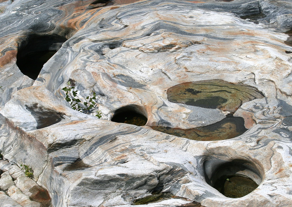
Glacial Potholes

A Place to Sit

summer weekend
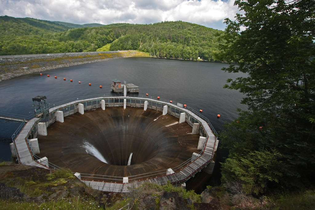
The Glory Hole ~ Harriman Reservoir

Old Man of the Falls

White Dahlia
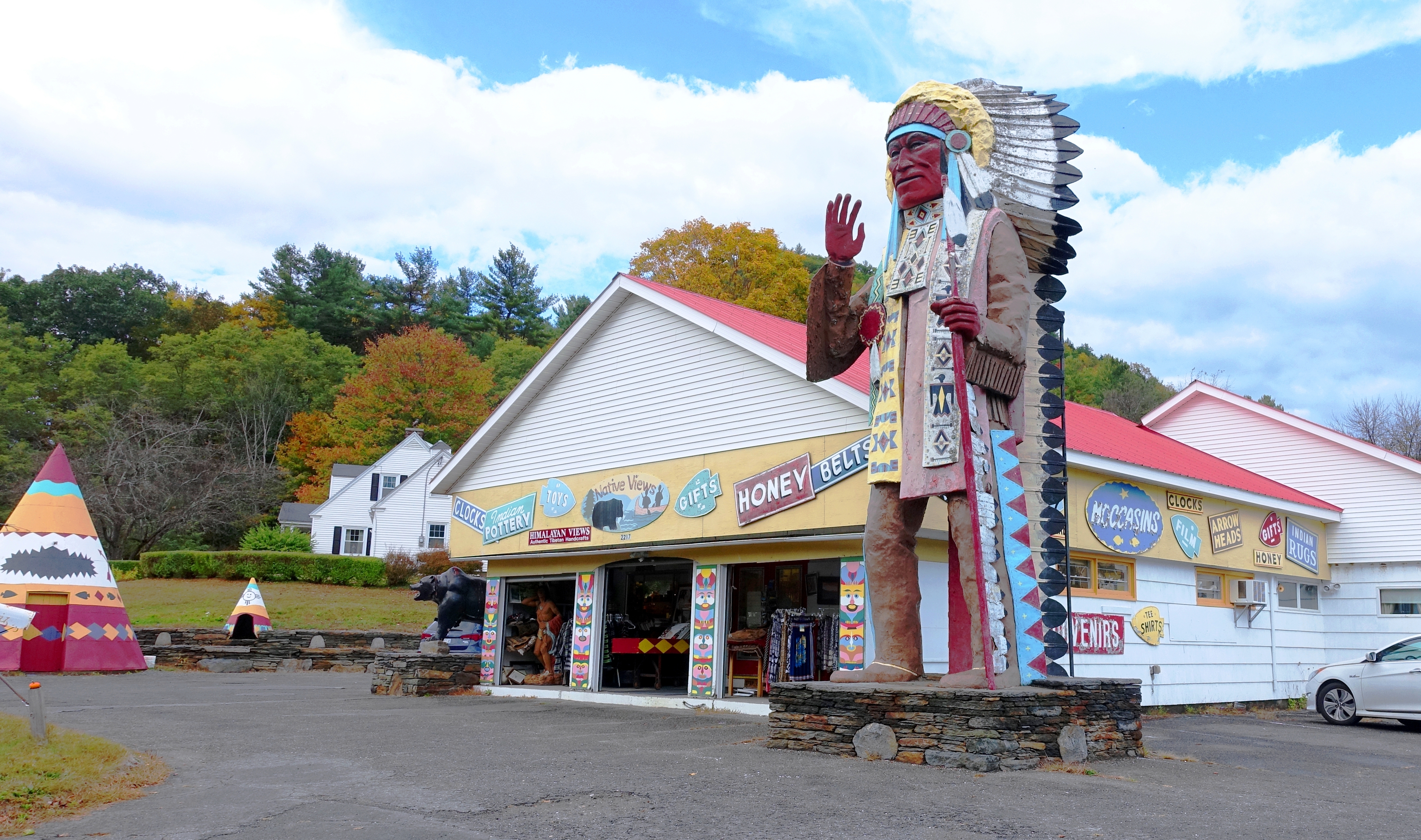
Native Views Trading Post on the Mohawk Trail in Shelburne Falls, Massachusetts

Sunshine in the Rain

View from East Side to Hurricane Damaged Eunice Williams Covered Bridge

View from East Side to Hurricane Damaged Eunice Williams Covered Bridge

View from East Side to Hurricane Damaged Eunice Williams Covered Bridge

View Upriver from West Side to Hurricane Damaged Eunice Williams Covered Bridge

View Upriver from West Side to Hurricane Damaged Eunice Williams Covered Bridge

View from East Side to Hurricane Damaged Eunice Williams Covered Bridge

View through Bridge to East Portal to Hurricane Damaged Eunice Williams Covered Bridge

View Upriver from East Side to Hurricane Damaged Eunice Williams Covered Bridge
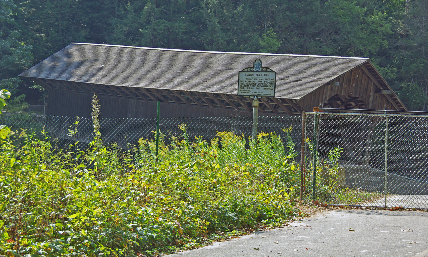
View from East Side to Hurricane Damaged Eunice Williams Covered Bridge

Bridge of Flowers - Shelburne Falls, MA.

All Bottled Up

char pano I

Shelburne Falls 0411-0417 Panorama

Buckland on Deerfield

Shelburne Falls

October on The Deerfield

Constant II. 1/4 second @f/22 #waterfall #waterflow #vermontshots #70d #10to18mm review is now available. @jicebee you are right, better with rock cropped.

Along the Canal on Rt. 112 in Colrain....

Shelburne Falls / Vista

Rocks at Halifax

Apple tree. Early spring. #gopro @polarpro polarizing filter.

"Big Indian Shop" on the Mohawk Trail

In Search of a Cool Breeze

Half on One Side

Ryder Pond, Whitingham, VT - Fall Foliage

Shelburne Falls Potholes_0276

Photo Oct 20, 3 18 54 PM

Deerfield River

Photo Oct 20, 1 41 03 PM

Photo Oct 20, 3 17 46 PM

Mohawk Trail State Forest
Topographic Map of 20 Stetson Brothers Rd, Colrain, MA, USA
Find elevation by address:

Places near 20 Stetson Brothers Rd, Colrain, MA, USA:
84 Hosmer Rd
84 Hosmer Rd
19 Wigwam Dr
30 Waterfall Dr
36 Shawnee Dr
4 Shawnee Dr
Flagg Hill Road
Heath Free Public Library
Heath
81 Ma-8a
Long Hill Road
10 Royer Rd
34 Royer Rd, Heath, MA, USA
85 Number 9 Rd
Royer Road
181 S Rd
10 Judd Rd
Mohawk Trail
MA-2, Shelburne Falls, MA, USA
231 Ma-8a
Recent Searches:
- Elevation of Elwyn Dr, Roanoke Rapids, NC, USA
- Elevation of Congressional Dr, Stevensville, MD, USA
- Elevation of Bellview Rd, McLean, VA, USA
- Elevation of Stage Island Rd, Chatham, MA, USA
- Elevation of Shibuya Scramble Crossing, 21 Udagawacho, Shibuya City, Tokyo -, Japan
- Elevation of Jadagoniai, Kaunas District Municipality, Lithuania
- Elevation of Pagonija rock, Kranto 7-oji g. 8"N, Kaunas, Lithuania
- Elevation of Co Rd 87, Jamestown, CO, USA
- Elevation of Tenjo, Cundinamarca, Colombia
- Elevation of Côte-des-Neiges, Montreal, QC H4A 3J6, Canada