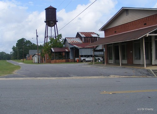
Elevation of Zion Baptist Church Rd, Surrency, GA, USA
Location: United States > Georgia > Appling County > Surrency >
Longitude: -82.181107
Latitude: 31.8635469
Elevation: 49m / 161feet
Barometric Pressure: 101KPa
Related Photos:
Topographic Map of Zion Baptist Church Rd, Surrency, GA, USA
Find elevation by address:

Places near Zion Baptist Church Rd, Surrency, GA, USA:
93 White Bluff Rd
Davis Landing, Baxley, GA, USA
Old Surrency Rd, Baxley, GA, USA
Surrency
Surrency Ga.
Golden Isles Hwy E, Baxley, GA, USA
Spring Branch Rd, Baxley, GA, USA
Appling County
Bell Dr, Baxley, GA, USA
Baxley
218 Fair St
83 Hollis St
Ranier St, Baxley, GA, USA
Blackshear Hwy SE, Baxley, GA, USA
Deen's Landing Road
441 Hutcheson Rd
R T Stanley Rd, Lyons, GA, USA
Tattnall County
Golden Isles W, Baxley, GA, USA
W Brazell St, Reidsville, GA, USA
Recent Searches:
- Elevation of Corso Fratelli Cairoli, 35, Macerata MC, Italy
- Elevation of Tallevast Rd, Sarasota, FL, USA
- Elevation of 4th St E, Sonoma, CA, USA
- Elevation of Black Hollow Rd, Pennsdale, PA, USA
- Elevation of Oakland Ave, Williamsport, PA, USA
- Elevation of Pedrógão Grande, Portugal
- Elevation of Klee Dr, Martinsburg, WV, USA
- Elevation of Via Roma, Pieranica CR, Italy
- Elevation of Tavkvetili Mountain, Georgia
- Elevation of Hartfords Bluff Cir, Mt Pleasant, SC, USA


