Elevation of Yamsay Mountain, Oregon, USA
Location: United States > Oregon > Chiloquin >
Longitude: -121.36390
Latitude: 42.9306949
Elevation: 2475m / 8120feet
Barometric Pressure: 75KPa
Elevation Map:
Satellite Map:
Related Photos:

Besökare Samtidigt
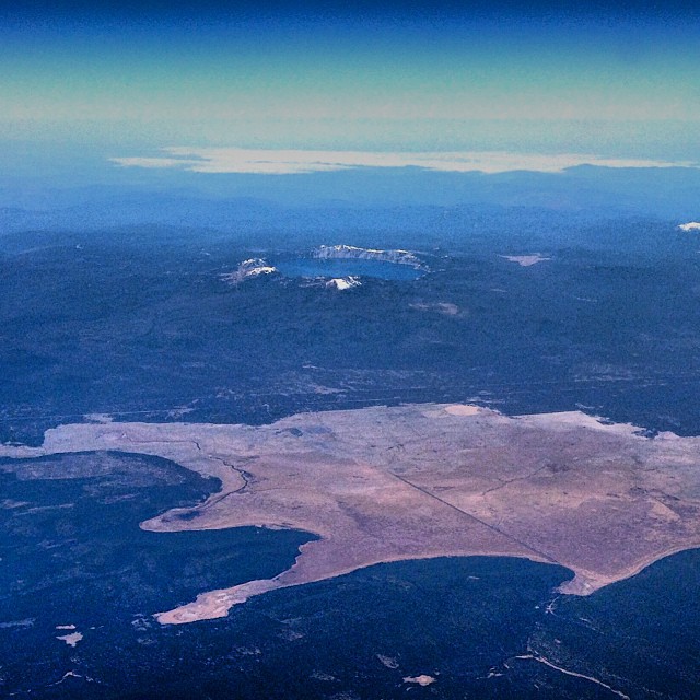
Crater Lake
Topographic Map of Yamsay Mountain, Oregon, USA
Find elevation by address:

Places near Yamsay Mountain, Oregon, USA:
Klamath County
Klamath Falls
OR-31, Silver Lake, OR, USA
Silver Lake
Oregon Pines Road
23401 Mt Trout Ln
Winema National Forest
36070 Saddle Mountain Pit Rd
23417 Cherrywood Ln
33185 Elde St
The Dalles-california Highway
Sprague River
45500 Or-140
US-97, Chemult, OR, USA
Chemult
Fort Rock State Park
14656 N Meadow Lark Dr
14656 N Meadow Lark Dr
9h37+r5
Obenchain Reservoir
Recent Searches:
- Elevation of Corso Fratelli Cairoli, 35, Macerata MC, Italy
- Elevation of Tallevast Rd, Sarasota, FL, USA
- Elevation of 4th St E, Sonoma, CA, USA
- Elevation of Black Hollow Rd, Pennsdale, PA, USA
- Elevation of Oakland Ave, Williamsport, PA, USA
- Elevation of Pedrógão Grande, Portugal
- Elevation of Klee Dr, Martinsburg, WV, USA
- Elevation of Via Roma, Pieranica CR, Italy
- Elevation of Tavkvetili Mountain, Georgia
- Elevation of Hartfords Bluff Cir, Mt Pleasant, SC, USA