Elevation of Tremont Dr, Owensboro, KY, USA

Location: United States > Kentucky > Daviess County > Owensboro >

Longitude: -87.110270

Latitude: 37.7442053

Elevation: -10000m / -32808feet

Barometric Pressure: 295KPa

Elevation Map:

elevation map of Tremont Dr, Owensboro, KY, USA

Satellite Map:

Satellite map of Tremont Dr, Owensboro, KY, USA

Related Photos:

bridge trees geotagged boat 5 kentucky transport indiana tugboat treeline onwhite soe picnik girders ohioriver bluehue barges onblack westernkentucky metalbridge blueblueblue blueribbonwinner otw ohiorivervalley 5faves kartpostal coalbarges owensborokentucky viewonblack shieldofexcellence commonwealthofkentucky ohiorivercity downtownowensboro flickraward zerofaves owensbororiverfront anythingtodowithwater betterthangood goldstaraward daviescountykentucky thebluegrassstate viewonwhite bluespointofview yourprefferedpicture jasonpresser olétusfotos jediphotographer dragondaggerphoto dragonflyawardsgroup geo:lat=37780213 geo:lon=87109351 jrmillerblvd jrmillerbridge bestofformyspacestation
Bridge Over the Ohio
flowers orange sunlight flower green leaves yellow rural geotagged countryside petals shadows dof bokeh kentucky country farmland crop sunflowers sunflower westernkentucky openfield sunflowerfield natureworld sunflowerfarm flowerwatching top20green top20yellow naturewatching top20summer thebluegrassstate top20greenish daviesscountykentucky gemsofnature agriculturalarea tbfsgallery agricultralarea geo:lat=37766915 awesomeblossoms geo:lon=87216511 sorghokentucky
Sunflower in an Open Field
First Car
photo scene cvb street bridge st museum 2nd firstbaptist main owensboro ky kentucky view downtown usa
2nd St - Downtown Owensboro
view holidayinn boardwalkpipeline owensboroconventioncenter owensboro aerial 5ds dslr ohioriver riverparkcenter occ smotherspark 50mp pier bluebridge downtown kentucky usa hampton inn
Downtown Owensboro
bridge blue bw monochrome sepia gazebo telephoto ohioriver englishpark
English Park - Bridge View
trees sunset summer sky sun clouds rural geotagged pod kentucky bluesky farmland summertime pow westernkentucky summersunset hendersoncountykentucky geo:lat=3782165 geo:lon=87259512 1on1sunrisesunsetsphotooftheweek 1on1sunrisesunsetsphotooftheweekaugust2007 jasonpresser corydonkentucky 11223344556677
Brush Strokes And Silhouettes II
water waterfall day steps waterfeature owensboro smotherspark
Smothers park - Water Feature
trees sunset summer sky sun clouds rural geotagged kentucky bluesky farmland summertime onwhite cloudysky onblack westernkentucky summersunset ohiorivervalley sunsunsun 1on1sunrisesunset 1on1nature 1on1landscape viewonblack ohiorivercity hendersoncountykentucky geo:lat=37788014 geo:lon=87223206 thebluegrassstate viewonwhite skyascanvas corydonkentucky
Bluegrass Sunset
That Fountain
county city storm kentucky ky bolt lightning tornado owensboro daviess therebeastormabrewin kentuckythunderstorms
lighting - my fav
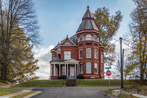
clements documentary monarch lavega historic house distillers home historyofowensboro owensboro architecture row building kentucky usa
La Vega Clements House
robin canon nest chicks 60d canonef75300f456usm
Robin chicks
plaza bridge blue sunset downtown aerial glover cary ohioriver owensboro riverparkcenter smotherspark
Bridge, RPC, Smothers Park - 2
railroad overgrown logo geotagged graffiti weeds kentucky tag tracks railway motto tags tagged southern gore rails weathered spraypaint graff graphiti 777 sou stamped dens ick trainart westernkentucky railart spraypaintart triple7 owensborokentucky retribalize wafflecar densr daviesscountykentucky taggedboxcar doctorscrew paintedrailcar taggedrailcar southernboxcar givesagreenlighttoinnovations 530736 geo:lat=3776851 geo:lon=87092571
Densr - Gore
sunset downtown aerial mainst ohioriver owensboro 2ndst
2nd Street - Downtown
ohioriver smotherspark bluebridge downtown glovercary panorama inn hampton
Panormama from Hampton Inn
view owensboro ohioriver bridge conventioncenter pier riverfront river occ overcast panorama waterfront pano downtown kentucky usa
Ohio RIver Panorama
water waterfall day steps waterfeature owensboro smotherspark
Smothers Park - Water Feature
railroad station kentucky depot unionstation 1905 nationalregisterofhistoricplaces illinoiscentralrailroad daviesscounty us431 louisvillenashvillerr nashvillehendersonstlouisrr henryfhawes johnbhutchings
Union Station, Kentucky, Owensboro (3,415b)
railroad geotagged graffiti stencil kentucky tag tracks railway tags tagged railcar rails sumo boxcar graff graphiti sws capped skol stamped gravel vois trainart str westernkentucky paintedtrain rbox railart railbox 37222 owensborokentucky r86 daviesscountykentucky geo:lat=37772258 taggedboxcar paintedboxcar paintedrailcar taggedrailcar geo:lon=8708431
...
hospital ohrh omhs owensboro aerial architecture dji medicalhealthsystem night p3p phantom regionalhealth kentucky usa
Aerial - Owensboro Health Regional Hospital
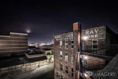
history night landscape store downtown ray parkinggarage historic department owensboro lyddane mcatees
McAtee's at Night
ohioriver owensboro blue bridge glovercary landscape lightning nature night storm
Lightning behind Bridge
sunset usa barn rural corn dof farm kentucky ky depthoffield
Corn Sunset
ky owensboro sunset country golfcourse pano panorama pearlclub rural summit landscape
Sunset at the Pearl Club (Summit)
omhs commercial healthregional photographer 50mp medicalhealthsystem owensboro helicopter ohrh ky aerial kentucky hospital 5ds usa
Aerial - Owensboro Health Regional Hospital
dof ky kentucky owensboro sunset country daviessco depthoffield driveway farm fence fencepost landscape rural
Rural Sunset
sunset lake sunrise landscape pond kentucky ky golfcourse summit daviesscounty pearlclub
Sunrise at the Pearl Club
sunset sky lake reflection water sunrise golf pond golfcourse summit owensboro daviess pearlclub
Sunrise in the Summit
ky kentucky owensboro sunset golfcourse lake landscape neighborhood night reflection subdivision thepearlclub thesummit
Sunset in The Summit
usa river unitedstates kentucky southern ohioriver owensboro towboat towboats glovercarybridge
87l040: Southern upbound at Glover Cary Bridge
color tree pearlclub landscape sky winter lake frozen summit snow
Frozen Lake
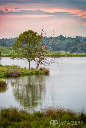
pond tree scene country 100400 sunset peaceful nature water reflection sky compression lake calm rural dead kentucky usa
Dead Tree - Lake Side
ohio river hotel inn downtown kentucky ky center historic convention historical riverfront hampton remodel owensboro revitalization cupcakery
Downtown - Mar 2011
sunset tracks rr crossing landscape railroad silo sky track train
Railroad Track at Sunset
red summer sky usa field barn rural landscape farm kentucky farmland daviess ky40143
Red Barn
scene daviess tree field landscape ky farm rural kentucky habit fence usa scenic
County Farm
panorama lake water pond pano kingfisher maceo carpenterslake
KIngfisher Lake Panorama
haze pearl sunrise tree pearlclub landscape club summit fog tpc hazy golfcourse foggy kentucky usa
Sunrise in Fog
event ky kentucky owensboro aerial applefest festival orchard p3p pano panorama reids usa
Aerial - Applefest 2015