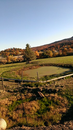
Elevation of Scott River Rd, Fort Jones, CA, USA
Location: United States > California > Siskiyou County > Fort Jones >
Longitude: -122.95022
Latitude: 41.6364345
Elevation: 849m / 2785feet
Barometric Pressure: 92KPa
Related Photos:
Topographic Map of Scott River Rd, Fort Jones, CA, USA
Find elevation by address:

Places near Scott River Rd, Fort Jones, CA, USA:
8701 Marble Mountain Ln
9007 Marble Mountain Ln
9007 Marble Mountain Ln
9007 Marble Mountain Ln
Smokey Lane
9515 Scott River Rd
Quartz Valley Rd, Fort Jones, CA, USA
Klamath River
Greenview
148 Newton St
25231 Scott River Rd
12094 Oak Mill Dr
Indian Creek Rd, Fort Jones, CA, USA
Fort Jones
Scott Bar
Scott River Rd, Scott Bar, CA, USA
1219 Patterson Creek Rd
Scott Valley Rd, Etna, CA, USA
29103 Scott River Rd
Boulder Peak
Recent Searches:
- Elevation of Corso Fratelli Cairoli, 35, Macerata MC, Italy
- Elevation of Tallevast Rd, Sarasota, FL, USA
- Elevation of 4th St E, Sonoma, CA, USA
- Elevation of Black Hollow Rd, Pennsdale, PA, USA
- Elevation of Oakland Ave, Williamsport, PA, USA
- Elevation of Pedrógão Grande, Portugal
- Elevation of Klee Dr, Martinsburg, WV, USA
- Elevation of Via Roma, Pieranica CR, Italy
- Elevation of Tavkvetili Mountain, Georgia
- Elevation of Hartfords Bluff Cir, Mt Pleasant, SC, USA


