Elevation of Potato Harbor Road, Potato Harbor Rd, California, USA

Location: United States > California > Santa Barbara County >

Longitude: -119.57666

Latitude: 34.0493404

Elevation: 107m / 351feet

Barometric Pressure: 100KPa

Elevation Map:

elevation map of Potato Harbor Road, Potato Harbor Rd, California, USA

Satellite Map:

Satellite map of Potato Harbor Road, Potato Harbor Rd, California, USA

Related Photos:

california island explore trail nationalparkservice santacruzisland channelislandsnationalpark usnationalparks explored 200comments scorpionanchorage bestcapturesaoi mygearandme mygearandmepremium mygearandmebronze mygearandmesilver mygearandmegold cavernpointtrail mygearandmeplatinum vigilantphotographersunite vpu2
Blue on Blue Green (Explore #102 8/10/2012)
and all too soon, we say farewell to our temporary home...
it’s sunny today!! and we hiked up to the ridge line for a view...
california blue sunset sea cliff santacruz moon island scorpionharbor moonpoint limuw dailynaturetnc10 californiatnc11
Moon Point, Santa Cruz Island (Limuw), California
sunrise channelisland santacruz rock coastline ocean top252017runnerups
View of Scorpion Anchorage in the morning
ocean california blue cliff island scenic kelp nationalparkservice santacruzisland lowangle naturephotography channelislandsnationalpark usnationalparks landscapephotography scorpionanchorage
Kayak's Eye View of Scorpion Anchorage
santa blue sky panorama santacruz mountains beach water colors santabarbara island coast boat nikon paradise pacific cove cliffs cruz ventura channelislands channel autopano d90 islandpackers autopanogiga
Colors of Paradise
view east from Santa Cruz Island, with fog catching on the peaks & rain in the way...
1hoyadiopter anacapa anacapaisland channelislands channelislandsnationalpark flabellinatrilineata places sanmiguelisland santabarbara santacruzisland santarosaisland underwater ventura aeolid color diverdoug marine nudibranch ocean orienthellatrilineata reef sea seaslug underwaterphotography
nudibranch11Feb22-19
two islands
california tractor island nationalparkservice santacruzisland channelislandsnationalpark usnationalparks farmimplements farmvehicle olivertractor scorpionanchorage gheriniranch sporpionranch
Oliver 70 Tractor
california nationalparkservice nationalparks channelislandsnationalparksantacruzislandscorpionranchfarmimplementcloseupcogwheelrustoxidization
Rusted Cog Wheel
anacapa anacapaisland californiaunderwater channelislands channelislandsnationalpark hypsypopsrubicundus sanmiguelisland santabarbara santacruzisland santarosaisland underwater ventura color damselfish diverdoug fish garibaldi marine ocean reef reefrecheck sea underwaterphotography
garibaldi2Jun9-17
anacapa anacapaisland californiaunderwater channelislands channelislandsnationalpark hypsypopsrubicundus sanmiguelisland santabarbara santacruzisland santarosaisland underwater ventura color damselfish diverdoug fish garibaldi marine ocean reef reefrecheck sea underwaterphotography
garibaldi1Jun9-17
california santacruzisland channelislandsnationalpark usnationalparks commercialvessel scorpionanchorage
Last Passengers Boarding "Island Adventure" at Scorpion Anchorage, Santa Cruz Island CHIS Nationl Park
california us parks nationalparkservice santacruzisland channelislandsnationalpark prisonersharbor npsvesselislandranger
National Park Service
california beach reflections island pier view scenic cliffs beaches nationalparkservice nationalparks santacruzisland wetsand channelislandsnationalpark landscapephotography supershot scorpionanchorage
View of Scorpion Anchorage and Pier from Little Scorpion Beach
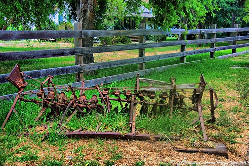
california island antique americana rusting nationalparkservice santacruzisland vanbrunt seeddrill channelislandsnationalpark usnationalparks farmimplements scorpionanchorage gheriniranch sporpionranch
Van Brunt Seed Drill
california island antique americana rusting nationalparkservice johndeere incomplete plows santacruzisland channelislandsnationalpark usnationalparks farmimplements scorpionanchorage gheriniranch sporpionranch 4discplow
A Four Bottom John Deere Disc Plow with One Disk Missing
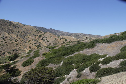
california weather fog island scenic hike nationalparkservice santacruzisland channelislandsnationalpark usnationalparks landscapephotography cavernpointtrail
Misty Hillsides Santa Cruz Island
channelisland california island rock
Close view of Scorpion Rock
present conditions: a brief respite between downpours
Santa Cruz Island interior
santacruzisland
Santa Cruz Island
ocean california color 120 film analog mediumformat landscape analógica 645 pacific 14 rangefinder fujifilm 100 60mm 6x45 f4 channelislands reala santacruzisland santabarbaracounty fujicolor película c41 reala100 yellowbanks fujicolorreala100 cn16 gs645s sescape chrisgrossman ebcfujinon 6x4½ 60mmebcfujinonw
Yellow Banks, Santa Cruz Island, California - GS645S - Reala 100
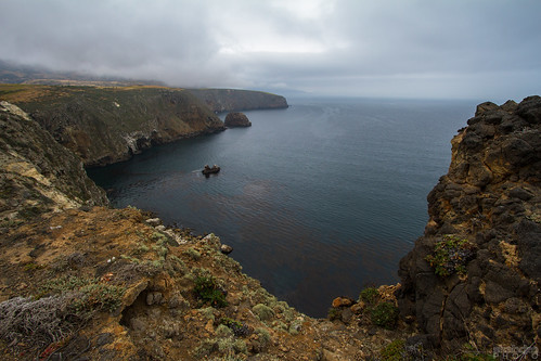
Potato Harbor, Santa Cruz Island, California
santacruzisland
Santa Cruz Island
santacruzisland
Santa Cruz Island
first stop on the island—we’re continuing on to the UC’s field station
waiting for the ferry
santacruzisland channelislandsnationalpark criticallyendangered islandfox urocyonlittoralis urocyonlittoralissantacruzae “californiatnc11” treklightly photocontesttnc13
Santa Cruz Island Fox (Urocyon littoralis santacruzae)
california pacificocean 1022mm channelislands seacaves santacruzislands canon7d ©shabdrophoto
Santa Cruz Island
santacruzisland channelislands nationalpark california unitedstatesventuracaliforniaunitedstatesus
Santa Cruz Island, Channel Islands National Park
©shabdrophoto
Part of the Mega-Pod
santacruzisland
Santa Cruz Island
santacruz silence fiveelements santabarbaracaliforniaunitedstatesusa
silence...