Elevation of Nizhoni Campground, Blanding, UT, USA
Location: United States > Utah > San Juan County > Blanding >
Longitude: -109.54001
Latitude: 37.7821755
Elevation: 2382m / 7815feet
Barometric Pressure: 76KPa
Elevation Map:
Satellite Map:
Related Photos:
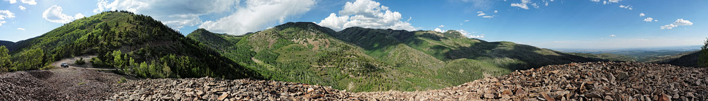
RAV4 parking, big view version

Dry Wash Cave Ruins

South Slope

View down to Blanding from the Shay Ridge Quad Trail, Manti-La Sal National Forest, at the edge of Bears Ears National Monument.

canyonlands bookmark

Stormy Skies

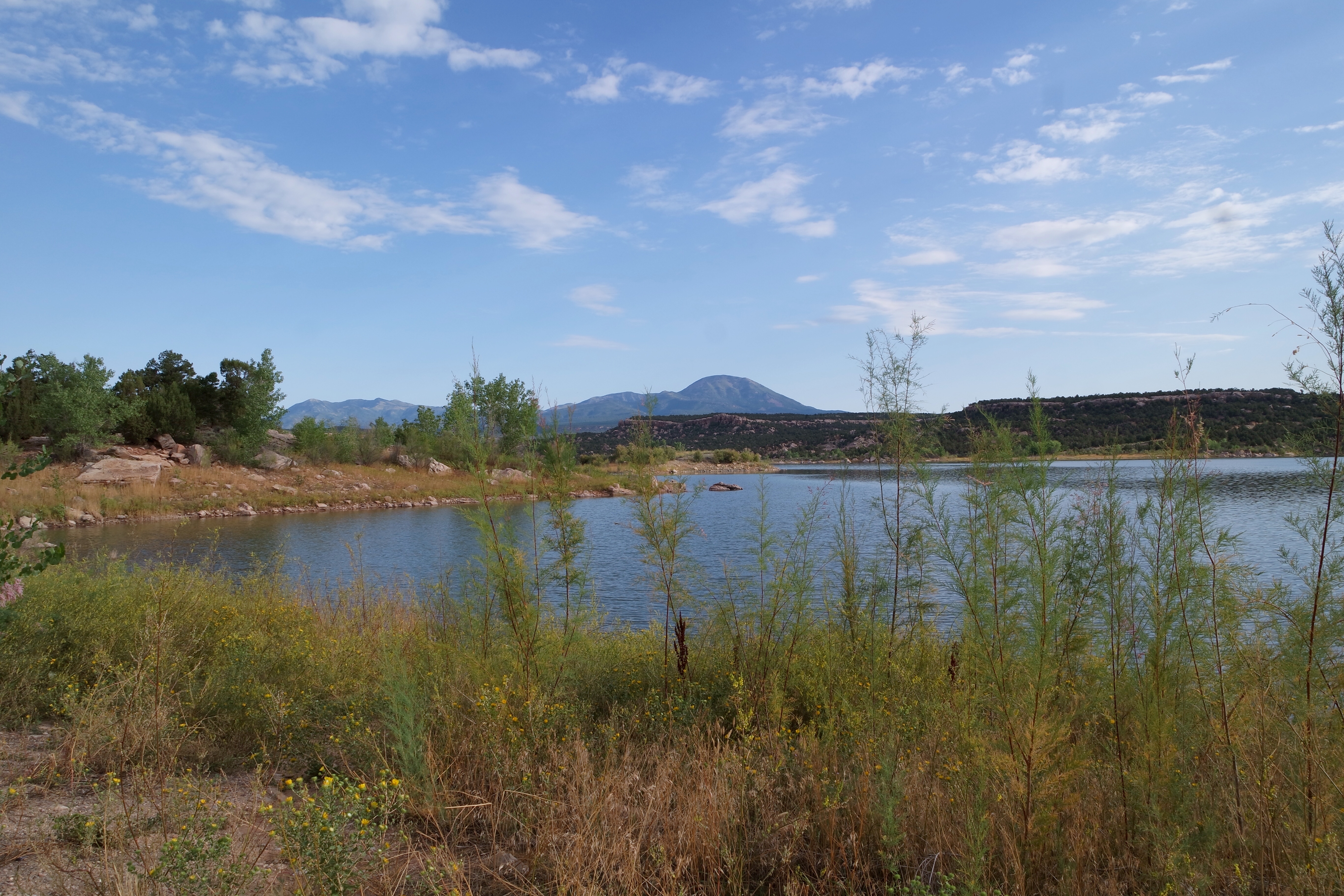
Mount Linnaeus

Thru the Window
USA - Utah - Route 191 to Goosenecks SP

Abajo Mountains, Utah

Needles District, Canyonland National Park, Utah

Abajo Loop State Scenic Backway
Abajo Loop State Scenic Backway

Abajo Loop State Scenic Backway

Mount Linnaeus HDR From Recapture Reservoir

Abajo Loop State Scenic Backway

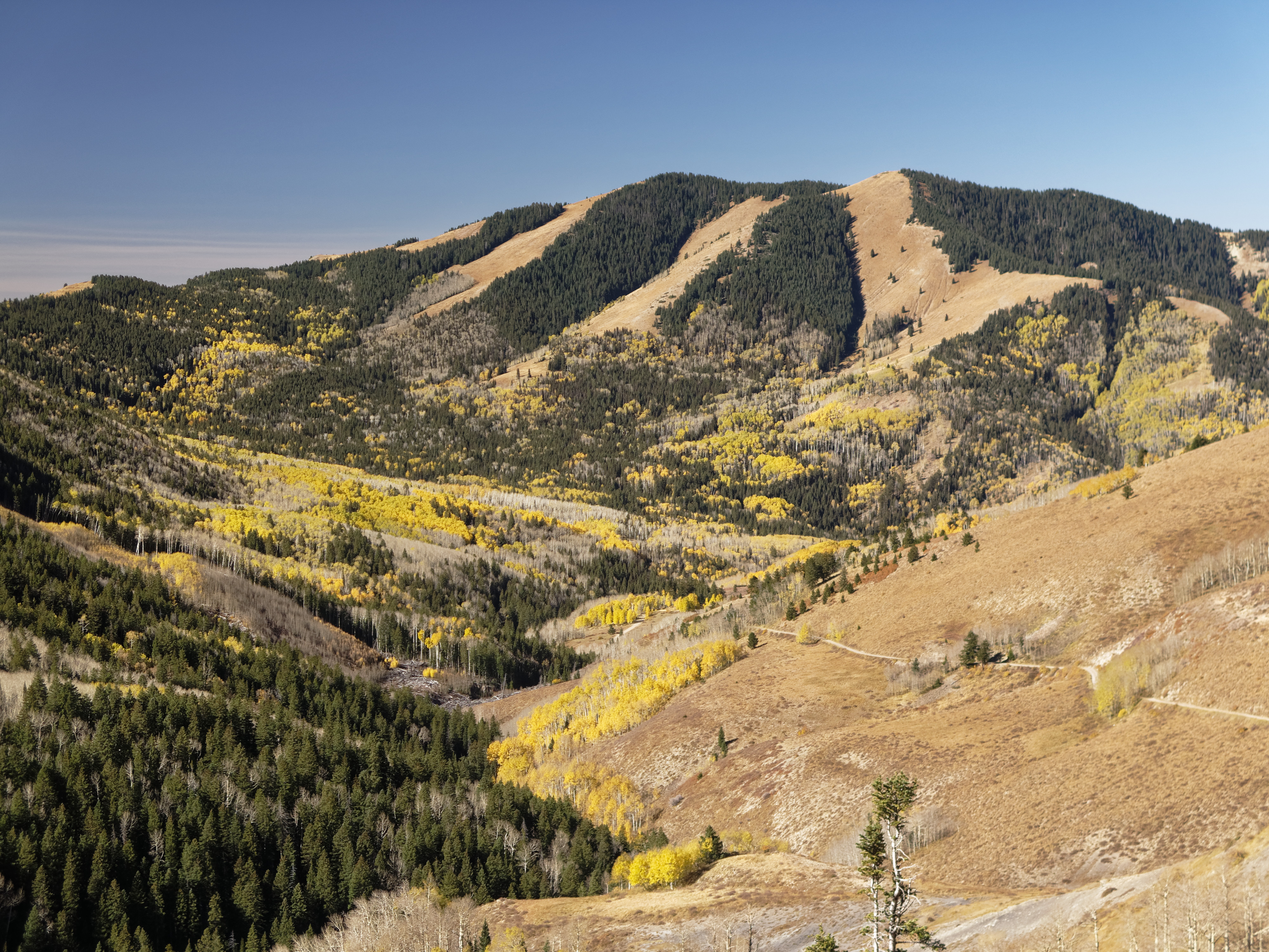
Jackson Ridge, Manti-La Sal National Forest

DJI Phantom Photos in Utah, Monument Valley and Mexican Hat

Sunrise San Juan County, Utah

DJI Phantom Photos in Utah, Monument Valley and Mexican Hat

Sunrise San Juan County, Utah

DJI Phantom Photos in Utah, Monument Valley and Mexican Hat

IMG_7915 - 2012-10-12 at 05-29-17

DJI Phantom Photos in Utah, Monument Valley and Mexican Hat

Abajo Loop State Scenic Backway

At the Shay Ridge Quad Trail, Manti-La Sal National Forest, at the edge of Bears Ears National Monument
Topographic Map of Nizhoni Campground, Blanding, UT, USA
Find elevation by address:

Places near Nizhoni Campground, Blanding, UT, USA:
Devils Canyon Campground
75 W Dude Ranch Rd
Blanding
355 E 850 S
Blue Mountain Rv & Trading
White Mesa Mill
Monticello
17 N E, Monticello, UT, USA
White Mesa
Butler Washington Road
Bluff
E Main St, Bluff, UT, USA
Dove Creek, CO, USA
County Rd 2, Dove Creek, CO, USA
3728 Rd P
Egnar
Dove Creek
County Road 10, Pleasant View, CO, USA
Road G, Cortez, CO, USA
490 County Rd G
Recent Searches:
- Elevation of Corso Fratelli Cairoli, 35, Macerata MC, Italy
- Elevation of Tallevast Rd, Sarasota, FL, USA
- Elevation of 4th St E, Sonoma, CA, USA
- Elevation of Black Hollow Rd, Pennsdale, PA, USA
- Elevation of Oakland Ave, Williamsport, PA, USA
- Elevation of Pedrógão Grande, Portugal
- Elevation of Klee Dr, Martinsburg, WV, USA
- Elevation of Via Roma, Pieranica CR, Italy
- Elevation of Tavkvetili Mountain, Georgia
- Elevation of Hartfords Bluff Cir, Mt Pleasant, SC, USA