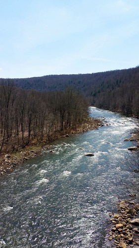
Latitude: 39.72725
Longitude: -79.1369714
Elevation: 740 meters / 2428 feet
Barometric Pressure 927KPa

Related Photos

Mountain Morning Mist - Explore 2-12 by thucydides5, the beautiful Catoctin mountains, taken from the vantage of the West side right near the W.V.a. bord
Mountain Morning Mist - Explore 2-12 by thucydides5
Western Maryland Keystone Viaduct by benpsut, 3924 bnsf3924 csx csxkeystonesub csxq370 csxt keystoneviaduct q370 snow wm westernmaryland westernma
Western Maryland Keystone Viaduct by benpsut
Salisbury Viaduct by benpsut, csx csxkeystonesub csxt csxt3246 dji djiphantom3 djiphantom3pro drone keystone q216 salisbury salisb
Salisbury Viaduct by benpsut
Sand Patch Grade by benpsut, csx csxkeystonesub csxq138 csxt csxt805 conrail dji djiphantom4pro drone q138 sandpatch sandpatchgra
Sand Patch Grade by benpsut
Western Maryland Keystone Viaduct Westbound by benpsut, csxkeystonesub csxq370 csxt csxt3433 keystoneviaduct q370 snow wm westernmaryland westernmarylandkey
Western Maryland Keystone Viaduct Westbound by benpsut
B&O and the WM by benpsut, bridge csx csxkeystonesub csxq136 csxt csxt3166 drone keystoneviaduct westernmaryland westernmarylan
B&O and the WM by benpsut
Manse PA Monday October 6th 1997 1640EDT by Hoopy2342, Westbound climbs Sand Patch grade passing Manse Loop  just below the summittrain rail railway railro
Manse PA Monday October 6th 1997 1640EDT by Hoopy2342
CSX 6403 and 2229 by Trains & Trails, CSX work train DO60-06 is shoving west on Track 2 Main underneath the Salisbury Viaduct on a beautif
CSX 6403 and 2229 by Trains & Trails
Sand Patch Grade by benpsut, railroad us unitedstates pennsylvania trains aerial aerialphotography meyersdale csx drone csxt phan
Sand Patch Grade by benpsut
Mysterious Forest by Denise's Pieces (formerly PaPeR.cLiP), This scene was captured on the winding trail to Mt. Davis, the tallest peak in Pennsylvania.  Taken
Mysterious Forest by Denise's Pieces (formerly PaPeR.cLiP)
Thomas Johnson Farmhouse by bagpiper, "Immediately beyond Little Savage; is the farm of Thomas Johnson, a descendent of the first sta
Thomas Johnson Farmhouse by bagpiper
Thomas Johnson Shed by bagpiper, "On the right [to the right of the shed, not seen in this picture], immediately beyond Little S
Thomas Johnson Shed by bagpiper
At Long Last by imartin92, After much waiting, we finally lensed something moving on the B&O from the former WM Salisbury V
At Long Last by imartin92
Casselman River by howderfamily.com, Day 3 on the Great Allegheny Passage bike trip, Ohiopyle to Meyersdale, Pennsylvania.

A view of the
Casselman River by howderfamily.com
Pinkerton Tunnel Viaduct by howderfamily.com, Day 3 on the Great Allegheny Passage bike trip, Ohiopyle to Meyersdale, Pennsylvania.

View from the
Pinkerton Tunnel Viaduct by howderfamily.com
Old Johnson Barn by bagpiper, "On the right [left in this picture], immediately beyond Little Savage; is the farm of Thomas J
Old Johnson Barn by bagpiper
Westward View of the Johnson Farm Buildings by bagpiper, "On the right, immediately beyond Little Savage; is the farm of Thomas Johnson, a descendent of
Westward View of the Johnson Farm Buildings by bagpiper
CSX 9045 and 7748 (2) by Trains & Trails, Sand Patch Grade helper pair B251-06 is going back west on Track 1 Main, and looking very tiny again
CSX 9045 and 7748 (2) by Trains & Trails
Pennsylvania: Crossing through the Cumberland Gap by Chuck & Alice Riecks, This area should not be confused with the far more famous pass, The Cumberland Gap down on the Kentu
Pennsylvania: Crossing through the Cumberland Gap by Chuck & Alice Riecks
CSX 9045 and 7748 (1) by Trains & Trails, Sand Patch Grade helper pair B251-06 is going back west on Track 1 Main, and looking very tiny again
CSX 9045 and 7748 (1) by Trains & Trails
Just west of Turner’s Curve before grading by Christopher Busta-Peck, Turner’s Curve is on the National Road 8 1/2 miles west of Frostburg, Maryland. This view is presuma
Just west of Turner’s Curve before grading by Christopher Busta-Peck
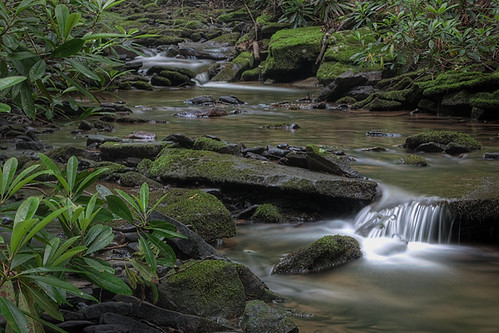
Poplar Lick by J.B. Churchill, at the Poplar Lick ORV trailpoplarlickorvtrail
Poplar Lick by J.B. Churchill
B&O Views by benpsut,
B&O Views by benpsut
Two-For-One by Kyle Korienek, Just moments after an auto rack train cleared the curve past the former Western Maryland Salisbury v
Two-For-One by Kyle Korienek
Salisbury View by imartin92, Despite CSX running a parade of trains up and down the mountain while we were biking along the old W
Salisbury View by imartin92
Mansard by neshachan, Just one last view of that slumpy house.slumpy johnsonhouse mansardroof rt40 nationalroad house buil
Mansard by neshachan
New Germany State Park by karma (Karen), another lake view, using an in-phone filter - HSS & HTMT!newgermanysp mdstateparks maryland garr
New Germany State Park by karma (Karen)
Climbing over the Patch by Don Kalkman, An alternate telephoto view of Q016's well-documented climb over the Sand Patch grade with the PoPo
Climbing over the Patch by Don Kalkman
West approach to Casselman River Bridge by Christopher Busta-Peck, This view is looking to the northeast. The bar with diagonal stripes, to the right, warns motorists
West approach to Casselman River Bridge by Christopher Busta-Peck
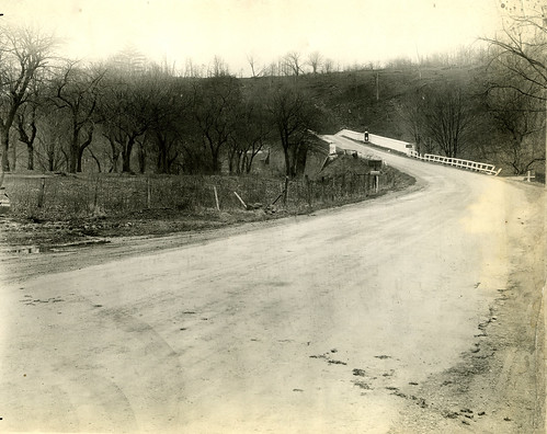
East approach to Casselman River Bridge by Christopher Busta-Peck, This view, looking west, shows the bridge in fall or winter. The "lighthouse", near the to
East approach to Casselman River Bridge by Christopher Busta-Peck
Casselman River Bridge by John H Bowman, The Casselman River Bridge on the National Road (later US 40) in Garrett County, Maryland, was built
Casselman River Bridge by John H Bowman
View from Salisbury Viaduct by joseph a, The Western Maryland crossed over the B&O mainline and Casselman River via the Salisbury Viaduct
View from Salisbury Viaduct by joseph a
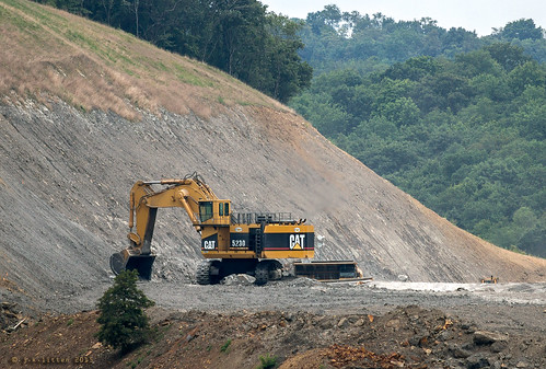
Mountain Vs 5230 by Western Maryland Photography, cat pennsylvania mining caterpillar shovel hydraulic route219 ef70300mmf456isusm 5230 myersdale cano
Mountain Vs 5230 by Western Maryland Photography
View SE from Mt. Davis Fire Tower by jmd41280, pennsylvania mountdavis mtdavis somersetcountypa pennsylvaniahighestpoint
View SE from Mt. Davis Fire Tower by jmd41280
Spruce Forest Artisan Village by karma (Karen), a different view of the bench I posted last week - HBM!grantsville maryland casselmanriverbridgesp m
Spruce Forest Artisan Village by karma (Karen)
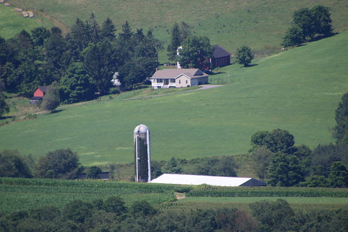
Overlook Rest Area on Route 219 (North of Accident, Maryland) - August 9th, 2017 by cseeman, deepcreeklake mchenry maryland westernmaryland deepcreek2017 garrettcounty overlook restarea route21
Overlook Rest Area on Route 219 (North of Accident, Maryland) - August 9th, 2017 by cseeman
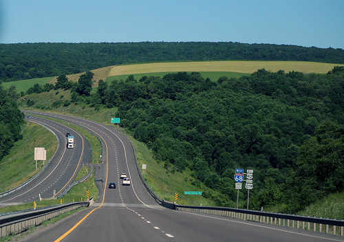
Hillside Field — Garrett County, Maryland by Pythaglio, field farmland farm agriculture appalachia appalachian ridgeandvalley garrett county maryland rural
Hillside Field — Garrett County, Maryland by Pythaglio
New Germany swamp by Matt Tillett,
New Germany swamp by Matt Tillett
Frostburg Reservoir Wetland by Western Maryland Photography, Absolutely no one was there yesterday evening.  Only the sounds of nature could be heard.  There wer
Frostburg Reservoir Wetland by Western Maryland Photography
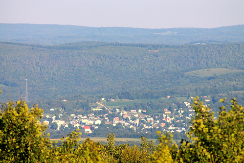
Salisbury, PA from Mt. Davis Fire Tower by jmd41280, pennsylvania salisbury mountdavis mtdavis somersetcountypa salisburypa pennsylvaniahighestpoint
Salisbury, PA from Mt. Davis Fire Tower by jmd41280
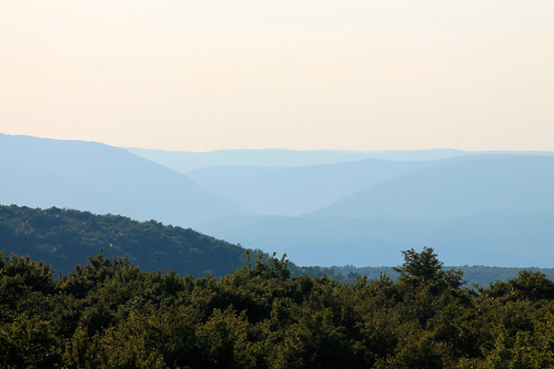
Youghiogheny River Gorge from Mt. Davis Fire Tower by jmd41280, pennsylvania laurelridge mountdavis mtdavis somersetcountypa youghioghenyrivergorge pennsylvaniahigh
Youghiogheny River Gorge from Mt. Davis Fire Tower by jmd41280
View from a Scenic Overlook on Garrett Highway (Route 219) by PhotosToArtByMike, Scenic Overlook on Garrett Highway (Route 219) near Accident Maryland. Accident is a small town in G
View from a Scenic Overlook on Garrett Highway (Route 219) by PhotosToArtByMike
Last Day Of Summer In Garrett County by Western Maryland Photography, A partly cloudy sky casts moving shadows over the hills and valleysroad summer mountains last barn l
Last Day Of Summer In Garrett County by Western Maryland Photography
Quite The View by Kyle Korienek, A run-through UP auto rack train rolls east along the CSX Keystone Sub just outside of Meyersdale, P
Quite The View by Kyle Korienek
Great Allegheny Passage (GAP) Trail, PA by Rails to Trails Conservancy, Photo by Milo Batemanrailswithtrails
Great Allegheny Passage (GAP) Trail, PA by Rails to Trails Conservancy
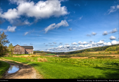
Fertile Valley In Grantsville, Maryland by Western Maryland Photography, Historic farmlands two miles East of Grantsville, Marylandold clouds barn farm scenic fluffy marylan
Fertile Valley In Grantsville, Maryland by Western Maryland Photography
Hillside under clouds. by ronnymariano, grass cloudsky landscape sunset plants nature scenics land meadow beautyinnature hill everypixel tre
Hillside under clouds. by ronnymariano
2021 07-05 0800-91 CSX ES44AH-3194 EB Q-016-04 Sand Patch, PA by guitartrain203, WIDE View: CSX's "Honoring Our Law Enforcement" ES44AH-3194 is leading E/B train Q-016-04
2021 07-05 0800-91 CSX ES44AH-3194 EB Q-016-04 Sand Patch, PA by guitartrain203
20130929-XE1-0490 by Ryan Lantzy,
20130929-XE1-0490 by Ryan Lantzy
Q216 by ZManMatt, Q216 rolls along the Casselman River with a gorgeous YN1 SD40-2 rebuild doing the honors.pennsylvani
Q216 by ZManMatt
View west toward Laurel Ridge from Mt. Davis Fire Tower by jmd41280, pennsylvania laurelridge mountdavis mtdavis somersetcountypa pennsylvaniahighestpoint
View west toward Laurel Ridge from Mt. Davis Fire Tower by jmd41280
Salisbury Viaduct, Great Allegheny Passage Tail by trainphotoz, The 1908-feet long Salisbury Viaduct carries the Great Allegheny Passage Trail over Route US#219, th
Salisbury Viaduct, Great Allegheny Passage Tail by trainphotoz
Overlook Rest Area on Route 219 (North of Accident, Maryland) - August 9th, 2017 by cseeman, deepcreeklake mchenry maryland westernmaryland deepcreek2017 garrettcounty overlook restarea route21
Overlook Rest Area on Route 219 (North of Accident, Maryland) - August 9th, 2017 by cseeman
CSX N720-11 At Sand Patch by Adam Klimchock, Fall colors are making their presence known in Somerset County as CSX N720-11 trudges up the hill at
CSX N720-11 At Sand Patch by Adam Klimchock
Salisbury Viaduct, Great Allegheny Passage Trail by trainphotoz, The 1908-feet long Salisbury Viaduct carries the Great Allegheny Passage Trail over Route US#219, th
Salisbury Viaduct, Great Allegheny Passage Trail by trainphotoz
Grand View Tavern, Maryland by Christopher Busta-Peck, The sign appears to have been painted on an old Coca Cola sign.old signs history america md driving
Grand View Tavern, Maryland by Christopher Busta-Peck
219 by Western Maryland Photography, Expansion North of Myersdale, PApennsylvania route219 myersdale canonefs1755mm28isusm canoneos7d
219 by Western Maryland Photography
View toward Maryland from Mt. Davis Fire Tower by jmd41280, pennsylvania mountdavis mtdavis somersetcountypa pennsylvaniahighestpoint
View toward Maryland from Mt. Davis Fire Tower by jmd41280
Casselman River by Kordite, View upstream from the Pinkerton Low Bridge.geotagged railstotrails railtrail youghrivertrail allegh
Casselman River by Kordite
2022 07-12 0959-2 AMTK P42DC-85, 172 E/B 30-P030 CL, Sand Patch, PA by guitartrain203, Amtrak's E/B Capitol Limited is on track two of CSX's Keystone Sub, at MP 211, in this view from the
2022 07-12 0959-2 AMTK P42DC-85, 172 E/B 30-P030 CL, Sand Patch, PA by guitartrain203