Latitude: 53.365432
Longitude: -2.0012794
Elevation: 198 meters / 650 feet
Barometric Pressure 990KPa

Related Photos

Hitting the summit by Captain Nikon, The rising sun hitting Lose hill summitmamtor derbyshire peakdistrict thegreatridge ridge leadinglin
Hitting the summit by Captain Nikon
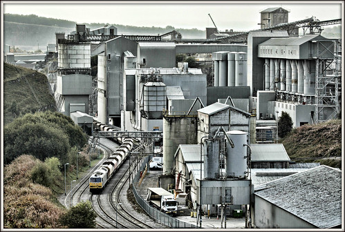
Man made beauty? by david.hayes77, The deep limestone gorges of Derbyshire are stunning in their natural beauty - so featuring an unsig
Man made beauty? by david.hayes77
view towards lose hill by Royston King, peak district national parklosehill hopevalley cliffs castleton peakdistrict derbyshire landscapes x
view towards lose hill by Royston King
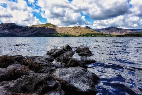
Derwent Water View, Cumbria by Michael Dambach,                                derwentwater cumbria bigsky clouds water summer catbells keswick
Derwent Water View, Cumbria by Michael Dambach
Good Morning Mam! by Dom Haughton, If we thought we were going to be alone up here, we very quickly realised we were wrong.  Huddled at
Good Morning Mam! by Dom Haughton
Busy times and former glories by david.hayes77, An image from seven years ago that has been reprocessed and re-loaded. 

Taken at this time of year
Busy times and former glories by david.hayes77
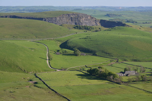
Eldon Hill Disused Quarry, Peak District National Park, Derbyshire, England. by westport 1946, Quarrying started at Eldon Hill in 1950 and finished in 1999.england unitedkingdom peakdistrict high
Eldon Hill Disused Quarry, Peak District National Park, Derbyshire, England. by westport 1946
Broadlee-Bank Tor, Peak District National Park, Derbyshire, England. by westport 1946, england unitedkingdom nationalpark thenationaltrust highpeak peakdistrict edale valeofedale bluesky
Broadlee-Bank Tor, Peak District National Park, Derbyshire, England. by westport 1946
30408 by benbobjr, Black Tor on the Great Ridge that separates Castleton and Edale in the Peak District, Derbyshire.
30408 by benbobjr
They Bridge The Faded Span by NIGHT X NIGHT Photography, This is one of those shots where you explain to someone, "I went all the way to Manchester and
They Bridge The Faded Span by NIGHT X NIGHT Photography
Autumn chocolate box by david.hayes77, If you like chocolate boxes, and let's be fair at this time of year they can be quite appealing, the
Autumn chocolate box by david.hayes77
rushup edge by Phil-Gregory, rushup edge taken from mam tor peak district Derbyshire at sun down mamtor nikon d7200 tokina 1120mm
rushup edge by Phil-Gregory
Grindslow Knoll, Peak District National Park, Derbyshire, England. by westport 1946, england unitedkingdom nationalpark thenationaltrust derbyshire highpeak peakdistrict edale grindslow
Grindslow Knoll, Peak District National Park, Derbyshire, England. by westport 1946
long way down by Phil-Gregory, this on kinder scout ,seal edge I think nikon d72 tokina 1116mm 1120mm 1116mmf8 1120mmf28 1120mmproa
long way down by Phil-Gregory
Snaking. by FadeToBlackLP, The shot Chris and I had on our list of places to hit up after dark.  The moon was big, snow on the
Snaking. by FadeToBlackLP
Down the ridge by Phil-Gregory, the great ridge ,park district national park uk at sunset nice nikon d7200 tokina tokina1120mmatx 11
Down the ridge by Phil-Gregory
Mam Tor by Peter Quinn1, A pleasant spring evening on a quiet Mam Tor summit.mamtor peakdistrict evening springevening summit
Mam Tor by Peter Quinn1
The Path To Edale, Peak District National Park, Derbyshire, England. by westport 1946, england unitedkingdom highpeak peakdistrict nationalpark thenationaltrust derbyshire valeofedale val
The Path To Edale, Peak District National Park, Derbyshire, England. by westport 1946
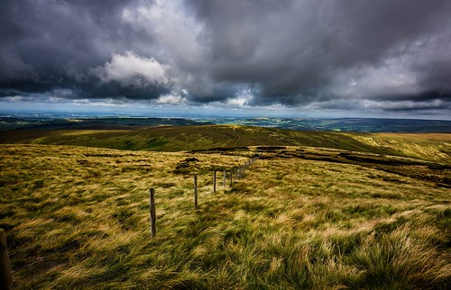
open country HFF by Phil-Gregory, On Kinder Scout , Peak District national park uknaturalphotograph naturalphotography naturephotograp
open country HFF by Phil-Gregory
29927 by benbobjr, Walking down from Black Tor towards Hollins Cross, the end part of the Great Ridge that separates Ca
29927 by benbobjr
Rain clouds by smir_001, Buxton & Buxton Country Park walk series. Day 5 in Buxton with following stretch of legs in a sh
Rain clouds by smir_001
Grindsbrook Panorama by l4ts, The view from The Nab across Grindsbrook to a snow-dusted Grindslow Knoll and Kinder Scout.landscape
Grindsbrook Panorama by l4ts
Moody sky by l4ts, A view of Crook Hill, the Woodlands Valley and a cloud-capped Win Hill seen from Crookstone Out Moor
Moody sky by l4ts
please close the gate by Phil-Gregory, peak district derbyshire nr the A57 snake pass after visiting alport castleskinder peakdistrict niko
please close the gate by Phil-Gregory
The Great Ridge from Mam Tor by Peter Quinn1,
The Great Ridge from Mam Tor by Peter Quinn1
Hope Valley. by Ade McCabe, Wild camp on Stanage Edge last night. 

I had the whole edge to myself from about 20:00 on. Set up a
Hope Valley. by Ade McCabe
Inverted by Nicks-2017, Sunday morning pe-sunrise and the very edge of the fog camped out over Castleton and the Hope Valley
Inverted by Nicks-2017
Social distancing on Mam Tor by PentlandPirate: Slapdash Photography, We were all expecting a great inversion.  God had turned the cooker on that causes the mist to boil
Social distancing on Mam Tor by PentlandPirate: Slapdash Photography
Mam Tor by l4ts, Mam Tor seen from The Great Ridge near Hollins Cross.landscape derbyshire peakdistrict darkpeak mamt
Mam Tor by l4ts
Tunstead Works by l4ts, A view of the dystopian but also interesting scene that is Tunstead Limestone Works.landscape derbys
Tunstead Works by l4ts
The Great Ridge by l4ts, A view along the Great Ridge shortly after sunrise. landscape derbyshire peakdistrict darkpeak hopev
The Great Ridge by l4ts
27720 by benbobjr, Looking out from Black Tor on the Great Ridge that separates Castleton and Edale in the Peak Distric
27720 by benbobjr
Edale by l4ts, The view east along the Vale of Edale. landscape derbyshire peakdistrict darkpeak edale panorama the
Edale by l4ts
The Pennine Way by l4ts, Edale. 
A coffee-toned monochrome image.landscape derbyshire peakdistrict darkpeak edale kinderscout
The Pennine Way by l4ts
Back Tor by l4ts, Looking east along the Great Ridge with Back Tor to the front and Lose Hill visible in the distance.
Back Tor by l4ts
Abney Spring canopy (explore) by jvarley19,
Abney Spring canopy (explore) by jvarley19
Mount Famine and South Head by l4ts, The view from the summit rocks of Mount Famine looking towards South Head.landscape derbyshire peakd
Mount Famine and South Head by l4ts
Fair Brook by l4ts, A waterfall along Fair Brook in the Woodlands Valley on the northern side of Kinder Scout. landscape
Fair Brook by l4ts
brown knollorama by Ron Layters, a panoramic view taken after my <a href="https://www.flickr.com/photos/ronlayters/31943578040/">52</
brown knollorama by Ron Layters
Moorland sunrise flickr by #JohnBleakleyPhotography, Not much in the way of cloud about on that morning, but a great subject to photograph.

Copyright: ©
Moorland sunrise flickr by #JohnBleakleyPhotography
Cave Dale by l4ts, Peveril Castle and Cave Dale near Castleton.landscape derbyshire peakdistrict whitepeak hopevalley c
Cave Dale by l4ts
My route lies ahead. by A tramp in the hills, This is the view from the start of my walk yesterday,up alongside Blackden brook and up onto Kinder
My route lies ahead. by A tramp in the hills
Edale by l4ts, A view of the Vale of Edale from the rocks of Ringing Roger.landscape derbyshire peakdistrict darkpe
Edale by l4ts
Crookstone Out Moor by l4ts, A view along the Woodlands Valley towards Crook Hill from Crookstone Out Moor on the eastern end of
Crookstone Out Moor by l4ts
Cowlow by l4ts, The ruined farm building at Cowlow and the view along the Hope Valley.landscape derbyshire peakdistr
Cowlow by l4ts
25605 by benbobjr, Looking from Hollins Cross towards Lose Hill, on the Great Ridge that separates Castleton and Edale
25605 by benbobjr
Back Tor by l4ts, Back Tor on the Great Ridge separating Edale and the Hope Valley.landscape derbyshire peakdistrict d
Back Tor by l4ts
Werneth Low by Toby Howard, Werneth Low Country Park is a lovely spot on the borders of Stockport and Tameside, with beautiful v
Werneth Low by Toby Howard
Anvil Stone by l4ts, Another view of the Anvil Stone at Bleaklow Stones, perhaps showing better how it got its name.lands
Anvil Stone by l4ts
River Noe by l4ts, A small waterfall on the River Noe in Edale.landscape derbyshire peakdistrict darkpeak edale riverno
River Noe by l4ts
Back Tor by l4ts, Back Tor on the Great Ridge between Edale and the Hope Valley.landscape derbyshire peakdistrict dark
Back Tor by l4ts
Mount Famine by l4ts, A just-before sunrise view of Mount Famine from the path to South Head. Every bit as cold as it look
Mount Famine by l4ts
The Cloughs by smir_001, Pennine Way, Jacob’s Ladder & the Cloughs walk series. Taken from Pennine Way. It was the last w
The Cloughs by smir_001
The Great Ridge by l4ts, The Great Ridge and Edale seen from Lose Hill.landscape derbyshire peakdistrict darkpeak thegreatrid
The Great Ridge by l4ts
Grindslow Knoll by l4ts, The view south-west from Grindslow Knoll to the sunlit  hills of Colborne and Horsehill Tor at the w
Grindslow Knoll by l4ts
The Limestone way...Cave dale. by A tramp in the hills, Headed to Castleton today to walk the first section of the Limestone way. limestoneway castleton cav
The Limestone way...Cave dale. by A tramp in the hills
Sett Valley by l4ts, The head of the Sett Valley and on the left, Mount Famine just before the low cloud came in to spoil
Sett Valley by l4ts
A break in the clouds by pct4nic, Early morning winter sun over Macclesfield Forest.
A break in the clouds by pct4nic
Mam Tor by l4ts, Sunrise colours catching Mam Tor, seen across the Vale of Edale.landscape derbyshire peakdistrict da
Mam Tor by l4ts
28821 by benbobjr, Climbing up Mam Tor on the Great Ridge that separates Castleton and Edale in the Peak District, Derb
28821 by benbobjr