Latitude: 39.547668
Longitude: -77.839573
Elevation: 136 meters / 446 feet
Barometric Pressure 997KPa

Related Photos

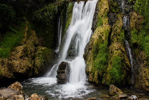
Falling Waters Falls by PeaceLoveJava™, Falling Waters was the site of two battles during the American Civil War:

The Battle of Hoke's Run
Falling Waters Falls by PeaceLoveJava™
Echoes of History by GSB Photography, Antietam National Battlefield Park, Maryland.

This lovely Maryland countryside is quiet today, simp
Echoes of History by GSB Photography
Burnside's Bridge and the Witness Tree by GSB Photography, One of the most photographed bridges associated with the American Civil War, “Burnside’s Bridge” (ac
Burnside's Bridge and the Witness Tree by GSB Photography
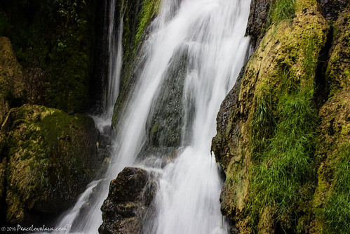
Falling Waters Falls Closeup by PeaceLoveJava™, Falling Waters was the site of two battles during the American Civil War:

The Battle of Hoke's Run
Falling Waters Falls Closeup by PeaceLoveJava™
Falling (Explored) by Scott of SWPA, It seems like an eternity since I snapped a photo for Flickr as work has been very busy so far this
Falling (Explored) by Scott of SWPA
Trickle (Explored) by Scott of SWPA, Falling Waters, WV with low flow. 

This past Monday, while in Chambersburg, PA, I managed to get ou
Trickle (Explored) by Scott of SWPA
Beauty Found by trainmann1, In the early parts of July 2020, still in the throws of the pandemic caused by the Coronavirus, my w
Beauty Found by trainmann1
0461 Red-bellied Woodpecker, Shepherdstown, WV by Traveling Man – Back after a long absence, This male Red-bellied woodpecker was feeding on the ground here on the farm during a break in the th
0461 Red-bellied Woodpecker, Shepherdstown, WV by Traveling Man – Back after a long absence
0012 C&O Canal Towpath, MD by Traveling Man – Back after a long absence, Biking along the C&O Canal Towpath, Chesapeake and Ohio Canal National Historical Park. The Poto
0012 C&O Canal Towpath, MD by Traveling Man – Back after a long absence
Dunker Church, Antietam Battlefield, a low light photo by PhotosToArtByMike, A three minute exposure with a spotlight "painting" the historic church.  It was a Low-Lig
Dunker Church, Antietam Battlefield, a low light photo by PhotosToArtByMike
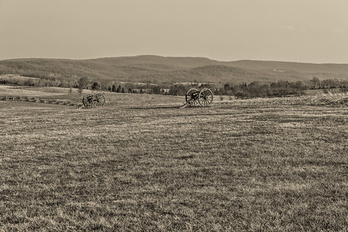
Antietam Battlefield by 95wombat, What I was taking a picture of in the <a href="http://www.flickr.com/photos/95wombat/9660695757/">pr
Antietam Battlefield by 95wombat
The New Day Brings its Shining Sun by SunnyDazzled, The Maryland Monument at Antietam National Battlefield in Sharpsburg is the only monument there dedi
The New Day Brings its Shining Sun by SunnyDazzled
Fence Sitting Snow by T-3 Photography, HFF!

A view down the fence line of the Piper Farm at the Antietam National Battlefield.battlefield
Fence Sitting Snow by T-3 Photography
Inside The Roundhouse by DJ Witty, The view inside the Western Maryland Railway's Hagerstown Roundhouse looking somewhat northwest towa
Inside The Roundhouse by DJ Witty
Upstream view of Town Run, Shepherdstown, West Virginia by PhotosToArtByMike, Town Run at the Princess Street riverfront at the confluence of Town Run and the Potomac River near
Upstream view of Town Run, Shepherdstown, West Virginia by PhotosToArtByMike
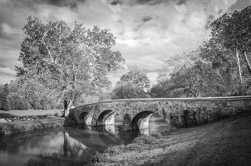
Burnside Bridge by TAC.Photography, Site of a historic civil war battle with much loss of life. Antietam, Maryland. 

<a href="http://ww
Burnside Bridge by TAC.Photography
1997 06-15 1745 AMTK P40DC-816 W/B P029 CL Martinsburg, WV by guitartrain203, Amtrak P40DC-816 & P42DC-15 are on the point of the W/B Capitol Limited, train #29. Here, in thi
1997 06-15 1745 AMTK P40DC-816 W/B P029 CL Martinsburg, WV by guitartrain203
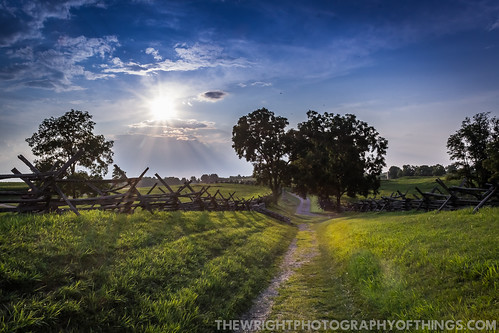
ANTIETAM BLOODY LANE SUNDOWN by The Wright Photography of Things, The sun begins to set on another day  recently at the Antietam battlefield near Sharpsburg, MD. Here
ANTIETAM BLOODY LANE SUNDOWN by The Wright Photography of Things
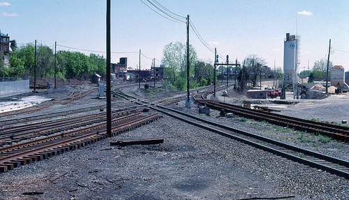
CP Town/NC Tower by DJ Witty, This is a view of the at-grade crossing between CSXT's Lurgan Subdivision and Conrail's Lurgan Line
CP Town/NC Tower by DJ Witty
F FOR FRESH by The Wright Photography of Things, Crossing the Potomac River at Shepherdstown, WV are the renumbered and repainted Norfolk Southern F
F FOR FRESH by The Wright Photography of Things
Devils Backbone Park, Boonesboro MD silky water by PhotosToArtByMike, This was a 3 or 4 second exposure late evening.  Print size 13x19 inches.

Critique by Jon Heller  <
Devils Backbone Park, Boonesboro MD silky water by PhotosToArtByMike
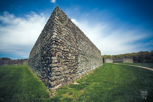
On The Knife Edge by T-3 Photography, A view from the southwest angle of Fort Frederick, just outside of Big Pool, MD. 

The photo title i
On The Knife Edge by T-3 Photography
US 11-1-2 by Mr_Samson, View of the Potomac River from Potomac Park in Williamsport, MD.

Once again many thanks for visits,
US 11-1-2 by Mr_Samson
The Slaughter Pen by T-3 Photography, HFF

A view of the fencing lining Bloody Lane at Antietam National Battlefield.battlefield civilwar
The Slaughter Pen by T-3 Photography
Fort Frederick Market Fair by Matt Champlin, Spent a couple days with some friends down in Maryland and southern Pennsylvania checking out the am
Fort Frederick Market Fair by Matt Champlin
Afternoon At Antietam by T-3 Photography, I stopped in at the battlefield on my way back from shooting trains around Shepherdstown, WV. The ni
Afternoon At Antietam by T-3 Photography
Sunset On The Six Eight by T-3 Photography, A view of yesterday's sunset from Maryland 68, near Clear Spring.

This HDR image was created from t
Sunset On The Six Eight by T-3 Photography
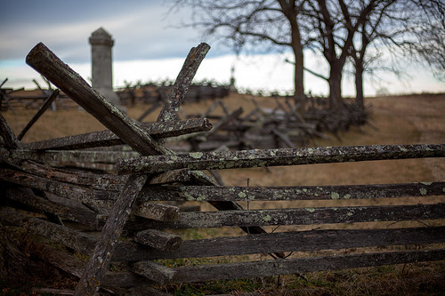
Piper Fence Post by T-3 Photography, HFF!

This is a view of the fence that lines the driveway to the Piper Farm at the Antietam National
Piper Fence Post by T-3 Photography
Looking Out The Church Window. by gleavesm, The view outside the window of the Dunker Church at Antietam National Battlefield in Sharpsburg, Mar
Looking Out The Church Window. by gleavesm
1985 01-27 1148 Norfolk Southern SD45-1767 S/B Shepherdstown, WV by guitartrain203, In two states. If not for the date of this photo, I could probably pass it off as true Norfolk &
1985 01-27 1148 Norfolk Southern SD45-1767 S/B Shepherdstown, WV by guitartrain203
Sherrick Farm by bluebird218, This was the residence of Joseph Sherrick and his family. The Sherrick farm was the site of the firs
Sherrick Farm by bluebird218
Hasselbladski Viewfinder by trainmann1, "Hasselbladski" at Fort Frederick, in Big Pool Maryland! Took this "waist-level viewf
Hasselbladski Viewfinder by trainmann1
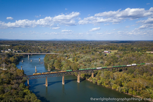
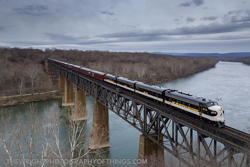
HIGH ABOVE THE POTOMAC by The Wright Photography of Things, Multiple crossings of the Potomac River have been used between the banks of Maryland and West Virgin
HIGH ABOVE THE POTOMAC by The Wright Photography of Things
Burnside Bridge by Mike Talplacido, antietam sharpsburg burnsidebridge americancivilwar antietambattlefield antietamnationalmilitarypark
Burnside Bridge by Mike Talplacido
B&O ROUNDHOUSE COMPLEX by The Wright Photography of Things,
B&O ROUNDHOUSE COMPLEX by The Wright Photography of Things
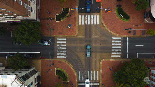
Rectangular Square by T-3 Photography, An overhead view of Hagerstown's City Square.drone dji mavic2pro aerial dronephotography hagerstown
Rectangular Square by T-3 Photography
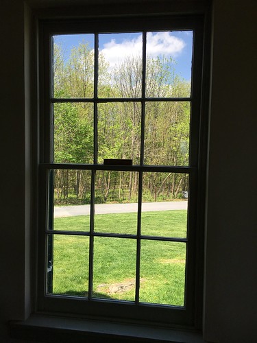
Antietam NB ~ view from Dunker Church by karma (Karen), and outside the Visitor Center below - HWW!antietamnb sharpsburg maryland usparks battlefields windo
Antietam NB ~ view from Dunker Church by karma (Karen)
Twelve-Pound Napoleon Complex by T-3 Photography, A 12-poun Napoleon marks the position of Batter B, 4th United States Artillery at Antietam.history b
Twelve-Pound Napoleon Complex by T-3 Photography
Devils Backbone Park, Boonsboro MD waterfall by PhotosToArtByMike, I can't believe I got my wife to hold still for a 3 second exposure.  Print size 8x10 inches.landsca
Devils Backbone Park, Boonsboro MD waterfall by PhotosToArtByMike
Martinsburg Roundhouse by i saw the Sign, The Martinsburg, West Virginia, Roundhouse, was part of the Baltimore and Ohio Railroad shops and si
Martinsburg Roundhouse by i saw the Sign
Doubleday Hill by T-3 Photography, A pair of 3-inch Ordnance Rifles (a third is behind me) represent the former earthworks on what used
Doubleday Hill by T-3 Photography
NS 13R - Shepherdstown, WV by T-3 Photography, Manifest 13R crosses the Potomac River into Shepherdstown, with the vehicles for an Army Stryker bat
NS 13R - Shepherdstown, WV by T-3 Photography
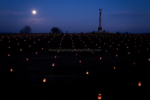
NEW YORK MONUMENT by The Wright Photography of Things, A near Full Moon lights the night sky as some of the 23,000 luminaries dot the "landscape turne
NEW YORK MONUMENT by The Wright Photography of Things
NS 203 - Hagerstown, MD by T-3 Photography, A pair of SD70s lead the Pennsy Heritage unit south out of Vardo Yard on the H-Line.
NS 203 - Hagerstown, MD by T-3 Photography
Burnside Bridge night photo, Antietam Battlefield Maryland by PhotosToArtByMike, This was a three minute exposure with a portable flood spotlight "painting" the bridge and
Burnside Bridge night photo, Antietam Battlefield Maryland by PhotosToArtByMike
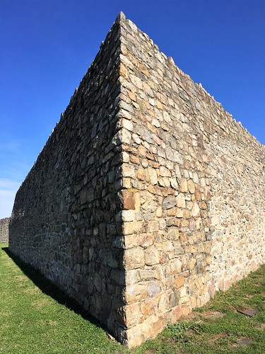
Ft Frederick State Park by karma (Karen), Here are two views of the fort built in 1756 by the colony of Maryland during the French and Indian
Ft Frederick State Park by karma (Karen)
Conococheague Aqueduct by Itinerant Wanderer, A view of the historic Conococheague Aqueduct in the Williamsport, Maryland section of Chesapeake &a
Conococheague Aqueduct by Itinerant Wanderer
South On North by T-3 Photography, A view south on North Potomac Street.street city longexposure urban night canon nocturnal citylife m
South On North by T-3 Photography
2015 Chesapeake Watershed Forum in Jefferson County, W.Va. by chesbayprogram, The Potomac River is seen in Shepherdstown, W. Va. on Sept. 26, 2015. (Photo by Will Parson/Chesapea
2015 Chesapeake Watershed Forum in Jefferson County, W.Va. by chesbayprogram
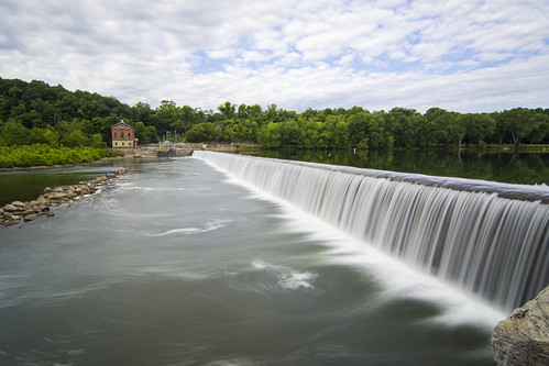
View of the West Virginia Power Plant across Dam No. 4 of the Potomac at Downsville MD by PhotosToArtByMike, Dam No.4 is one of seven dams on the Potomac River which were originally built to divert water into
View of the West Virginia Power Plant across Dam No. 4 of the Potomac at Downsville MD by PhotosToArtByMike
Across by T-3 Photography, A view into the cemetery behind the Zion United Church of Christ in Hagerstown. The former M. P. Möl
Across by T-3 Photography
2015-11-23 0956 W&W 459 on #86 Falling Waters, WV by jimkleeman, At Learic Road in Falling Waters the tracks turn to the east on the approach to the Potomac River br
2015-11-23 0956 W&W 459 on #86 Falling Waters, WV by jimkleeman
Antietam Valley Sunset by Msanders55, Along Branch Avenue on the southern end of the Antietam battlefield.autumn sunset landscape fallcolo
Antietam Valley Sunset by Msanders55
Morning on the Conococheague Creek in Williamsport MD by PhotosToArtByMike, Print size 13x19 inches. morning sunrise landscape md scenic maryland potomacriver cocanal cushwa ca
Morning on the Conococheague Creek in Williamsport MD by PhotosToArtByMike
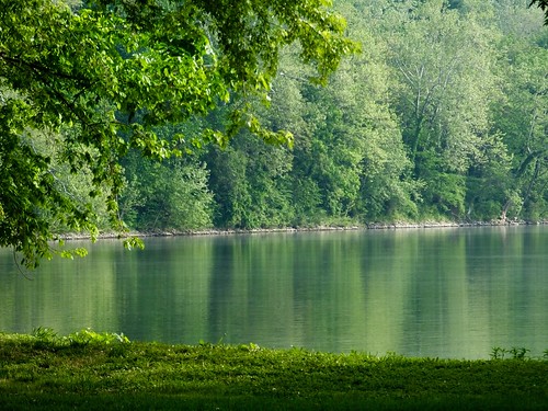
Four Locks by JRWhitaker1, Photographed at the Four Locks area, Chesapeake and Ohio Canal National Historic Park near Clear Spr
Four Locks by JRWhitaker1
City Square by T-3 Photography, A look down view of Hagerstown's city square from about 200' up.
City Square by T-3 Photography
Antietam, October Field by Msanders55, autumn fence landscape corn fallcolor maryland antietam battlefield farmfield washingtoncountymd
Antietam, October Field by Msanders55
2021-03-10 0822 NS 8014 Jordon Rd, Fairplay, MD by jimkleeman, I spent Wednesday 3/10/2021 railfanning the NS Lurgan and H-Line with Bob Kaplan. Bob knew of this n
2021-03-10 0822 NS 8014 Jordon Rd, Fairplay, MD by jimkleeman
field-sunset by KateDAS.Photos, (55/366) This is one of the fields near my home. It is VERY windy here today (suppose to get up to 6
field-sunset by KateDAS.Photos
A Love of Bridges, Part 5: The Burnside Bridge, Antietam National Battlefield, Maryland, USA (1836) by rwgabbro1, <i>Looking northeastward from the western bank of Antietam Creek. On September 17, 1862 this would h
A Love of Bridges, Part 5: The Burnside Bridge, Antietam National Battlefield, Maryland, USA (1836) by rwgabbro1