Elevation of Myrtle Crest Ln, Myrtle Point, OR, USA
Location: United States > Oregon > Myrtle Point >
Longitude: -124.13118
Latitude: 43.0580278
Elevation: 32m / 105feet
Barometric Pressure: 101KPa
Elevation Map:
Satellite Map:
Related Photos:

First National Bank of Coquille -- DSC03107

Monadenia fidelis flava Hemphill, 1892

Oregon Landscape

King Tide, Coquille River at Fat Elk Rd., west of Cedar Point (see map)

King Tide, Coquille River at Coquille

King Tide, Coquille River between Norway and Myrtle Point (see map)

King Tide, Coquille River at Sturdivant Park, Coquille

King Tide, Coquille River at Fat Elk Rd., west of Cedar Point (see map)

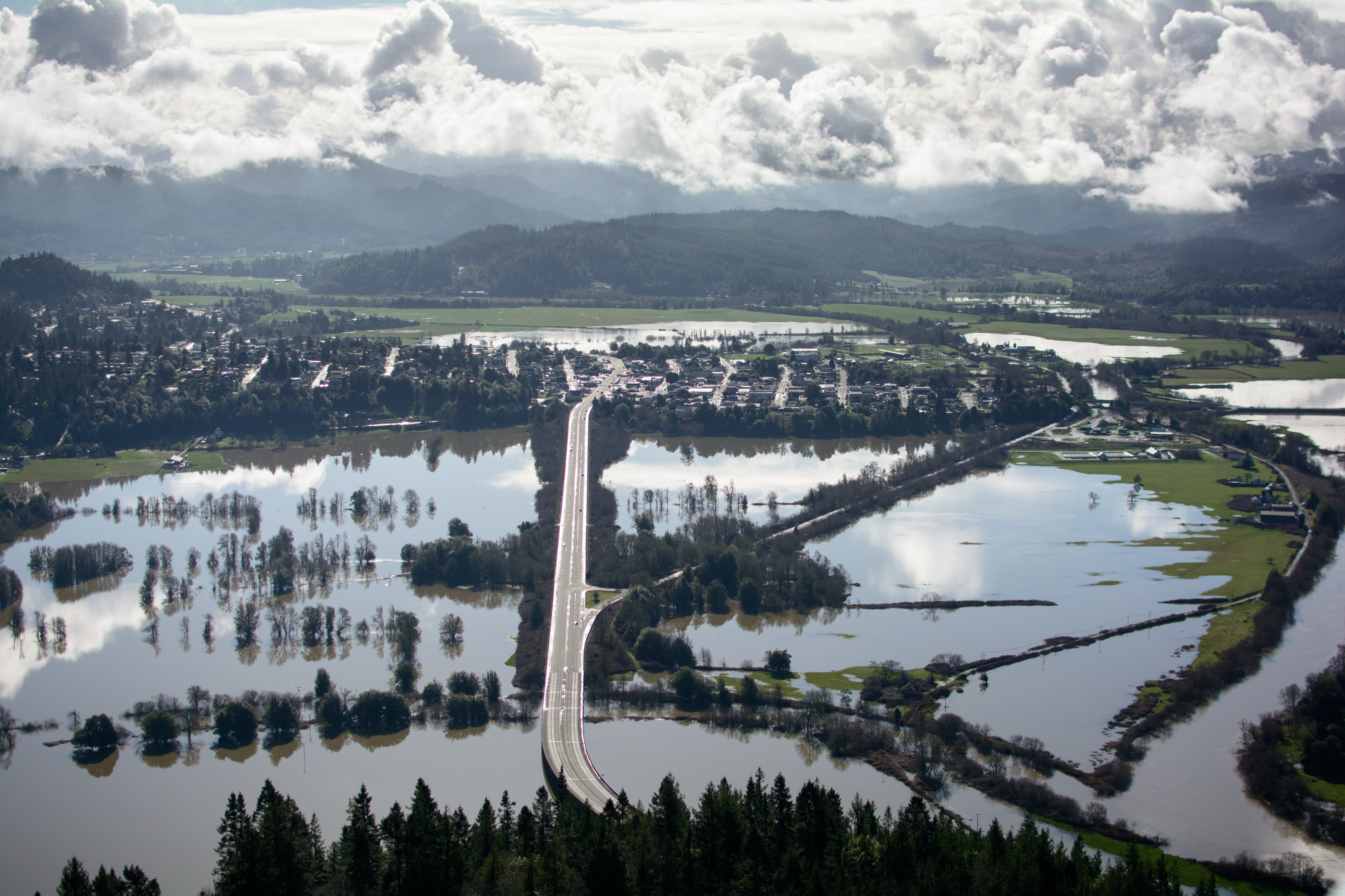
King Tide, Coquille River at Myrtle Point (see map)

King Tide, Coquille River at Coquille

King Tide, Coquille River at Coquille

King Tide, Coquille River at Maryland Ave., Myrtle Point (see map)

King Tide, Coquille River at Norway

King Tide, Coquille River at Sturdivant Park, Coquille

King Tide, Coquille River at Johnson Mill Rd., Coquille

King Tide, Coquille River at Gray Creek, Coquille

King Tide, Coquille River at Lower Norway Ln., Norway

Route of proposed pipeline near Dora, MP 27

King Tide, Coquille River at Myrtle Point (see map)
King Tide, Coquille River at Myrtle Point (see map)

King Tide, Coquille River at Myrtle Point (see map)

King Tide, Coquille River at Myrtle Point (see map)

King Tide, Coquille River at Sitkum Ln., Myrtle Point (see map)
Topographic Map of Myrtle Crest Ln, Myrtle Point, OR, USA
Find elevation by address:

Places near Myrtle Crest Ln, Myrtle Point, OR, USA:
621 25th St
Myrtle Point
204 Maple St
204 Maple St
Old Hwy 42, Myrtle Point, OR, USA
90849 Catching Creek Ln
94787 Mark Pl
795 Se 3rd Ave
Bridge
Beaver Hill Disposal Site
Coquille
E 3rd St, Coquille, OR, USA
511 E 6th St
798 N Henry St
516 N Baxter St
47 Cedar St
460 E 7th St
620 N Baxter St
281 W 4th St
1331 E 15th St
Recent Searches:
- Elevation of Corso Fratelli Cairoli, 35, Macerata MC, Italy
- Elevation of Tallevast Rd, Sarasota, FL, USA
- Elevation of 4th St E, Sonoma, CA, USA
- Elevation of Black Hollow Rd, Pennsdale, PA, USA
- Elevation of Oakland Ave, Williamsport, PA, USA
- Elevation of Pedrógão Grande, Portugal
- Elevation of Klee Dr, Martinsburg, WV, USA
- Elevation of Via Roma, Pieranica CR, Italy
- Elevation of Tavkvetili Mountain, Georgia
- Elevation of Hartfords Bluff Cir, Mt Pleasant, SC, USA