Elevation of Mchughs Creek Rd, South Arm NSW, Australia
Location: Australia > New South Wales > Nambucca Shire Council >
Longitude: 152.7399315
Latitude: -30.6947468
Elevation: 140m / 459feet
Barometric Pressure: 0KPa
Related Photos:

The view...

The view over the coffee plants

hazard reduction burn Guy Fawkes River National Park_300413_IMG_7317

Tent city

The dam

Another beautiful day at Prana Ridge

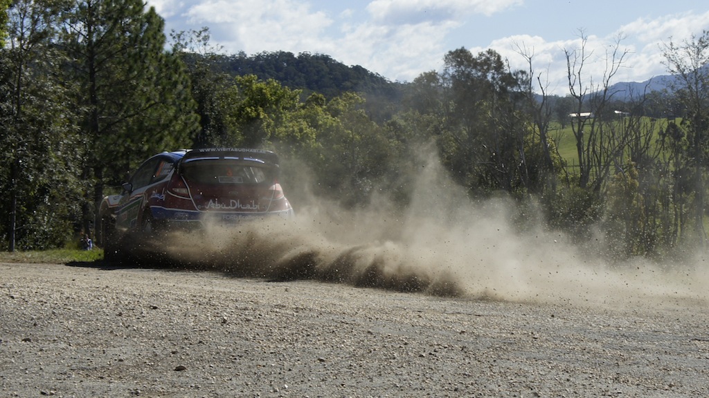
WRC Australia 2011 - SS15 Welshes 2 - Sat 10th Sept

fire pit

WRC Australia 2011 - SS12 Grace 1 - Sat 10th Sept

WRC Australia 2011 - SS15 Welshes 2 - Sat 10th Sept

WRC Australia 2011 - SS15 Welshes 2 - Sat 10th Sept

WRC Australia 2011 - SS15 Welshes 2 - Sat 10th Sept
WRC Australia 2011 - SS15 Welshes 2 - Sat 10th Sept
Topographic Map of Mchughs Creek Rd, South Arm NSW, Australia
Find elevation by address:

Places near Mchughs Creek Rd, South Arm NSW, Australia:
Nambucca Shire Council
Medlow Public School
Burrapine
521 Greenhills Rd
Bakers Creek
Upper Taylors Arm
Bowraville
Missabotti
1841 Valla Rd
64 Helliwells Rd
697 Bellingen Rd
Millbank
4 Jellico St
Macksville
Malibells Country Cottages
Kalang Road
1399 Bowraville Rd
1399 Bowraville Rd
1399 Bowraville Rd
Spicketts Creek
Recent Searches:
- Elevation of 4655, Krischke Road, Schulenburg, Fayette County, Texas, 78956, USA
- Elevation of Carnegie Avenue, Downtown Cleveland, Cleveland, Cuyahoga County, Ohio, 44115, USA
- Elevation of Walhonding, Coshocton County, Ohio, USA
- Elevation of Clifton Down, Clifton, Bristol, City of Bristol, England, BS8 3HU, United Kingdom
- Elevation map of Auvergne-Rhône-Alpes, France
- Elevation map of Upper Savoy, Auvergne-Rhône-Alpes, France
- Elevation of Chamonix-Mont-Blanc, Upper Savoy, Auvergne-Rhône-Alpes, France
- Elevation of 908, Northwood Drive, Bridge Field, Chesapeake, Virginia, 23322, USA
- Elevation map of Nagano Prefecture, Japan
- Elevation of 587, Bascule Drive, Oakdale, Stanislaus County, California, 95361, USA
- Elevation of Stadion Wankdorf, Sempachstrasse, Breitfeld, Bern, Bern-Mittelland administrative district, Bern, 3014, Switzerland
- Elevation of Z024, 76, Emil-von-Behring-Straße, Marbach, Marburg, Landkreis Marburg-Biedenkopf, Hesse, 35041, Germany
- Elevation of Gaskill Road, Hunts Cross, Liverpool, England, L24 9PH, United Kingdom
- Elevation of Speke, Liverpool, England, L24 9HD, United Kingdom
- Elevation of Seqirus, 475, Green Oaks Parkway, Holly Springs, Wake County, North Carolina, 27540, USA
- Elevation of Pasing, Munich, Bavaria, 81241, Germany
- Elevation of 24, Auburn Bay Crescent SE, Auburn Bay, Calgary, Alberta, T3M 0A6, Canada
- Elevation of Denver, 2314, Arapahoe Street, Five Points, Denver, Colorado, 80205, USA
- Elevation of Community of the Beatitudes, 2924, West 43rd Avenue, Sunnyside, Denver, Colorado, 80211, USA
- Elevation map of Litang County, Sichuan, China