Elevation of McAdoo St, Blackfoot, ID, USA
| Latitude | 43.1860935 |
|---|---|
| Longitude | -112.3625056 |
| Elevation | 1370m / 4495feet |
| Barometric Pressure | 859KPa |
Related Photos:

Fairly High

On the Snake River Plain north of Pocatello. Ft. Hall Reservation

Air Fair

Late winter Fort Hall Reservation. Portneuf Range northern end

Meghan and Kade

Kennedy Miller

Megan Martinsen

Tyler Mikesell
Hells Half Acre; view of lava field

She Plays In The Grass

Blackfoot, Id 033

Irrigation canal. Dry for the winter. Fort Hall Indian Reservation.

Looking up to Blue Skies and Cloud Wisps in the Idaho Skies (Black & White)

022 Frosty Lane Blackfoot, ID USA

The drab sagebrush landscape of late winter on the Fort Hall Indian Reservation.

Abandoned tracks leading into the storm

013 Cemetary Blackfoot, ID

Farm field and mountains near Blackfoot, Idaho

The Portneuf Range (telephoto) in late May 2017

Snake River, Interstate 15 Near Blackfoot, Idaho

Sunset on the Snake River Plain near Blackfoot, ID

December storm cloud over the eastern part of Ft. Hall Indian Res.

Day 107 of 365-Pt.2: Where the west was all but won

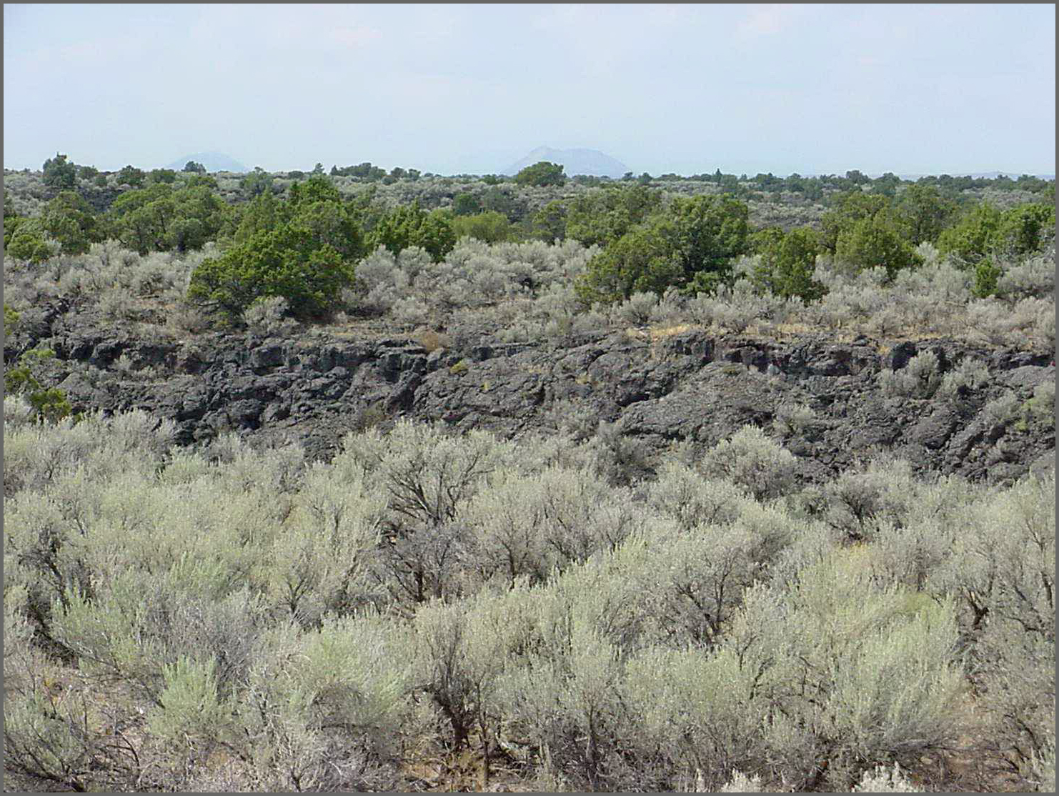
Lava Rock

479 Idaho, Hells Half Acre Services, Lava Cave

488 Idaho, Hells Half Acre Services, Lava Cave In Cliff
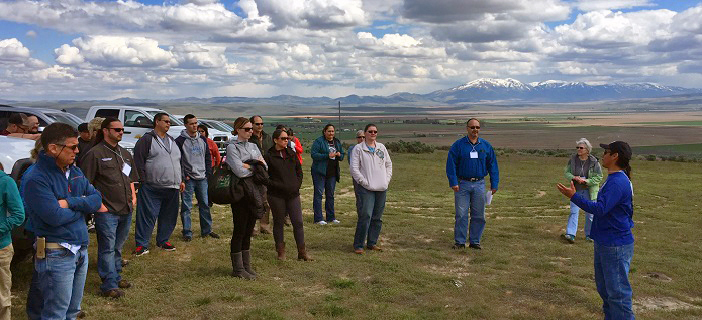
Tribal Climate Change Adaptation Workshop

487 Idaho, Hells Half Acre Services, Unstable Lava Cliff

Interpretive Trail

Collapse Feature
Topographic Map of McAdoo St, Blackfoot, ID, USA
Find elevation by address:
Places near McAdoo St, Blackfoot, ID, USA:
Blackfoot
Bingham County
330 Mcdougal St
N W, Blackfoot, ID, USA
N W, Blackfoot, ID, USA
N W, Blackfoot, ID, USA
W N, Blackfoot, ID, USA
Taber Rd, Blackfoot, ID, USA
E N, Blackfoot, ID, USA
N W, Blackfoot, ID, USA
W S, Blackfoot, ID, USA
N E, Firth, ID, USA
637 N 550 E
Firth
Firth Rd, Firth, ID, USA
N Yellowstone Hwy, Pocatello, ID, USA
587 E 1250 N
1085 Stars Rd
Chubbuck
2505 Michelle St
Recent Searches:
- Elevation of 104, Chancery Road, Middletown Township, Bucks County, Pennsylvania, 19047, USA
- Elevation of 1212, Cypress Lane, Dayton, Liberty County, Texas, 77535, USA
- Elevation map of Central Hungary, Hungary
- Elevation map of Pest, Central Hungary, Hungary
- Elevation of Pilisszentkereszt, Pest, Central Hungary, Hungary
- Elevation of Dharamkot Tahsil, Punjab, India
- Elevation of Bhinder Khurd, Dharamkot Tahsil, Punjab, India
- Elevation of 2881, Chabot Drive, San Bruno, San Mateo County, California, 94066, USA
- Elevation of 10370, West 107th Circle, Westminster, Jefferson County, Colorado, 80021, USA
- Elevation of 611, Roman Road, Old Ford, Bow, London, England, E3 2RW, United Kingdom
- Elevation of 116, Beartown Road, Underhill, Chittenden County, Vermont, 05489, USA
- Elevation of Window Rock, Colfax County, New Mexico, 87714, USA
- Elevation of 4807, Rosecroft Street, Kempsville Gardens, Virginia Beach, Virginia, 23464, USA
- Elevation map of Matawinie, Quebec, Canada
- Elevation of Sainte-Émélie-de-l'Énergie, Matawinie, Quebec, Canada
- Elevation of Rue du Pont, Sainte-Émélie-de-l'Énergie, Matawinie, Quebec, J0K2K0, Canada
- Elevation of 8, Rue de Bécancour, Blainville, Thérèse-De Blainville, Quebec, J7B1N2, Canada
- Elevation of Wilmot Court North, 163, University Avenue West, Northdale, Waterloo, Region of Waterloo, Ontario, N2L6B6, Canada
- Elevation map of Panamá Province, Panama
- Elevation of Balboa, Panamá Province, Panama