Elevation of Matamoras, OH, USA

Location: United States > Ohio > Washington County > Grandview Township > New Matamoras >

Longitude: -81.065806

Latitude: 39.5231932

Elevation: -10000m / -32808feet

Barometric Pressure: 295KPa

Elevation Map:

elevation map of Matamoras, OH, USA

Satellite Map:

Satellite map of Matamoras, OH, USA

Related Photos:

35mmslr 35mmfilm flood flowersplants knowltoncoveredbridgepark littlemuskingumriver monroecounty ohio outdoor plant rinardmills river summer transportation travel usa water watercraft waynenationalpark bhagavideocom boat circa1977 haroldbrowncom harolddashbrowncom photosbhagavideocom tree haroldbrown
Little Muskingum River
sky moon tree silhouette night dark early scary cloudy silhouettes eerie full fullmoon spooky wv westvirginia late mystical erie lunar takenbyandy mywinners abigfave
Cloudy Night.
mushroom fungus mariettaohio shelfmushroom southeasternohio waynenationalforest mushroomonlog littlemuskingumriver washingtoncountyohio photobypeterwendelken peterwendelken
SHELF MUSHROOM on Log on the Banks of the Little Muskingum River in the Wayne National Forest in Washington County in Southeastern Ohio. Photo by Peter Wendelken.
westvirginia stmaryswestvirginia stmarys saintmaryswestvirginia saintmarys pleasantscountywestvirginia pleasantscounty parkersburgmarietta parkersburgmetropolitanarea midohiovalley 20100715 july2010 july 2010 westvirginiaroute2 stateroute2 route2 landscape view westvirginialandscape stmaryslandscape fog foggylandscape foggymorning bigdaddyshotspotcafe bigdaddyshotspot hotspot bigdaddy casino videolottery limitedvideolotteryretailer limitedvideolottery videolotteryretailer westvirginiacasino westvirginialottery westvirginialotterycommission convertedgasstation formerservicestation convertedservicestation servicestation gasstation pumpcanopy servicestationpumpcanopy gasstationpumpcanopy formergasstation tarpaulins tarpaulinwrappedgaspumps coveredgaspumps wrappedgaspumps formergaspumps parkinglot parking paved pavement cafe misuseofwords powerlines utilitypoles telephonepoles roadsidecasino trashylittlecasino fogshroudedtrees gambling gamblingjoint videogambling videogamegambling img4110
I found big daddy's hot spot.
ohio print 1800s ohioriver monroecounty jacksontownship ohioartthrough1865
View of Long-Reach
2015 20150429 april april2015 fivepoints img5781 knowltoncoveredbridgepark monroecounty monroecountyohio monroecountylandscape ohio ohiolandscape townshiproad384 washingtontownship washingtontownshipmonroecountyohio washingtontownshipohio washingtontownshiplandscape countrylandscape countrylife countypark dandelions distanthouse distantwoodland distantwoods eastohio easternohio gravelroad house intersections landscape lawn mowed mowedarea mowedexpanse park road rurallandscape rurallife ruralroad southeastohio southeasternohio sunny sunnylandscape view woodedhillside woodland woods unitedstates
A rural fivepoints.
2013 20130628 countyroad63 img4699 june june2013 littlesanchocreekroad tylercounty tylercountywestvirginia tylercountylandscape westvirginia westvirginialandscape countryroad countyroad doubleyellowline grass guardrail landscape mowed mowedarea nopassingzone northernwestvirginia northwesternwestvirginia road ruralwestvirginia ruralwestvirginialandscape rurallandscape view middlebourne unitedstates
The "double yellow lines" portions of our ideations of "country roads" in rural West Virginia.
2015 20150429 alleghenyplateau alleghenyplateaulandscape alleghenyplateauriver april april2015 clearfork clearforklittlemuskingumriver clearforkofthelittlemuskingumriver highway26 img5818 littlemuskingumriverwatershed monroecounty monroecountyohio monroecountylandscape ohio ohio26 ohioriverwatershed ohioroute26 ohiostateroute26 ohiolandscape route26 statehighway26 stateroute26 washingtontownship washingtontownshipmonroecountyohio washingtontownshipohio washingtontownshiplandscape creek creeklandscape eastohio easternohio landscape river riverlandscape riverbanks smallriver southeastohio southeasternohio spring springlandscape springtrees stream streamlandscape sunny sunnycreek sunnyriver sunnystream view graysville unitedstates
The Clear Fork of the Little Muskingum River was extraordinarily good-looking this late-April day.
2015 20150429 alleghenyplateau alleghenyplateaulandscape april april2015 img5748 knowltoncoveredbridgepark monroecounty monroecountyohio monroecountylandscape ohio ohiolandscape vitis washingtontownship washingtontownshipmonroecountyohio washingtontownshipohio washingtontownshiplandscape climbingplants countypark eastohio easternohio grapevines landscape park plantsuccession southeastohio southeasternohio springlandscape springplants springtrees sunny sunnylandscape view woodedlandscape woods woodygrapevines woodyvines youngwoodland graysville unitedstates
I refuse to be convinced that late April isn't the best time to see this rural Ohio Applachian plant area.
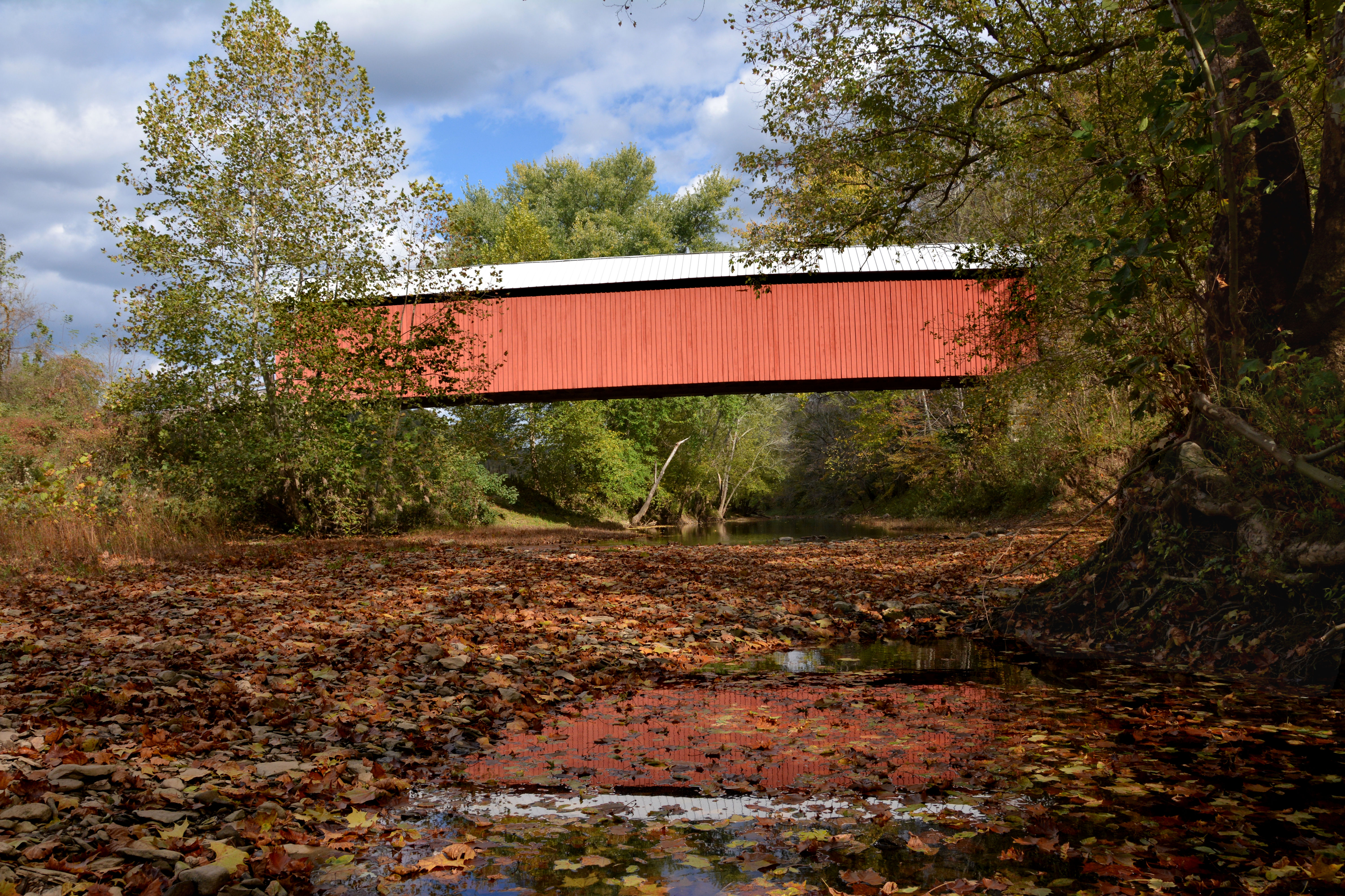
coveredbridge flickrmeet ohiocoveredbridges hunecoveredbridge
Hune Covered Bridge
ohio monroecounty countryroads rural fallcolor ruralohio october2015 october 2015 canon24704l
Road to Knowlton Bridge
35mmslr 35mmfilm architecture bridge covered knowltoncoveredbridgepark monroecounty ohio outdoor rinardmills summer travel usa waynenationalpark bhagavideocom circa1977 haroldbrowncom harolddashbrowncom photosbhagavideocom vanishingpoint haroldbrown
Knowlton Covered Bridge
35mmslr 35mmfilm architecture bridge covered googleearth knowltoncoveredbridgepark monroecounty ohio rinardmills summer travel usa views waynenationalpark bhagavideocom circa1977 haroldbrowncom harolddashbrowncom photosbhagavideocom haroldbrown
Knowlton Covered Bridge
coveredbridge flickrmeet ohiocoveredbridges hunecoveredbridge
Hune Covered Bridge
coveredbridge flickrmeet ohiocoveredbridges hunecoveredbridge
Hune Covered Bridge
coveredbridge mariettaohio southeasternohio waynenationalforest littlemuskingumriver washingtoncountyohio hunecoveredbridge hunebridge photobypeterwendelken peterwendelken
HUNE COVERED BRIDGE Spanning the Little Muskingum River in the Wayne National Forest in Washington County in Southeastern Ohio. Photo by Peter Wendelken.
flickrmeet monroecounty knowltoncoveredbridge
County Road 384
ohio sunrise fly ohioriver foggymorning
Foggy Fly Sunrise
35mmslr 35mmfilm architecture bridge covered googleearth knowltoncoveredbridgepark monroecounty ohio outdoor rinardmills summer travel usa views waynenationalpark bhagavideocom circa1977 haroldbrowncom harolddashbrowncom photosbhagavideocom vanishingpoint haroldbrown
Knowlton Covered Bridge
ohio july coveredbridges latelight riversandstreams 2011 washingtoncounty nrhp canon24105l ohiocoveredbridges littlemuskingumriver july2011 hunebridge longtruss
Hune Covered Bridge & Little Muskingum River
route26 rinardcoveredbridge rinnard
Rinard Covered Bridge
ohio summer sunrise fly foggy aug ohioriver
Foggy Ohio River Sunrise
1918 1918bridge 2013 20130628 countyroad11 duncanconstructioncompany elkforkroad img4750 june june2013 kidwell kidwellwestvirginia marlinton marlintonwestvirginia pointpleasantcreek tylercounty tylercountywestvirginia tylercountylandscape westvirginia westvirginialandscape bridgecontractor bridgenameplate bridgeplaque concretebridge constructioncontractor creek landscape nameplate northernwestvirginia northwesternwestvirginia plaque river ruralwestvirginia ruralwestvirginialandscape stream view
"1918; Duncan Construction Company, Contractor, Marlinton, W. Va.," it says.
rinardcoveredbridge countyroad406
County Road 407
autumncolors coveredbridge falllandscape ohiocoveredbridge hunecoveredbridge
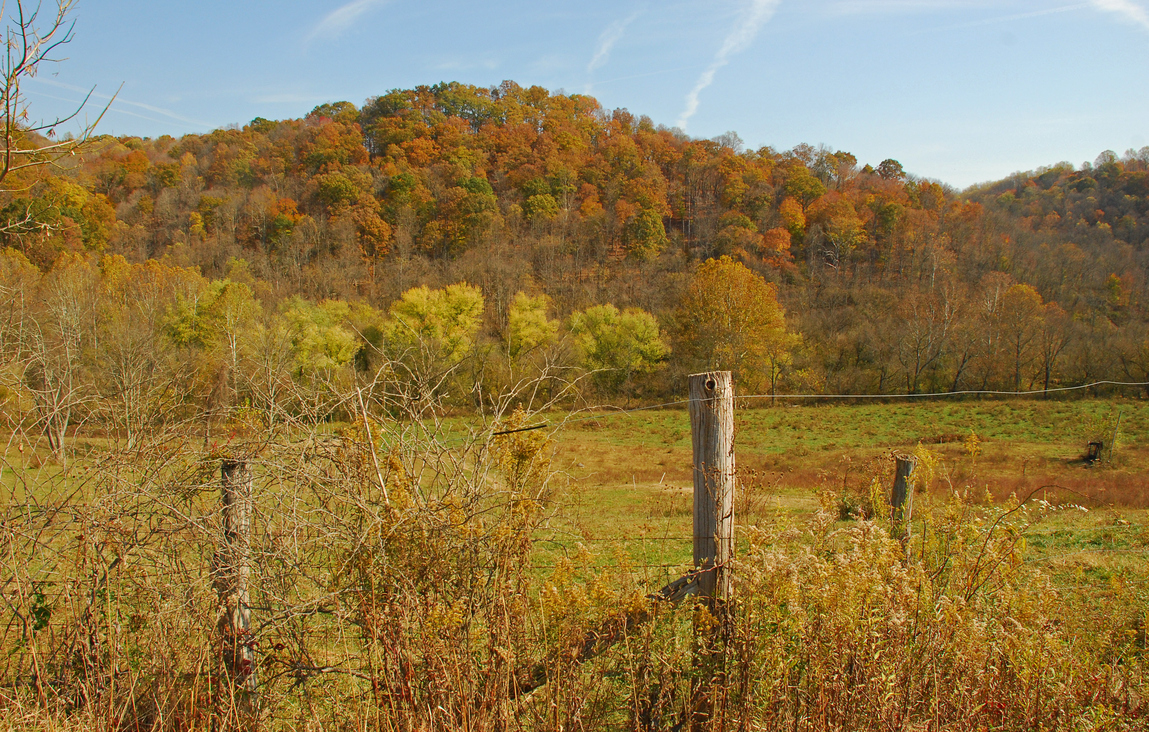
Duff Road Fall Colors
sistersville country club autumn fall landscape foliage trees tree outside nature green bridge flickr flickriver day overcast rainy misty
Sistersville Country Club
autumn color fall landscape
Fall 2010 Colors From Ohio Route 260
ohio sunrise fly ohioriver foggymorning
Foggy Fly Sunrise
ohio coveredbridge route26 knowltoncoveredbridge route260
Parting Shot of Knowlton Covered Bridge
westvirginia padencitywestvirginia padencity wetzelcountywestvirginia wetzelcounty 20100715 july2010 july 2010 williamefordpark padencitypark park citypark ohioriver river riverlandscape monroecountyohio monroecounty ohiorivervalley ohiovalley riverbank rocks riverbankrocks rockyriverbank landscape view westvirginialandscape ohiolandscape padencitylandscape ohioriverlandscape fog foggymorning morningfog summerfog mud stump treestump riverfrontpark img4161
One of the weirdo things about the Ohio River Valley is: that there are not hordes of area residents lined up along the riverbanks, to gawk at the Ohio River, on pretty mornings such as these.
ohio historic route26 washingtoncounty hunecoveredbridge
Route 26 Fall Colors
autumn fall route26 orio littlemuskingumriver
Don't Touch That Third Wire
autumn color fall landscape
Fall 2010 Colors From Ohio Route 260
ohio june creek woodland landscape sticks stream view mud branches muddywater nationalforest leith riverbank treebranches 2009 ohioriver backwater washingtoncounty independencetownship streambank southeasternohio ohiolandscape waynenationalforest midohiovalley img0166 southeastohio rivermud leithrun washingtoncountyohio june2009 ohiorivermud fallentreebranches parkersburgmarietta parkersburgmetropolitanarea 20090626 leithohio independencetownshipohio leithrunrecreationarea leithruncampground ohioriverbackwater
O the mud!
2015 20150429 april april2015 img5807 knowltoncoveredbridgepark littlemuskingumriver monroecounty monroecountyohio monroecountylandscape ohio ohioriverwatershed ohiolandscape washingtontownship washingtontownshipmonroecountyohio washingtontownshipohio washingtontownshiplandscape countypark creek creeklandscape eastohio easternohio flooddebris fluvialgeomorphology grass landscape mud mudbar muddybanks muddyriverbank park river riverlandscape riverbanks sandbar smallriver southeastohio southeasternohio spring springlandscape springtrees stream streamlandscape view youngtrees unitedstates
Rural mudbar in a color of water.
autumn color fall landscape
Fall 2010 Colors From Ohio Route 260
The Ohio River Glistening in the Sun