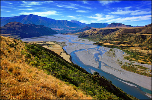
Elevation of Gray Hill, Canterbury, New Zealand
Location: New Zealand > Canterbury > Selwyn District > Bealey >
Longitude: 171.963333
Latitude: -42.954166
Elevation: 1829m / 6001feet
Barometric Pressure: 81KPa
Related Photos:
Topographic Map of Gray Hill, Canterbury, New Zealand
Find elevation by address:

Places near Gray Hill, Canterbury, New Zealand:
Mount Binser
Mount Turnbull
Waimakariri River
Lees Valley
Lake Taylor
Bealey
Castle Hill
7 Torlesse Pl
Castle Hill Peak
Selwyn District
View Hill
Springfield
Springfield
1 York St
84 Depot Rd
Oxford
Otira
Mount Longfellow
Mount Alexander
Lake Lyndon
Recent Searches:
- Elevation of Corso Fratelli Cairoli, 35, Macerata MC, Italy
- Elevation of Tallevast Rd, Sarasota, FL, USA
- Elevation of 4th St E, Sonoma, CA, USA
- Elevation of Black Hollow Rd, Pennsdale, PA, USA
- Elevation of Oakland Ave, Williamsport, PA, USA
- Elevation of Pedrógão Grande, Portugal
- Elevation of Klee Dr, Martinsburg, WV, USA
- Elevation of Via Roma, Pieranica CR, Italy
- Elevation of Tavkvetili Mountain, Georgia
- Elevation of Hartfords Bluff Cir, Mt Pleasant, SC, USA

