Elevation of Coastal Rd, Brooksville, ME, USA

Location: United States > Maine > Hancock County > Brooksville >

Longitude: -68.749132

Latitude: 44.3574809

Elevation: 59m / 194feet

Barometric Pressure: 101KPa

Elevation Map:

elevation map of Coastal Rd, Brooksville, ME, USA

Satellite Map:

Satellite map of Coastal Rd, Brooksville, ME, USA

Related Photos:

coastguard lighthouse fog coast maine shoreline newengland romance belltower september highway1 fortpoint peninsula atlanticocean navigation 18thcentury acadia route1 barharbor 2012 optic thewaylifeshouldbe acadianationalpark uscoastguard 2470mm penobscotriver fogbell fourthorderfresnellens keepershouse fogsignal bangormaine stocktonsprings fortpointlight fortpointstatepark capejellison lighthousesofmaine penobscotnarrowsbridgeandobservatory yenumula worldofarun uslighthouseservice nikond800 fogbelltower mainelightsprogram arunyenumula fortpownall firstriverlighthouseinmaine lumberingport pyramidalbelltower
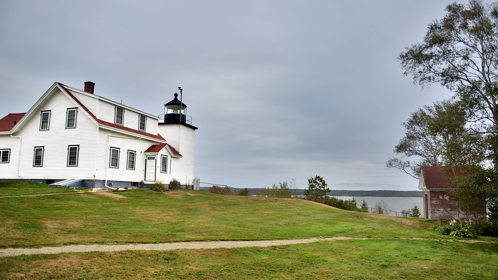
The lighthouse at Fort Point, Maine
house main tiny
The view of our cottage from the beach
maine
the view from the sleeping porch
newengland maine hancockcounty castine lighthouses atlanticlighthouses newenglandlighthouses mainelighthouses dyceheadlight lightkeepershouses overcast september2017 september 2017 canon16354l
Waterside Home
blueberrybarrens maine caterpillarhill view ocean mountains trees field
View from Caterpillar Hill
newengland maine hancockcounty castine outbuildings weatheredwood bicycles september2017 september 2017 canon16354l
Second Time Around
newengland maine hancockcounty castine lighthouses atlanticlighthouses newenglandlighthouses mainelighthouses dyceheadlight overcast september2017 september 2017 canon24704l
Dyce Head Lighthouse
vw bus vwbus maine summer view road roadtrip
Summer Bus! - Sedgwick Maine
Keeper's Access
Bridge Downtown Blue Hill 3D cross view
High Tide 3D Cross View
ocean sky bw lighthouse water grass clouds blackwhite maine newengland coastline fortpointlighthouse stocktonsprings fortpointstatepark robertallanclifford cliffordphotographynhcom
Fort Point Lighthouse
coastguard lighthouse fog coast maine shoreline newengland romance belltower september highway1 fortpoint peninsula atlanticocean navigation 18thcentury acadia route1 barharbor 2012 optic thewaylifeshouldbe acadianationalpark uscoastguard 2470mm penobscotriver fogbell fourthorderfresnellens keepershouse fogsignal bangormaine stocktonsprings fortpointlight fortpointstatepark capejellison lighthousesofmaine penobscotnarrowsbridgeandobservatory yenumula worldofarun uslighthouseservice nikond800 fogbelltower mainelightsprogram arunyenumula fortpownall firstriverlighthouseinmaine lumberingport pyramidalbelltower
Fort Point Lighthouse, Maine
Brooksville Events 3d Cross Eye View
bridge suspension maine aerial finepix fujifilm deerisle stonington eggemoggin littledeerisle penobscotislandair s9600 s9100 lighthouseweekend lighthouseday chipsfolio
Aerial View of Little Deer Isle and the Deer Isle - Sedgwick Bridge
ocean light sea coastguard usa lighthouse water america port coast harbor rocks lighthouses waterfront maine newengland atlantic american shore granite hafen leuchtturm vacationland castine uscg dyce penobscotbay uscoastguard mainelighthouse dicehead dyceheadlight wbnawneme davensuze
Dyce Head Light in Castine, Maine
bridge suspension maine aerial finepix fujifilm deerisle stonington penobscotislandair s9600 s9100 lighthouseweekend lighthouseday chipsfolio
Aerial View (1) of the Deer Isle - Sedgwick Bridge
maine aerial finepix fujifilm deerisle stonington penobscotislandair s9600 s9100 lighthouseweekend lighthouseday chipsfolio
Aerial View of Deer Isle, Maine
ocean sea usa beach water fog america port island coast harbor rocks waterfront maine newengland belfast atlantic american shore granite hafen mack penobscot vacationland searsport penobscotbay oilterminal the4elements davensuze
Campsite, Sears Island, Maine
ocean sea usa water america island coast rocks waterfront maine newengland atlantic american shore granite lichen vinalhaven deerisle vacationland stonington northhaven penobscotbay fromthewater the4elements fromwater davensuze flickr5100941301
Hardhead Island in northeastern Penobscot Bay, Maine
maine aerial finepix fujifilm deerisle stonington eagleisland penobscotislandair s9600 s9100 lighthouseweekend wbnawneme lighthouseday chipsfolio
Aerial View of Eagle Island Light
longexposure vacation color digital stars landscape minolta sony 28mm maine astrophotography nightsky headlamp brooklin a7 milkyway starscape ƒ2 robbhohmann
E.T., Phone Hohmann
ocean maine
Coast 6a
history fort maine newengland roadtrip historic americanrevolution fortgeorge castine earthwork
Castine, Maine
history fort maine newengland roadtrip historic americanrevolution fortgeorge castine earthwork
Castine, Maine
people fog landscape dock maine foggy streetphotography shipyard docked smalltown dingy boatlaunch castine mma mainemaritimeacademy boatcradle thestateofmaine
Prepping the Dingy
usa2017 gdg bw road maine landscape newengland deerisle unitedstates us
(drive) ... on the water
light lighthouse house landscape coast maine
Fort Point Light House.
pictures ocean new trip travel light sea sky usa seaweed color beach nature water fog clouds landscape geotagged island photography us photo spring day image photos live maine picture bluesky images clear photograph digitalcamera lowtide exploration seashore umi atlanticocean shima deerisle saltwater taikai mainecoast seasmoke mizu laisla photooftheday picoftheday locéan leau dieinsel greatphotographers fugifilm elagua littlecrowisland daswasser elocéano dailynaturetnc12 rong58 derozean finepixhs50exr
Little Crow Island
British Canal
sky night farmhouse stars star farm maine trails deer nighttime pro nik isle topaz adjust denoise colorefex
Deer Isle Night 7480
sky night farmhouse stars star farm maine nighttime deerisle startrails nikcolorefexpro topazadjust topazdenoise
Star Trails over Deer Isle 7482
pictures ocean new trip travel light sea sky usa color beach nature water clouds forest landscape geotagged island photography us photo spring woods day waves image photos live maine picture bluesky images photograph digitalcamera lowtide exploration seashore umi atlanticocean mori shima deerisle saltwater taikai mainecoast mizu laisla photooftheday picoftheday locéan leau heartisland dieinsel fugifilm laforêt elagua daswasser elocéano dailynaturetnc12 rong58 derozean finepixhs50exr pwpartlycloudy
Heart Island At Low Tide
pictures ocean new trip travel light sea sky usa color beach nature water clouds forest landscape geotagged island photography us photo spring woods day waves image photos live maine picture bluesky images clear photograph digitalcamera exploration seashore umi atlanticocean mori shima deerisle saltwater hightide taikai mainecoast mizu laisla photooftheday picoftheday locéan leau heartisland dieinsel fugifilm laforêt elagua daswasser elocéano dailynaturetnc12 rong58 derozean finepixhs50exr
Heart Island At High Tide
pictures ocean new trip travel light sea sky usa seaweed color nature water fog clouds forest landscape geotagged island photography us photo spring woods day image cloudy photos live maine picture bluesky images photograph digitalcamera exploration seashore umi atlanticocean mori shima deerisle saltwater taikai mainecoast seasmoke mizu laisla photooftheday picoftheday locéan leau dieinsel fugifilm laforêt elagua daswasser elocéano dailynaturetnc12 rong58 derozean finepixhs50exr bradburyisland
Bradbury Island
maine littledeerisle deerisle sunset djimavicpro mavic dji mavicpro downeastmaine penobscotbay
Sunset over the Cove
ocean landscape lighthouses maine places dicehead
Dice Head-01a.jpg