Latitude: 53.3382689
Longitude: -1.939154
Elevation: 195 meters / 640 feet
Barometric Pressure 990KPa

Related Photos

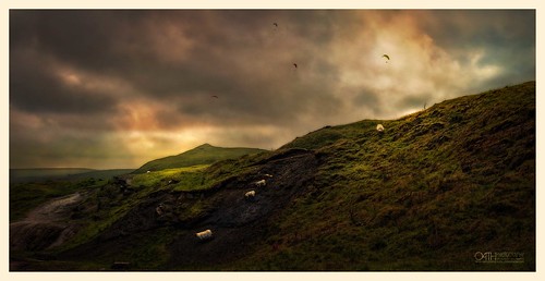
Sheep on the Mam Tor by OATH Photography by Alison Richards, Explored twice; first on the 10 September, and again on 21 April 2021 for Flickr World Earth Day!

M
Sheep on the Mam Tor by OATH Photography by Alison Richards
Hitting the summit by Captain Nikon, The rising sun hitting Lose hill summitmamtor derbyshire peakdistrict thegreatridge ridge leadinglin
Hitting the summit by Captain Nikon
Hope and Wide by Captain Nikon, Captured on that fabulous August bank holiday weekend, weather and light like this seems a distant m
Hope and Wide by Captain Nikon
Man made beauty? by david.hayes77, The deep limestone gorges of Derbyshire are stunning in their natural beauty - so featuring an unsig
Man made beauty? by david.hayes77
view towards lose hill by Royston King, peak district national parklosehill hopevalley cliffs castleton peakdistrict derbyshire landscapes x
view towards lose hill by Royston King
Good Morning Mam! by Dom Haughton, If we thought we were going to be alone up here, we very quickly realised we were wrong.  Huddled at
Good Morning Mam! by Dom Haughton
Good Morning says Mr Sun by Twiglet Images, Last weekend at the Peaks and again it didn't disappoint us! the cloud was gorgeous and the light wa
Good Morning says Mr Sun by Twiglet Images
Valley Road Ride by OATH Photography by Alison Richards, The sun is out, the landscape is imposing yet welcoming so get your bike, get outside and ride the o
Valley Road Ride by OATH Photography by Alison Richards
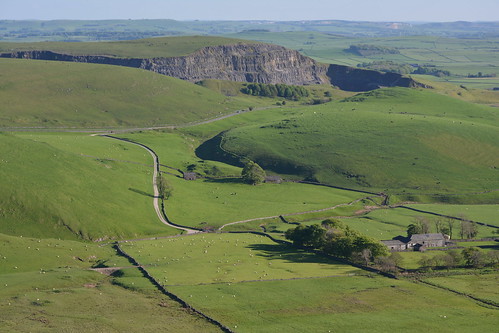
Eldon Hill Disused Quarry, Peak District National Park, Derbyshire, England. by westport 1946, Quarrying started at Eldon Hill in 1950 and finished in 1999.england unitedkingdom peakdistrict high
Eldon Hill Disused Quarry, Peak District National Park, Derbyshire, England. by westport 1946
Broadlee-Bank Tor, Peak District National Park, Derbyshire, England. by westport 1946, england unitedkingdom nationalpark thenationaltrust highpeak peakdistrict edale valeofedale bluesky
Broadlee-Bank Tor, Peak District National Park, Derbyshire, England. by westport 1946
Fairbrook naze by Phil-Gregory, fairbrook naze on kinder scout peak district fairbrooknaze fairbrook kinderscout nikon d7200 tokina
Fairbrook naze by Phil-Gregory
Back Tor View by johngregory250666, Another View from Back Tor , on Derwent Edge Deceember 2019, Peak District, Derbyshire, UKthe river
Back Tor View by johngregory250666
rushup edge by Phil-Gregory, rushup edge taken from mam tor peak district Derbyshire at sun down mamtor nikon d7200 tokina 1120mm
rushup edge by Phil-Gregory
Trees and Fields by Peter Quinn1, My eye was drawn to the neat line of trees on the ridge, with some pleasing diagonals in between. Im
Trees and Fields by Peter Quinn1
Snaking. by FadeToBlackLP, The shot Chris and I had on our list of places to hit up after dark.  The moon was big, snow on the
Snaking. by FadeToBlackLP
Down the ridge by Phil-Gregory, the great ridge ,park district national park uk at sunset nice nikon d7200 tokina tokina1120mmatx 11
Down the ridge by Phil-Gregory
Mam Tor by Peter Quinn1, A pleasant spring evening on a quiet Mam Tor summit.mamtor peakdistrict evening springevening summit
Mam Tor by Peter Quinn1
Lone Tree by Peter Quinn1, Just the faintest hint of mist shadows cast by a lone tree in fields near Litton at sunrise.sunrise
Lone Tree by Peter Quinn1
Wild HFF by Phil-Gregory, up on kinder scout in the peak district ,on a bleak daynikon d7200 naturalphotograph naturephotograp
Wild HFF by Phil-Gregory
The Path To Edale, Peak District National Park, Derbyshire, England. by westport 1946, england unitedkingdom highpeak peakdistrict nationalpark thenationaltrust derbyshire valeofedale val
The Path To Edale, Peak District National Park, Derbyshire, England. by westport 1946
Dark Green Fritillary by Peter Quinn1, Miller's Dale Quarry Nature Reserve, Derbyshire. millersdale millersdalenaturereserve derbyshirewild
Dark Green Fritillary by Peter Quinn1
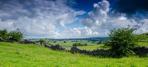
Summer Day, White Peak by Peter Quinn1, Fields near Priestcliffe, Derbyshireskyscape derbyshire peakdistrict cloudscape whitepeak summersky
Summer Day, White Peak by Peter Quinn1
Don't look down by Phil-Gregory, Grinsbrook clough, I think, kinder scout peak district Derbyshire uknikon d7200 tokina1120mmatx toki
Don't look down by Phil-Gregory
Hope Valley. by Ade McCabe, Wild camp on Stanage Edge last night. 

I had the whole edge to myself from about 20:00 on. Set up a
Hope Valley. by Ade McCabe
Grindsbrook Panorama by l4ts, The view from The Nab across Grindsbrook to a snow-dusted Grindslow Knoll and Kinder Scout.landscape
Grindsbrook Panorama by l4ts
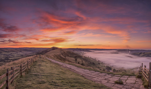
Inverted by Nicks-2017, Sunday morning pe-sunrise and the very edge of the fog camped out over Castleton and the Hope Valley
Inverted by Nicks-2017
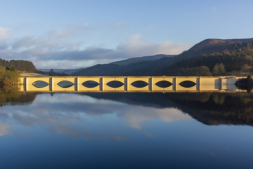
Ashopton Viaduct by l4ts, Ashopton Viaduct which carries the A57 Snake Pass Road across Ladybower Reservoir.landscape derbyshi
Ashopton Viaduct by l4ts
Edale by l4ts, A view across Edale towards Grindslow Knoll from the Chapel Gate path below Rushup Edge.landscape de
Edale by l4ts
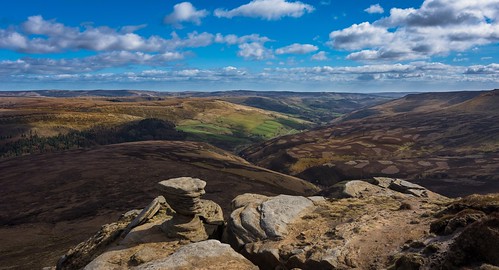
Fairbrook naze by Phil-Gregory, A well known rock formation on the fairbrook side of kinder peak district Derbyshire
Fairbrook naze by Phil-Gregory
Social distancing on Mam Tor by PentlandPirate: Slapdash Photography, We were all expecting a great inversion.  God had turned the cooker on that causes the mist to boil
Social distancing on Mam Tor by PentlandPirate: Slapdash Photography
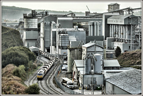
Tunstead Works by l4ts, A view of the dystopian but also interesting scene that is Tunstead Limestone Works.landscape derbys
Tunstead Works by l4ts
Trio by l4ts, A group of three wind-blown trees overlooking Bradwell Dale.landscape derbyshire peakdistrict darkpe
Trio by l4ts
Rushing in to Rushup by PentlandPirate: Slapdash Photography, I had rushed to Mam Tor very early on Monday morning before I took a long way round to work, to see
Rushing in to Rushup by PentlandPirate: Slapdash Photography
27720 by benbobjr, Looking out from Black Tor on the Great Ridge that separates Castleton and Edale in the Peak Distric
27720 by benbobjr
The Great Ridge by l4ts, A view along the Great Ridge shortly after sunrise. landscape derbyshire peakdistrict darkpeak hopev
The Great Ridge by l4ts
Eccles Pike by l4ts, Eccles Pike marooned in a sea of mist.landscape derbyshire peakdistrict darkpeak chinley ecclespike
Eccles Pike by l4ts
Recession by l4ts, The view south from Rushup Edge.landscape derbyshire peakdistrict darkpeak rushupedge blackwhite mon
Recession by l4ts
Edale by l4ts, The view east along the Vale of Edale. landscape derbyshire peakdistrict darkpeak edale panorama the
Edale by l4ts
Fair Brook by l4ts, A waterfall along Fair Brook in the Woodlands Valley on the northern side of Kinder Scout. landscape
Fair Brook by l4ts
High Peak Panorama by l4ts, Mount Famine and South Head forming the middle ground in this view with Kinder Scout and Brown Knoll
High Peak Panorama by l4ts
Crook Hill by l4ts, Kinder Scout and the Woodlands Valley seen from Crook Hill.landscape derbyshire peakdistrict darkpea
Crook Hill by l4ts
Cave Dale by l4ts, Peveril Castle and Cave Dale near Castleton.landscape derbyshire peakdistrict whitepeak hopevalley c
Cave Dale by l4ts
Sunrise by l4ts, Snowdrifts on the climb up Win Hill.landscape derbyshire peakdistrict darkpeak goldenhour sunrise ho
Sunrise by l4ts
Crookstone Out Moor by l4ts, A view along the Woodlands Valley towards Crook Hill from Crookstone Out Moor on the eastern end of
Crookstone Out Moor by l4ts
Edale by l4ts, A view of the Vale of Edale from the rocks of Ringing Roger.landscape derbyshire peakdistrict darkpe
Edale by l4ts
Cowlow by l4ts, The ruined farm building at Cowlow and the view along the Hope Valley.landscape derbyshire peakdistr
Cowlow by l4ts
Werneth Low by Toby Howard, Werneth Low Country Park is a lovely spot on the borders of Stockport and Tameside, with beautiful v
Werneth Low by Toby Howard
Strange Light in the Peaks by iainmerchant, Strange Light in the Peaks

Winnats Pass on a spooky day

Flickr:       <a href="http://www.flickriv
Strange Light in the Peaks by iainmerchant
Rushup Edge by l4ts, Low cloud rolling over Rushup Edge.landscape derbyshire peakdistrict darkpeak edale rushupedge mamto
Rushup Edge by l4ts
Anvil Stone by l4ts, Another view of the Anvil Stone at Bleaklow Stones, perhaps showing better how it got its name.lands
Anvil Stone by l4ts
Back Tor by l4ts, Back Tor on the Great Ridge separating Edale and the Hope Valley.landscape derbyshire peakdistrict d
Back Tor by l4ts
Rays by l4ts, Crepuscular rays shining down through the misty woodland by Ladybower Reservoir.landscape derbyshire
Rays by l4ts
The Cloughs by smir_001, Pennine Way, Jacob’s Ladder & the Cloughs walk series. Taken from Pennine Way. It was the last w
The Cloughs by smir_001
Grindsbrook by l4ts, The head of Grindsbrook on Kinder Scout with a fellow walker admiring the view on this chilly mornin
Grindsbrook by l4ts
'Cracken' view by l4ts, The view east towards Kinder Scout, Mount Famine and South Head from Cracken Edge.landscape derbyshi
'Cracken' view by l4ts
Mount Famine by l4ts, A just-before sunrise view of Mount Famine from the path to South Head. Every bit as cold as it look
Mount Famine by l4ts
The Limestone way...Cave dale. by A tramp in the hills, Headed to Castleton today to walk the first section of the Limestone way. limestoneway castleton cav
The Limestone way...Cave dale. by A tramp in the hills
Over the rooftops by l4ts, A view over the rooftops of Earl Sterndale to the limestone peaks of Parkhouse Hill and Chrome Hill.
Over the rooftops by l4ts
Ashopton Viaduct by l4ts, A long exposure image of Ashopton Viaduct and Ladybower Reservoir taken using a 10 stop filter.lands
Ashopton Viaduct by l4ts
Derwent Reservoir by l4ts, A view of the very dry northern end of Derwent Reservoir. On the right of the image can be seen the
Derwent Reservoir by l4ts