Elevation of Canada, KY, USA
Location: United States > Kentucky > Pike County >
Longitude: -82.3246094
Latitude: 37.6061055
Elevation: 259m / 850feet
Barometric Pressure: 0KPa
Related Photos:

Hotel Hallway

Flex Your BeeCepts

A Mime's Staircase

view from The Railroad Dorm in Williamson WV
Williamson WV Thursday October 27th 1988 1620EDT

South Side Mall of South Williamson, KY

Matewan WV: The Tug River Outside the Flood Wall

Pawpaw Tree Execution

Tug River Thru Williamson, WV

Killing of Asa Harmon McCoy

Welcome to West Virginia

Welcome to West Virginia

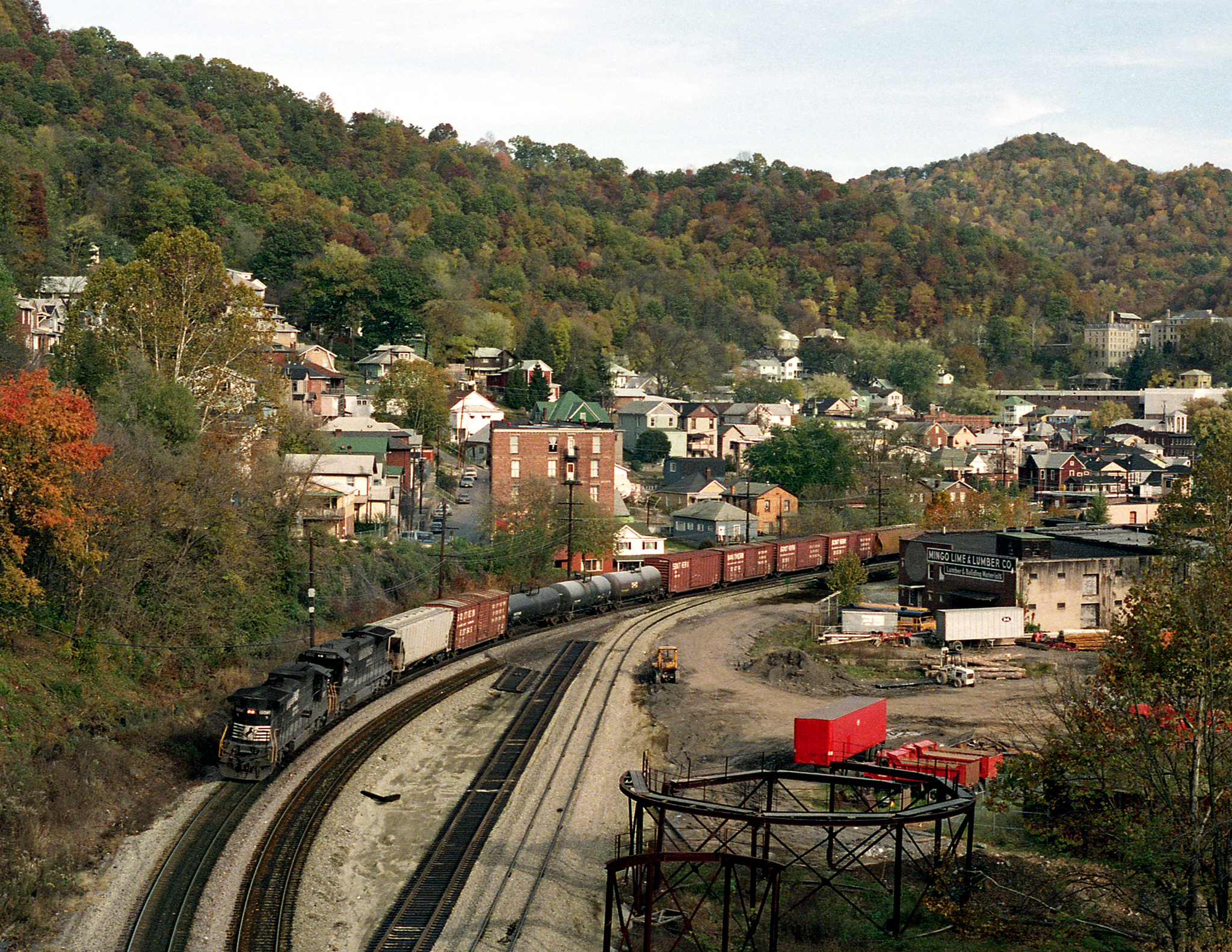
Norfolk Southern Mainline

Matewan Floodwall

Matewan Floodwall

Matewan Floodwall

Matewan, WV

West Virginia scenery

US 119 Construction near Pikeville
Topographic Map of Canada, KY, USA
Find elevation by address:

Places in Canada, KY, USA:
Places near Canada, KY, USA:
2665 Meathouse Fork
1173 State Hwy 199
Stone
Belfry
35 Taylor Fork
Turkey Creek
US-, Belfry, KY, USA
Williamson
16 W 4th Ave, Williamson, WV, USA
440 Hurricane Branch Rd
Winifrede St, Borderland, WV, USA
21 Deskins Dr, Williamson, WV, USA
Williamson
5768 State Hwy 1056
Ransom
State Hwy, McCarr, KY, USA
Tug Hardee
Buffalo Mountain Trailhead, Hatfield-mccoy Trails
WV-49, Delbarton, WV, USA
Mccarr
Recent Searches:
- Elevation of 24, Auburn Bay Crescent SE, Auburn Bay, Calgary, Alberta, T3M 0A6, Canada
- Elevation of Denver, 2314, Arapahoe Street, Five Points, Denver, Colorado, 80205, USA
- Elevation of Community of the Beatitudes, 2924, West 43rd Avenue, Sunnyside, Denver, Colorado, 80211, USA
- Elevation map of Litang County, Sichuan, China
- Elevation map of Madoi County, Qinghai, China
- Elevation of 3314, Ohio State Route 114, Payne, Paulding County, Ohio, 45880, USA
- Elevation of Sarahills Drive, Saratoga, Santa Clara County, California, 95070, USA
- Elevation of Town of Bombay, Franklin County, New York, USA
- Elevation of 9, Convent Lane, Center Moriches, Suffolk County, New York, 11934, USA
- Elevation of Saint Angelas Convent, 9, Convent Lane, Center Moriches, Suffolk County, New York, 11934, USA
- Elevation of 131st Street Southwest, Mukilteo, Snohomish County, Washington, 98275, USA
- Elevation of 304, Harrison Road, Naples, Cumberland County, Maine, 04055, USA
- Elevation of 2362, Timber Ridge Road, Harrisburg, Cabarrus County, North Carolina, 28075, USA
- Elevation of Ridge Road, Marshalltown, Marshall County, Iowa, 50158, USA
- Elevation of 2459, Misty Shadows Drive, Pigeon Forge, Sevier County, Tennessee, 37862, USA
- Elevation of 8043, Brightwater Way, Spring Hill, Williamson County, Tennessee, 37179, USA
- Elevation of Starkweather Road, San Luis, Costilla County, Colorado, 81152, USA
- Elevation of 5277, Woodside Drive, Baton Rouge, East Baton Rouge Parish, Louisiana, 70808, USA
- Elevation of 1139, Curtin Street, Shepherd Park Plaza, Houston, Harris County, Texas, 77018, USA
- Elevation of 136, Sellers Lane, Repton, Monroe County, Alabama, 36475, USA