Elevation of Yamada, Shimohei District, Iwate Prefecture, Japan
Location: Japan > Iwate Prefecture > Shimohei District >
Longitude: 141.948950
Latitude: 39.467662
Elevation: 10m / 33feet
Barometric Pressure: 101KPa
Elevation Map:
Satellite Map:
Related Photos:
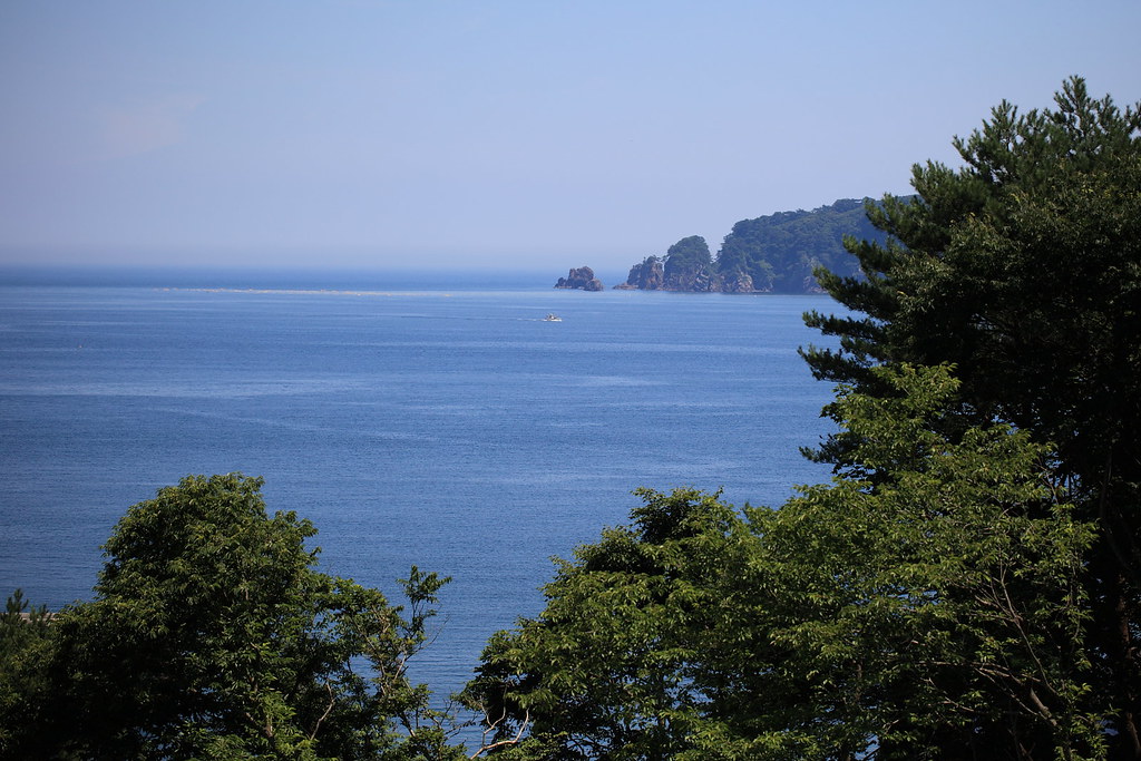
Ocean View in Iwate

Downtown Ootsuchi today
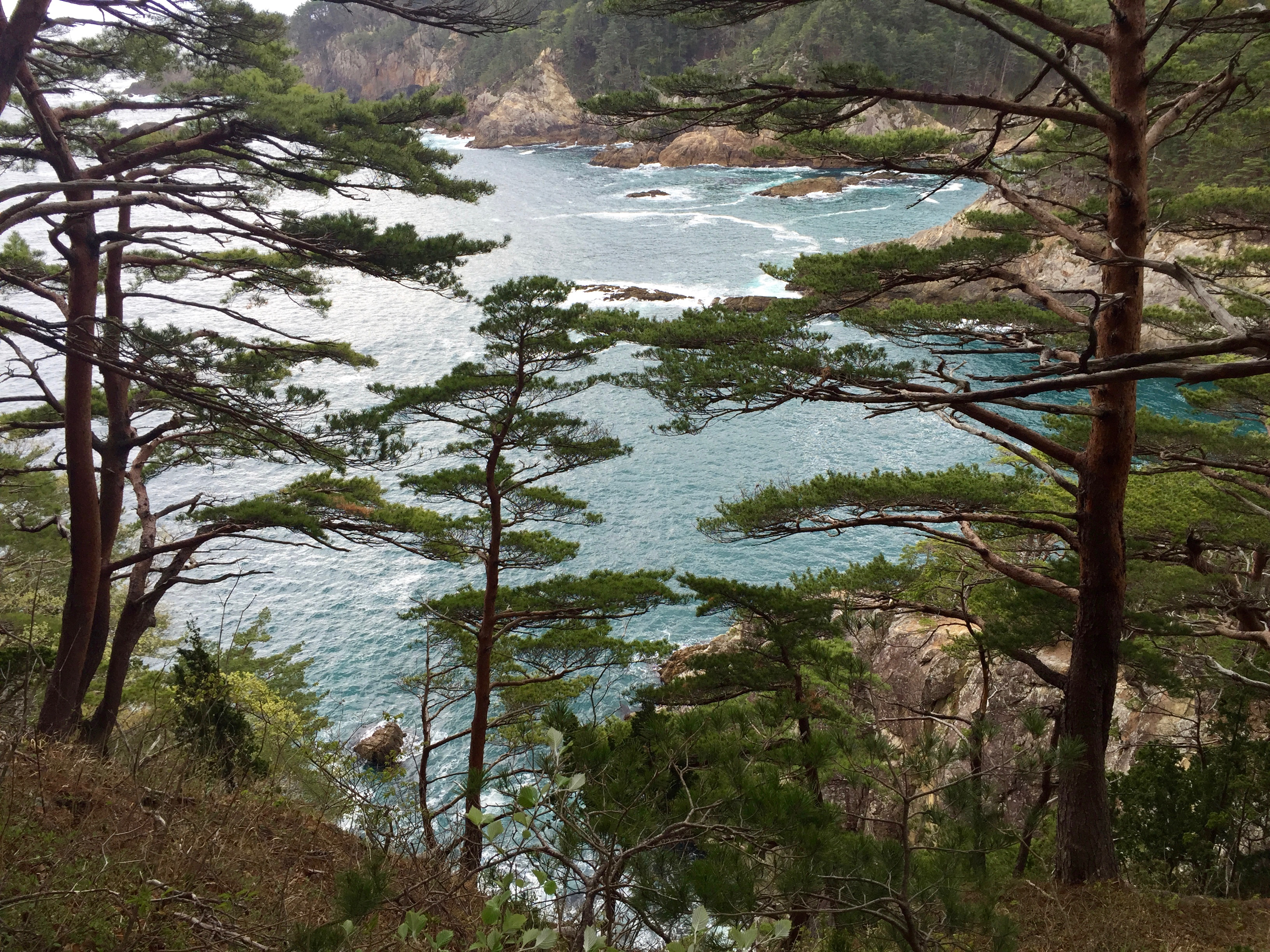
View from esplanade
魹ヶ崎まで行けるだろうか?
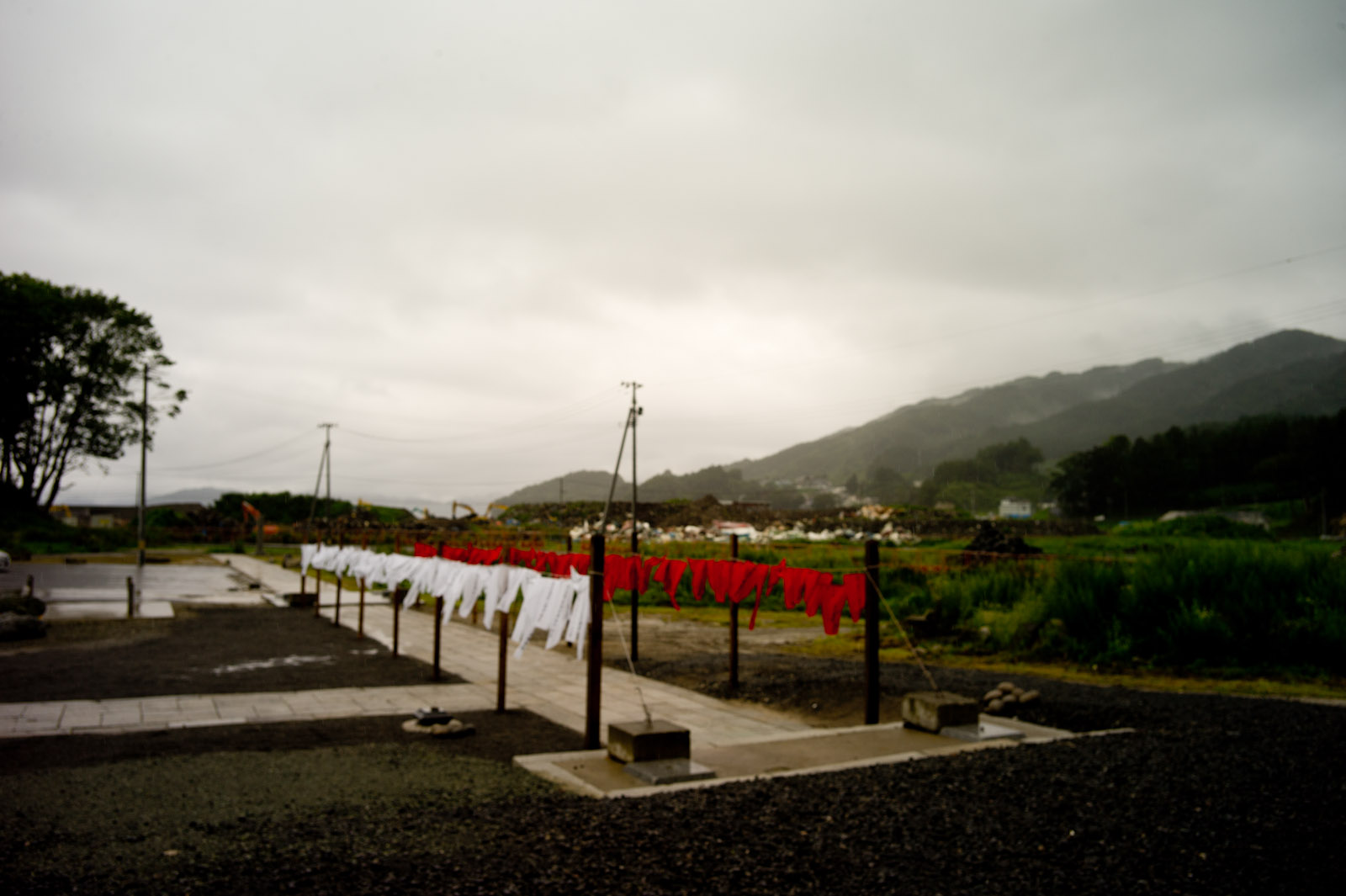
Yamada | The second summer from tsunami
Yamada | The second summer from tsunami

Funakoshi Bay | The second summer from tsunami

Sea of fertility

船越湾の風景
Cape Todogasaki, Miyako

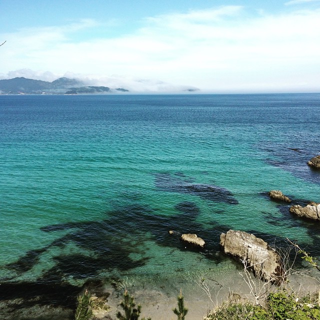
Yamada Bay
Rikuchu-Yamada station

Oozuchi Town

20160212 10:37 Yamadamachi Iwate
20130402 16:39 Ootsuchicho,Iwate

Yamada Bay
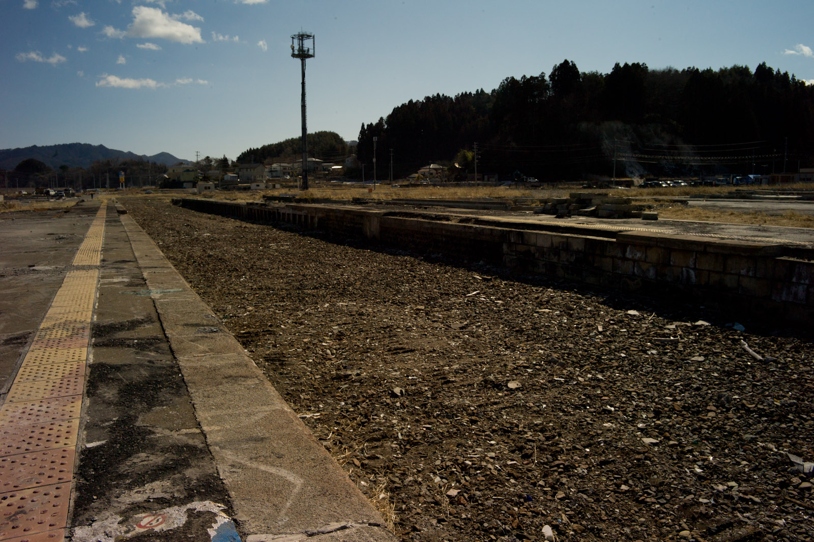
Rikuchu-Yamada station
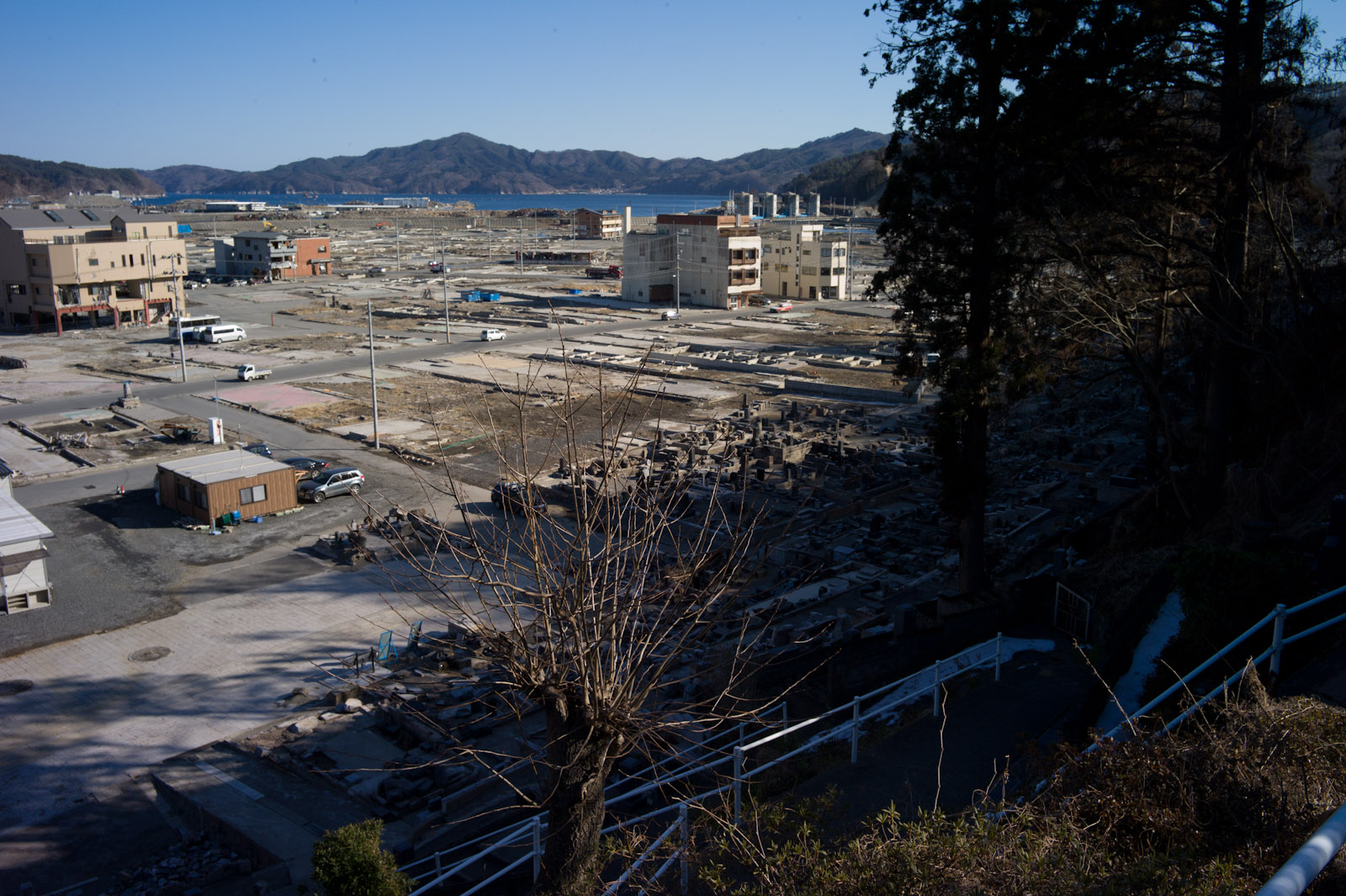
Town was lost
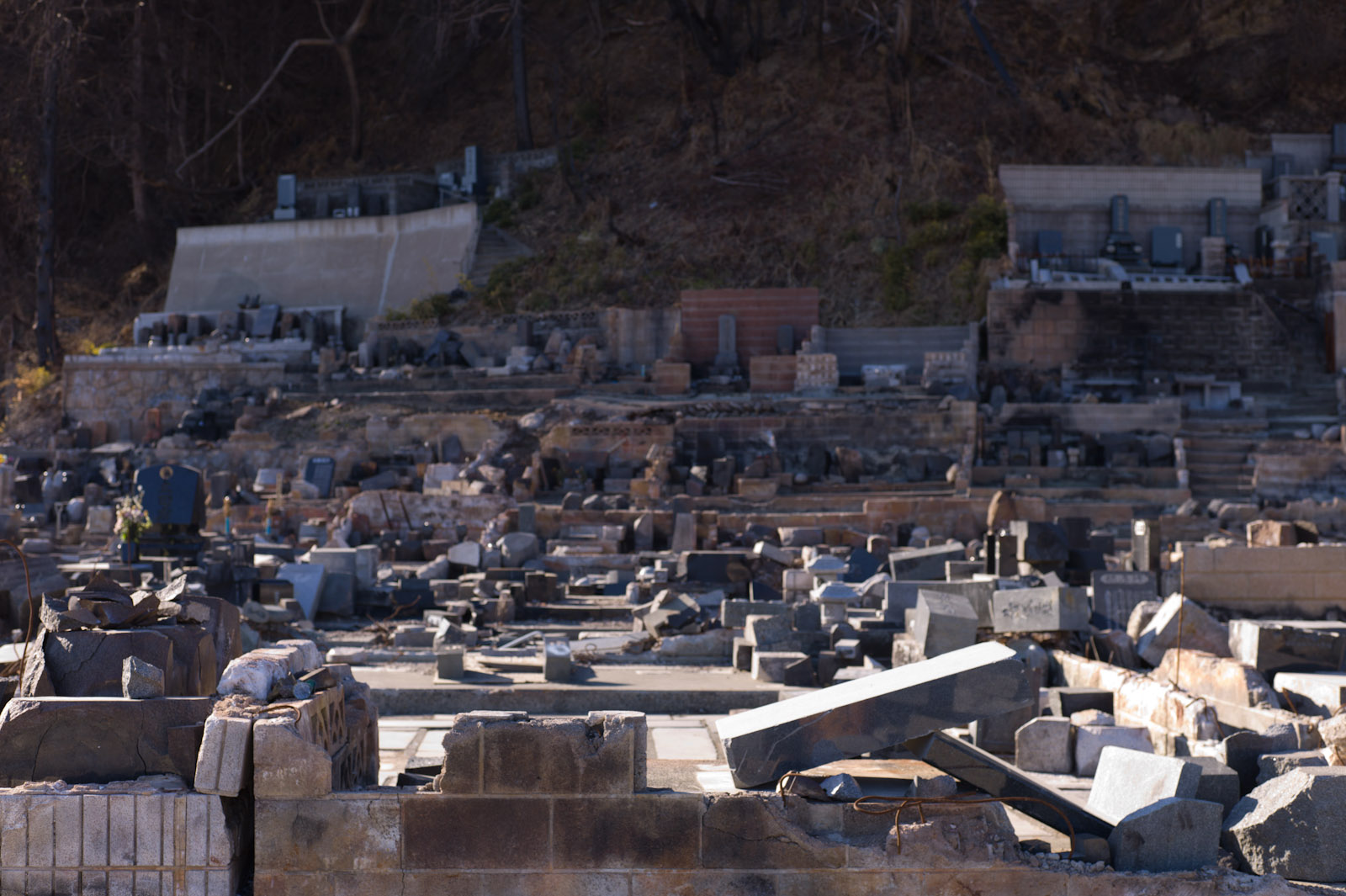
Broken tombs
岩手県大槌町(須賀町) 2011年6月
ひょっこりひょうたん島のモデルになった岩手県大槌町の蓬莱島に、ちゃっかりひょうきんモノの僕が来ましたよ

July 23, 2011, 大槌「ひょっこりひょうたん島」

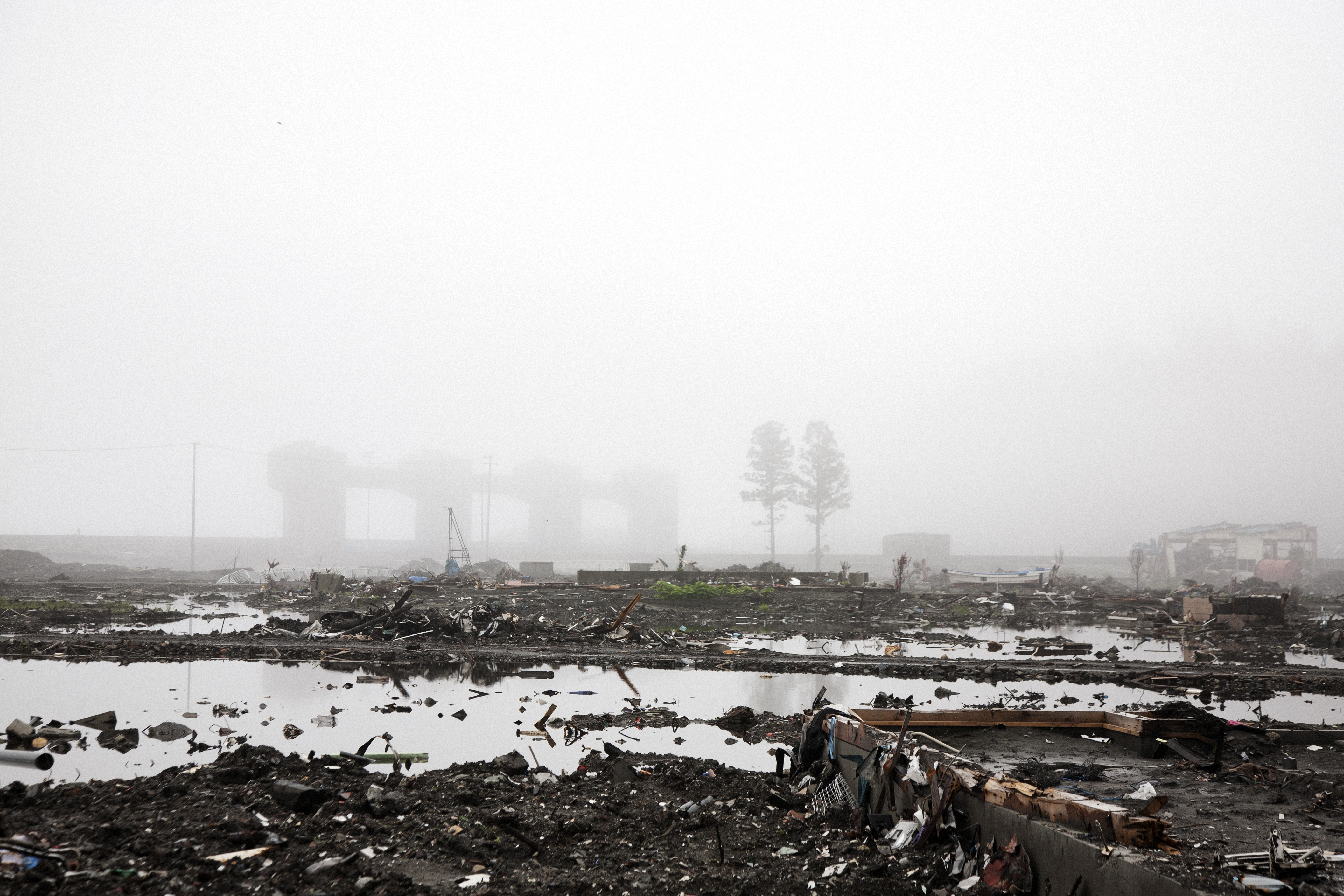
大槌町の状況

Oozuchi Town
Topographic Map of Yamada, Shimohei District, Iwate Prefecture, Japan
Find elevation by address:

Places in Yamada, Shimohei District, Iwate Prefecture, Japan:
Places near Yamada, Shimohei District, Iwate Prefecture, Japan:
4-6 Hachimanchō, Yamada-machi, Shimohei-gun, Iwate-ken -, Japan
Dai 20 Chiwari-55-2 Yamada, Yamada-machi, Shimohei-gun, Iwate-ken -, Japan
Dai 15 Chiwari-15-10 Funakoshi, Yamada-machi, Shimohei-gun, Iwate-ken -, Japan
Dai 5 Chiwari-51 Akamae, Miyako-shi, Iwate-ken -, Japan
2 Chome-13-7 Ogakuchi, Ōtsuchi-chō, Kamihei-gun, Iwate-ken -, Japan
Kamihei District
7-24 Tateaichō, Miyako-shi, Iwate-ken -, Japan
Miyako
Kamimoriyama-36 Soiri, Iwaizumi-chō, Shimohei-gun, Iwate-ken -, Japan
Iwaizumi
Shimohei District
Tanohata
Nanataki, Tanohata-mura, Shimohei-gun, Iwate-ken -, Japan
Mount Hayachine
Dai 3 Chiwari- Kuzakai, Miyako-shi, Iwate-ken -, Japan
Dai 8 Chiwari- Noda, Noda-mura, Kunohe-gun, Iwate-ken -, Japan
Dai 5 Chiwari-- Tamagawa, Noda-mura, Kunohe-gun, Iwate-ken -, Japan
Noda
Dai 10 Chiwari-55-26 Ōhasamamachi Kamegamori, Hanamaki-shi, Iwate-ken -, Japan
Dai 25 Chiwari-33 Kokujichō, Kuji-shi, Iwate-ken -, Japan
Recent Searches:
- Elevation of 7 Waterfall Way, Tomball, TX, USA
- Elevation of SW 57th Ave, Portland, OR, USA
- Elevation of Crocker Dr, Vacaville, CA, USA
- Elevation of Pu Ngaol Community Meeting Hall, HWHM+3X7, Krong Saen Monourom, Cambodia
- Elevation of Royal Ontario Museum, Queens Park, Toronto, ON M5S 2C6, Canada
- Elevation of Groblershoop, South Africa
- Elevation of Power Generation Enterprises | Industrial Diesel Generators, Oak Ave, Canyon Country, CA, USA
- Elevation of Chesaw Rd, Oroville, WA, USA
- Elevation of N, Mt Pleasant, UT, USA
- Elevation of 6 Rue Jules Ferry, Beausoleil, France