Elevation of Whiting Creek Rd, Locust Hill, VA, USA

Location: United States > Virginia > Middlesex County > Saluda > Locust Hill >

Longitude: -76.501370

Latitude: 37.6070791

Elevation: 9m / 30feet

Barometric Pressure: 101KPa

Elevation Map:

elevation map of Whiting Creek Rd, Locust Hill, VA, USA

Satellite Map:

Satellite map of Whiting Creek Rd, Locust Hill, VA, USA

Related Photos:

virginia middlesexcounty middlepeninsula marinasharbors dockspiers riversandstreams rappahannockriver greatskies november2015 november 2015 cloudsstormssunsetssunrises canon16354l
"Popcorn" Sky
virginia middlesexcounty middlepeninsula dockspiers riversandstreams rappahannockriver greatskies patios gardenstructures trellisespergolas benches november2015 november 2015 canon24704l explore
Waterside Dining
virginia middlesexcounty middlepeninsula marinasharbors dockspiers riversandstreams lockliescreek rappahannockriver commercialbuildings restaurants warmsunlight greatskies reflections november2015 november 2015 canon16354l
Oyster Pier & Merroir "Tasting Room"
virginia middlesexcounty middlepeninsula marinasharbors dockspiers lockliesmarina riversandstreams lockliescreek november2015 november 2015 canon24704l
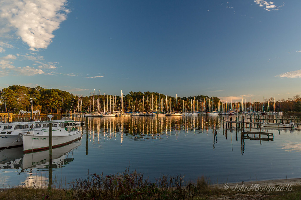
Locklies Marina, Near Chesapeake Bay
virginia middlesexcounty middlepeninsula churches colonialchurches episcopalchurches christchurch historic nrhp countrychurches cemeteries churchyards gravestones blueskies february2011 february 2011 canon241054l
Sheltering Arms
christchurch virginia march churches blueskies lancastercounty 2008 nationalhistoriclandmark northernneck nrhp countrychurches colonialchurches march2008 episcopalchurches
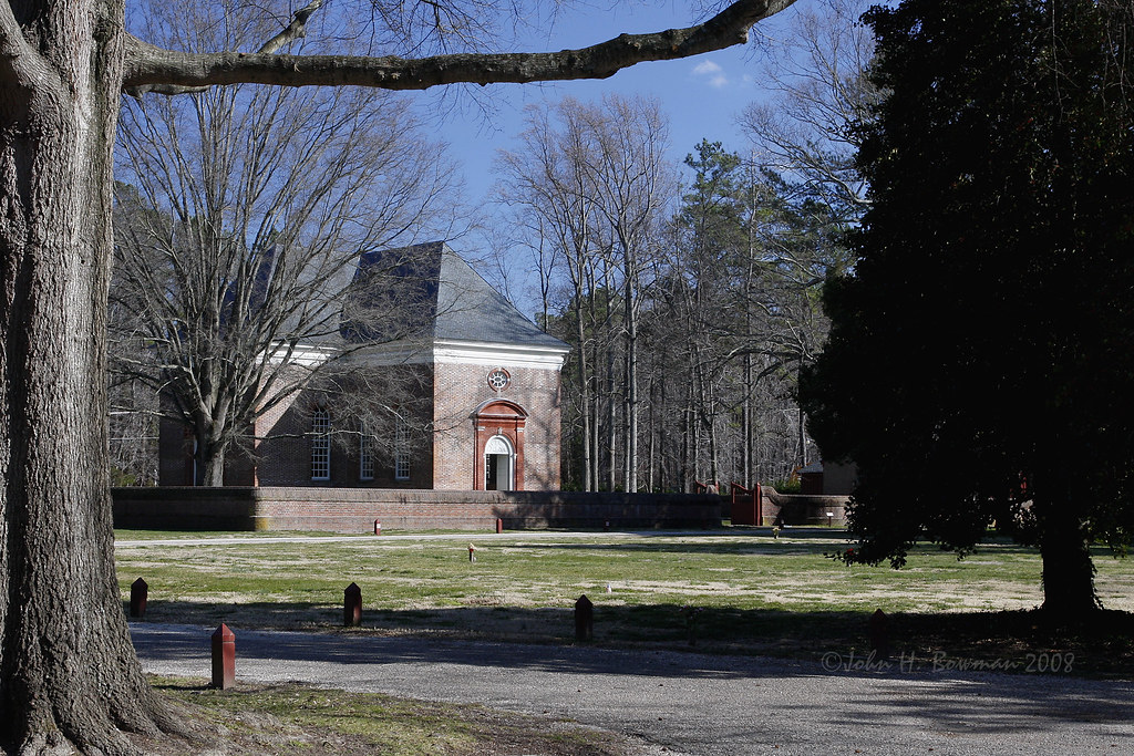
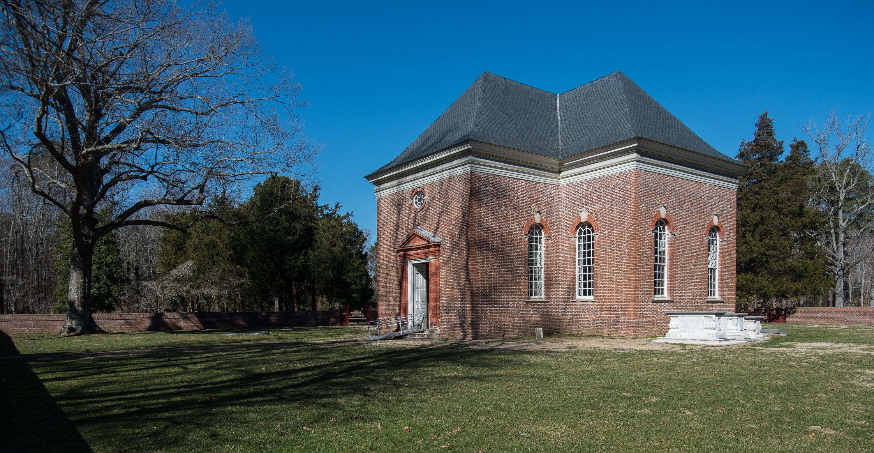
Wooded setting of Christ Church
virginia february courthouses saluda latelight 2011 middlesexcounty middlepeninsula nrhp canon24105l virginiacourthouses february2011 middlesexcourthouse
Old Middlesex Courthouse
christchurch virginia march churches blueskies lancastercounty 2008 nationalhistoriclandmark northernneck nrhp countrychurches colonialchurches march2008 episcopalchurches
Gated brick wall - Christ Church
christchurch virginia march churches lancastercounty 2008 nationalhistoriclandmark northernneck nrhp brickdetail countrychurches colonialchurches march2008 episcopalchurches
Brick wall detail - Christ Church
christchurch virginia march churches lancastercounty 2008 nationalhistoriclandmark northernneck nrhp brickdetail countrychurches colonialchurches march2008 episcopalchurches
Defaced bricks - Christ Church
christchurch virginia march churches lancastercounty 2008 nationalhistoriclandmark churchinterior northernneck nrhp countrychurches colonialchurches march2008 episcopalchurches
Aisle & doorway - Christ Church
christchurch virginia march churches lancastercounty 2008 nationalhistoriclandmark churchinterior northernneck nrhp countrychurches colonialchurches march2008 episcopalchurches
Aisle & altar - Christ Church
christchurch virginia march churches lancastercounty 2008 nationalhistoriclandmark churchinterior northernneck nrhp countrychurches colonialchurches march2008 episcopalchurches
Pew box detail - Christ Church
christchurch virginia march churches lancastercounty 2008 baptismalfont nationalhistoriclandmark northernneck nrhp countrychurches colonialchurches march2008 episcopalchurches
Baptismal font - Christ Church
View from the Road to Towles Point, Lancaster County, VA
christchurch virginia march churches lancastercounty 2008 nationalhistoriclandmark churchinterior northernneck nrhp countrychurches colonialchurches march2008 episcopalchurches
Tri-level pulpit - Christ Church
airplane virginia pilot environmentalportrait odt opencockpit wwiitrainer 1943fairchildpt19
Pilot Michael...
christchurch virginia march churches lancastercounty 2008 nationalhistoriclandmark northernneck nrhp brickdetail countrychurches colonialchurches march2008 episcopalchurches stoneworkdetail
Aged stone - Christ Church
chesapeakebay environment unitedstates exif:aperture=ƒ80 camera:model=canoneos5dmarkii camera:make=canon exif:isospeed=100 geostate exif:model=canoneos5dmarkii exif:lens=ef2470mmf28lusm geo:country=unitedstates geocity exif:focallength=48mm exif:make=canon
Rappahannock River Oyster Company in Middlesex County, Va.
anglican church d800 fieldwork georgian architecture colonial interior pulpit religiousbuildings soundingboard lancastercounty virginia unitedstates
2014JEK0227123.jpg
anglican church d800 exterior fieldwork georgian rubbedbrick architecture brick colonial religiousbuildings lancastercounty virginia unitedstates
2014JEK0227089.jpg
Locklies Creek, Topping Virginia 7:20 p.m. 6/10/16
2016 lancastercounty virginia va unitedstates usa dymercreek georgescove waterway bluesky water docks
George's Cove
above neck way stars virginia farm over trail northern comet milky millenbeck
Above The Fields
unitedstates environment geocity geo:country=unitedstates camera:make=canon exif:isospeed=800 geostate exif:lens=ef24105mmf4lisusm exif:focallength=105mm exif:aperture=ƒ80 exif:model=canoneos5dmarkiv exif:make=canon camera:model=canoneos5dmarkiv nonprofits aerial transportation southwings
King William County, Va.
ocean sunset sky beach water clouds bay sand surf waves dusk calm va chesapeake deltaville
Sturgeon Creek
mathewscounty virginia va usa deeppointboatramp landscape waterway river piankatankriver
Deep Point Boat Ramp on the Piankatank River
sunset sea sky water birds clouds evening dusk chesapeakebay rappahannockriver
Time to Head Home
road beautiful america landscape virginia town us path country scenic peaceful retro business va 17 serene roads adventures beaten tranquil smalltown saluda tidewater us17 middlesexcounty tidewaterva middlesexva middlesexcountyva
Blissful Business
wedding sunset love water dance engagement couple va chesapeakebay deltaville
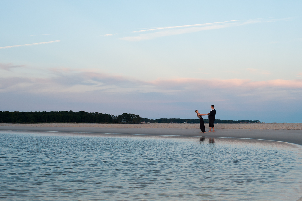
Marston Engagement Shoot
sunset sun water evening boat
Sunset on Sturgeon Creek - Deltaville, VA
mathewscounty virginia va usa deeppointboatramp landscape waterway river piankatankriver
Deep Point Boat Ramp on the Piankatank River
mathewscounty virginia va usa deeppointboatramp landscape waterway river piankatankriver
Deep Point Boat Ramp on the Piankatank River
lancastercountyvirginiavausa fishingboat boat prideofvirginia waterway
Fishing Boat
Crossing Rappahannock River, Virginia State Route 3
county summer white classic beach nature water beautiful beauty stone river virginia waterfront natural south country scenic peaceful sunny front southern va lancaster coastline lancastercounty whitestone smalltown eastcoast rappahannock rappahannockriver northernneck northernneckva lancastercountyva whitestoneva
At Dusk
tangierrappahannockcruises va virginia tangierva tangiervirginia tangier island tangierisland chesapeake bay chesapeakebay islandliving smallisland accomackvirginia accomackva accomackcountyvirginia accomackcountyva accomack 23440 elichristman elijahchristman elijameschristman elijahjameschristman elichristmanrva elijahchristmanrva elichristmanrichmondva elichristmanrichmondvirginia elijahchristmanrichmondva elijahchristmanrichmondvirginia
Tangier, VA
Virginia State Route 3, Mathews, Virginia
lofi hdr
#0476-8 - Groundfog (HDR / Lofi)
film travel sunset skyline shore river nature landscape happy evening closeup clear autumn afternoon outdoor 1986 family water beach aerial dusk linda virginia scanned day grouped favorited
1986.12.15 Linda
d7000 dailyphoto landscape middlepeninsula middlesexcounty middlesexcountyvirginia pauldiming rappahannockriver summer virginia wake unitedstates
Rappahannock River, Wake, VA