Elevation of Sawpit Creek Rd, Stratford VIC, Australia
Location: Australia > Victoria > Wellington Shire >
Longitude: 147.129705
Latitude: -37.881582
Elevation: 103m / 338feet
Barometric Pressure: 100KPa
Elevation Map:
Satellite Map:
Related Photos:

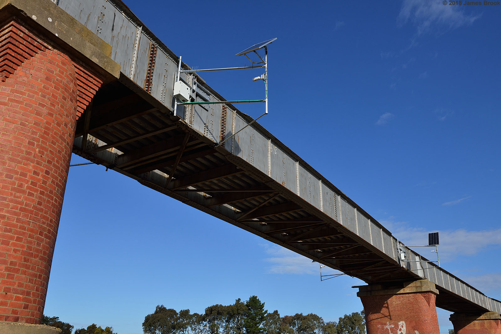
Avon River Bridge at Stratford

Avon River Bridge at Stratford

Avon River Bridge at Stratford

Avon River Bridge at Stratford

Avon River Bridge at Stratford

Avon River Bridge at Stratford
Avon River Bridge at Stratford

8206E-04

Old crossing of the Avon River

Stratford - Avon River Former Alignment

Lightning Inverted

N458 on the Avon River Bridge with 8413

Weide bei Munro

Avon River, Stratford

Avon River, Stratford

8206E-03

Weide bei Munro

Powerscourt Platform, Maffra
Topographic Map of Sawpit Creek Rd, Stratford VIC, Australia
Find elevation by address:

Places near Sawpit Creek Rd, Stratford VIC, Australia:
Maffra
66 King St
884 Fernbank-glenaladale Rd
Fernbank
1155 Princes Hwy
Dargo
Seaton
Bairnsdale
Bairnsdale
Alpine National Park
Arbuckle
5 Cobungra Rd
48 Cobungra Rd
51 Cobungra Rd
Cobungra
75 Cobungra Ct
32 Fox Ct
25 Fox Ct
40 Victoria Ct
Victoria Falls Road
Recent Searches:
- Elevation of Bella Terra Blvd, Estero, FL, USA
- Elevation of Estates Loop, Priest River, ID, USA
- Elevation of Woodland Oak Pl, Thousand Oaks, CA, USA
- Elevation of Brownsdale Rd, Renfrew, PA, USA
- Elevation of Corcoran Ln, Suffolk, VA, USA
- Elevation of Mamala II, Sariaya, Quezon, Philippines
- Elevation of Sarangdanda, Nepal
- Elevation of 7 Waterfall Way, Tomball, TX, USA
- Elevation of SW 57th Ave, Portland, OR, USA
- Elevation of Crocker Dr, Vacaville, CA, USA