Elevation of Sambu, Maharashtra, India
Location: India > Maharashtra > Kolhapur >
Longitude: 73.9668408
Latitude: 16.9203828
Elevation: 556m / 1824feet
Barometric Pressure: 95KPa
Elevation Map:
Satellite Map:
Related Photos:

Along India's National Highway 204

Along India's National Highway 204

Along India's National Highway 204
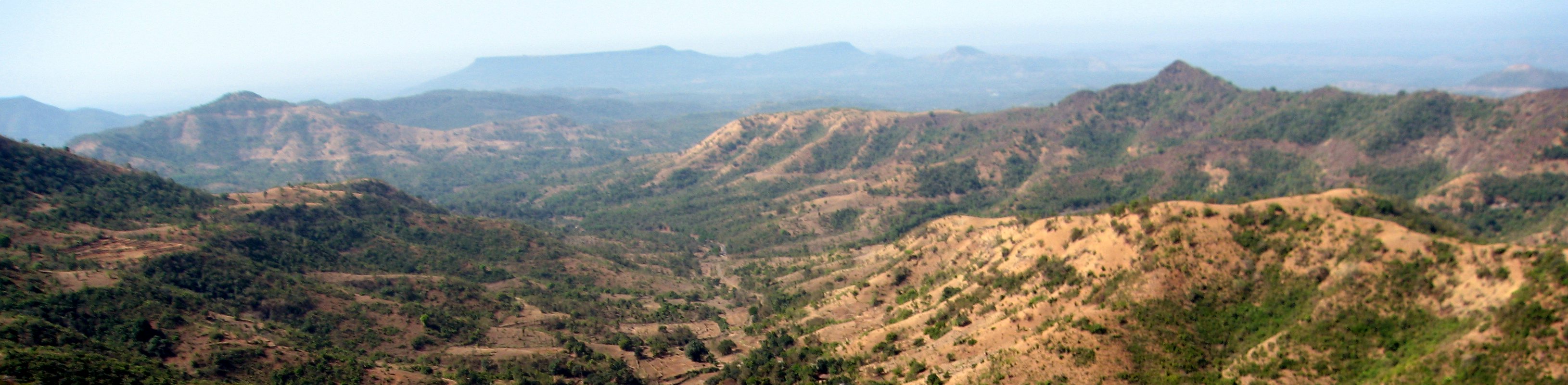
Along India's National Highway 204

The religious feelings

Natural Perls
Topographic Map of Sambu, Maharashtra, India
Find elevation by address:

Places near Sambu, Maharashtra, India:
Yadavwadi
Shahuwadi
Perid
Ameni
Arul
Yelur
Shivare
Kadave
Shelarwadi
Bajagewadi
Patilwadi
Sutarwadi
Parale
Gogave
Shimpe
Vadgaon
Patane
Nerle
Kode
Dhanagarwada
Recent Searches:
- Elevation of SW Elderview Dr, Sherwood, OR, USA
- Elevation of Hickory St, Greenville, NC, USA
- Elevation of Poplar Ln, Guffey, CO, USA
- Elevation of Falling Spring Rd, Clyde, NC, USA
- Elevation of Kingsfield St, Castle Rock, CO, USA
- Elevation of AMELIA CT HSE, VA, USA
- Elevation of Abbey Dr, Virginia Beach, VA, USA
- Elevation of Brooks Lp, Spearfish, SD, USA
- Elevation of Panther Dr, Maggie Valley, NC, USA
- Elevation of Jais St - Wadi Shehah - Ras al Khaimah - United Arab Emirates