Elevation of Kushinagar, Uttar Pradesh, India
Location: India > Uttar Pradesh >
Longitude: 83.8869698
Latitude: 26.7398787
Elevation: 80m / 262feet
Barometric Pressure: 100KPa
Elevation Map:
Satellite Map:
Related Photos:
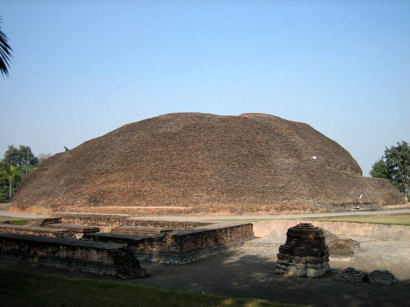
The Buddha's cremation stupa

Cremation Stupa outside of Kushinagar

080917-G7-030

Kusinara - 007

Kusinara - 010

20130210-WX1-038

20130210-WX1-039

080917-G7-012
080917-G7-014
Topographic Map of Kushinagar, Uttar Pradesh, India
Find elevation by address:

Places near Kushinagar, Uttar Pradesh, India:
Gorakhpur
Bashratpur
Central Academy Vikas Nagar Vistar ,bargadwa Gorakhpur
Vistar Colony
Bihar
Maharajganj
Balapar
Bargadwa
Gorakhpur
Siktaur
Maniram Railway Station
Jangal Mehtab Rai
Azizullah Urf Chakia
Pashchim Champaran
Ramgram
Sonauli
India Nepal Border, Sonauli
Sant Kabir Nagar
Siddharthanagar
Shiva Flex Printing Parsahawa Marchawar
Recent Searches:
- Elevation of Dog Leg Dr, Minden, NV, USA
- Elevation of Dog Leg Dr, Minden, NV, USA
- Elevation of Kambingan Sa Pansol Atbp., Purok 7 Pansol, Candaba, Pampanga, Philippines
- Elevation of Pinewood Dr, New Bern, NC, USA
- Elevation of Mountain View, CA, USA
- Elevation of Foligno, Province of Perugia, Italy
- Elevation of Blauwestad, Netherlands
- Elevation of Bella Terra Blvd, Estero, FL, USA
- Elevation of Estates Loop, Priest River, ID, USA
- Elevation of Woodland Oak Pl, Thousand Oaks, CA, USA