Elevation of Bollinger Canyon Rd, San Ramon, CA, USA
Location: United States > California > Contra Costa County > San Ramon >

Longitude: -121.95446

Latitude: 37.7598938

Elevation: 132m / 433feet

Barometric Pressure: 100KPa

Elevation Map:

elevation map of Bollinger Canyon Rd, San Ramon, CA, USA

Satellite Map:

Satellite map of Bollinger Canyon Rd, San Ramon, CA, USA

Related Photos:

oakland california eastbay alamedacounty july 2016 boury pbo31 nikon d810 over view dark night dusk city urban traffic lightstream motion color highway red 580 freeway expressway hillcrestknolls 150th overpass roadway black
150th avenue
california winter panorama dublin storm motion black color reflection wet rain station northerncalifornia night dark nikon highway view traffic metro over bart january large panoramic transit bayarea eastbay stitched pleasanton alamedacounty 580 2016 lightstream redrain boury pbo31 d810
dublin / pleasanton platform in the rain
borgesranch california farm mountdiablo oak trees unitedstates walnutcreek hairyvetch viciavillosa oaktree wildflower 2017borges
The Old Oak Tree
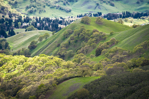
california green landscape view hills mtdiablo karith explored
After the Rains
bayarea california nikon february 2018 color winter boury pbo31 city urban eastbay alamedacounty motion traffic lightstream roadway tracks 580 highway bart station over castrovalley view infinity metro transit d810
just before the downpour
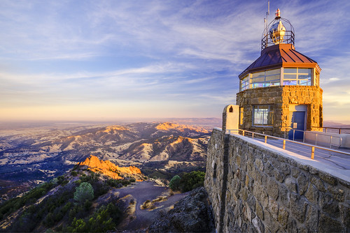
mtdiablo mountdiablo california usa bayarea sanfrancisco
Mount Diablo views
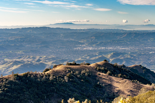
alameda alamedacounty america bayarea berkeley california californiastate d610 ebrpd eeuu eastbay eastbayregionalparkdistrict estadosunidos fotografíadepaisaje fullframe landscape landscapephotography landschaftsfotografie lens livermorevalley nikkor nikkor70300mmf4556gedifafsvrzoomlens nikon nikon70300mmf4556gedifafsvrnikkorzoomlens nikond610 norcal northamerica northerncalifornia oakland paisaje photography pleasanton pleasantonridge pleasantonridgeregionalpark regionalpark ridge sfbayarea sfbay sanfrancisco sanfranciscobayarea telephoto telephotolens travel travelphotography traveling travels usa unitedstates unitedstatesofamerica viaje westcoast westoakland zoomlens アメリカ合衆国 カリフォルニア サンフランシスコ ニコン ニッコール 加州 北カリフォルニア 北米 米国 美国 西海岸 風景 風景写真
Pleasanton Ridge Regional Park, Pleasanton, California, USA
farmmachinery rust tractor olympusomdem1mkll 2019borges steeringwheel ford fordson
Driver's View
bayarea california nikon d810 color october 2018 fall boury pbo31 over view night dark black dublin pleasanton lightstream traffic 580 eastbay alamedacounty exchange highway motion red exit ramp infinity theater imax regal overpass 680
highway 580 / 680 exchange
street blue trees usa house brick green ford lamp station clouds trash dumpster truck fire graffiti 1 us am garbage escape cloudy pov pavement teal balcony c united mason parking main lot pickup grand tags engines pontiac walls states hayward hybrid hdr mostviewed1 mostviewed7 mostviewed6 mostviewed10
Dumpster's Point of View
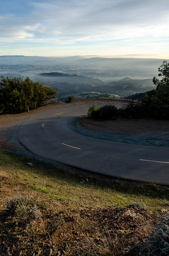
california road park nikon mt view state summit diablo d5100
California - Mt. Diablo Summit Road
50mm america bayarea berkeley california californiastate clayton contracosta contracostacounty cropsensor d5000 danville diablorange eeuu eastbay estadosunidos focallength50mm fotografíadepaisaje hike hiking hikingtrail hill landscape landscapephotography landschaftsfotografie lens mountdiablo mountdiablostatepark mountain nikkor nikkor50mmf14gsicswprimeafs nikon nikond5000 norcal northamerica northerncalifornia oakland paisaje photography prime primelens sfbay sanfrancisco sanfranciscobayarea trail travel travelphotography traveling travels trekking usa unitedstates unitedstatesofamerica viaje westcoast westoakland f14 アメリカ合衆国 カリフォルニア サンフランシスコ ニコン ニコンd5000 ニッコール 加州 北カリフォルニア 北米 米国 美国 西海岸 風景 風景写真
Mount Diablo Summit Hiking, Clayton, California, USA
bayarea california nikon d810 color december 2018 boury pbo31 dublin eastbay alamedacounty over view infinity 580 680 interchange pleasanton highway roadway urban city traffic bart station metro panorama large stitched panoramic hotel rooftops
dublin / pleasanton interchange panorama
alameda alamedacounty america bayarea berkeley california californiastate d610 ebrpd eeuu eastbay eastbayregionalparkdistrict estadosunidos fotografíadepaisaje fullframe landscape landscapephotography landschaftsfotografie lens livermorevalley nikkor nikkor70300mmf4556gedifafsvrzoomlens nikon nikon70300mmf4556gedifafsvrnikkorzoomlens nikond610 norcal northamerica northerncalifornia oakland paisaje photography pleasanton pleasantonridge pleasantonridgeregionalpark regionalpark ridge sfbayarea sfbay sanfrancisco sanfranciscobayarea telephoto telephotolens travel travelphotography traveling travels usa unitedstates unitedstatesofamerica viaje westcoast westoakland zoomlens アメリカ合衆国 カリフォルニア サンフランシスコ ニコン ニッコール 加州 北カリフォルニア 北米 米国 美国 西海岸 風景 風景写真
Pleasanton Ridge Regional Park, Pleasanton, California, USA
california statepark trees fall fog geotagged moss roots trail liveoak bayarea viewlarge mtdiablo 18200mmf3556gvr nikonstunninggallery abigfave geo:lat=37844781 geo:lon=121927058 nwpa07
Fossil Ridge Trail - View Large
pink clouds
The view to hide the moon
california sunset summer panorama dublin orange color green evening nikon highway view over large august panoramic hills vista eastbay stitched castrovalley alamedacounty 580 2015 boury pbo31 d810 dublinhillsregionalpark
suburban sunset lll
california winter panorama dublin storm motion black color reflection wet rain station northerncalifornia night dark nikon highway view traffic metro over bart january large panoramic transit bayarea eastbay stitched pleasanton alamedacounty 580 2016 lightstream redrain boury pbo31 d810
sunday night station
california sunset summer panorama dublin color green evening nikon highway view over large august panoramic hills vista eastbay stitched alamedacounty 580 2015 boury pbo31 d810 dublinhillsregionalpark
east bay valley panorama
2870 alamedacounty alamo america bayarea berkeley bollingercreek california californiastate contracostacounty d610 danville ebmud eastbay eastbayregionalparkdistrict estadosunidos eugeneoneillnationalhistoricsite fotografíadepaisaje fullframe landscape landscapephotography lastrampas lastrampasregionalwilderness lastrampasridge lens moraga nikkor nikkor2870mmf28d nikkor2870mmf28dedifafszoomlens nikon nikond610 norcal northamerica northerncalifornia oakland paisaje photography professionallens regionalpark regionalwilderness rockyridge sfbay sanfrancisco sanfranciscobayarea thetraps travel travelphotography traveling travels usa unitedstates unitedstatesofamerica viaje westcoast westoakland yermoregionallastrampas astbaymunicipalutilitydistrict thetoughguyoftheeastbayregionalparkdistrict アメリカ合衆国 カリフォルニア サンフランシスコ ニコン ニッコール 加州 北カリフォルニア 北米 米国 美国 西海岸 風景 風景写真 dry seco drought
Chamise Trail, Las Trampas Regional Wilderness, California, USA
bayarea california nikon d810 color october 2018 fall boury pbo31 over view night dark black dublin pleasanton lightstream traffic 580 eastbay alamedacounty exchange highway motion bart station westdublin transit metro public 680
over the west dublin bart station
road trees mountain snow ice nature wet forest landscape diablo mtdiablo sergeybidun
Icy Road
mountains mtdiablo canon5dmkii color clouds canon24105mmf4l california landscapes
Mt Diablo
redwoodroad alemedacounty greenhills clouds
While the Hills are Green!
ebparksok
Morgan Territory Regional Preserve
california panorama foothills walnutcreek alamo wateringhole californiastatepark mountdiablo contracostacounty mountdiablostatepark mountdiablofoothills brionesmountdiablotrail pixelmama chinawallroad happycowshangouthere brionestomountdiablotrail
Over Hill & Dale
ebparksok
Lake Chabot
ridge ramage bayarea northern california
Hanging with the stones
7dwf landscape alamo flowers
...glowing grasses, so nice to see in late summer and fall
mtdiablo oaksavannah diablofoothills
Oak sunset, Shell Ridge
ebparksok
Las Trampas
houses sky mountain water evening pond dusk
A Pond at Dusk
nikon hills shadows oaks landscape sun nature tree parks
Winter Oaks (Explored)
bayarea california nikon d810 color november 2018 boury pbo31 dublin eastbay alamedacounty hills sky army defense satellite communications white clouds space radar
quietly listening
travel nature sunny clear
Tassajara Hills
fence mountdiablo alamo new zealand newzealandnorthisland
...the golden hills are green this time of year. HFF!
7dwf landscape napa fires sonoma wine country smoke loss sanfrancisco alamo bayarea
...a sad day in the San Francisco Bay area as smoke fills the skies as a constant reminder of the ongoing Napa and Sonoma tragedy
city trees urban usa lake fog clouds landscape spread drive us san factory dr united wide area states sprawl scape residential uphill leandro fairmont neighborhoods foothill chabot mostviewed5
Fairmont Fog