Elevation of Washington Township, OH, USA
Location: United States > Ohio > Preble County >
Longitude: -84.668834
Latitude: 39.7974087
Elevation: 336m / 1102feet
Barometric Pressure: 97KPa
Elevation Map:
Satellite Map:
Related Photos:

Clear View of the DPU

DC to AC on the Lead

West Alexandria Depot

Oklahoma, Ohio- Washington Twp. Number 4 Schoolhouse

Giant Cross at New Creations Chapel

The Roberts Bridge

The Roberts Bridge
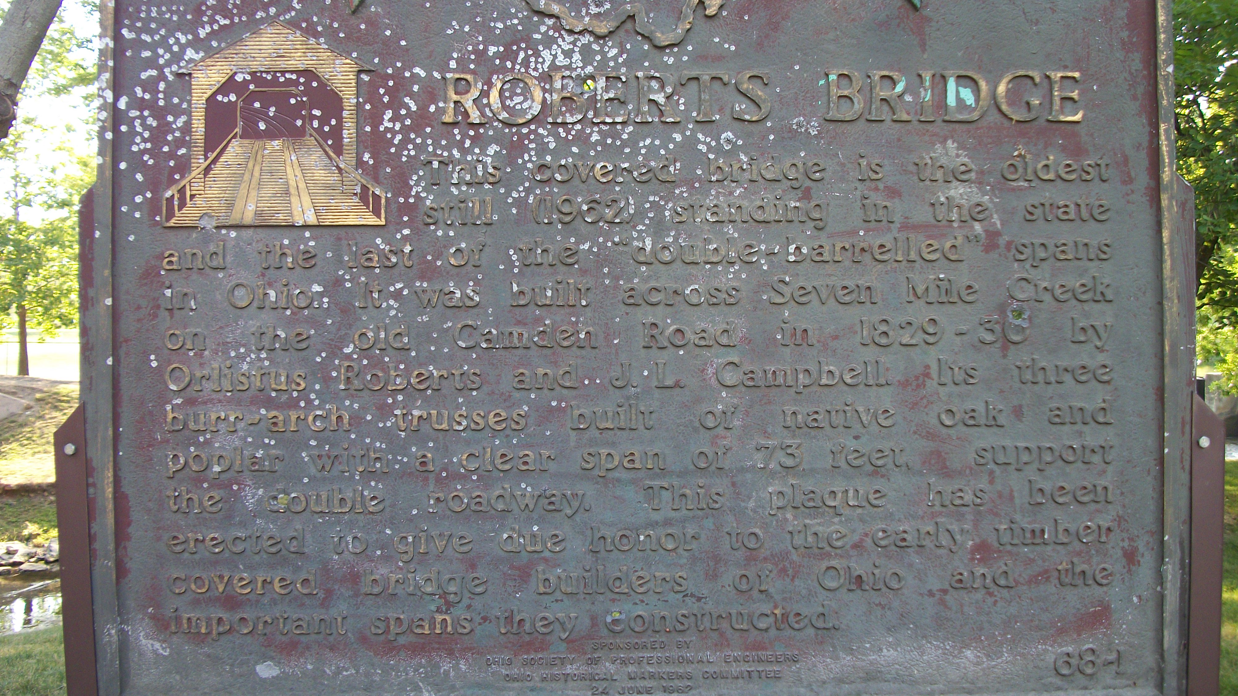
The Roberts Bridge
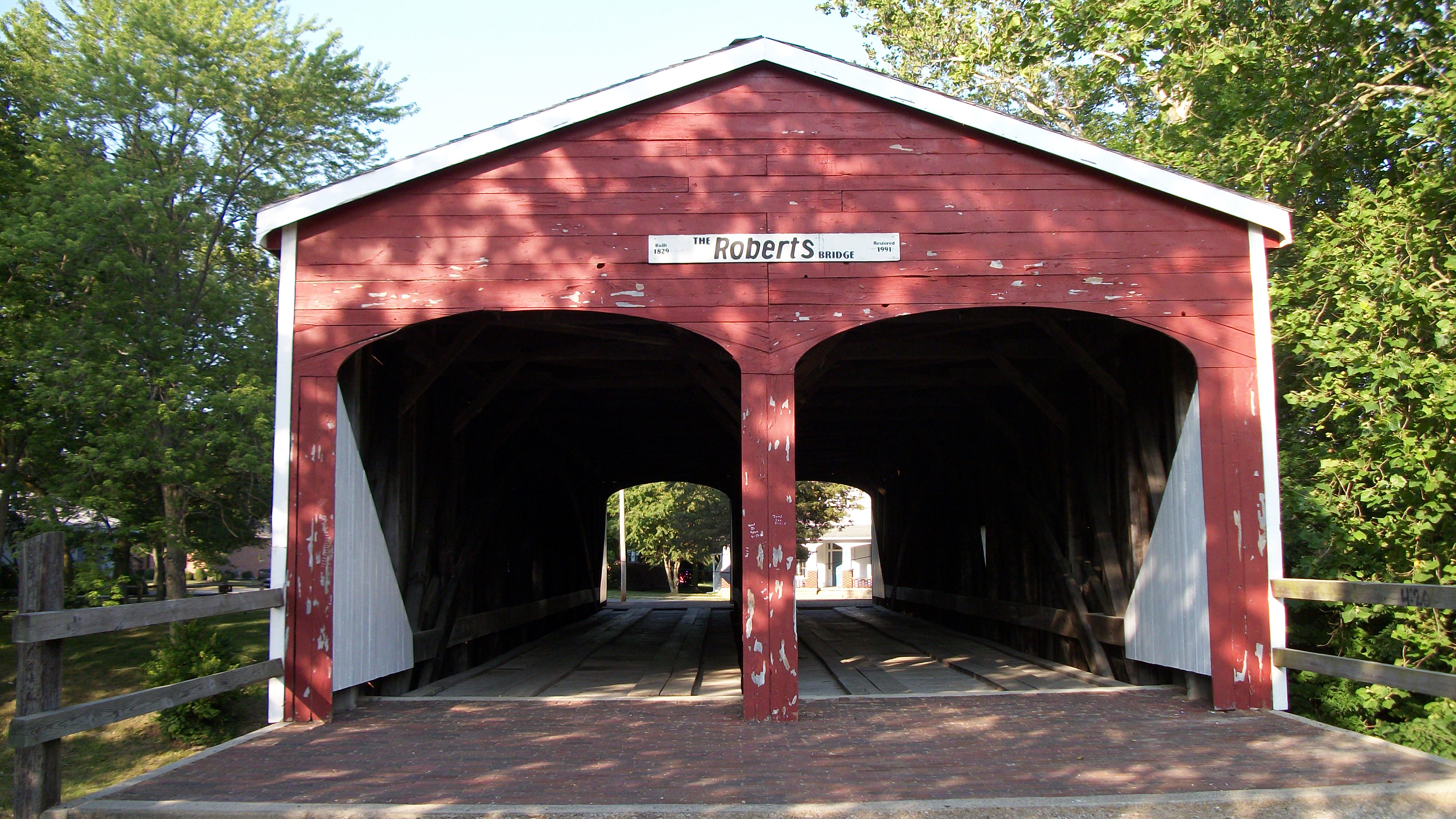
The Roberts Bridge

The Roberts Bridge

The Roberts Bridge

Roberts Covered Bridge, barrel view

Dam in Eaton, Ohio

Dam in Eaton, Ohio
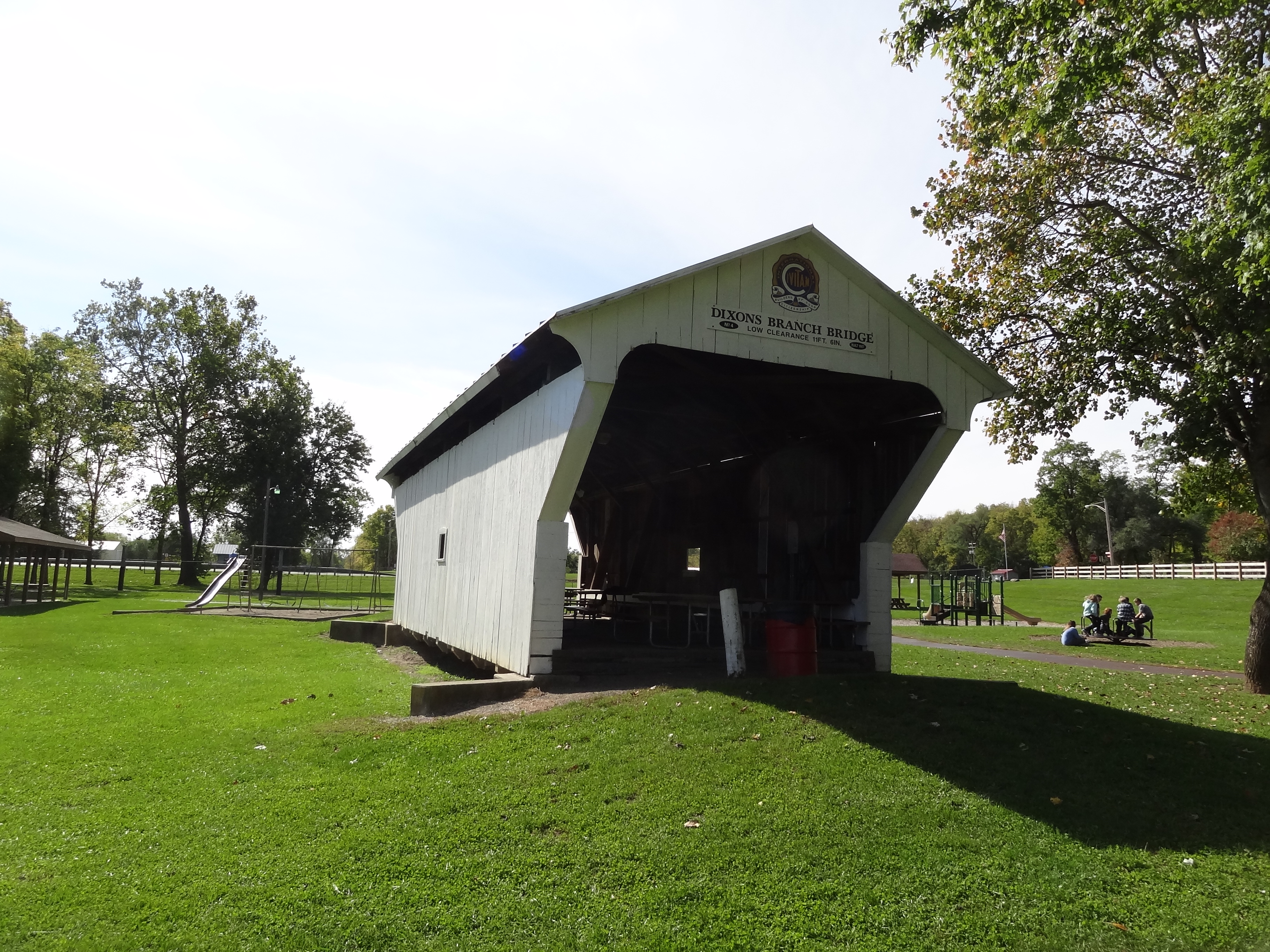
Dixon's Branch Covered Bridge, side view, Preble County, Ohio
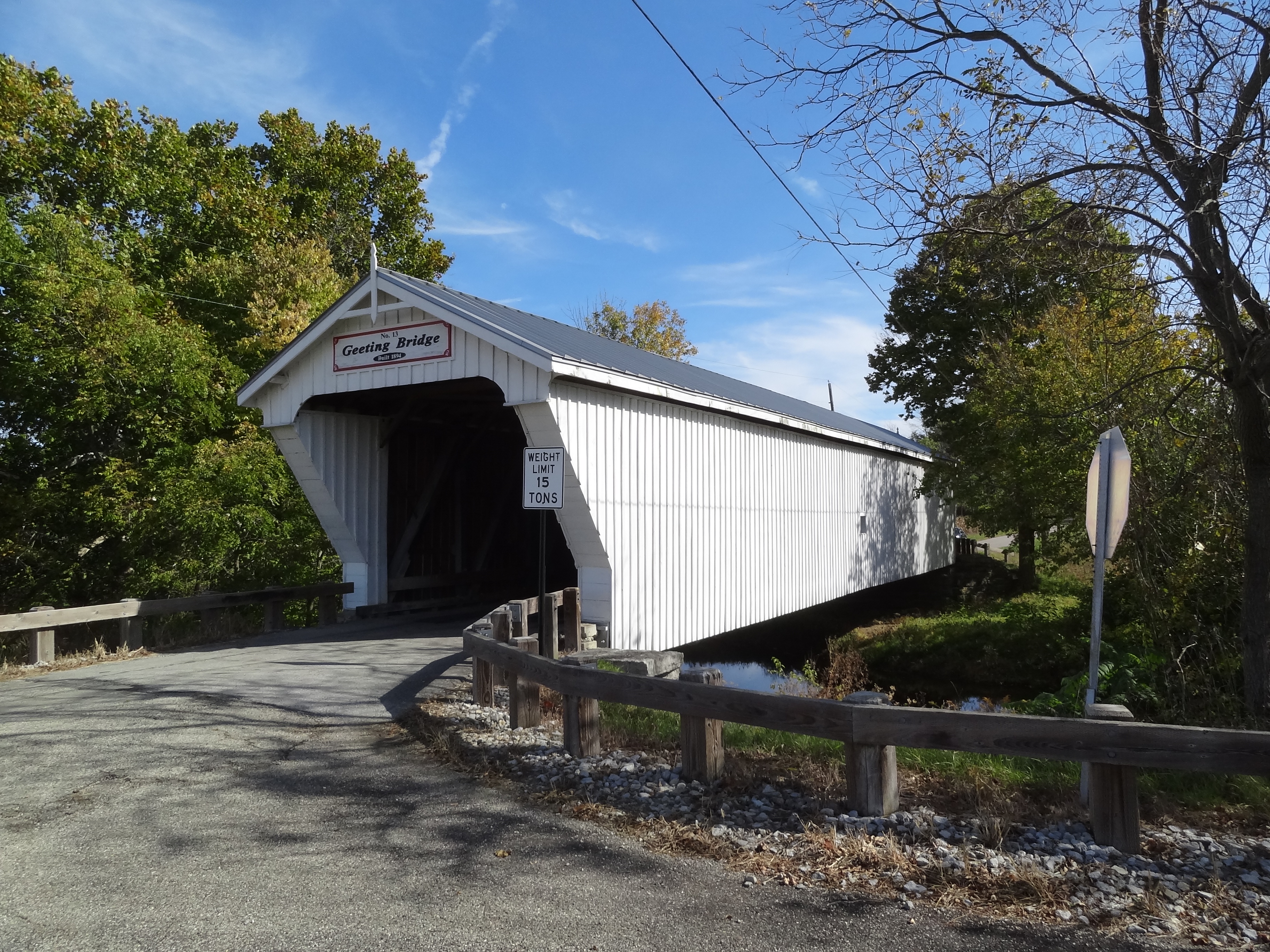
Geeting Covered Bridge, Preble County, OH - side view

Harshman Covered Bridge, side view, Preble County, Ohio

Harshman Covered Bridge, window view, Preble County, Ohio

Harshman Covered Bridge, barrel view, Preble County, Ohio

Geeting Covered Bridge, Preble County, OH - first view

Geeting Covered Bridge, Preble County, OH - right side creek view

B-17 Visits the Richmond Municipal Airport

Aerial View of Preble County, Ohio Estate

Two roads diverged in a yellow wood

James Whitcomb Riley House Birthplace, Greenfield. Indiana, USA

Auto Trail at Hayes Arboretum

Yellow Trail to Trilllum Hill

Horses on a Fall Morning

horizon tall

The End of the Earth

The End of the Earth

Frame Cemetery, Eaton, Ohio, United States

B-17 Visits the Richmond Municipal Airport

Christman Covered Bridge, Preble County, OH - landscape

Gasper Somers Road

Landscape — Washington Township, Preble County, Ohio

Landscape — Washington Township, Preble County, Ohio

GC3PRZ0 - Geocaching

#view from the #road

The End of the Earth

Paint Creek 4 Mile Road
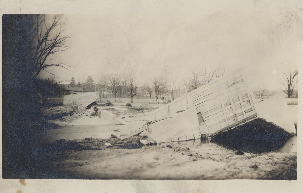
Flood of 1913 - New Paris, Ohio
Topographic Map of Washington Township, OH, USA
Find elevation by address:

Places near Washington Township, OH, USA:
1800 W Winnerline Rd
Preble County
3737 Upshur Northern Rd
W Main St, Eaton, OH, USA
Eaton
Eaton, OH, USA
123 Hillcrest Dr
US-40, New Paris, OH, USA
121 Amelia Dr
109 Tiffin Ct
Monroe Township
Eldorado
S Main St, Eldorado, OH, USA
93 Quaker Trace Rd, West Alexandria, OH, USA
Twin Township
N Commerce St, Lewisburg, OH, USA
Lewisburg
OH-, West Alexandria, OH, USA
West Alexandria
59 E 2nd St
Recent Searches:
- Elevation of Corso Fratelli Cairoli, 35, Macerata MC, Italy
- Elevation of Tallevast Rd, Sarasota, FL, USA
- Elevation of 4th St E, Sonoma, CA, USA
- Elevation of Black Hollow Rd, Pennsdale, PA, USA
- Elevation of Oakland Ave, Williamsport, PA, USA
- Elevation of Pedrógão Grande, Portugal
- Elevation of Klee Dr, Martinsburg, WV, USA
- Elevation of Via Roma, Pieranica CR, Italy
- Elevation of Tavkvetili Mountain, Georgia
- Elevation of Hartfords Bluff Cir, Mt Pleasant, SC, USA