Elevation of Washington Township, OH, USA

Location: United States > Ohio > Warren County >

Longitude: -84.037889

Latitude: 39.3960098

Elevation: 291m / 955feet

Barometric Pressure: 98KPa

Elevation Map:

elevation map of Washington Township, OH, USA

Satellite Map:

Satellite map of Washington Township, OH, USA

Related Photos:

lake leaves fisherman caesarcreeklake fallfoliege autumn fall dock nikondigital nikond500 waves shore rocks overcast clouds ohio southwestohio
Fishing with a view
clarksville greatblueheron ohio birds cowanlake clintoncounty
GREAT BLUE HERON
morrowgravelpit warrencounty adult ohio osprey morrow juvenile nest
OSPREY ADULT & 3 JUVENILES
First Time At First Creek
clarksville clintoncounty ringbilledgull fish ohio birds cowanlake doublecrestedcormorant wilmington unitedstatesofamerica
CORMORANTS & GULLS DIVING FOR FISH
warrencounty ohio morrowgravelpit morrow osprey nest adult
OSPREY ADULT & 3 JUVENILES
clarksville greatblueheron ohio birds cowanlake clintoncounty
GREAT BLUE HERON
sky skydiving flying great photographers skydiver parachute photomatix hdraddicted hdrps zensationalworld
Parachute deployment
indianaandohiorailway iory emd gp382 bb diesel blanchester ohio usa train railway locomotive railroad
01/10/2017 - Blanchester, Ohio, USA.
shorebird clarksville ringbilledgull greategret ohio birds cowanlake waterfowl clintoncounty
GREAT EGRETS and ....
scaup cowanlake clintoncounty redhead panorama clarksville ohio ringbilledgulls otherkeywords birds places
WATERFOWL ON COWAN LAKE
pano1 canadagoose brantacanadensis snowgoose chencaerulescens clarksville ohio cowanlake clintoncounty
CANADA GEESE AT THE ISLAND 12162016
clarksville scaup cowanlake clintoncounty redhead ohio places birds
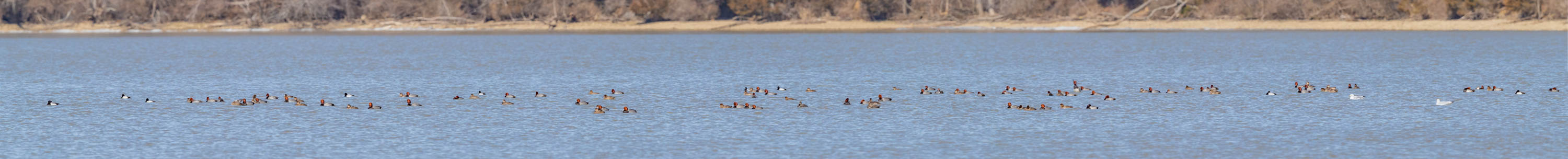
REDHEADS on COWAN LAKE
ohio clarksville commonloon gaviaimmer
COMMON LOON
ohio clarksville commonloon gaviaimmer cowanlake
COMMON LOON
clarksville birds redbreastedmerganser clintoncounty ohio cowanlake places ruddyduck wilmington unitedstatesofamerica
RED-BREASTED MERGANSERS
ohio clarksville dryocopuspileatus pileatedwoodpecker cowanlake
PILEATED WOODPECKER
instagramapp square squareformat iphoneography uploaded:by=instagram sunset road car drive highway interstate 71 i71 north ohio traffic jam rear view mirror sun sky evening reflection
Traffic Jam Sunset
county door wood trees winter ohio building tree vertical creek pen early village cross board logs structure historic steeple single warren moved agriculture siding bushes pioneer exposed caesars gable township elam massie outbuilding smokehouse relocated onestory hewn harveysburg chinking notching daubing hewed
Elam Smokehouse — Caesar's Creek Pioneer Village, Harveysburg, OH
county school ohio house abandoned senior rural gum one wooden grove decay room forgotten warren schoolhouse
Senior, Ohio- Gum Grove Schoolhouse
ohio clarksville northernflicker colaptesauratus cowanlake
NORTHERN FLICKER
HorseShoe Falls
waterfall horseshoefalls flatrockcreek caesarcreek hiking mirrorless olympusem1
Horseshoe Waterfall
Right Under My Nose
animals forest nikon places deer fawn d300 fotocompetitionbronze
Bold Fawns!
sky sun field grass fence meadow caterpillar esmithiii esmithiii2003 caterpillargrass
Caterpillar grass
First Aerial Camera Photo
sky field outdoors corn farm
Just corn
trees sunset ohio panorama nature america forest river landscape explore valley gorge dayton caesarcreekstatepark justinmyers justinmyersphotography
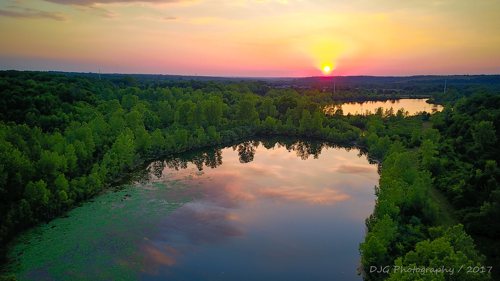
Summer Sunset in the Valley, Caesar Creek State Park
square gingham squareformat iphoneography instagramapp uploaded:by=instagram
Trying a new course out today, weather is perfect
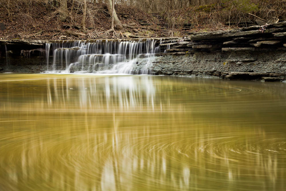
ohio 1212 caesarcreek ceasarcreekstatepark radarbrat 5dm2
Horseshoe Falls
autumn portrait sky fall girl smile face field hat pumpkinpatch
cast my worries to the sky
ohio sky sun field esmithiii esmithiii2003
A sullen sun
sunset ohio sky sun lake creek caesar caesarcreeklake esmithiii esmithiii2003 caesarcreeklakesunset
Caesar Creek Lake Sunset
ohio field grass clouds rural landscape evening countryside airport cloudy farmland oh farms airports runway dandelions grassy landingstrip clintoncounty grassrunway ruralohio grassstrip blanchester craigsairport
Craigs Airport
roadtrip exhibit tourist entertainment oddity pitstop photoop artcar restarea suprise sra freeart thatcar safetybreak picklepark thatcarartcar
Rest Area Exhibition
winter snow ice water frozen waterfall snowy caesarcreek
Icy Falls
sunset ohio cloud sun lake reflection water day dusk waynesville caesarcreek pwpartlycloudy
Caesar Creek sunset
lake silhouette sunrise fishing recreation
Morning is a peaceful time to cast out a line on Caesar Creek Lake.
bridge autumn orange green fall colors leaves trail
Stairs on the interpretive trail at Caesar Creek Lake.
ohio grass buildings airplane landscape flying airport aviation airplanes hangar flight oh airports soaring glider runway gliders airstrip overview airfield waynesville gliderport hangars airfields ccsc caesarcreeksoaringclub grassrunway airstrips grassstrip ohioairport ohioairports caesarcreekgliderport 2oh9 ohiogliderport ohiogliderports
Caesar Creek Gliderport 2OH9