Elevation of Wakorr, Kenya
Location: Kenya > West Pokot County >
Longitude: 35.4179172
Latitude: 1.5049452
Elevation: 1523m / 4997feet
Barometric Pressure: 0KPa
Related Photos:

Panoramic view of the bandas (huts)

Termite hill

_MG_1696.jpg

20110308_004.jpg

20110308_005.jpg

20110308_002.jpg
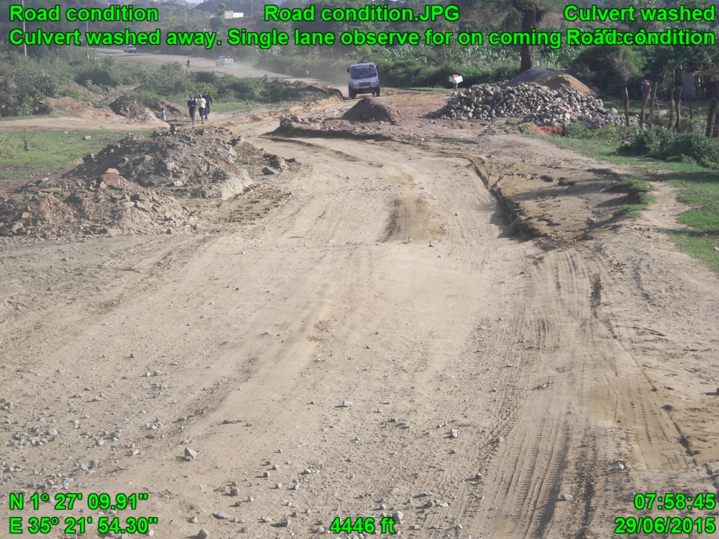
Road condition
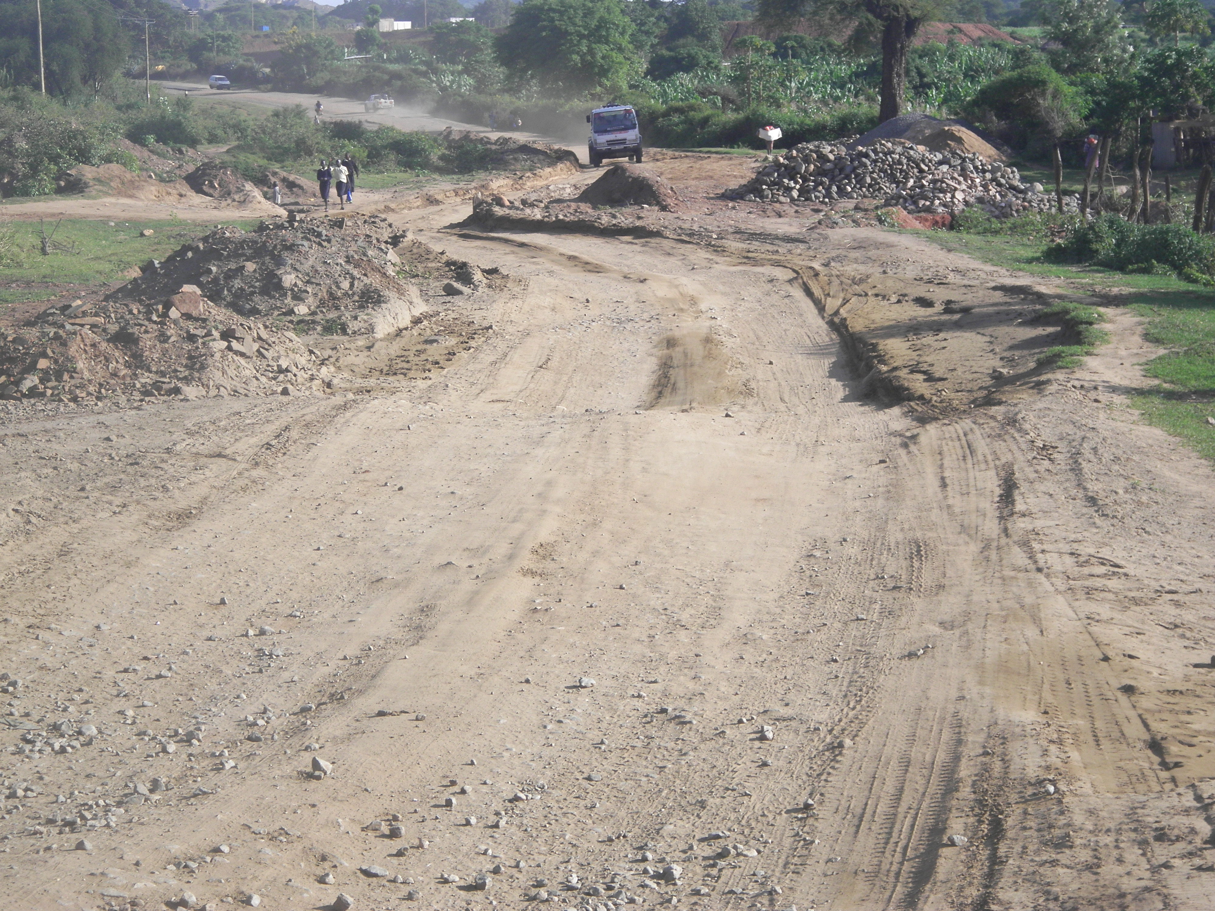
Road condition

This dude could have done with a snooze button

Local schoolgirls attending a motivational afternoon to encourage them to study for their exams

Holy Rosary Secondary School

On Sunday, Mrs G and I gatecrashed a local gospel church - check out the order of service!

Marich Pass's mbwa (dog)

The school is one of the initatives set up by Dr Roden and funded by Friends From Marich Pass

In Marich goats are kept as dowry and inheritence. Currency that also keeps the grass down.

Reception and shop (and elephant bones!)

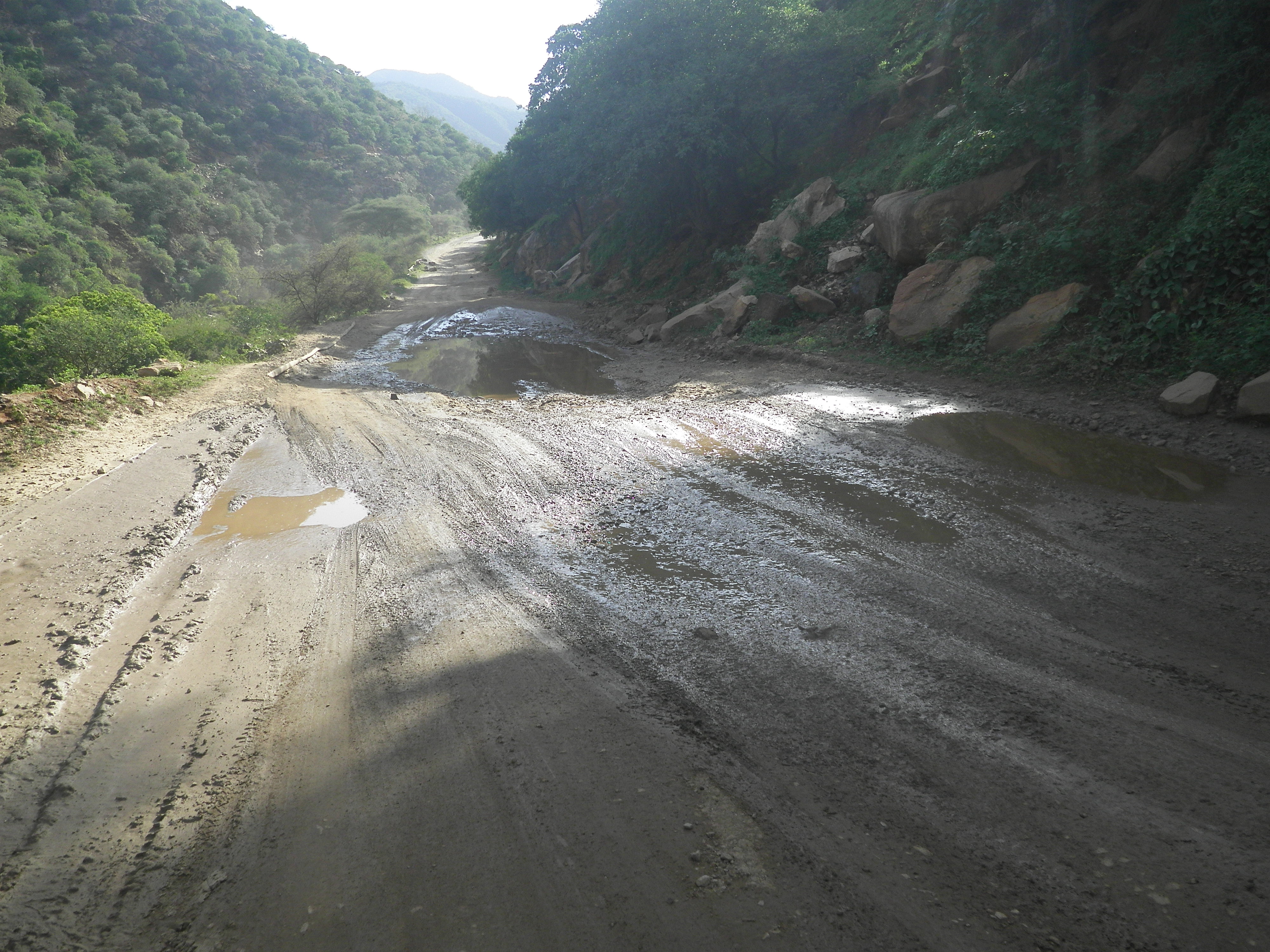
On the road back to Marich
Caution for lowbeddrivers
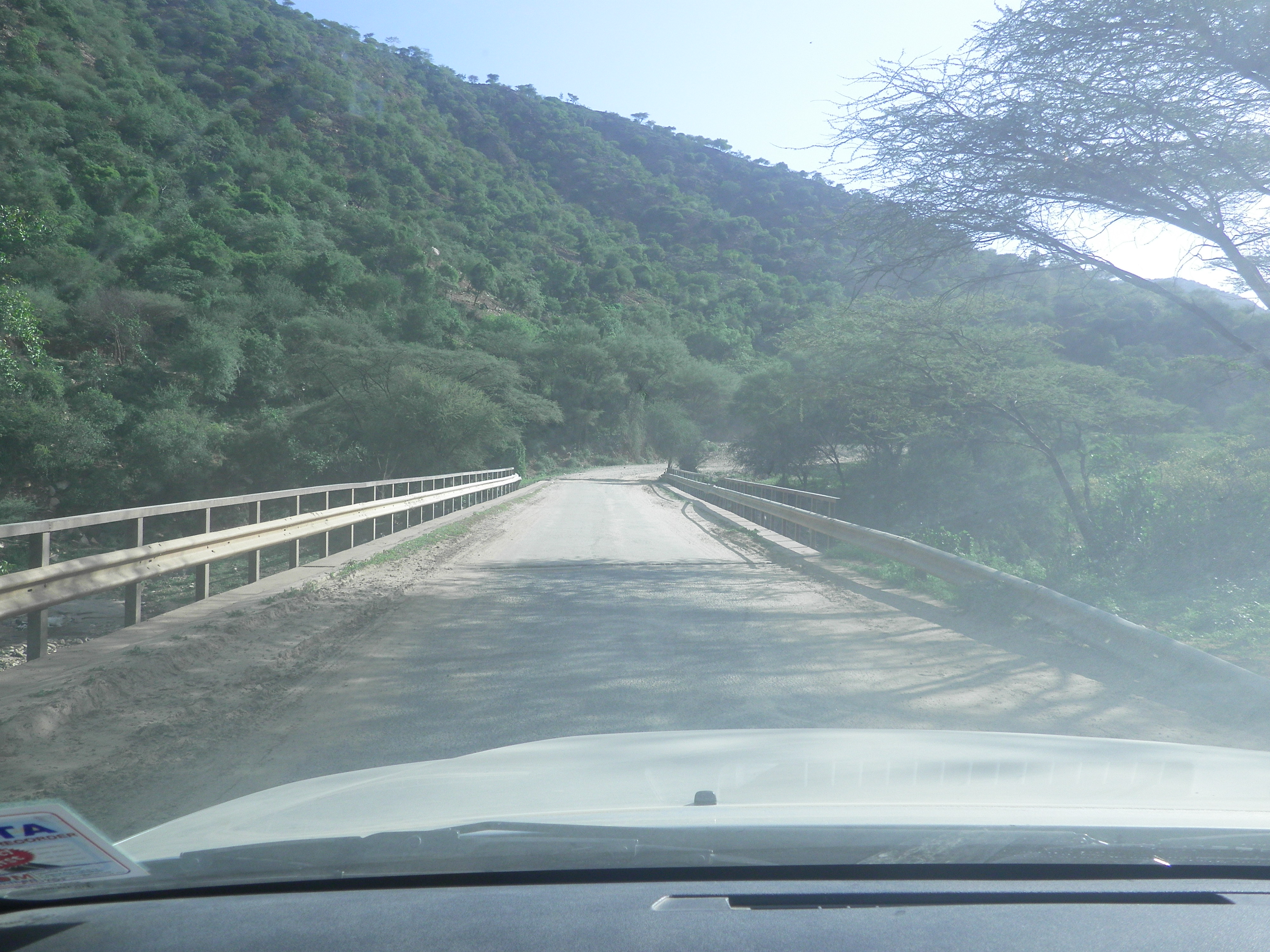
Narrow bridge

Water course1

Caution for lowbeddrivers

Narrow bridge

Water course1
Topographic Map of Wakorr, Kenya
Find elevation by address:

Places in Wakorr, Kenya:
Places near Wakorr, Kenya:
Recent Searches:
- Elevation map of Litang County, Sichuan, China
- Elevation map of Madoi County, Qinghai, China
- Elevation of 3314, Ohio State Route 114, Payne, Paulding County, Ohio, 45880, USA
- Elevation of Sarahills Drive, Saratoga, Santa Clara County, California, 95070, USA
- Elevation of Town of Bombay, Franklin County, New York, USA
- Elevation of 9, Convent Lane, Center Moriches, Suffolk County, New York, 11934, USA
- Elevation of Saint Angelas Convent, 9, Convent Lane, Center Moriches, Suffolk County, New York, 11934, USA
- Elevation of 131st Street Southwest, Mukilteo, Snohomish County, Washington, 98275, USA
- Elevation of 304, Harrison Road, Naples, Cumberland County, Maine, 04055, USA
- Elevation of 2362, Timber Ridge Road, Harrisburg, Cabarrus County, North Carolina, 28075, USA
- Elevation of Ridge Road, Marshalltown, Marshall County, Iowa, 50158, USA
- Elevation of 2459, Misty Shadows Drive, Pigeon Forge, Sevier County, Tennessee, 37862, USA
- Elevation of 8043, Brightwater Way, Spring Hill, Williamson County, Tennessee, 37179, USA
- Elevation of Starkweather Road, San Luis, Costilla County, Colorado, 81152, USA
- Elevation of 5277, Woodside Drive, Baton Rouge, East Baton Rouge Parish, Louisiana, 70808, USA
- Elevation of 1139, Curtin Street, Shepherd Park Plaza, Houston, Harris County, Texas, 77018, USA
- Elevation of 136, Sellers Lane, Repton, Monroe County, Alabama, 36475, USA
- Elevation of 12914, Elmington Drive, Lakewood Forest, Houston, Harris County, Texas, 77429, USA
- Elevation of 417, Camelot Drive, Statesville, Iredell County, North Carolina, 28625, USA
- Elevation of 5792, Wildridge Road, Avon, Eagle County, Colorado, 81620, USA