Elevation map of West Pokot County, Kenya
Location: Kenya >
Longitude: 35.3905046
Latitude: 1.6210076
Elevation: 2165m / 7103feet
Barometric Pressure: 0KPa
Related Photos:

Panoramic view of the bandas (huts)

Termite hill

20110308_004.jpg

20110308_005.jpg

20110308_002.jpg

Lambi and the confort of a 16-hour matatu ride

This dude could have done with a snooze button

Local schoolgirls attending a motivational afternoon to encourage them to study for their exams

Holy Rosary Secondary School

On Sunday, Mrs G and I gatecrashed a local gospel church - check out the order of service!

Marich Pass's mbwa (dog)

The school is one of the initatives set up by Dr Roden and funded by Friends From Marich Pass

In Marich goats are kept as dowry and inheritence. Currency that also keeps the grass down.

Reception and shop (and elephant bones!)

On the road back to Marich
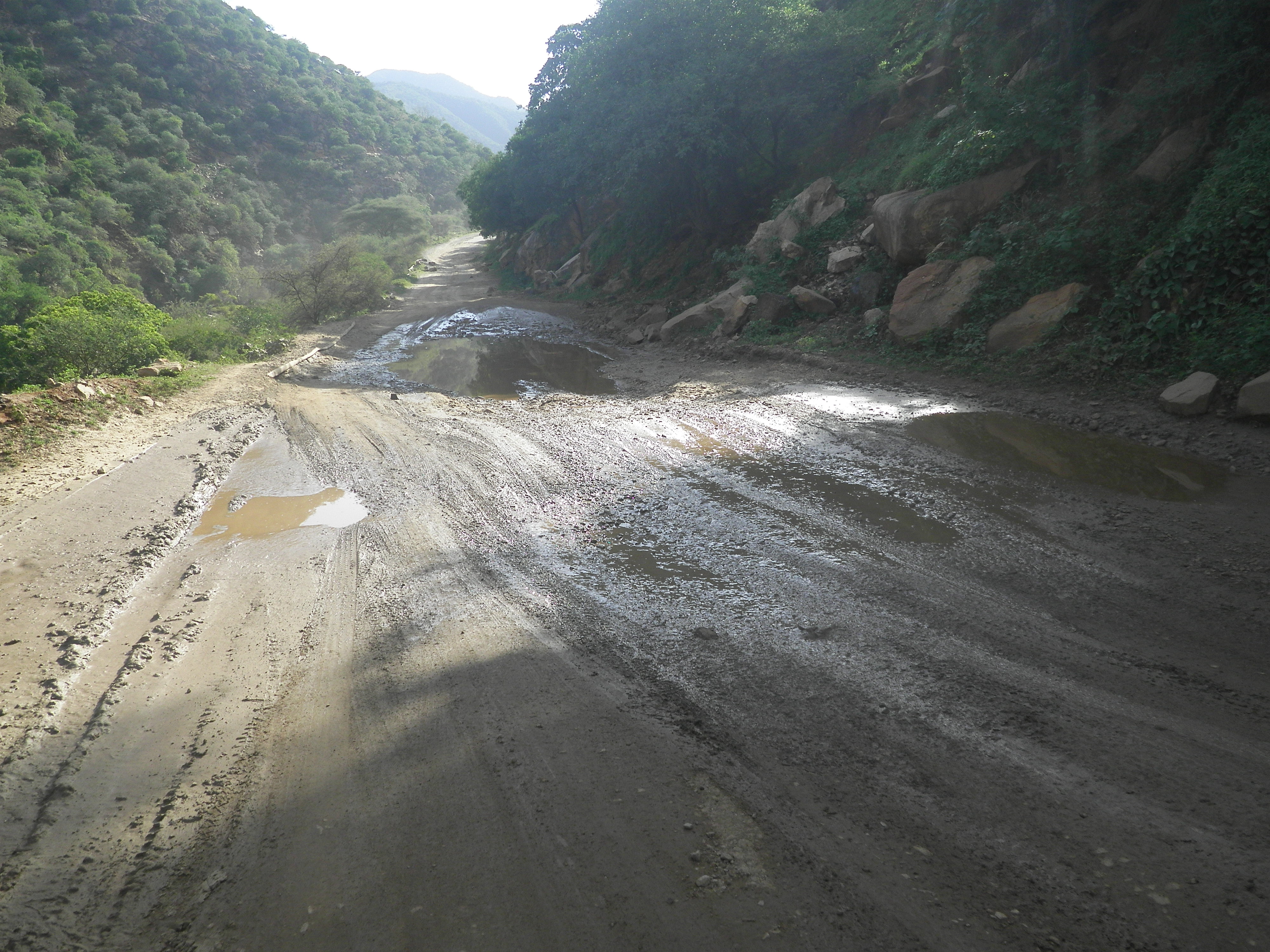
Caution for lowbeddrivers
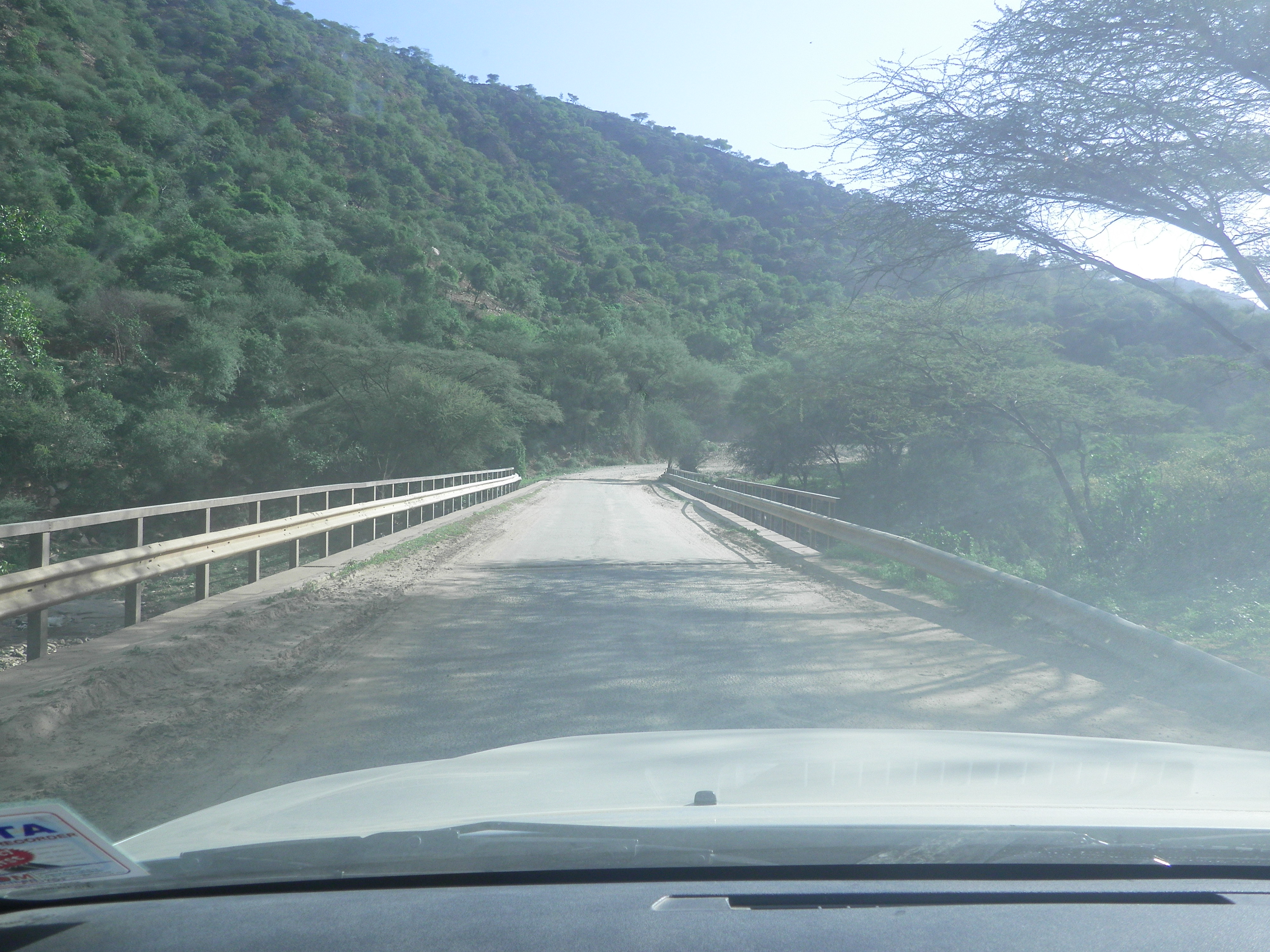
Narrow bridge

Water course1

Caution for lowbeddrivers

Narrow bridge

Water course1
Topographic Map of West Pokot County, Kenya
Find elevation by address:

Places in West Pokot County, Kenya:
Places near West Pokot County, Kenya:
Recent Searches:
- Elevation map of Greenland, Greenland
- Elevation of Sullivan Hill, New York, New York, 10002, USA
- Elevation of Morehead Road, Withrow Downs, Charlotte, Mecklenburg County, North Carolina, 28262, USA
- Elevation of 2800, Morehead Road, Withrow Downs, Charlotte, Mecklenburg County, North Carolina, 28262, USA
- Elevation of Yangbi Yi Autonomous County, Yunnan, China
- Elevation of Pingpo, Yangbi Yi Autonomous County, Yunnan, China
- Elevation of Mount Malong, Pingpo, Yangbi Yi Autonomous County, Yunnan, China
- Elevation map of Yongping County, Yunnan, China
- Elevation of North 8th Street, Palatka, Putnam County, Florida, 32177, USA
- Elevation of 107, Big Apple Road, East Palatka, Putnam County, Florida, 32131, USA
- Elevation of Jiezi, Chongzhou City, Sichuan, China
- Elevation of Chongzhou City, Sichuan, China
- Elevation of Huaiyuan, Chongzhou City, Sichuan, China
- Elevation of Qingxia, Chengdu, Sichuan, China
- Elevation of Corso Fratelli Cairoli, 35, Macerata MC, Italy
- Elevation of Tallevast Rd, Sarasota, FL, USA
- Elevation of 4th St E, Sonoma, CA, USA
- Elevation of Black Hollow Rd, Pennsdale, PA, USA
- Elevation of Oakland Ave, Williamsport, PA, USA
- Elevation of Pedrógão Grande, Portugal