Elevation of W Co Rd 17, Mizpah, MN, USA
Location: United States > Minnesota > Koochiching County >
Longitude: -94.22882
Latitude: 47.974702
Elevation: 421m / 1381feet
Barometric Pressure: 96KPa
Elevation Map:
Satellite Map:
Related Photos:

Lost Forty NSA

Cirsium muticum

Platanthera psycodes

Roadside Bog

Celastrina ladon

Calopogon tuberosus

Leucorrhinia frigida

Leucorrhinia frigida

Vaccinium macrocarpon

Calla palustris
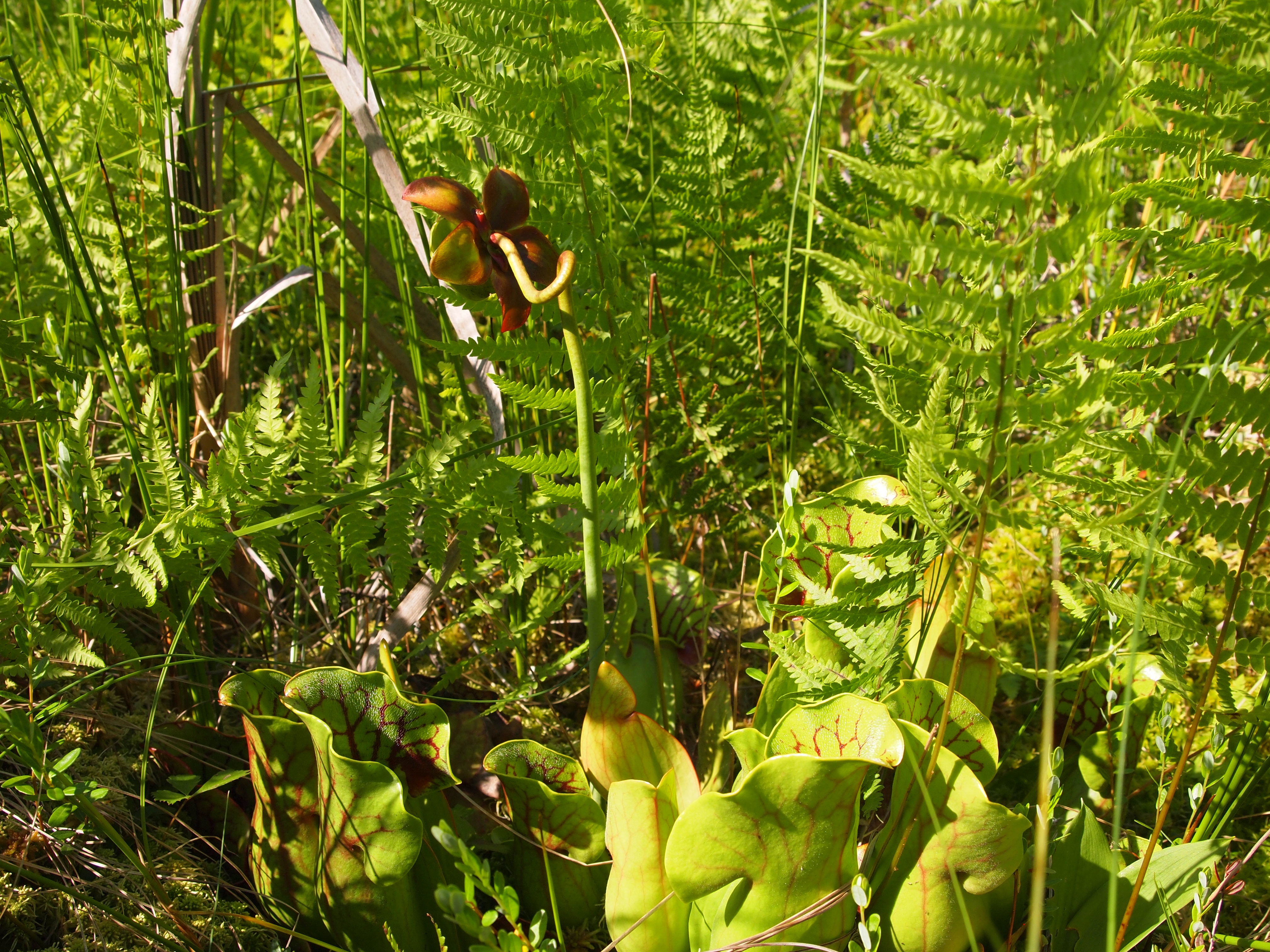
Sarracenia purpurea

Leucorrhinia hudsonica

Somatochlora minor

Somatochlora walshii

Platanthera sp.

Calopogon tuberosus

Big bear

Group picture
What the heck is this thing?!

Jungle Land Golfers

Jungle Land Buyer
Topographic Map of W Co Rd 17, Mizpah, MN, USA
Find elevation by address:

Places near W Co Rd 17, Mizpah, MN, USA:
Co Rd 30, Northome, MN, USA
Main St E, Kelliher, MN, USA
MN-72, Northome, MN, USA
Shooks Township
Rogers Rd NE, Kelliher, MN, USA
Beltrami County
81 Atwood 2 Rd
81 Atwood 2 Rd
218 4th St
Baudette
Main St, Baudette, MN, USA
Dawson
Lake Of The Woods County
Norris Camp
Roosevelt
Lakewood Township
Lake Of The Woods
Rocky Point Rd NW, Williams, MN, USA
Lake St NE, Warroad, MN, USA
Warroad
Recent Searches:
- Elevation of Corso Fratelli Cairoli, 35, Macerata MC, Italy
- Elevation of Tallevast Rd, Sarasota, FL, USA
- Elevation of 4th St E, Sonoma, CA, USA
- Elevation of Black Hollow Rd, Pennsdale, PA, USA
- Elevation of Oakland Ave, Williamsport, PA, USA
- Elevation of Pedrógão Grande, Portugal
- Elevation of Klee Dr, Martinsburg, WV, USA
- Elevation of Via Roma, Pieranica CR, Italy
- Elevation of Tavkvetili Mountain, Georgia
- Elevation of Hartfords Bluff Cir, Mt Pleasant, SC, USA