Elevation of Scenic, SD, USA
Location: United States > South Dakota > Pennington County >
Longitude: -102.55486
Latitude: 43.7797143
Elevation: -10000m / -32808feet
Barometric Pressure: 295KPa
Elevation Map:
Satellite Map:
Related Photos:

Moving in Circles - Velvia 100F

Stormy Sunrise Shadows

Sheep Mountain Table, Badlands, South Dakota

Old Badlands Stereo

Old Badlands Stereo 2

X Marks The Spot

Aerial View Indian Creek Area, Buffalo Gap National Grassland

Aerial View Badlands National Park And Vicinity (october, 2005)

Aerial View Badlands National Park And Vicinity (october, 2005)

Aerial View Indian Creek Area, Buffalo Gap National Grassland

Aerial View Indian Creek Area, Buffalo Gap National Grassland

Aerial View Indian Creek Area, Buffalo Gap National Grassland

Aerial View Badlands National Park And Vicinity (october, 2005)

Aerial View Indian Creek Area, Buffalo Gap National Grassland

Aerial View Badlands National Park And Vicinity (october, 2005)

P1050575 Sheep Mountain Table

Aerial View Indian Creek Area, Buffalo Gap National Grassland

Aerial View Indian Creek Area, Buffalo Gap National Grassland

Aerial View Indian Creek Area, Buffalo Gap National Grassland
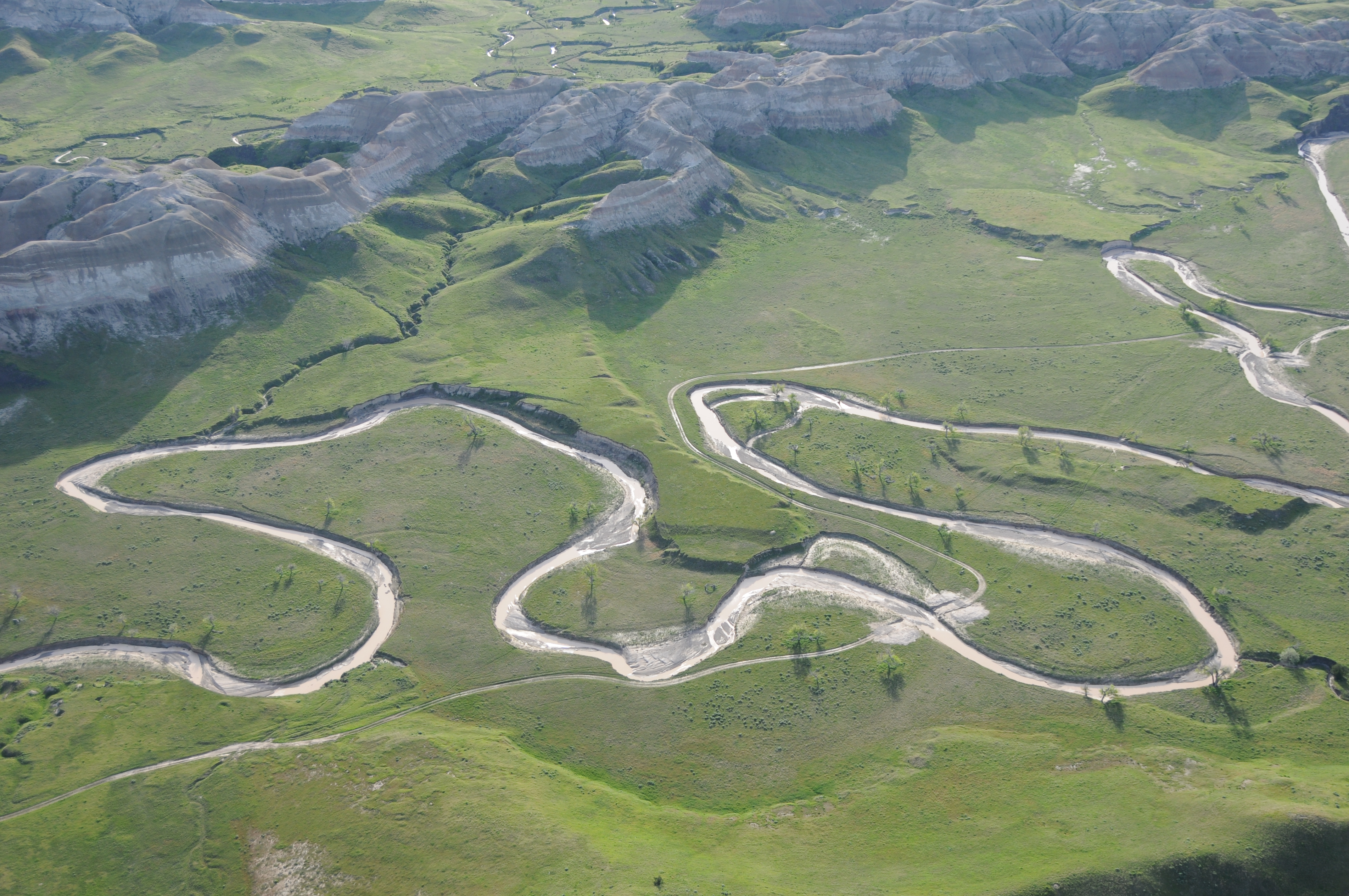
Aerial View Indian Creek Area, Buffalo Gap National Grassland

Aerial View Indian Creek Area, Buffalo Gap National Grassland

Badlands, South-Dakota, USA

Approaching Storm from Sheep Mountain Road in Badlands National Park

Scenic, South Dakota

Passing Storm in Badlands National Park

Scenic, South Dakota

Scenic, South Dakota

Scenic Township, South Dakota

Pine Ridge

Badlands National Park, South Dakota

Badlands NP

Sunset, Badlands National Park

Storm over the Badlands

Sunset, Badlands National Park

South Dakota and Wyoming-402

Thunder Clouds, Pine Ridge Agency, SD

Fluidic Erosion
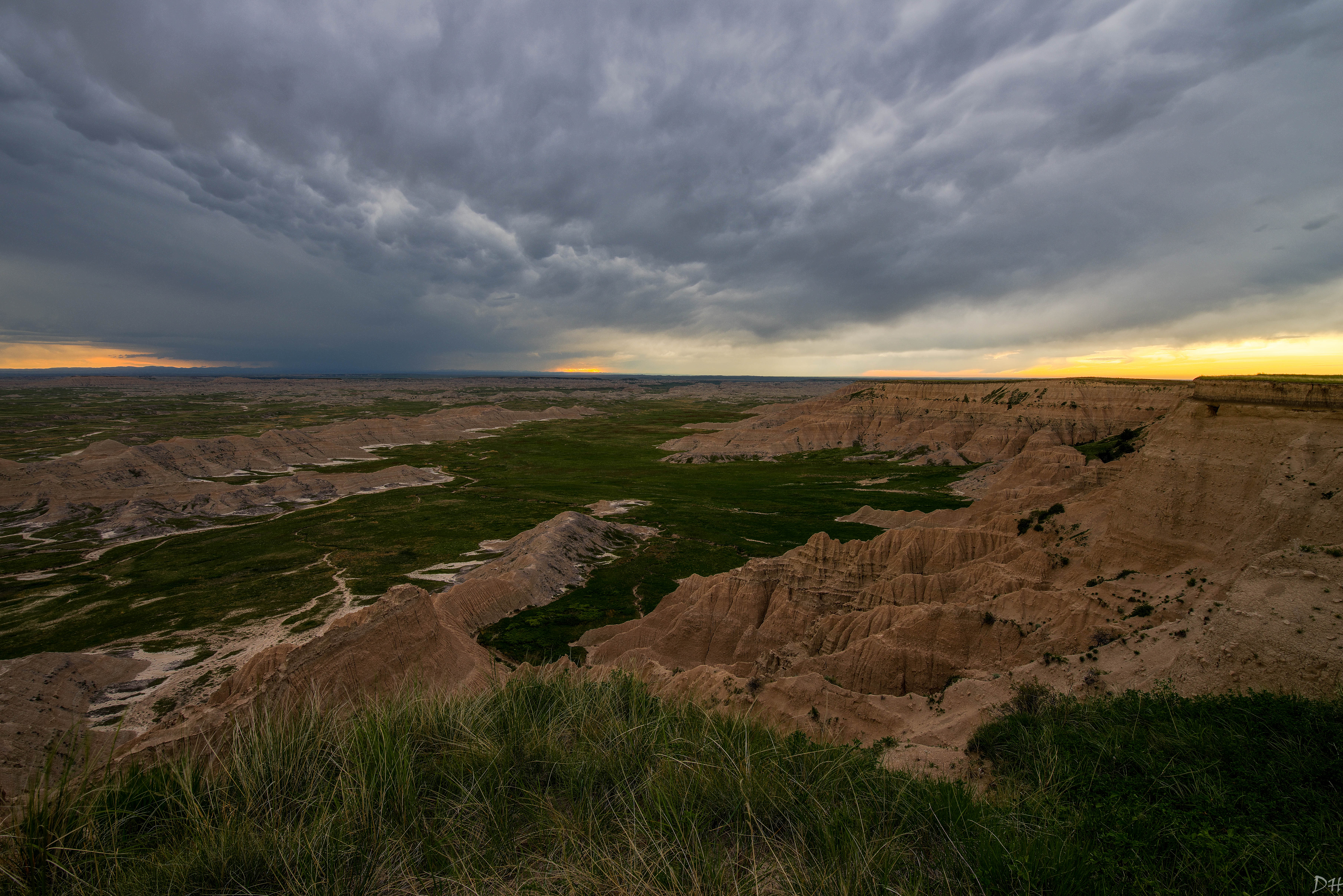
Bad Weather in the Black Hills

Abandoned Farmhouse, Scenic Twp, SD
Topographic Map of Scenic, SD, USA
Find elevation by address:

Places near Scenic, SD, USA:
24460 Heinrich Rd
Badlands National Park
Pennington County
Wall
Norris St, Wall, SD, USA
Castle Butte Township
Circle View Guest Ranch
Main St, Interior, SD, USA
Interior
Cedar Pass Lodge
21295 Sd-240
Cactus Flat
Belle Fourche River
Northwest Jackson
Wilsey Rd, Wall, SD, USA
Dakota Township
Jackson County
2nd Ave, Kadoka, SD, USA
Kadoka
203rd Street
Recent Searches:
- Elevation of Corso Fratelli Cairoli, 35, Macerata MC, Italy
- Elevation of Tallevast Rd, Sarasota, FL, USA
- Elevation of 4th St E, Sonoma, CA, USA
- Elevation of Black Hollow Rd, Pennsdale, PA, USA
- Elevation of Oakland Ave, Williamsport, PA, USA
- Elevation of Pedrógão Grande, Portugal
- Elevation of Klee Dr, Martinsburg, WV, USA
- Elevation of Via Roma, Pieranica CR, Italy
- Elevation of Tavkvetili Mountain, Georgia
- Elevation of Hartfords Bluff Cir, Mt Pleasant, SC, USA