Elevation of Wilsey Rd, Wall, SD, USA
Location: United States > South Dakota > Pennington County >
Longitude: -102.11769
Latitude: 44.4159549
Elevation: 615m / 2018feet
Barometric Pressure: 94KPa
Elevation Map:
Satellite Map:
Related Photos:
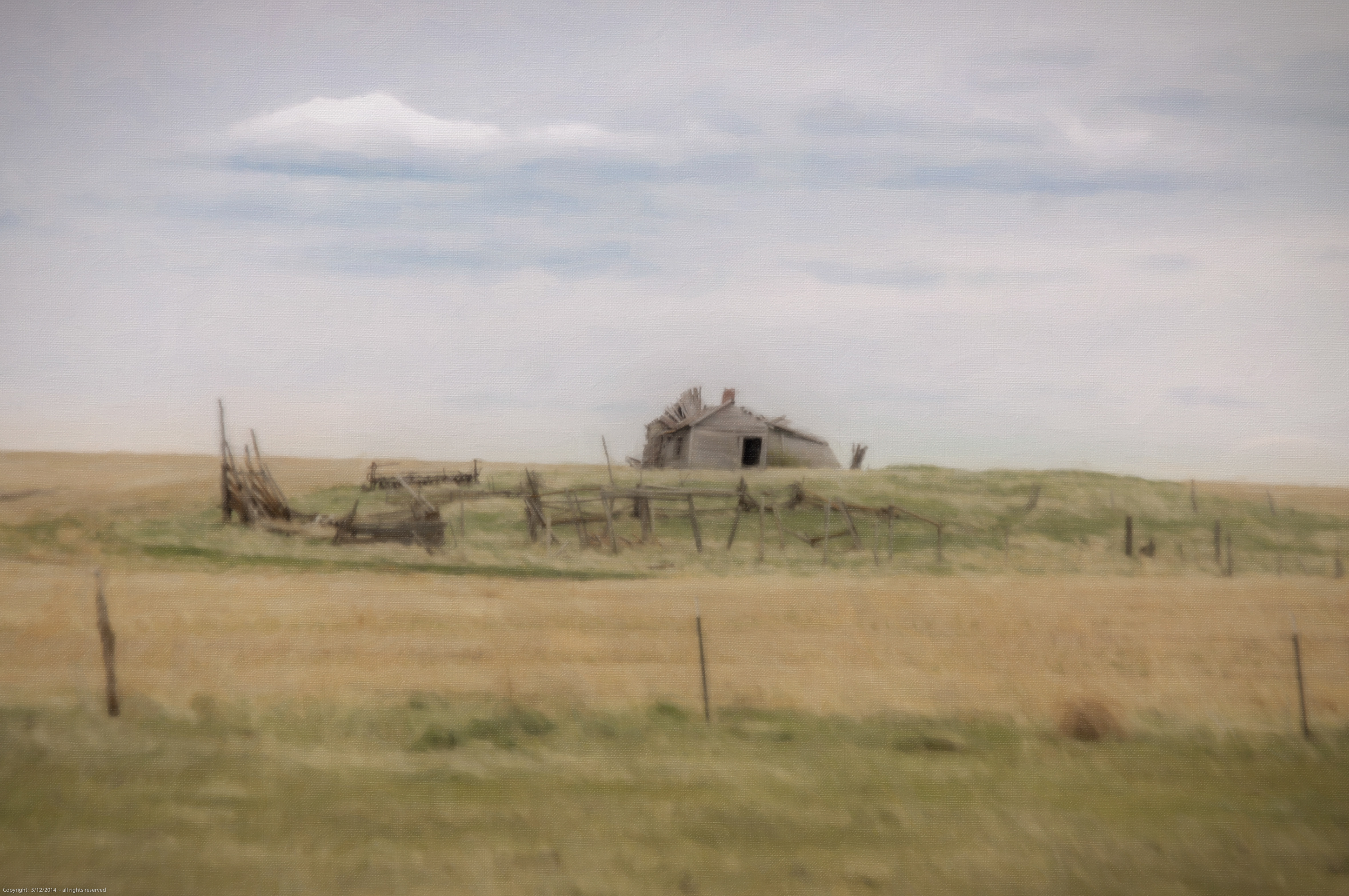
old place close to the sioux spiritual center

Blessed Kateri Tekakwitha.jpg
Topographic Map of Wilsey Rd, Wall, SD, USA
Find elevation by address:

Places near Wilsey Rd, Wall, SD, USA:
Dakota Township
Belle Fourche River
203rd Street
Wall
Norris St, Wall, SD, USA
Pennington County
Northwest Jackson
Ziebach County
Badlands National Park
Cactus Flat
21295 Sd-240
Castle Butte Township
Cedar Pass Lodge
Main St, Interior, SD, USA
Interior
Circle View Guest Ranch
24460 Heinrich Rd
Scenic
2nd Ave, Kadoka, SD, USA
Kadoka
Recent Searches:
- Elevation of Corso Fratelli Cairoli, 35, Macerata MC, Italy
- Elevation of Tallevast Rd, Sarasota, FL, USA
- Elevation of 4th St E, Sonoma, CA, USA
- Elevation of Black Hollow Rd, Pennsdale, PA, USA
- Elevation of Oakland Ave, Williamsport, PA, USA
- Elevation of Pedrógão Grande, Portugal
- Elevation of Klee Dr, Martinsburg, WV, USA
- Elevation of Via Roma, Pieranica CR, Italy
- Elevation of Tavkvetili Mountain, Georgia
- Elevation of Hartfords Bluff Cir, Mt Pleasant, SC, USA