Elevation of Sangameshwar, Maharashtra, India
Location: India > Maharashtra > Ratnagiri >
Longitude: 73.552051
Latitude: 17.1871271
Elevation: 19m / 62feet
Barometric Pressure: 101KPa
Elevation Map:
Satellite Map:
Related Photos:

CSP_6040.JPG

CSP_6057.JPG
CSP_6038.JPG

Gad River Viaduct

CSP_6042.JPG

CSP_6054.JPG

CSP_6036.JPG

CSP_6039.JPG

CSP_6041.JPG

CSP_6058.JPG

CSP_6048.JPG

CSP_6046.JPG
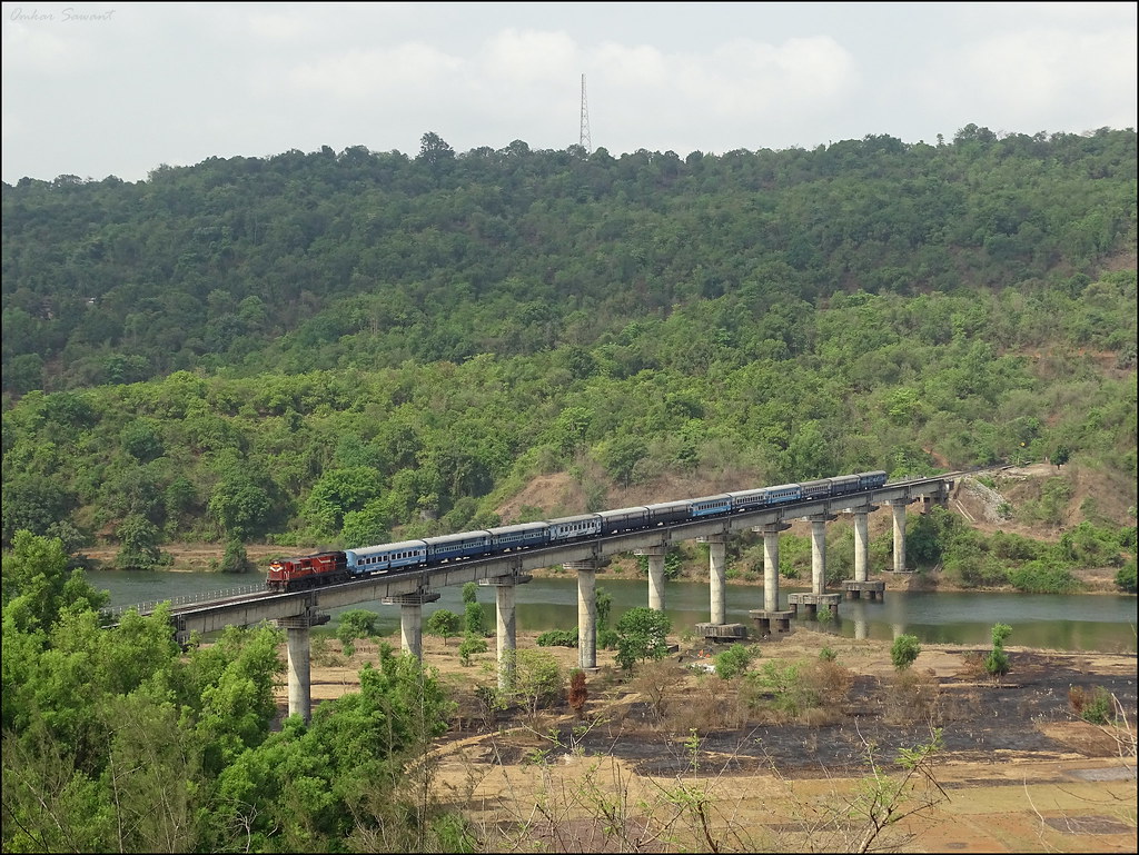
View of a holiday special train crossing Shastri Viaduct.

CSP_6034.JPG
CSP_6060.JPG
CSP_6035.JPG
Topographic Map of Sangameshwar, Maharashtra, India
Find elevation by address:

Places near Sangameshwar, Maharashtra, India:
Ambedu Kh.
Kumbharkhani Kh.
Kurdhunda
Kurdhunda Kh.
Ambedu Bk.
Musalman Wadi
Tamhane Kh.
Ozare Kh.
Kumbhar Khani Bk.
Aravali
Murdav
Aravali Road Railway Station
Nive Bk.
Devrukh
Belari Bk.
Belari Kh.
Malapwadi
Asurde
Nive Kh.
Patharpunj
Recent Searches:
- Elevation of Corso Fratelli Cairoli, 35, Macerata MC, Italy
- Elevation of Tallevast Rd, Sarasota, FL, USA
- Elevation of 4th St E, Sonoma, CA, USA
- Elevation of Black Hollow Rd, Pennsdale, PA, USA
- Elevation of Oakland Ave, Williamsport, PA, USA
- Elevation of Pedrógão Grande, Portugal
- Elevation of Klee Dr, Martinsburg, WV, USA
- Elevation of Via Roma, Pieranica CR, Italy
- Elevation of Tavkvetili Mountain, Georgia
- Elevation of Hartfords Bluff Cir, Mt Pleasant, SC, USA