Elevation of S Roan St, Johnson City, TN, USA

Location: United States > Tennessee > Washington County > Johnson City >

Longitude: -82.318531

Latitude: 36.271721

Elevation: 517m / 1696feet

Barometric Pressure: 95KPa

Elevation Map:

elevation map of S Roan St, Johnson City, TN, USA

Satellite Map:

Satellite map of S Roan St, Johnson City, TN, USA

Related Photos:

Hale's Grocery
church tn tennessee presbyterian jonesborough 1850 jonesboro washingtoncounty bmok bmokchurch
First Presbyterian Church - Jonesborough, TN
church tn tennessee presbyterian jonesborough 1850 jonesboro washingtoncounty bmok bmokchurch
First Presbyterian Church - Jonesborough, TN
IMAG0059-1-1
square squareformat hefe iphoneography instagramapp uploaded:by=instagram foursquare:venue=4b43ad73f964a52015e625e3
You deserve a donut... with a view.
toby mountain view tn tennessee tenn east viewfrommywindow wilkins flickrfriday unaka
Toby's, Limestone Cove
building architecture outdoors tennessee depot appalachia railroads easttennessee
Johnson City, TN Depot
city sports basketball memorial university state tennessee johnson mini center east explore dome ncaa etsu bucs thechallengefactory
Watching the Game
square squareformat iphoneography instagramapp uploaded:by=instagram
My view - what are you looking at right now?
sunset panorama lens unitedstates tennessee hdr unicoi hdrpanorama vanlife geo:country=unitedstates geo:state=tennessee exif:make=panasonic camera:make=panasonic exif:aperture=ƒ35 lumixg14mmf25 exif:lens=lumixg14f25 picsporadic exif:isospeed=100 exif:focallength=14mm brendanjamesphotography camera:model=dmcg7 exif:model=dmcg7 geo:city=unicoi
Pinnacle Mountain Fire Tower HDR Panorama
tennessee fallcolors reststop restarea highway26 24105l tennesseehighways highway26tennessee
203 walking down path to parking lot
hiking treking johnsoncitytn buffalomtn
Buffalo Pano
square lofi squareformat iphoneography instagramapp uploaded:by=instagram foursquare:venue=4dc9b734b0fb4d30a44181bf
Parents view.
tennessee reststop highway26 scenicviewpoint 24105l tennesseehighways scenicreststop highway26tennessee
195 Trail to top of hill at rest stop in Tennessee
highway26 scenicviewpoint tennesseehighways scenicreststop claireastafford claireathompson highway26tennessee
201 Claire on the trail
unitedstates tennessee unicoi vanlife geo:country=unitedstates geo:state=tennessee exif:make=panasonic camera:make=panasonic exif:aperture=ƒ35 exif:lens=lumixg14f25 picsporadic exif:isospeed=100 exif:focallength=14mm brendanjamesphotography camera:model=dmcg7 exif:model=dmcg7 geo:city=unicoi
Pinnacle Tower HDR Panorama 2
travel tn tennessee butterflies insects roadtrip moths bicycletour cycletouring fromabike theworldfromabike
myspace 023
uploaded:by=flickrmobile flickriosapp:filter=nofilter
Great view
tn tennessee storefronts 1908 elizabethton cartercounty bmok bmok2 elizabethtonwalkingtour barnesboringhardware
Storefronts of Historic Elizabethton - Barnes Boring Hardware
travel tn tennessee butterflies insects roadtrip moths bicycletour cycletouring fromabike theworldfromabike
myspace 022
park city autumn kite geotagged photography tennessee johnson aerial deer kap winged geotoolgmif geolat36394066 geolon82360811
May Isolation Theme Entry
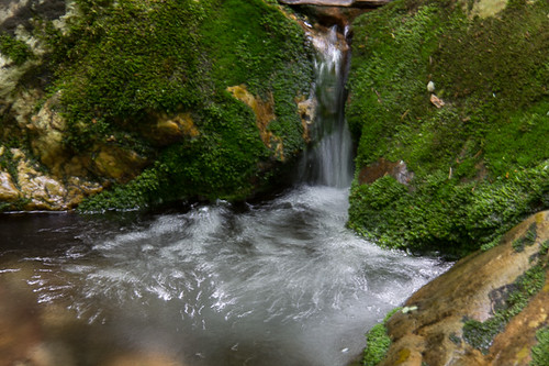
water canon waterfall unakamountain t2i redforkfalls
Red Fork Falls
P1000298.JPG
Unicoi Mountain
cameraphone
WP_20141124_040.JPG
winter snow river tennessee nolichuckyriver
Nolichucky River
boyscouts hike scouts rockcreek
Rock Creek Hike
old city bridge autumn fall leaves river landscapes town travels downtown tn south southern tennesee elizabethon destinationweddingphotographer missoulaweddingphotographer missoulaweddingphotography
Elizabethon, TN
old city bridge autumn fall leaves river landscapes town travels downtown tn south southern tennesee elizabethon destinationweddingphotographer missoulaweddingphotographer missoulaweddingphotography
Elizabethon, TN
old city bridge autumn fall leaves river landscapes town travels downtown tn south southern tennesee elizabethon destinationweddingphotographer missoulaweddingphotographer missoulaweddingphotography
Elizabethon, TN
bridge tn tennessee coveredbridge elizabethton haer 1882 doeriver cartercounty howetruss nrhp queenofthesouth doerivercoveredbridge elizabethtoncoveredbridge bmok fivedollarbridge kissingbeidge
Doe River Covered Bridge
boyscouts hike scouts rockcreek
Rock Creek Hike
boyscouts hike scouts rockcreek
Rock Creek Hike
IMG_0160.JPG
Wautauga River
county city washington tn tennessee johnson tenn east
Pine Oaks Golf Course
waterfall fork falls clear april 2007
Clear Fork Creek
old city bridge autumn fall leaves river landscapes town travels downtown tn south southern tennesee elizabethon destinationweddingphotographer missoulaweddingphotographer missoulaweddingphotography
Elizabethon, TN
Weather Up Ahead