Latitude: 37.3402697
Longitude: -95.2621464
Elevation: 276 meters / 906 feet
Barometric Pressure 981KPa

Related Photos

1984 07-26 1225 MKT GP40-193 S/B Parsons, KS by guitartrain203, In this view from US Rt. 59, Osborne Road, a Missouri-Kansas-Texas S/B TOFC train, with what I assum
1984 07-26 1225 MKT GP40-193 S/B Parsons, KS by guitartrain203
1984 07-26 1020 MKT GP40-178 N/B Parsons, KS by guitartrain203, WIDE View: A N/B Missouri-Kansas-Texas freight is getting under way, as seen from the US Rt. 59, Osb
1984 07-26 1020 MKT GP40-178 N/B Parsons, KS by guitartrain203
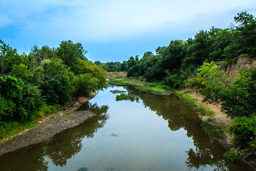
Labette Creek by DIGITAL IDIOT, creek day cloudy ©allrightsreserved digitalidiot
Labette Creek by DIGITAL IDIOT
1984 07-26 1021 MKT GP40-178 N/B Parsons, KS by guitartrain203, TELE View: A N/B Missouri-Kansas-Texas freight is getting under way, as seen from the US Rt. 59, Osb
1984 07-26 1021 MKT GP40-178 N/B Parsons, KS by guitartrain203
view from a bridge 2 by DIGITAL IDIOT, ©allrightsreserved digitalidiot
view from a bridge 2 by DIGITAL IDIOT
view from a bridge by DIGITAL IDIOT, ©allrightsreserved digitalidiot
view from a bridge by DIGITAL IDIOT
Tolen Creek Bridge by gmeador, kansas parsons bighilllakeandtolencreekpark tolencreektrails
Tolen Creek Bridge by gmeador
Stone Pile at Tolen Creek by gmeador, kansas parsons bighilllakeandtolencreekpark tolencreektrails
Stone Pile at Tolen Creek by gmeador
Fishing at Tolen Creek Trails by gmeador, kansas parsons bighilllakeandtolencreekpark tolencreektrails
Fishing at Tolen Creek Trails by gmeador
view from Subway over the underpass by DIGITAL IDIOT, railroad yard, old water tower St. Pat's©allrightsreserved digitalidiot
view from Subway over the underpass by DIGITAL IDIOT
Rock-lined Trail at Tolen Creek by gmeador, kansas parsons bighilllakeandtolencreekpark tolencreektrails
Rock-lined Trail at Tolen Creek by gmeador
Fishing at Tolen Creek Pond by gmeador, kansas parsons bighilllakeandtolencreekpark tolencreektrails
Fishing at Tolen Creek Pond by gmeador
Parsons Filled Arch Bridge (Parsons, Kansas) by courthouselover, Built in 1915, this filled spandrel bridge spans a small tributary of Labette Creek for Queens Road
Parsons Filled Arch Bridge (Parsons, Kansas) by courthouselover
2016-06-25_16-23-50_00039 by Railfan-Eric, UP 7950 south on the UP Parsons sub approaching Parsons KS north of town.   uprr unionpacific trains
2016-06-25_16-23-50_00039 by Railfan-Eric
2016-06-25_16-23-41_00038 by Railfan-Eric, UP 7950 south on the UP Parsons sub approaching Parsons KS north of town.   uprr unionpacific trains
2016-06-25_16-23-41_00038 by Railfan-Eric
19358 by richiekennedy56, Construction is progressing on the new US 400 bypass on the east side of Parsons,us400 kansas labett
19358 by richiekennedy56
farm by DIGITAL IDIOT, barn ©allrightsreserved digitalidiot
farm by DIGITAL IDIOT
19356 by richiekennedy56, us400 kansas labettecountyks parsons orchardpark views unitedstates
19356 by richiekennedy56