Elevation of Roscoe, MT, USA

Location: United States > Montana > Carbon County >

Longitude: -109.49655

Latitude: 45.3496655

Elevation: 1524m / 5000feet

Barometric Pressure: 84KPa

Elevation Map:

elevation map of Roscoe, MT, USA

Satellite Map:

Satellite map of Roscoe, MT, USA

Related Photos:

panorama mountain color canon rockies montana farm pasture bigsky rockymountains range mountians billings redlodge beartooth
Beartooth Mountian Range Panorama
blue trees sky panorama sunlight white mountains green nature grass clouds landscape montana colorful scenic absarokamountains
Big Sky Country... Leaving Daniel Angus Ranch... heading for the Absaroka Mountains...
Beartooth Mountains
montana postoffice roscoe carboncounty
Roscoe, Montana 59071
montana postoffice roscoe carboncounty
Roscoe, Montana 59071
ranch autumn shadow cloud foothills west color reflection water colors field clouds rural reflections landscape landscapes countryside pond montana mt shadows farm country farming scenic western fields waters farms rockymountains hay agriculture bales bale ponds hayrolls agricultural ranching foothill beartoothmountains redlodge therockies carboncounty ranches hayroll hogancreek
Foothill highlights
montana nye mountain ridge moraine glacialdeposists erratics glacial kettle depression pond lake boulders water panorama geology geomorpology turcopond wyojones
Morainal Pond
flowers lupine
Quaking Aspen and Lupine
autumn mountain mountains color fall colors yellow rural landscape scenery montana mt scenic peak snowcapped rockymountains peaks roscoe beartoothmountains therockies carboncounty custernationalforest southernmontana mt78 peabodyditch montanahighway78
Autumn at the foot of the Beartooth
Somewhere near Luther!
wood old travel blue wild sky house mountain mountains building tree history abandoned home broken monument nature beautiful beauty field grass metal architecture barn rural america truck vintage landscape outdoors gold town wooden junk nikon montana butte day alone exterior antique decay farm empty wildlife traditional country rustic meadow sunny bluesky canyon farmland structure haunted nostalgia hut 1950s fields weathered trucks shack aged agriculture deserted beartoothmountains beartooth beartoothhighway
Vacation Home
autumn sky bw cloud mountain mountains fall monochrome clouds rural landscape landscapes scenery montana ray skies mt scenic peak snowcapped rockymountains rays peaks roscoe beartoothmountains mountainous therockies carboncounty custernationalforest southernmontana mt78 peabodyditch montanahighway78
At the foot of the Beartooth
mountains landscapes montana valleys beartoothmountains eastrosebudcreek
Mountain high, valley low
montana snow peak east rosebud
Up The Valley
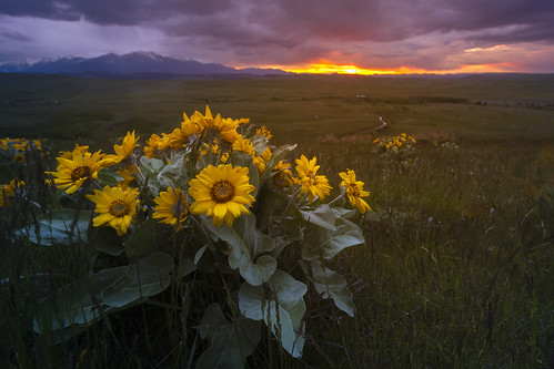
redlodge clouds evening flowers glow portfolio storm sunset mountains montana montanamoment explore west wilderness yellow color orange landscape rural beartoothmountains beartooths weather ominous
Late Spring
montana adventure autumn clouds explore fall freezing frozen portfolio sky snow stream sunset tracks wanderlust wild wilderness winter wonderland water ice evening color endless blankets
Endless Winter Landscape
beartoothmountains montana alpine custernationalforest spring may snowy snowcapped foliage trees valley evening nikond750 tamron2470mmf28 blue sky sunny
Spring in the Valley
road winding montana open country
Winding road in Montana
bromusinermis smoothbrome introduced rhizomatous grass poaceae bromeae coolseason redlodge montana roadside disturbedsite carboncounty
Bromus inermis (Carbon County, Montana)
bromusinermis smoothbrome introduced rhizomatous grass poaceae bromeae coolseason redlodge montana roadside disturbedsite carboncounty
Bromus inermis
montana mt landscapes carboncounty northamerica unitedstates us
Southern Montana Landscape (Carbon County, Montana)
mountains fly fishing montana hiking beartooths
0image (2)
mountains fly fishing montana hiking beartooths
0image(4)
family karl montana travel
West Rosebud Rose Bud Valley