| Latitude: | 44.5760013 |
|---|---|
| Longitude: | -75.6639179 |
| Elevation: | 81 meters / 266 feet |
| Barometric Pressure | 1004KPa |
Related Photos

Brockville Ontario - Canada - Fulton Place - Heritage Trust - Garden by Bill Badzo

Brockville Ontario - Canada - Fulton Place - Heritage Trust - Garden by Bill Badzo

Brockville Ontario - Canada - Fulton Place - Heritage Trust - Water Fountain Head by Bill Badzo

Brockville Ontario - Canada - Fulton Place - Heritage Trust - Water Fountain by Bill Badzo

Brockville Ontario - Canada - Fulton Place - Heritage Trust - Water Fountain by Bill Badzo

Brockville Ontario - Canada - Fulton Place - Heritage Trust by Bill Badzo

Hopes Set High by Thousand Word Images by Dustin Abbott
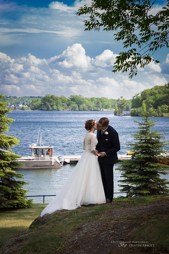
Thousand Islands Love by Thousand Word Images by Dustin Abbott

The Princess Bride by Thousand Word Images by Dustin Abbott

Newfound Intimacy by Thousand Word Images by Dustin Abbott
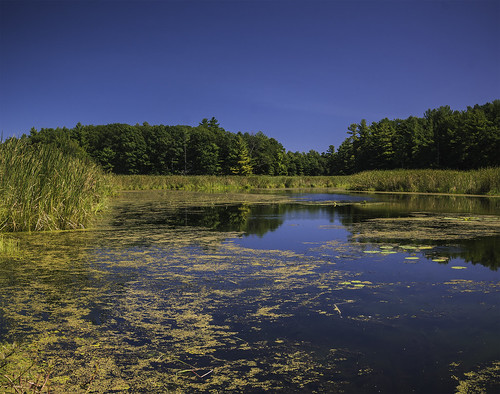
1000 Islands NP by Wim van de Meerendonk, back from Norway!

Highway 401 by Ben_Senior

Augusta TWP Pumper 1 view 2 Maitland, Ontario Canada 06162007 ©Ian A. McCord by ocrr4204

Brockville Ontario - Canada - Fulton Place - Heritage Trust - Water Fountain by Bill Badzo

IMG_1648 by 2lsnop

Rose window by Will S.

Brockville Railway Tunnel by Light Collector

Street Scene Brockville by "Photo Guy"

Vastness by Éric B.

Aerial view of Rob and Ted, Blockhouse Island, Brockville, Ontario - Kite Aerial Photography (KAP) by Rob Huntley Photography - Ottawa, Ontario, Canada

Aerial photograph - The Boardwalk condominium block , the being built Tall Ships Landing waterfront condominiums and the site of the future Maritime Discovery Centre. The Marina at Blockhouse Island, by Rob Huntley Photography - Ottawa, Ontario, Canada

Big bolt from the blue... by Kevbo
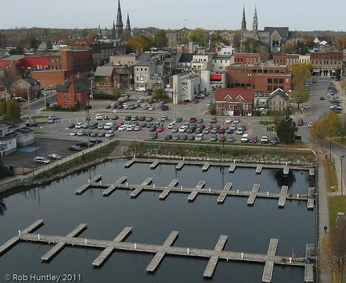
Aerial photograph - Marina at Blockhouse Island, Brockville, Ontario - Kite Aerial Photography (KAP) by Rob Huntley Photography - Ottawa, Ontario, Canada

Brockville Victorian by Light Collector

A distant view of McNair Island on the St. Lawrence River belonging to and across the waters from the city of Brockville, Ontario by Ullysses

Via Rail - Toronto - Montreal by davidcwong888

Aerial photograph - Marina at Blockhouse Island, Brockville, Ontario - Kite Aerial Photography (KAP) by Rob Huntley Photography - Ottawa, Ontario, Canada

Aerial photograph - The Boardwalk condominium block , the being built Tall Ships Landing waterfront condominiums and the site of the future Maritime Discovery Centre. Blockhouse Island, Brockville, On by Rob Huntley Photography - Ottawa, Ontario, Canada
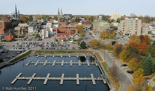
Aerial photograph - Marina at Blockhouse Island, Brockville, Ontario - Kite Aerial Photography (KAP) by Rob Huntley Photography - Ottawa, Ontario, Canada
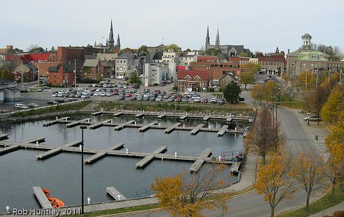
Aerial photograph - Marina at Blockhouse Island, Brockville, Ontario - Kite Aerial Photography (KAP) by Rob Huntley Photography - Ottawa, Ontario, Canada

Aerial photograph - Marina at Blockhouse Island, Brockville, Ontario - Kite Aerial Photography (KAP) by Rob Huntley Photography - Ottawa, Ontario, Canada

Aerial photograph - The Boardwalk condominium block , the being built Tall Ships Landing waterfront condominiums and the site of the future Maritime Discovery Centre. The Marina at Blockhouse Island, by Rob Huntley Photography - Ottawa, Ontario, Canada

Aerial photograph - roadways and parking on Blockhouse Island, Brockville, Ontario - Kite Aerial Photography (KAP) by Rob Huntley Photography - Ottawa, Ontario, Canada

Aerial photograph - Marina at Blockhouse Island, Brockville, Ontario - Kite Aerial Photography (KAP) by Rob Huntley Photography - Ottawa, Ontario, Canada

Aerial photograph - Saint Lawrence River at Blockhouse Island, Brockville, Ontario - Kite Aerial Photography (KAP) by Rob Huntley Photography - Ottawa, Ontario, Canada

Aerial photograph - Marina at Blockhouse Island, Brockville, Ontario - Kite Aerial Photography (KAP) by Rob Huntley Photography - Ottawa, Ontario, Canada

Aerial photograph - Saint Lawrence River and the beginning of the Thousand Islands at Blockhouse Island, Brockville, Ontario - Kite Aerial Photography (KAP) by Rob Huntley Photography - Ottawa, Ontario, Canada

Aerial photograph - Marina at Blockhouse Island, Brockville, Ontario - Kite Aerial Photography (KAP) by Rob Huntley Photography - Ottawa, Ontario, Canada

Aerial photograph straight down abstract view of the entrance roadway on Blockhouse Island, Brockville, Ontario - Kite Aerial Photography (KAP) by Rob Huntley Photography - Ottawa, Ontario, Canada

Birds Eye View by Dan Dewan

The Maplehurst Manor and Carriage House (1829) in Maitland, Ontario by Ullysses

Aerial photograph - Marina at Blockhouse Island, Brockville, Ontario - Kite Aerial Photography (KAP) by Rob Huntley Photography - Ottawa, Ontario, Canada

Aerial photograph - roadways and parking on Blockhouse Island, Brockville, Ontario - Kite Aerial Photography (KAP) by Rob Huntley Photography - Ottawa, Ontario, Canada

Aerial photograph - Marina at Blockhouse Island, Brockville, Ontario - Kite Aerial Photography (KAP) by Rob Huntley Photography - Ottawa, Ontario, Canada
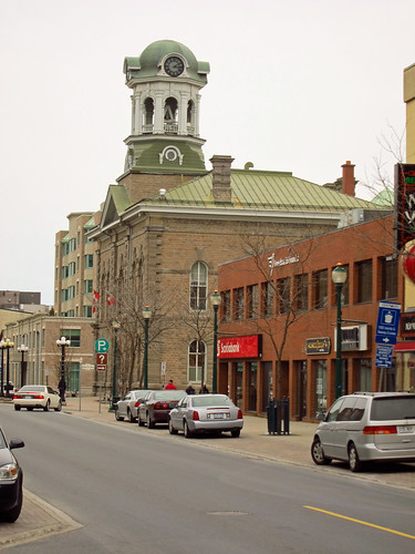
Day 4 - Downtown Brockville by Bobcatnorth

First Baptist Church, 5 Pine Street, Brockville, ON by Snuffy

A distant view of McNair Island on the St. Lawrence River belonging to and across the waters from the city of Brockville, Ontario by Ullysses

BYC by kylefmdavies

Mac Johnson Wildlife Area by johnchambers8

Twilight in Brockville by "Photo Guy"

Sublime Island Archipelago: Thousand Islands in Fall by Duncan Rawlinson - Duncan.co

Sapling, Trees, and Stone by Duncan Rawlinson - Duncan.co

Mud Creek (up) by Quevillon

Tunnel Vision by Light Collector

The Back Pond by Will S.

A view inside The Blue Church (1845) in Augusta, Ontario by Ullysses

Downside up by Will S.

A view of the frozen St. Lawrence River near Maitland, Ontario by Ullysses

Frozen Ribbons: Aerial River Art by Duncan Rawlinson - Duncan.co

A peaceful day on the St Lawrence by Justin Koning