| Latitude: | 44.5863631 |
|---|---|
| Longitude: | -75.6484276 |
| Elevation: | 86 meters / 282 feet |
| Barometric Pressure | 1003KPa |
Related Photos

Around back

Birds Eye View

The Princess Bride

Newfound Intimacy
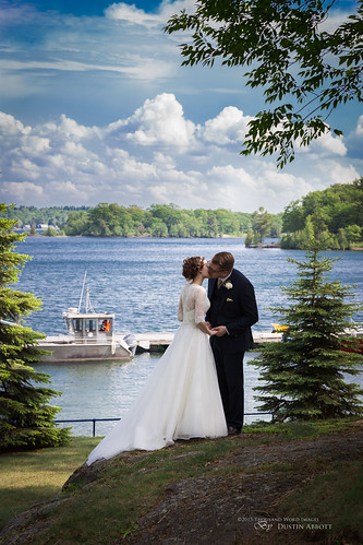
Thousand Islands Love

Highway 401

Vastness

Sublime Island Archipelago: Thousand Islands in Fall

First Baptist Church, 5 Pine Street, Brockville, ON

Augusta TWP Pumper 1 view 2 Maitland, Ontario Canada 06162007 ©Ian A. McCord

A view of the frozen St. Lawrence River near Maitland, Ontario

Tunnel Vision

Hopes Set High

Via Rail - Toronto - Montreal

A distant view of McNair Island on the St. Lawrence River belonging to and across the waters from the city of Brockville, Ontario

The Maplehurst Manor and Carriage House (1829) in Maitland, Ontario

A distant view of McNair Island on the St. Lawrence River belonging to and across the waters from the city of Brockville, Ontario
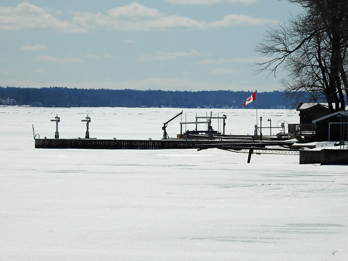
A view of the frozen St. Lawrence River near Maitland, Ontario

Rose window

Aerial view of Rob and Ted, Blockhouse Island, Brockville, Ontario - Kite Aerial Photography (KAP)

Aerial photograph - The Boardwalk condominium block , the being built Tall Ships Landing waterfront condominiums and the site of the future Maritime Discovery Centre. The Marina at Blockhouse Island, Brockville, Ontario - Kite Aerial Photography (KAP)
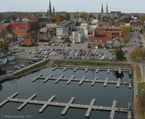
Aerial photograph - Marina at Blockhouse Island, Brockville, Ontario - Kite Aerial Photography (KAP)

Brockville Railway Tunnel

Aerial photograph - The Boardwalk condominium block , the being built Tall Ships Landing waterfront condominiums and the site of the future Maritime Discovery Centre. Blockhouse Island, Brockville, Ontario - Kite Aerial Photography (KAP)

Aerial photograph - Marina at Blockhouse Island, Brockville, Ontario - Kite Aerial Photography (KAP)

Aerial photograph - roadways and parking on Blockhouse Island, Brockville, Ontario - Kite Aerial Photography (KAP)
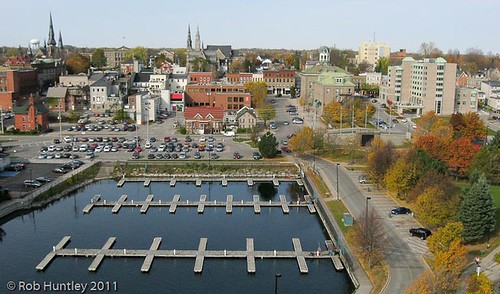
Aerial photograph - Marina at Blockhouse Island, Brockville, Ontario - Kite Aerial Photography (KAP)

Aerial photograph - The Boardwalk condominium block , the being built Tall Ships Landing waterfront condominiums and the site of the future Maritime Discovery Centre. The Marina at Blockhouse Island, Brockville, Ontario - Kite Aerial Photography (KAP)

Brockville Victorian
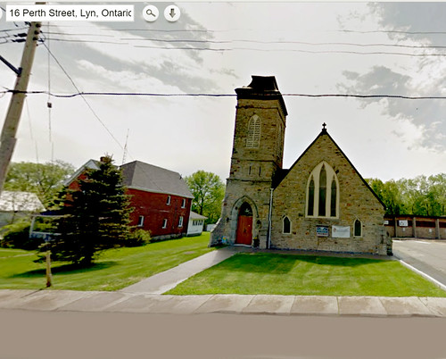
Christ United Church, Lyn, Ontario
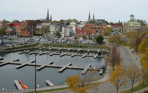
Aerial photograph - Marina at Blockhouse Island, Brockville, Ontario - Kite Aerial Photography (KAP)

Aerial photograph - Marina at Blockhouse Island, Brockville, Ontario - Kite Aerial Photography (KAP)

Aerial photograph straight down abstract view of the entrance roadway on Blockhouse Island, Brockville, Ontario - Kite Aerial Photography (KAP)

Aerial photograph - Marina at Blockhouse Island, Brockville, Ontario - Kite Aerial Photography (KAP)

Aerial photograph - Saint Lawrence River at Blockhouse Island, Brockville, Ontario - Kite Aerial Photography (KAP)

Aerial photograph - Saint Lawrence River and the beginning of the Thousand Islands at Blockhouse Island, Brockville, Ontario - Kite Aerial Photography (KAP)

Aerial photograph - Marina at Blockhouse Island, Brockville, Ontario - Kite Aerial Photography (KAP)

Aerial photograph - Marina at Blockhouse Island, Brockville, Ontario - Kite Aerial Photography (KAP)

Aerial photograph - Marina at Blockhouse Island, Brockville, Ontario - Kite Aerial Photography (KAP)

Aerial photograph - The Boardwalk condominium block , the being built Tall Ships Landing waterfront condominiums and the site of the future Maritime Discoverey Centre. The Marina at Blockhouse Island, Brockville, Ontario - Kite Aerial Photography (KAP)

Aerial photograph - Marina at Blockhouse Island, Brockville, Ontario - Kite Aerial Photography (KAP)
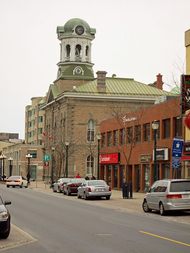
Day 4 - Downtown Brockville

Aerial photograph - roadways and parking on Blockhouse Island, Brockville, Ontario - Kite Aerial Photography (KAP)

Aerial photograph - The Boardwalk condominium block , the being built Tall Ships Landing waterfront condominiums and the site of the future Maritime Discoverey Centre. The Marina at Blockhouse Island, Brockville, Ontario - Kite Aerial Photography (KAP)

Aerial photograph - roadways and parking on Blockhouse Island, Brockville, Ontario - Kite Aerial Photography (KAP)

Aerial photograph - roadways and parking on Blockhouse Island, Brockville, Ontario - Kite Aerial Photography (KAP)

Aerial photograph - Marina at Blockhouse Island, Brockville, Ontario - Kite Aerial Photography (KAP)

Aerial photograph - Marina at Blockhouse Island, Brockville, Ontario - Kite Aerial Photography (KAP)

Brockville Ontario - Canada - Fulton Place - Heritage Trust - Water Fountain

Brockville Ontario - Canada - Fulton Place - Heritage Trust - Water Fountain