Elevation of Ramban
Longitude: 75.1938909
Latitude: 33.2463875
Elevation: 938m / 3077feet
Barometric Pressure: 91KPa
Elevation Map:
Satellite Map:
Related Photos:
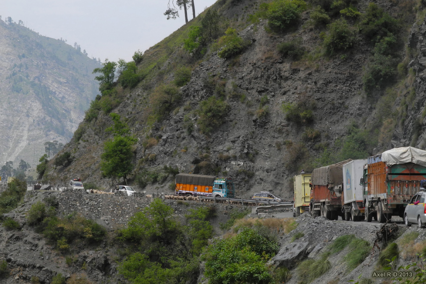
Jammu-Srinagar Highway

Baglihar dam on river Chenab

#ChenabValley #Gool #ShoaibTantray

CHENAB VALLEY, RAMBAN_ Shoaib Tantray

2013-08-03_16h54m33s

A typical house in Sanasar, Kashmir, India

India - Dragonfly

chenab railway bridge

...along the banks of the river Chenab, Ramban(Jammu & kashmir)... Phone click! ???? #chenab #ramban #ChenabValley #river #stone #stones #nature #water

#me #portrait

CHENAB VALLEY, RAMBAN_ Shoaib Tantray

CHENAB VALLEY, RAMBAN_ Shoaib Tantray

CHENAB VALLEY, RAMBAN_ Shoaib Tantray

CHENAB VALLEY, RAMBAN_ Shoaib Tantray

CHENAB VALLEY, RAMBAN_ Shoaib Tantray
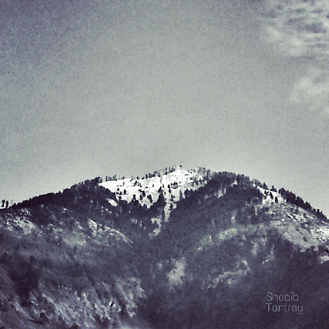
#ChenabValley #Ramban #Snow #mountain #ShoaibTantray

What's its English name? #ShoaibTantray #vegetable

#ChenabValley #RiverChenab #Ramban ©Shoaib Tantray

#myself

2013-08-03_16h08m54s
Topographic Map of Ramban
Find elevation by address:

Places near Ramban:
Ganote
Patnitop
J&k Bank
Jawahar Tunnel
Leray
Udhampur Bus Stand Road
Vaishno Devi
Udhampur
Kokernag
Katra
Doda
Domel
Doda
Anantnag Ktm
Bhaderwah Fire Station
Shopian
Forest Block Padpawan
Jammu
Jammu Tawi
Lemon Tree Hotel, Jammu
Recent Searches:
- Elevation of Corso Fratelli Cairoli, 35, Macerata MC, Italy
- Elevation of Tallevast Rd, Sarasota, FL, USA
- Elevation of 4th St E, Sonoma, CA, USA
- Elevation of Black Hollow Rd, Pennsdale, PA, USA
- Elevation of Oakland Ave, Williamsport, PA, USA
- Elevation of Pedrógão Grande, Portugal
- Elevation of Klee Dr, Martinsburg, WV, USA
- Elevation of Via Roma, Pieranica CR, Italy
- Elevation of Tavkvetili Mountain, Georgia
- Elevation of Hartfords Bluff Cir, Mt Pleasant, SC, USA